
Start, Lamar, CO; end Pampa, TX; 488 miles; lunch Dumas (287 Diner)
May 11 was another chase day with somewhat so-so severe weather potential on the Great Plains. SPC had their slight risk south of Childress. We were starting out in Lamar, Colorado, and it didn’t seem worthwhile to make the long drive to northwest Texas today. Hey, I found my original write-up for this day, written back when I actually remembered what happened! It is pasted below.
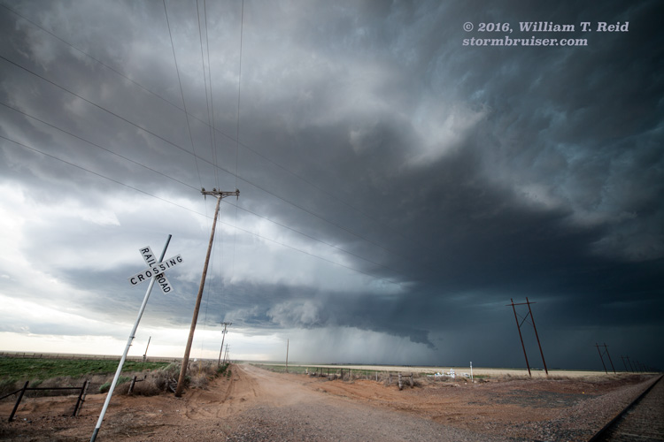
We got up early and headed south out of Lamar, CO, thinking that we would need to be WAY down in SW OK or NW TX this day. But, that target area was hosed due to overnight convection. It did not appear worthwhile to drive 7 hours to chase storms that would be moving southeast somewhere around Abilene with near zero tornado potential, so we stuck around the northwestern Texas Panhandle to wait for development coming out of northeastern New Mexico. Our expectations were low due to meager moisture and instability, though shear was very good due to upslope flow from the east at 10-15 knots beneath 500mb flow from the WSW at 40 knots or thereabouts.
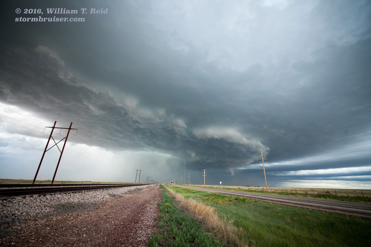
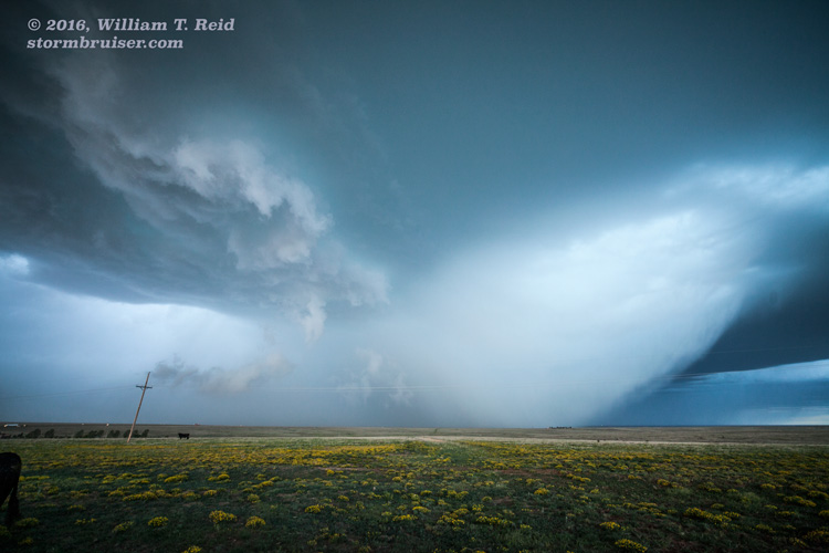
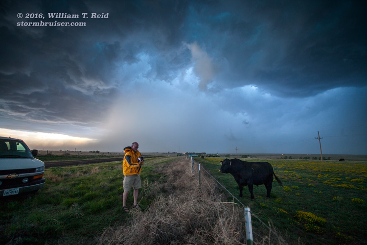
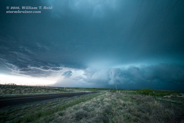
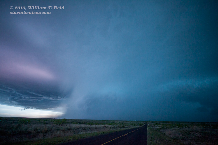
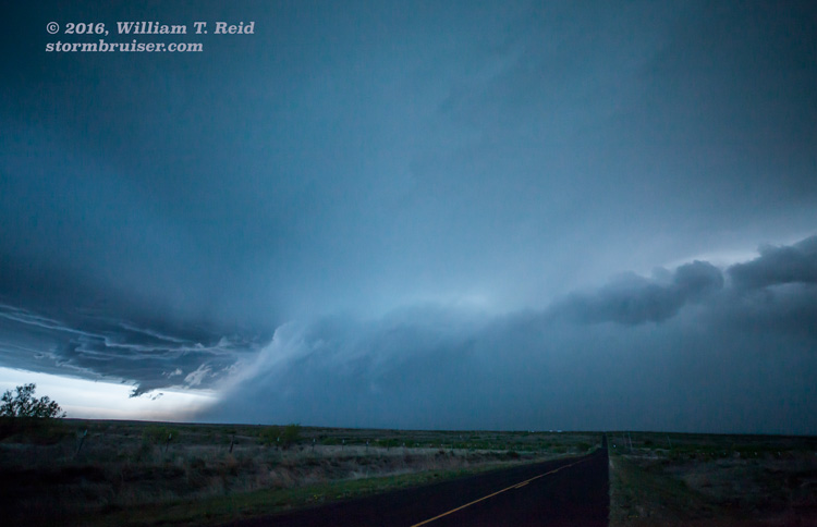
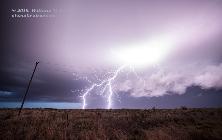
We latched onto a cell near Clayton and stayed with it to Dalhart, Channing, and Fourway (north of Amarillo). This storm evolved into quite the beast of a supercell, though it spilled cold outflow and was undercut fairly early on (due in part to its rather high storm base). The RFD area filled with precip between Channing and Fourway, and then a giant swath of hail descended from the leading edge. East of Fourway, the supercell was spitting plenty of lightning and had quite the nasty look, much to the delight of the few observers on this storm! We saw only a couple of other chasers during the entire chase, which is almost unheard of for a supercell in the TX Panhandle in May.
As the cell marched to the ESE from near Fourway, radar showed impressive TVS markers with values over 100 knots. We battled heavy rain wind, flooded and hail-covered roads and tumbleweeds from Fritch to Borger and Pampa. Panhandle Magic in May is alive and well!
I had to head back home to Los Angeles for the weekend, so the last couple of days for Tour 2 were without me. May 12 was, conveniently, a down day convectively on the Plains. I dropped myself off in Oklahoma City. The tour chased a supercell or two in the eastern TX PH on May 13, and their final chase day, May 14, was another down day.


Leave a Reply
You must be logged in to post a comment.