
Start, Oklahoma City; end Plainview, TX; 593 miles; fast-food lunch in Woodward and dinner in Amarillo (Applebees)
Tour 3 began out of OKC on May 16, and I was back from Los Angeles after a 4-day break. Tempest drivers for this 10-day tour were Tom Trott and Chris Gullikson. It was obvious that we needed to get ourselves up to the northern TX Panhandle for today’s chase, so we did a relatively quick guest orientation this morning. Initial development was expected around the western OK PH and NW TX PH, where wind shear was quite good and instability more than adequate for organized storms and supercells. Low-level moisture was too meager to provide a really good tornado risk…but you know how it goes in the Panhandles in May.
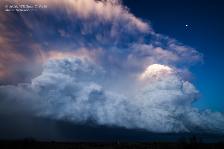
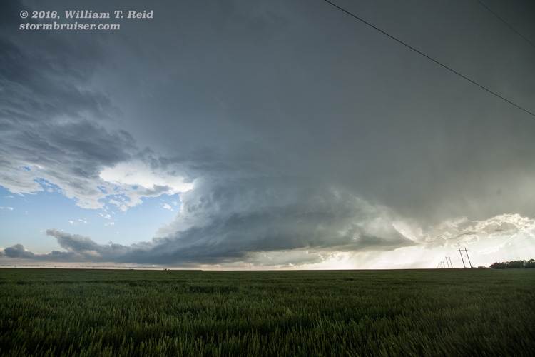
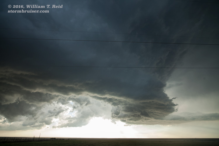
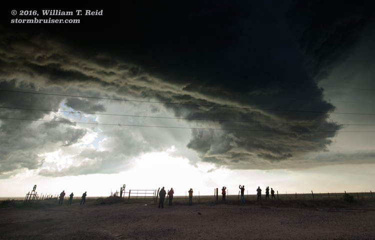
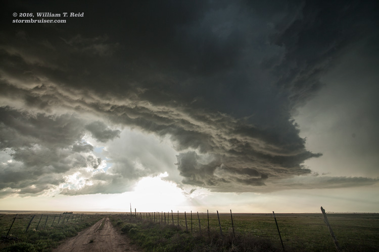
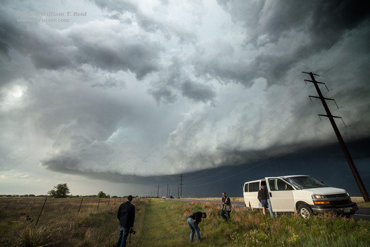
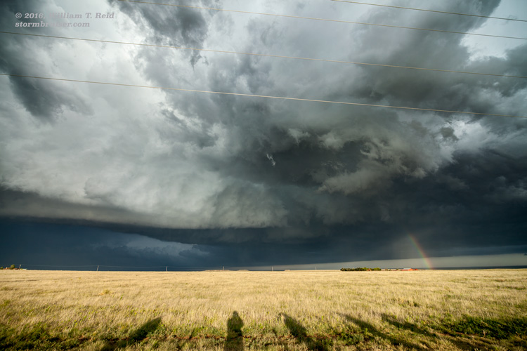
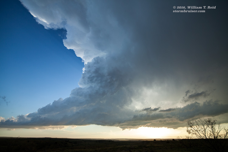
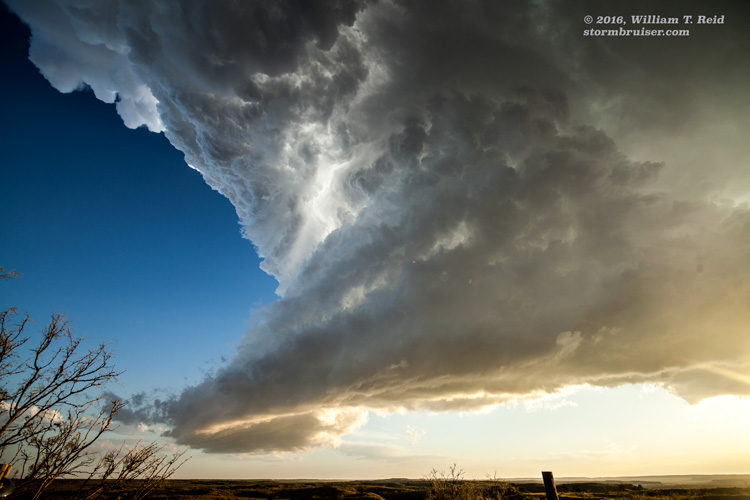
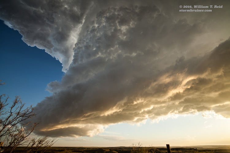
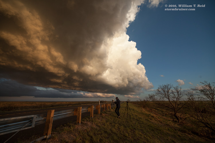
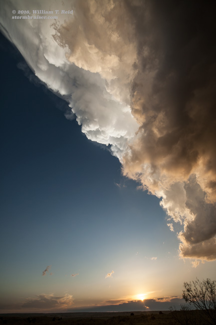
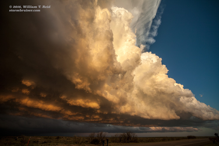
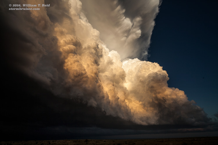
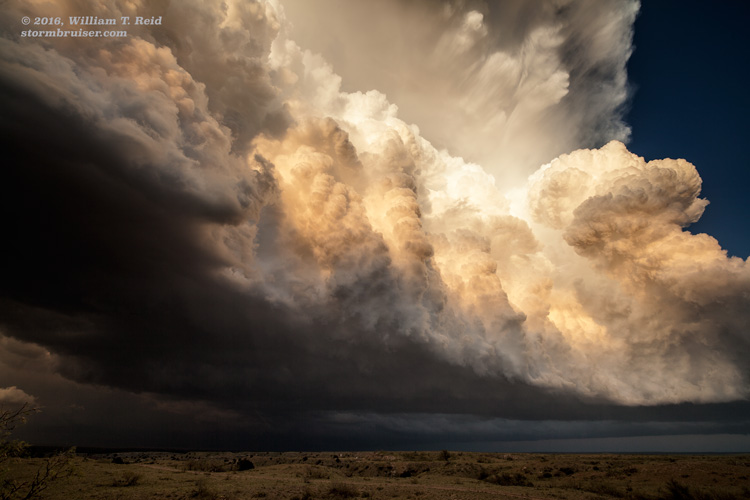
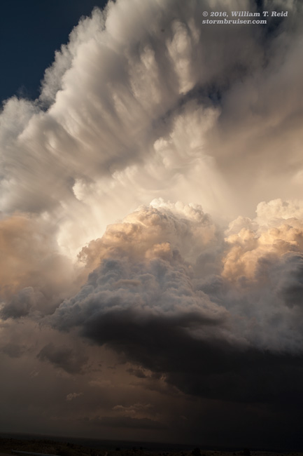
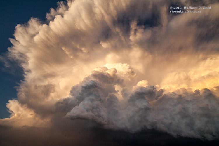
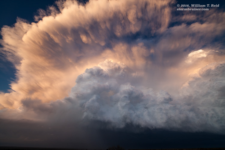
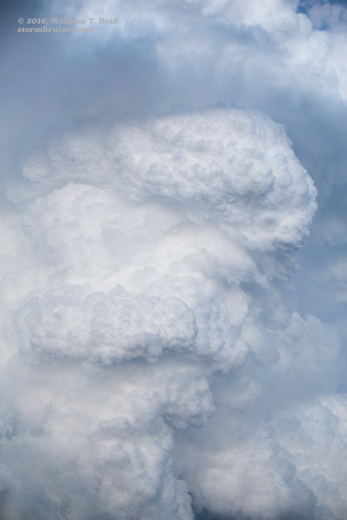
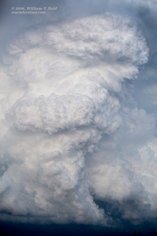
We continued to the NW TX PH from Woodward following a quick lunch, and zeroed in on a supercell that was moving towards Dalhart from the northwest. This storm, and/or another nearby storm, had already produced a few (relatively weak and brief) tornadoes. Some were near the town of Felt, OK. This supercell had a bit of a wet and outflowish look to it as it came into view. We stayed with it from Dalhart to a little east of Hartley. It looked somewhat nasty and ugly, but did not appear to be a good tornado-making candidate. A new storm beckoned to our west, and seemed to be in decent air. We went back to Hartley, and viewed a splendid, rounded, storm base to the west. The images below begin at this point. A nice RFD cut in, and the north side of the updraft base wrapped up nicely, but no tornado emerged. The storm forced us down to Channing, and a little south of there. We allowed the updraft to pass overhead, and we did not have to move in order to enjoy the pretty sunset light on the rear of the development as it drifted to our east.
Leave a Reply
You must be logged in to post a comment.