Start, Woodward, OK; end Wakeeney, KS; 297 miles; lunch in Laverne (La Cocina)
spc-mesoscale-discussion-706 KS and PHs/2:30 p.m.
spc-mesoscale-discussion-707 ne CO/3:30 p.m.
spc-mesoscale-discussion-711 KS and PHs/6:15 p.m
spc-mesoscale-discussion-712 ne CO/6:45 p.m.
spc-mesoscale-discussion-713 KS/7:15 p.m.
spc-mesoscale-discussion-714 ne CO/7:30 p.m.
spc-mesoscale-discussion-715 KS/8:30 p.m.
spc-mesoscale-discussion-719 KS/10 p.m.
may-24-route (large file, courtesy of Chris Gullikson)
NWS Dodge City summary of event
Cool video and images for the event from TWC
GoPro timelapse of chase, courtesy of Tempest guide Chris Gullikson
My images of the magnificent mammatus and anti-crepuscular ray display at sunset are in this separate post for May 24.
————
On this chase day we began in Woodward and observed a tornado very close to Dodge City. On the previous day, we began in Dodge City and observed a tornado that was very close to Woodward. What does this mean?
Chasers and SPC had a pretty good handle on this day’s potential, and where the best conditions were likely to be. Ground zero (for KS) would be where a (roughly) east-west boundary intersected the dry line. This locale was in extreme northwestern OK during the late morning, and it migrated to the north during the afternoon. Moisture and instability were excellent east of the dry line, and the mid-level flow was great, too, from the WSW at 40 knots. See the maps and discussions from SPC (provided above) for more details on the setup. There was an additional very promising target area on this day, and that was northeastern Colorado. If our group had started the day in Goodland, then I am not so sure that I would have been on the Dodge City storm later on! As it turned out, both areas had tremendous and gorgeous supercells. The Colorado storms had very impressive structure, but, compared to the Dodge City supercell, were much less prolific with the tornadoes.
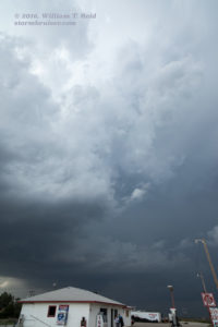
Unlike yesterday, I figured that we had plenty of time for a big sit-down Mexican lunch in Laverne. Lunch was nice and quick, and I determined that we were still pretty much where we wanted to be afterwards. Some cumulus clouds were getting awfully perky near Laverne during the early afternoon, which did not make me happy, of course. It was far too early for strong convection, unless one was yearning for a big mess and a long, frustrating chase day. Fortunately, these attempts at storms fell far short. I led the group up to Gate, OK: a very small community in the extreme eastern OK Panhandle. Here we had a little shade, a place which sold sodas and goodies, and a good cell phone signal. A few old and abandoned buildings attracted the photographers among us, and I watched the sky and the laptop. We must have been in Gate for nearly two hours.
From Gate we drifted north into Kansas, as we wanted to stay close to the old outflow boundary and the associated area of greatest surface moisture convergence. Development would be most likely here, of course! We didn’t go very far, stopping just west of Englewood, KS. Again we found the few shade trees that were available along a lonely road, and we watched the sky for another hour or so. It was after 4 p.m., and the sky was still looking rather benign.
Finally, a clump of cumulus clouds was looking somewhat promising to our northwest. We headed up to the 283/160 intersection west of Ashland. A gaggle of chasers gathered here, but we still had plenty of time to socialize or to stare at the cumulus clouds and laptop intermittently. This seemed to be “the place to be” on paper, or on LCD. Would things work out today? We drifted west on 160, and viewed a vigorous tower that was to our west. It must have been over Meade, KS. This was it, folks! We headed north to Fowler and we squeezed in one more pit stop before things got serious. As the last guest got back to the vans, our tower had already organized into a fledgling supercell. The base was just northwest and north of town, and I wanted to be east of it. Our road here, U.S. 54, conveniently headed towards the ENE. This would work out well, as the storm would be moving to the ENE. Right?
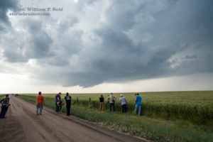
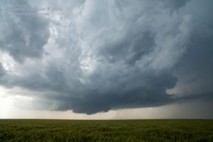
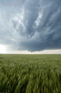
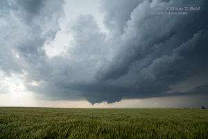
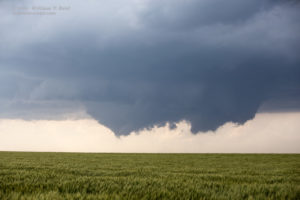
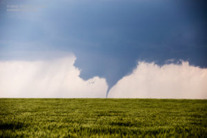
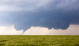
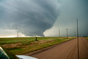
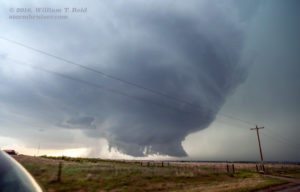
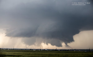
It was after 5:30 p.m. Our activity today made us wait quite a while, but it was close to the perfect time diurnally for tornadic storms to form. We drove the 10 or 11 miles ENE to Minneola and found a wheat field northwest of town from which to watch the supercell. And this was perfect, too — an unobstructed view of a strengthening, isolated storm in southwest Kansas in a tornado watch — life is good! Our viewing spot was great for storm structure, but quite distant from the storm base. I figured that that was not going to be for long, as the storm would be nearing us eventually, and eventually crossing our north-south highway, U.S. 283. The storm base was quite low almost from the outset. It drifted from our WNW to our NW, but it was not getting closer to us. A shallow wall cloud formed, and then a more prominent wall cloud formed. Two wall clouds formed — two prominent wall clouds! It was about 6 o’clock magic time, and I was not going out on a limb when I said that there would soon be a tornado. After a few more minutes, a black and slithery tornado touched down. It went back up and down a time or two, and then it was firmly down.
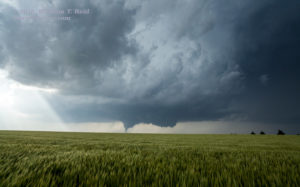
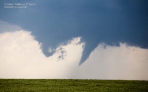
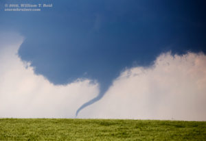
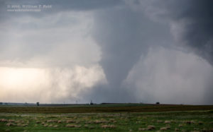
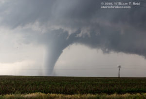
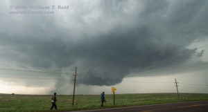
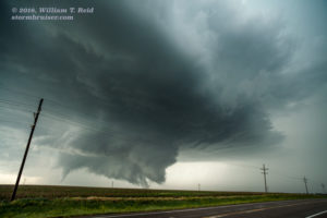
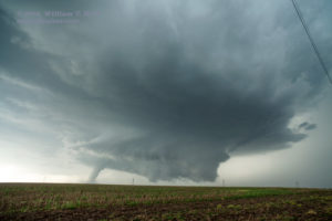
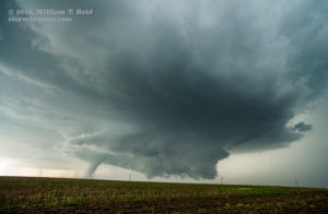
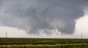
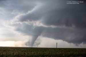
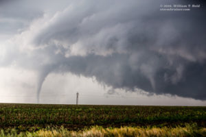
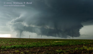
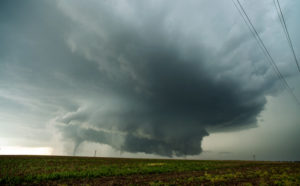
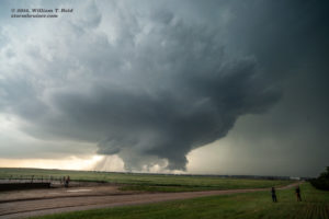
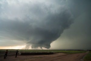
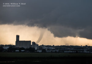
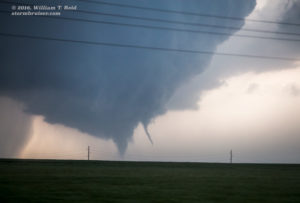
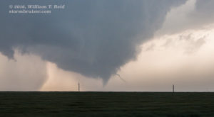
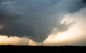
I was thinking that the storm would drag the tornado eastward, towards U.S. 283, but that was not happening right now. The action area was getting farther away. It was going to the north. I didn’t really think about why it was behaving somewhat strangely, given the steering flow at mid-levels. I just knew that we had to get closer. This storm wanted to produce tornadoes. When storms want to produce tornadoes, they can provide a wild ride for one or two hours or more. We went back the mile or so to 283 and blasted north. Well, blasting would have been nice, but it was a bit of a circus chaser-wise already along 283. Plenty of chasers and chase tours were on the storm and were lined up along 283 north of Minneola. I still thought that the tornado might cross 283, and I was wondering how far north we should go. After a minute or two on 283 northbound, the tornado to our northwest had increased in girth quite a bit. Hmmm…this could be quite an intercept…if and when the tornado crosses our highway! How far north should I go? We went about four or five miles north, I think, and stopped. The guests got out and we took some pictures, but I was not enamored with this spot. The tornado was still to our northwest! The tornado still seemed content to stay some five miles or so west of 283 as it moved to the north, and we were farther away than I wanted to be. I rounded up the group and we headed north again, and this time I wanted to be practically due east of the tornado. Any farther north and we would be in precipitation. I did not consider using unpaved roads at this point. I still thought that the storm would get closer to 283! We went perhaps another 5 or 6 miles north, with the fat, elephant-trunk-shaped tornado persisting. This stop was about five miles south of Dodge City, and we gathered along the fence on the west side of the road again to watch. There were two well-defined “action areas” in close proximity to our WNW. The one with the long-lived and substantial tornado was on the south side. On the north side, a large, rotating wall cloud was dropping sporadic small and skinny tornadoes, sometimes two at once (making three total at once for the storm). The storm was moving slowly enough to the north here, maybe 15 mph, which allowed us to set up tripods for video for several minutes. The view was outstanding, as little or no rain was wrapping around the storm base; there was nothing to obstruct the tornadoes except for the power lines! The group of stills below is for the time frame when the storm was northwest of Minneola to just southwest of Dodge City, from approximately 6:15 p.m. to 6:45 p.m. CDT.
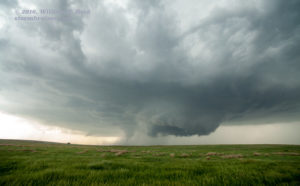
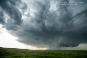
Once again it was time to reposition. The storm was getting away from us, and the logistics were becoming more complex. The chaser traffic along U.S. 283 was becoming problematic, and I had to figure out how I wanted to get through Dodge City. Would there be traffic jams at the stop signs and traffic lights? Would the cops have the roads closed? Would I be able to quickly get into position again? As we neared the E-W route around the south side of Dodge City (U.S. 400), our road (U.S. 283) became more clogged and the pace was excruciatingly slow at times. The storm continued to our northwest and was on the west side of the town, continuing to the north. It appeared that the tornadic activity had ended for the time being, but storm structure was sweet and very evident. I was concerned that we might get hopelessly bogged down in traffic or roadblocks in Dodge City. So, a mile south of U.S. 400, I elected to divert eastward onto an unpaved road (Outlaw Rd.). Yes—I would outsmart all of these other chasers and the cops, avoid the big intersection just up the road, blast east and north on these convenient section roads and get back into position on the northeast side of Dodge City! We went a mile east and then turned north to get to U.S. 400. But, my idea turned out to be not-so-great. The road had been rained on, and now we were going about 20 mph so we wouldn’t slide off into the ditch. Tom and Chris did great jobs to keep the vans in the middle of the road and out of the ditches. Our road south went up a slope, and at the top of a hill the view of the storm just behind Dodge City was just too fabulous to pass up. We stopped to get out and get some shots.
From our little hilltop southeast of Dodge City, we watched another good-sized tornado form to our northwest. This tornado was northwest of Dodge City. In some of the images above town’s large, white grain elevator is visible. It persisted for several minutes at least. The storm once more was getting too far away from us, so we slithered back down the mud road and made our way around Dodge City on the east side. There wasn’t too much delay, fortunately. From the U.S. 50/283 segment northeast of Dodge City, a prominent lowering to our north began to “drop” tornadoes, and I managed to get a few shots with the long lens.
We went north a mile or two on 283 to stay with this activity. The tornado had lifted or disappeared from view, and the look of the storm was much less organized. I wasn’t sure of where I needed to be now, and new convection was developing rapidly to our south and coming at us. I was not inclined to drift off to the north towards the increasingly wet and messy stuff with the chaser hordes, so I went back south and west towards Dodge City. There appeared to be an area of interest to the northwest from here, but we couldn’t get close due to a big tank that was blocking the road (just north of U.S. 50). The tornado we had watched from the hilltop had relocated a few items.
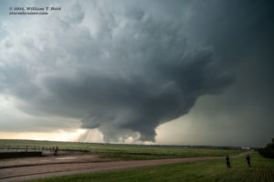
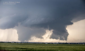
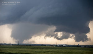
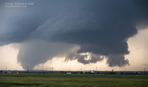
By now we were kind of hopelessly behind the supercell, or supercells. It seemed that the window of highly visible and strong tornadoes had closed, anyway. Our group had definitely been afforded a long and good look through that window, thankfully! It was time to take a break, catch our breath, and enjoy the sunset light on the back side of the severe storms. We were treated to a magnificent mammatus display with anti-crepuscular rays — wow — a separate web site post was made to showcase my sunset images (teaser below!). I tried to reserve rooms in Dodge City for the guests and guides, but my favorite places were not answering their phones. The power was apparently out in much of the town. We wound up in Wakeeney for the night, which put us in great shape for the May 25 chase.
















Leave a Reply
You must be logged in to post a comment.