Start, Wakeeney, KS; end Wichita, KS; 445 miles; lunch at the TK Smokehaus in Hays
SPC Day Two Outlook, 1730Z, issued on May 24 for May 25
spc-mesoscale-discussion-726 2:45 p.m. CDT
spc-mesoscale-discussion-731 7 p.m. CDT
spc-mesoscale-discussion-734 10 p.m. CDT
may-25-chase-route-a (wide view, large file)
may-25-chase-route (zoomed-in area, Bennington to Chapman, large file)
GoPro timelapse for the chase, courtesy of Tempest guide Chris Gullikson
Our group was fat and happy on the morning of May 25 in Wakeeney, having completed three consecutive chase days with tornadoes (Friend, KS; Woodward, OK; Dodge City, KS). In contrast to May 24, the forecast target for May 25 was vague. There was indeed a weak surface low pressure area forecast for central Kansas. Great CAPE values would be piling up a little east and northeast of the surface low (and in a swath east of the dry line down into western OK and northwest TX). Like yesterday, the mid-level winds (at and near the 500 mb level) were fast enough for adequate shear for severe storms. Get to the triple point in front of the surface low, right?
Well, there seemed to be more than a little doubt that storms would be able to form on the triple point in Kansas. In the early afternoon Day Two outlook the day before, SPC had a huge slight risk area on the Plains (Aberdeen to Altus), and favored W OK with a hatched area. In their 13Z Day One outlook that I showed the guests during the morning weather briefing on the 25th, SPC had downgraded the large slight risk area to “marginal” risk. For the area we were looking at (KS and OK), in this 13Z outlook, Rich Thompson of SPC wrote:
THERE WILL BE LITTLE FORCING FOR ASCENT AND SOME
   LINGERING CONVECTIVE INHIBITION.  THE EXTREME BUOYANCY AND
   SUFFICIENT DEEP-LAYER VERTICAL SHEAR WILL FAVOR A CONDITIONAL RISK
   FOR ISOLATED SUPERCELLS WITH LARGE HAIL...BUT THE UNCERTAINTY
   REGARDING STORM INITIATION/COVERAGE PRECLUDES MORE THAN LOW SEVERE
   PROBABILITIES.
The models that we looked at mid-morning were a bit weak and wishy-washy with regard to storm development near the surface low and down the dry line. It is never fun to wake up and see a downgrade by SPC, but I did not necessarily disagree in this case. I think I told the group that we would be playing the triple-point at the surface low. The instability and shear would be excellent to our east and southeast later on, towards Salina, and we would just have to cross our fingers that the cap would not be too strong.
We had lunch in Hays, and SPC had upgraded the Kansas target (near the surface low) to slight risk in the 1630Z outlook:
...CENTRAL KS...
   LATEST SURFACE ANALYSIS SHOWS A LOW OVER CENTRAL KS WITH THE DRYLINE
   EXTENDING SOUTHWARD INTO WESTERN OK/TX.  LOW CLOUDS ARE ERODING IN
   THIS AREA...WITH SOUTHERLY LOW LEVEL WINDS HELPING TO TRANSPORT
   MID/UPPER 60S DEWPOINTS INTO THE REGION.  BY MID/LATE AFTERNOON...A
   VERY UNSTABLE AIR MASS IS EXPECTED TO BE PRESENT WITH STEEP MID
   LEVEL LAPSE RATES YIELDING MLCAPE VALUES OVER 3500 J/KG.  A DRYLINE
   BULGE IS EXPECTED TO FORM ON THE SOUTH SIDE OF THE LOW...HELPING TO
   INITIATE A FEW THUNDERSTORMS AROUND PEAK HEATING.  VERTICAL SHEAR
   PROFILES WOULD PROMOTE SUPERCELL STORM STRUCTURES IN THE
   REGION...WITH A RISK OF LARGE HAIL...DAMAGING WINDS...AND PERHAPS A
   TORNADO.
(In the 20Z Outlook, SPC bumped the 2% tornado risk up to 5% in central KS, but only south of I-70. The large hail (hatched) area was a small circle around Wichita. Of course, I don’t necessarily chase based on what the Storm Prediction Center thinks, but I and every other chaser is influenced to some degree by the SPC maps on most chase days. On this day, it was natural to feel a pull southward a little from I-70 in Kansas given the SPC outlooks.)
From lunch in Hays, I led the group east to Russell and south to the Great Bend area. This put us pretty close to the low and to the area with some surface moisture convergence. From Great Bend we continued eastward. An area of agitated cumulus was festering to our southeast. This was looking good visually, and looking good as far as SPC’s thinking. Here is the blurb for KS in their 20Z update:
 ...E CNTRL KS INTO N CNTRL OK...
   CU IS GRADUALLY INCREASING NEAR DRYLINE/OUTFLOW INTERSECTION NEAR
   WICHITA AND SWD INTO N CNTRL OK WHERE TEMPERATURES ARE IN THE LOW
   90S F AND DEWPOINTS NEAR 70 F. THIS EXTREMELY UNSTABLE AIR MASS
   SHOULD FOSTER RAPID DEVELOPMENT OF A SEVERE STORM OR TWO CAPABLE OF
   VERY LARGE HAIL AND PERHAPS A BRIEF TORNADO AS LOW-LEVEL SHEAR NEAR
   THE OUTFLOW BOUNDARY IS LOCALLY GREATER. FOR MORE INFORMATION SEE
   MCD 726.
The mesoscale discussion referred to (see link near the top on this page) generally highlighted the area south of Salina, especially Wichita and vicinity. On the surface map provided by SPC in mesoscale discussion 726, the observations for 2 p.m. (presumably) are shown. The surface low and triple-point is just west of Great Bend (81/65 wind S 5 kt). Hays is cool and murky (66/63 ENE 5). Conditions were a little warmer and sunnier when we reached Russell after lunch, but I went south from there to find more sunshine. The east-west outflow boundary is drawn between Salina (83/71 wind S 10) and Concordia (73/65 SE 10). Note that any wind convergence southeast of the low, in the area near and west of Wichita, appears weak at this time. Based on this map, the convergence along the old outflow boundary a little northeast of the surface low looks much better. Any development here has access to those low 70s dew points, plus the advantage of being along the boundary for better tornado potential.
I elected to continue eastward from Great Bend on U.S. 56, towards McPherson. We could see an impressive cumulonimbus or two go up very close to Wichita (to our southeast). That activity would take another couple of hours to get to, if it didn’t move much. In my mind I was still was not sold on that region. The spotter network showed a lot of chasers scurrying around near the new radar blips, and I had a slightly sick feeling, knowing that we were not close at all.
But, the feeling was only slight, because we were pretty much in our original target area. The dry line, behind us, was starting to boil. A handful of turkey towers materialized back to our west (a county or two). I brought the tour to a stop on U.S. 56 near Windom, Kansas — perhaps 15 miles short of McPherson.
What am I doing? Do we really want to go after that Wichita stuff? Sure, it looks pretty good, but…
I had a strategic powwow with Chris and we decided that our best bet was to blow off the Wichita-area activity and to focus on Plan A — the nearby surface low and triple-point. We turned around and headed back west and north again, stopping in Geneseo (north of Lyons) for a pit stop. The cumulus towers to our west were getting taller and a bit beefier. And, very quickly, a new and strong updraft began exploding to our NNE, perhaps 45 miles away. We had to get there. We had to be there. NOW!!
After 25 years or so of chasing, there are some visual cues that are so obvious that I don’t have to think twice. As we left Geneseo, I looked at that developing CB to the NNE and I didn’t think, “Hmmm, should we see what these other towers do first? Should we give it a minute or two or three to see if it holds together?!” That was our baby, and there was no question that this would quickly be a special storm. Still we had to get to it, and if it started moving to the northeast too quickly, then we were in trouble. Fortunately, it drifted to the east at no more than 25 mph. We got ourselves just south of the updraft base, west of Bennington, via 14, 156, I-70, and the road north through Culver. That took about an hour, maybe a little more, and we got a lousy glimpse of a brief tornado with the cell while on I-70.
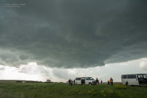
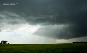
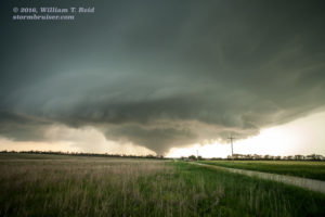
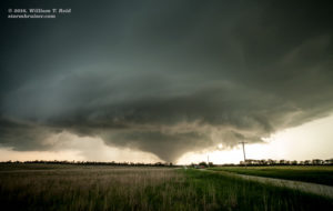
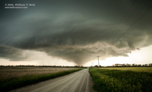
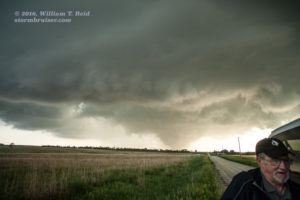
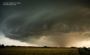
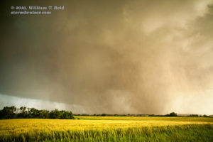
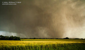
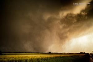
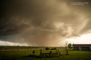
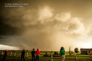
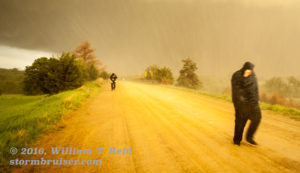
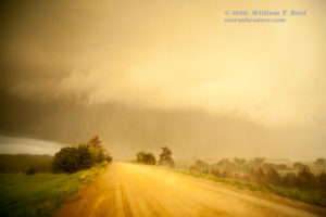
The base, west of Bennington, was medium-low and getting a bit of a wrapped-up look. There was no spectacular wall cloud or funnel cloud, but enough broad rotation so that you knew the storm was serious (see pics of storm base above, looking WNW along Hwy 18). It had nothing in front of it except backed winds and 4000 CAPE! We stayed close to the base along 18 to U.S. 81 and N 170th Road in south-central Ottawa County. I needed a good road which continued to the east in order to stay close on the south side of the storm base, which necessitated a jog three miles to the south, to Ottawa Road. This worked reasonably well to N 210th Road. The supercell’s base was starting to get that look just a few miles away to our northeast. It was largely rain-free, and the RFD cut was doing its thing. The show was about to begin, I was certain. But after four miles on Ottawa Road, we were dealing with slime and mush. The reasonably dry road was becoming treacherous. We went north a mile at most and aborted. GAD. We are RIGHT THERE, mere minutes away from being in the perfect spot, but we can’t get there — at least, I can’t risk using these roads any longer because we might wind up hopelessly stuck. We had a great view here, at least for a a little bit, but the storm would be moving away from us. There was no tornado yet. I had to get us back on pavement if we were to stay with the storm. We went back down to Ottawa Road and headed back to the west, away from the burgeoning tornadic supercell, and I tried not to look behind me.
The storm was moving generally to the east at perhaps 20 mph, so we would be able to catch up again. The question was, would we be too late? Would we miss the show, the show that I KNEW was beginning NOW?! Four miles later and back on N 170th Rd/Old U.S. 81, we cruised south to Interstate 70. That was close to seven miles, and fortunately there was an easy onramp right there. Almost 15 minutes lost…what was the storm doing?! On radar, it looked like a classic tornadic supercell already. UGH.
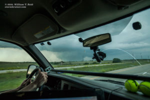
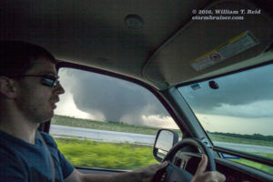
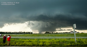
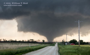
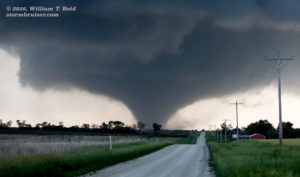
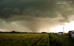
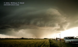
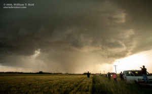
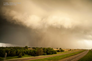
We caught a big break as far as having Interstate 70 handy. Once on that, we were able to quickly catch up, and the road angled up to the ENE just about perfectly! Still, we had to cover 15 miles or thereabouts to get back even with the tornado. Yes, it was a big-honkin’ tornado in progress as we approached. The base was a beastly soda-can updraft and a big black block was smack dab against the ground. WOW! The images below show Tom and the tornado, as we approach Solomon and vicinity on I-70.
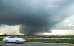
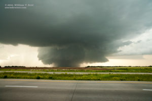
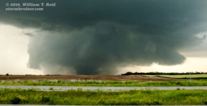
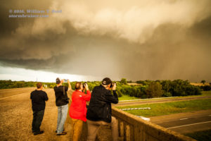
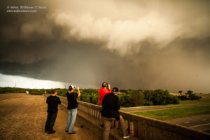
I believe we stopped along I-70 for a few minutes east of Solomon to get some pictures. I was not crazy about stopping on the Interstate, but the storm to the north by maybe four miles was so incredible that I had to make sure we all got some decent pics, in case it suddenly became rain-wrapped or weakened. From here, we went the next six miles or so to the exit for Abilene (the town is just south of the interstate). We stopped along the exit ramp, which provided a slightly elevated view across the highway. The tornado was still about four miles to our NNW, and then north, and there was a bit more rain involved with it. Our stay here was a little longer, and I managed some tripodded video. There were a number of non-chaser motorists stopped here to watch the tornado, too. The images below are wide-angle from I-70. The top two were taken near Solomon, and the bottom two from Abilene.
The tornado continued quite strongly, but with more and more precip around it. It was getting more difficult to discern at times. There were also some trees in the way that needed to be cut down immediately. I thought that, since it looked like more of an HP supercell, it would be a good idea to get ahead of it a ways and check out the storm structure. I was also concerned that law enforcement might close I-70 soon, somewhere right up the road, as it looked like the storm would eventually cross it. From Abilene to Chapman, I-70 heads to the east-northeast again.
With the plan of getting a good view of the supercell on its east side, we got back into the vans and motored away from Abilene. We passed Jeep Road — that was not far enough east — and came up to Mink Road (exit 281), a mile north of a little community called “Detroit.” This is in central Dickinson County. In the meantime, the rain had cleared some form the storm base, and now a good-sized elephant trunk tornado was in progress. This was the same tornado, but it looked quite a bit smaller compared to the Solomon and Abilene phase. Maybe it was going to rope out.
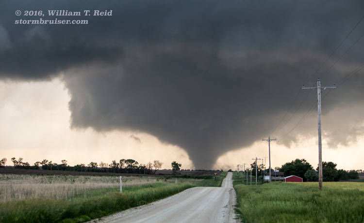
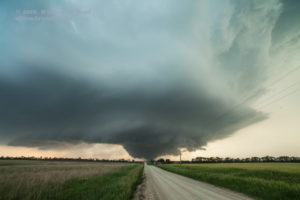
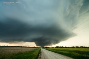
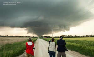
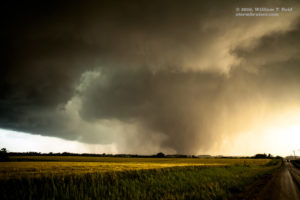
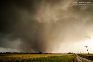
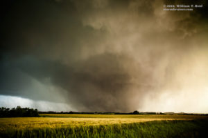
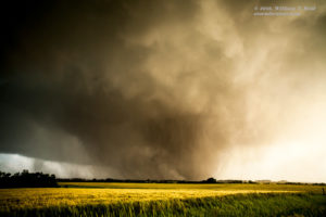
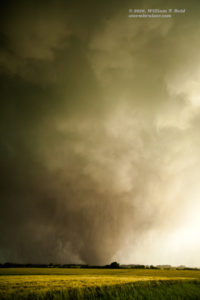
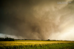
We exited at Mink Road and headed north. We were east-southeast of the supercell now, and I was eager to stop really soon —- ONE, because I wanted a good look at the storm, and TWO, because if we went any farther to the north, we would be in the path and/or in anvil rain. The first mile north of I-70 was heart-breaking. There were zero good viewing points, due to trees and hills. Making matters worse, there was no “2600 Avenue” cut through here after the first mile! We needed to go another mile north to 2700 Avenue. I was getting agitated —- this was taking too long and we are going farther north than I wanted to go! We turned west onto 2700 Avenue, and all of my concerns evaporated instantly. Right down the road to the west, maybe four-to-five miles distant, was the supercell, and the tornado, and the tornado was fat now, and the tornado was sitting right on 2700 Avenue! WOW again! And did I mention that the contrast was perfect and that there was no rain wrapping around now? No? Well, the contrast was perfect and the there was no rain wrapping around — it was a chaser’s dream view!
Our vans emptied about one-half mile west of Mink Road, on the west side of a small hilltop along 2700 Avenue. The guests lined up to get their shots and I set up my tripod and camcorder, got it perfectly focused and composed, and forgot to hit the record button. Yes, the perfectly contrasted wedge tornado in 4k footage, tripodded, was not videoed by me. That was the goof of the day. I did get a lot of stills, thankfully (images above). The tornado was coming at us at about a mile every three minutes, so after about six minutes I got nervous and re-positioned to the east a mile or so. There was more rain wrapping around the tornado again now, and the tornado was migrating to the south a bit. It looked like we could stay at this new spot (east of Mink Road) for a while as the strong tornado continued to our WSW and SW. I did the camcorder and tripod routine again, and this time I hit the record button! (I did not learn until later that night that I had messed up at the previous stop.) The tornado came to within maybe 1.5 miles to our southwest, and its roar was quite pronounced — perhaps the loudest I have heard, even at that distance.
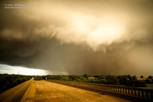
Wrapping rain curtains approached us, and we went a couple of miles farther to the east. We stopped just south of the intersection of Paint Road and 2700 Avenue, and at this point there was so much rain-wrapping that it was difficult to make out the large tornado…but we knew it was in there just a mile or two to our southwest (top tow images below). Again, we went east a mile, to Quail Road, where it crosses I-70. Several of us ran up to the bridge over I-70 to get a look at the rain-wrapped madness that was approaching the southwest corner of Chapman (images 3 to 6 below).
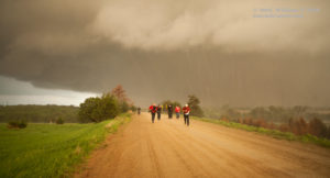
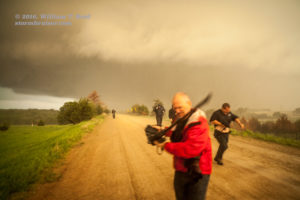
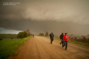
As the tornado slipped by to our SSW and south, we were hit by a barrage of rain and relatively small hail, and wind of about 25 mph. It wasn’t too bad, but several guests got a bit wet as they ran back to the vans (bottom five images above). From here we had lost any view of the tornado, and we couldn’t see much of anything else, either. I decided to get away from the danger zone some by driving north a mile. I wanted to minimize the chance of getting hit if the tornado made a sudden turn to the left — which it did not do.
We rode out some heavy rain and hail while in someone’s driveway, and after 5 minutes or so made our way back to the Interstate and into Chapman. The town barely escaped devastation, as the tornado skirted just the south edge of the town. We didn’t see any damage at all. Skies were darkening as it was dusk now, and we stopped at the Chapman convenience store, which was open, thankfully. Plenty of lightning flashed in the impressive cloud towers right above us, and the chase was over. The tornado, which started near Bennington and continued to the east past Solomon and Abilene and beyond, would come to be known as the “Chapman” tornado. It lasted for 90 minutes, the path length was 26 miles, and it was rated EF4. There apparently were no injuries or deaths, despite numerous demolished residences and the I-70 crossing.
—————-
Below are the musings, most-mortem, on the Chapman chase by guide Chris Gullikson:
For the 25th I was expecting to see nothing and just happy to get east or southeast to be be in position for tomorrow’s “big event” and get a steak dinner. The 00Z Nam 4k run the night before had a blip on reflectivity in central KS but by the morning’s 12z run, that blip was gone. It looked like we were behind the wave in a veered, capped environment. We had lunch in Hays and it was there I envisioned a mesoscale accident along that I-70 OFB (outflow boundary) that hadn’t become totally washed out and a few surface obs had light east/northeast winds north of the boundary. I didn’t believe it would happen…but it DID happen pretty much as I envisioned it. I was starting to doubt my I-70 OFB scenario as SPC came out with their updated outlooks and MD’s…highlighting another boundary furthur south near Wichita. We also had that agitated CU that we could see near ICT. Once that dryline started to light up back to our west and northwest, I got excited for a storm to go up further north on the OFB…and once it did, it was obviously the storm to be on. The rest is history.
For the record, Chris posted this on Facebook around 10:45 a.m.:
Potential meso-scale accident shaping up along I-70 in the Salina vicinity.
and followed up 15 minutes later with:
A nearly stationary outflow boundary along I-70 with a stratus deck (that will mix out later) will really help back the low level winds and generate horizontal vorticity. Storm initiation is/was quite questionable with subsidence behind an earlier upper wave but a sharp dryline surge up against a nice thermal boundary may allow initiation. If it happens…a tornadic supercell riding that boundary seems quite possible.
Obviously, this was a darn good forecast post by Chris! I saw the potential, too, and was not particularly interested in wandering off to another target area. A good number of chasers wound up on the “sucker storm” near Wichita. It had difficulties due to a healthy cap. Some of these chasers managed to get north in time to get a glimpse of the Chapman storm towards the end of its existence.
NWS Topeka info on the Chapman tornado
Detailed map of damage path with aerial pictures of damage taken the next day
By the way, much of Chapman, KS, suffered major damage from an EF3 tornado at 10:20 p.m. CDT on June 11, 2008.

Leave a Reply
You must be logged in to post a comment.