

Start/Denver, CO
End/Belle Fourche, SD
468 miles
Lunch at Wellington, CO (Taco Johns, for me at least)
I was back in Denver, and ready to start Tour 6 with Rook and Steve P. Tour 5 had had some success in Montana and the Northern Plains, but the overall pattern for the first two weeks of June continued to be on the dismal side for chasers on the Plains. On this chase day, there was a risk of tornadoes around the Minnesota/Dakotas border area, but that would not be reachable this day from Denver. I saw some potential for a supercell in western South Dakota, so we made our way northward after the guest orientation. SPC painted western SD and adjacent areas with a marginal risk of severe.
We reached southwestern SD via Lusk and Sundance. By the time we hit I-90, near the WY/SD border, we had in our view a growing cumulonimbus cloud well to our NNE. The developing storm was likely not far from Redig, between Belle Fourche and Buffalo. That is what we wanted, and it was surrounded by beautiful blue skies! And, not surprisingly, its updraft started to rotate, and the storm propagated to the right — towards the east-southeast. That gave us a good chance of catching it relatively quickly.
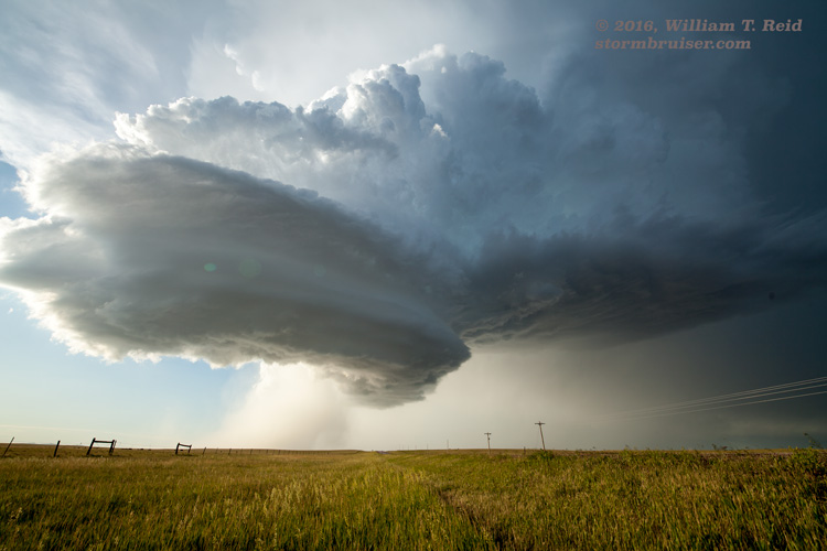
We stopped a little north of Belle Fourche for pictures. The storm was west of Castle Rock, perhaps 30 miles distant, and to our NNE. The updraft was impressive, and a shallow lowered area was apparent on the updraft base. In order to get close and to be in the right position to view the storm base, we headed east to Newell and then north. The wall cloud was impressive to our north as we made our way east to Newell. This may have been the period when the supercell was closest to producing a tornado. The fourth image below shows some scud near the ground behind Belle Fourche Reservoir.
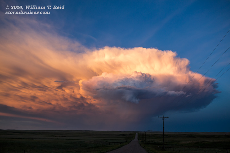
As we neared, north of Newell along Route 79, the wall cloud was less pronounced, there was more rain from the base, and the updraft was getting a nice, round sculpted shape. The supercell moved over 79 to our north, and baseball-sized hail was noted and reported by a police officer. It was at about this stage, though, that the updraft tower became more and more sheared over. It may have been that the loss of daytime heating was diminishing the instability available for this surface-based storm. We stayed with the slowly shrinking updraft base to the east of Newell for perhaps 10 or 15 miles, along old U.S. Highway 212, and then it was back to Belle Fourche for the night. Interestingly, this storm resulted in the largest hail report for the day in the country. Well, the actual report itself was the same size as all of the others, but the hail size given was the greatest.


Leave a Reply
You must be logged in to post a comment.