
Start/Denver
End/North Platte
402 miles
Lunch at Fort Morgan (Taco Johns for me!)
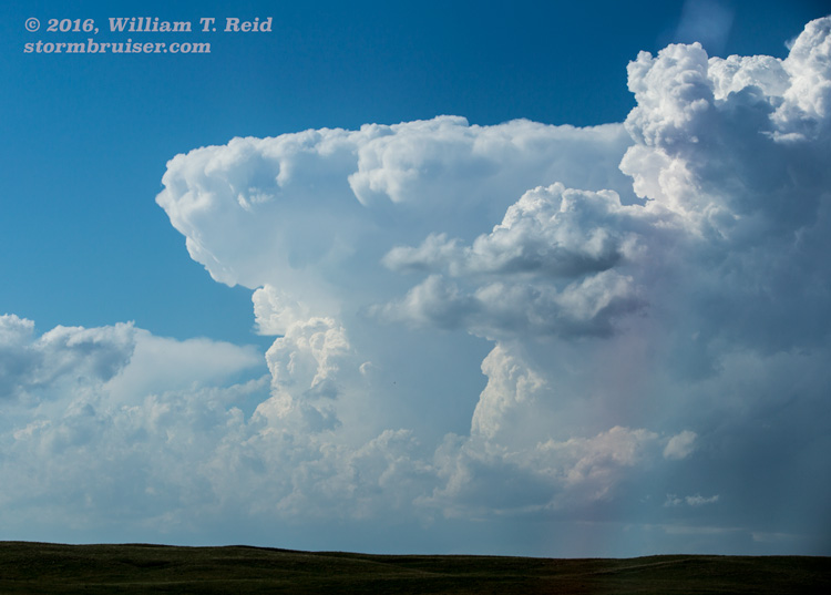
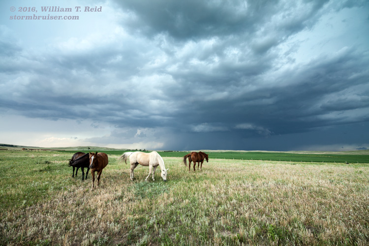
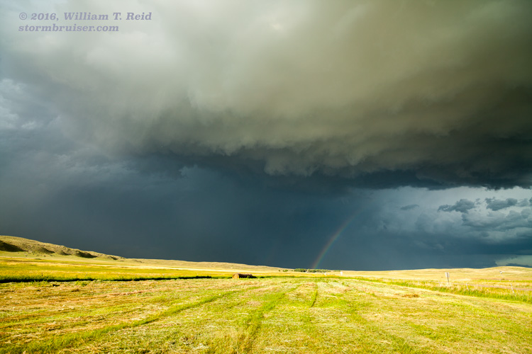
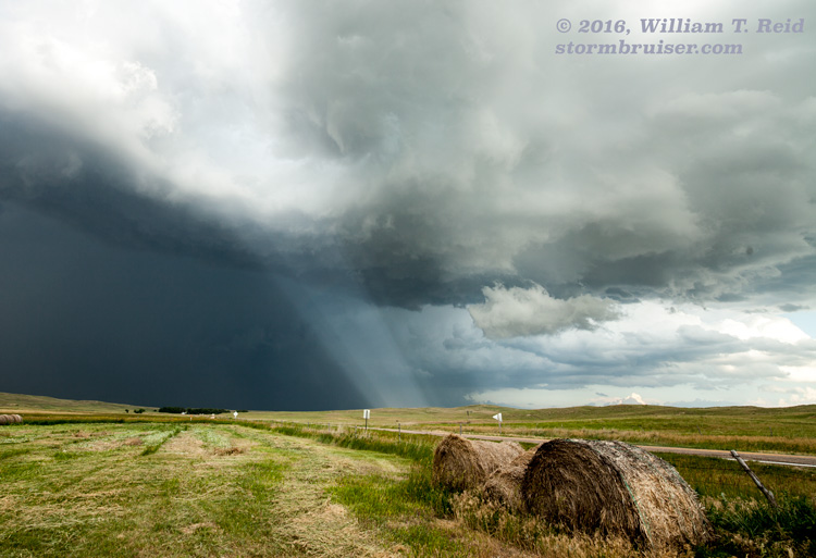
The Storm Prediction Center was not particularly impressed with the severe weather potential on the Great Plains on June 26. I thought that our new group had a good chance of seeing an impressive storm or two in western Nebraska, where SPC showed a marginal risk. The late afternoon mesoscale discussion indicated plenty of instability and shear for supercells, but high storm bases mitigated the tornado risk. We continued out of northeastern Colorado after lunch and headed for the Sandhills north of Ogallala. From a couple of spots along Highway 92 east of Arthur, we watched a few supercells move southeastward. These had pretty good structure, with some nice RFD cuts into the high storm bases.
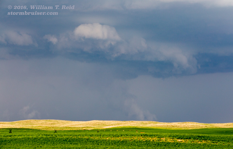
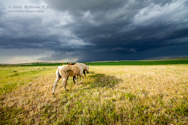
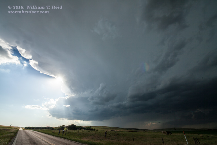
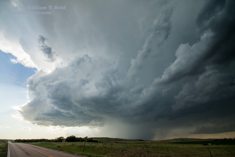
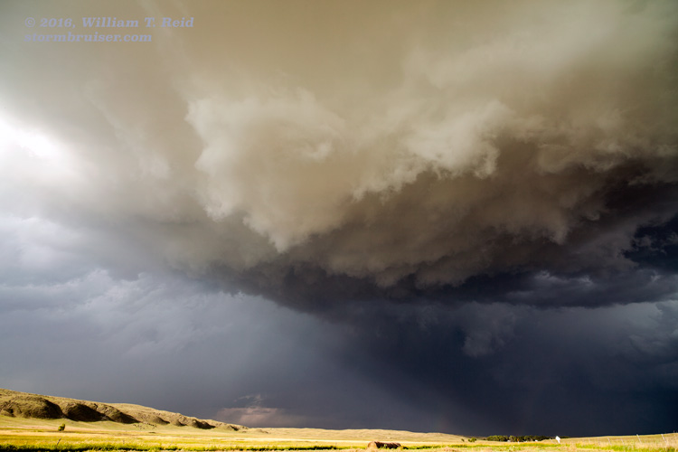
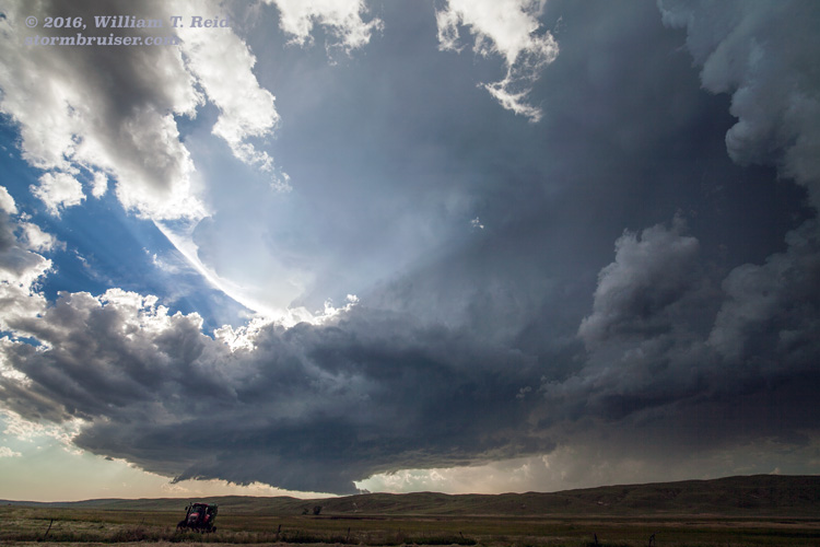
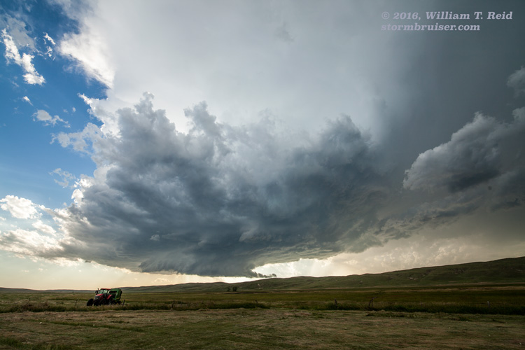
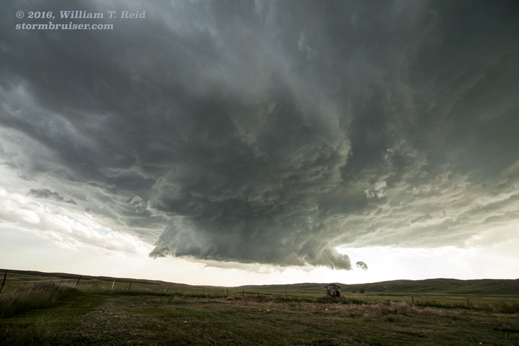
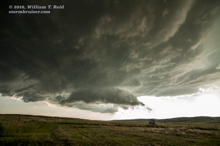
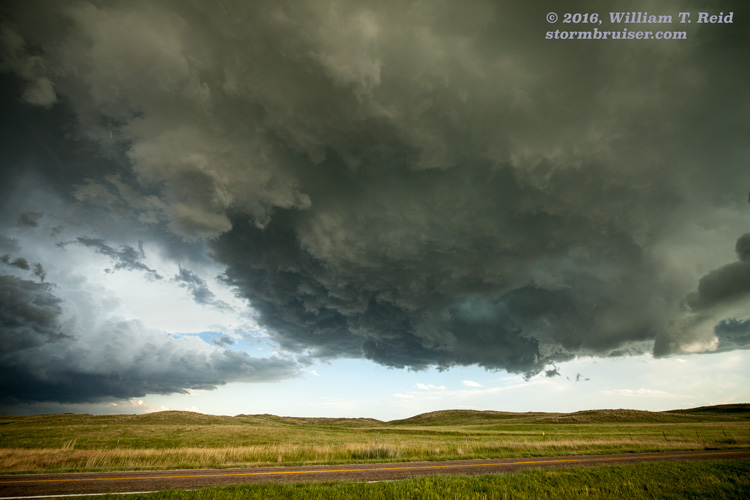
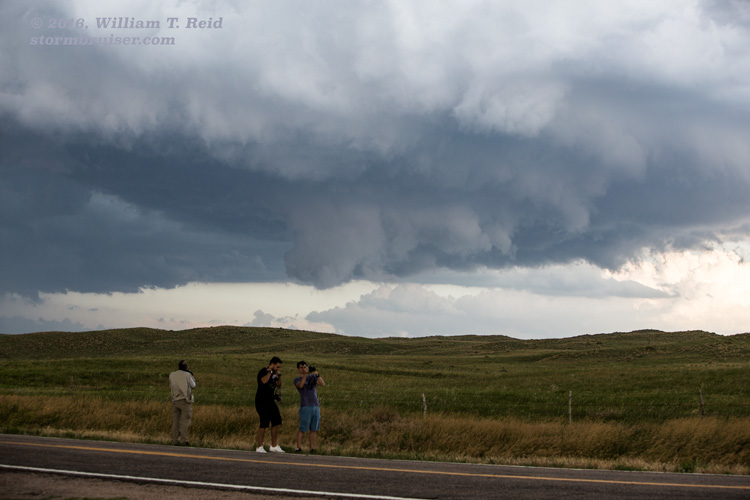
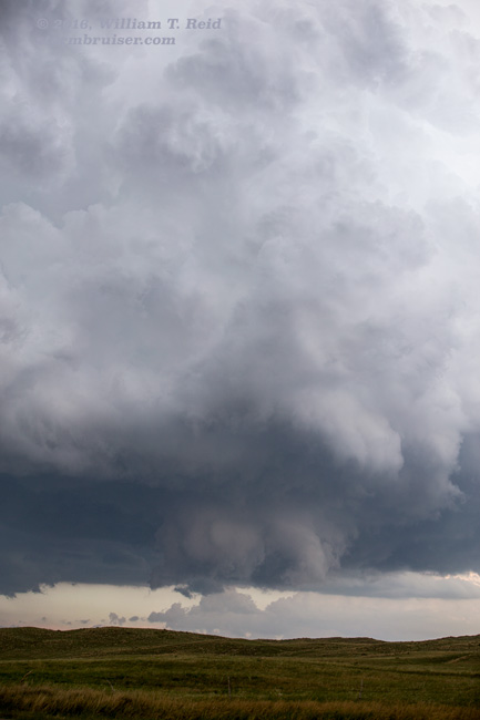
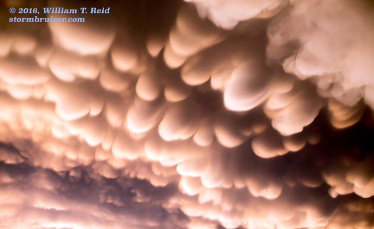
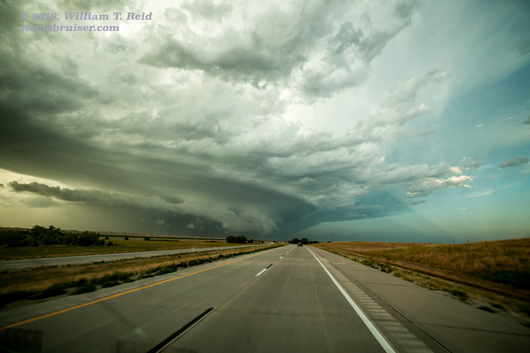
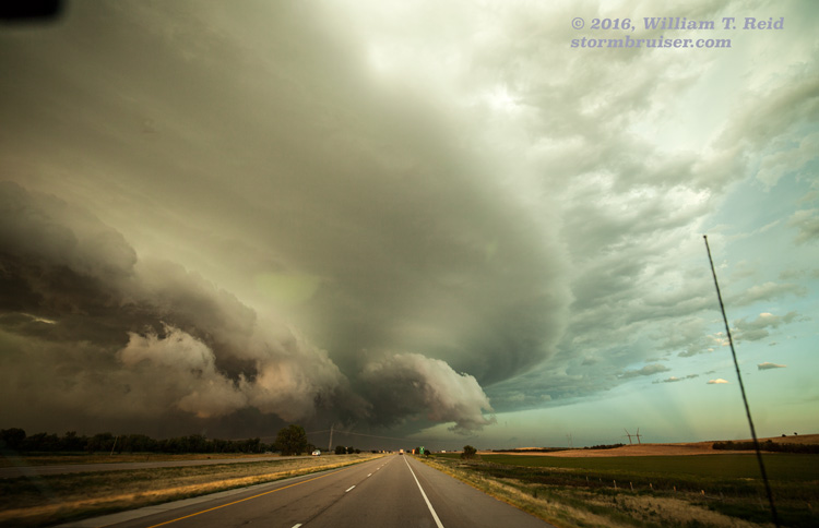
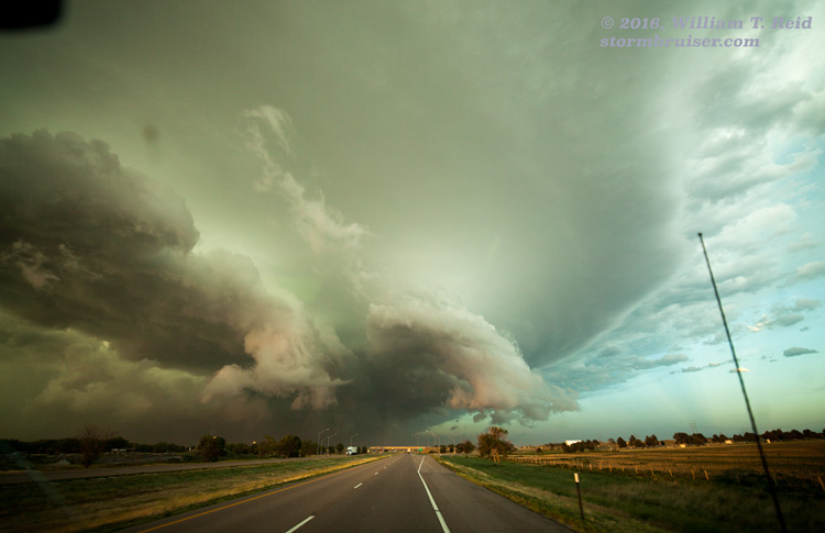
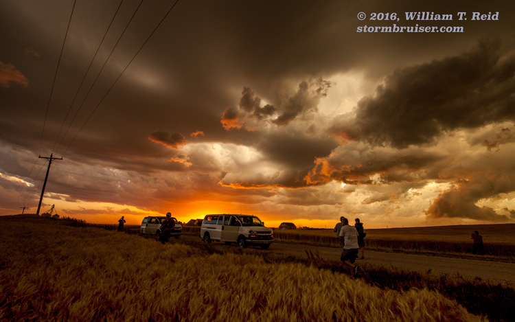
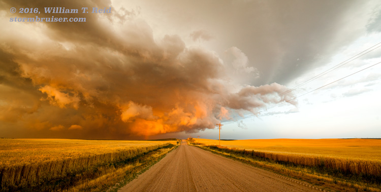
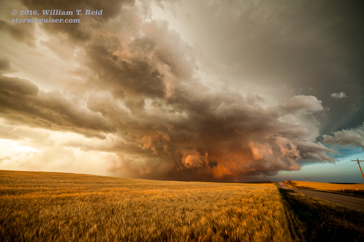
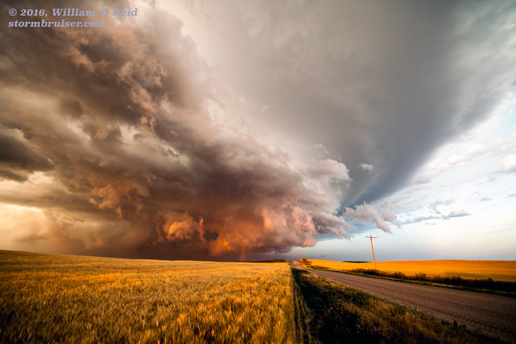
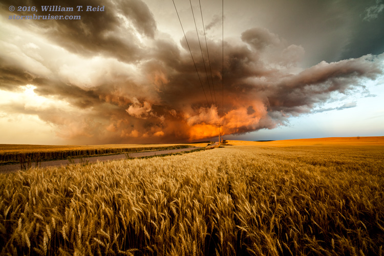
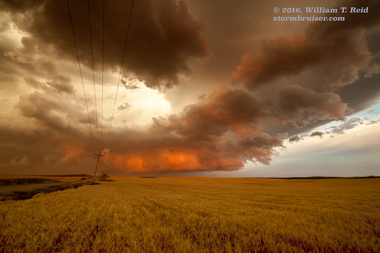
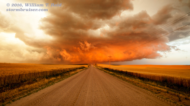
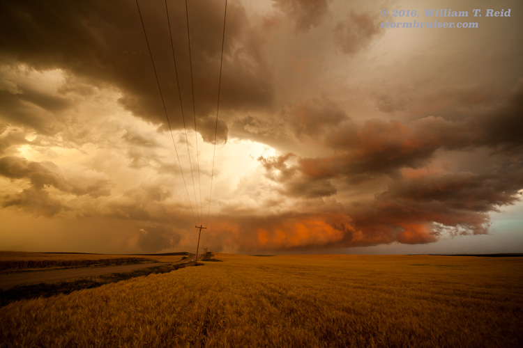
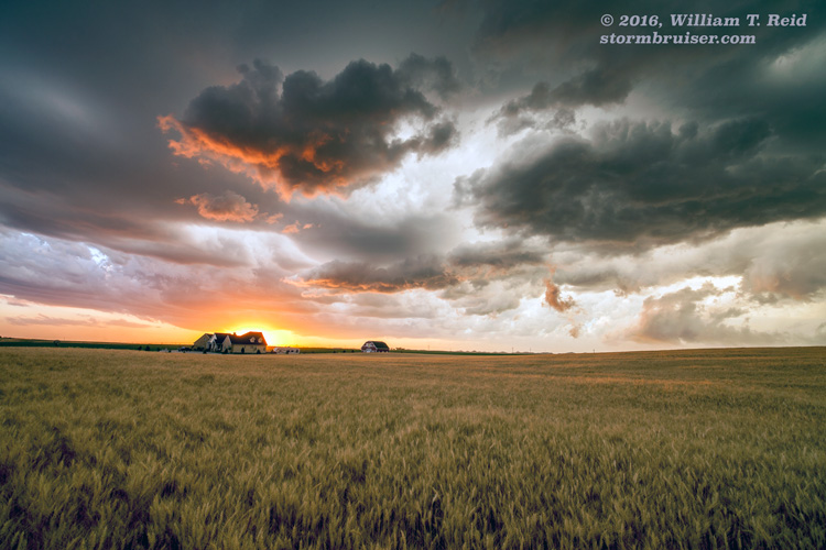
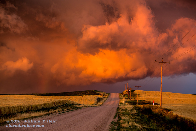
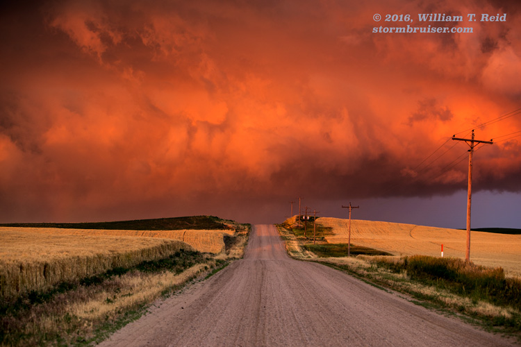
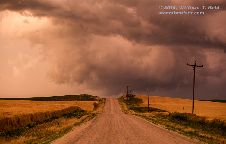
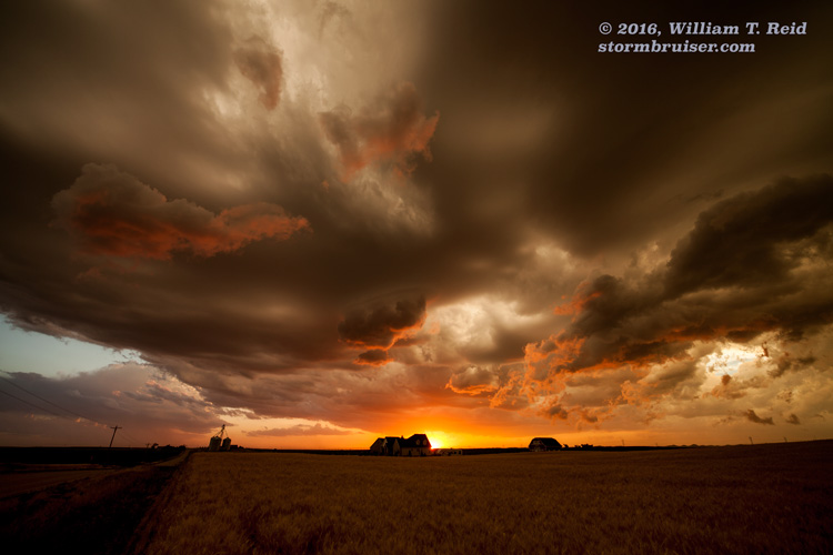
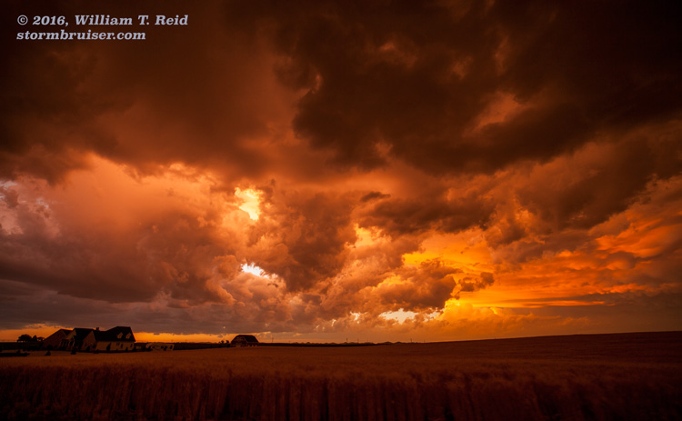
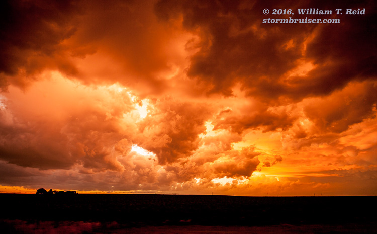
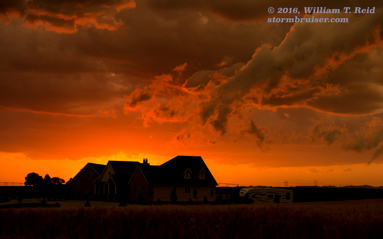
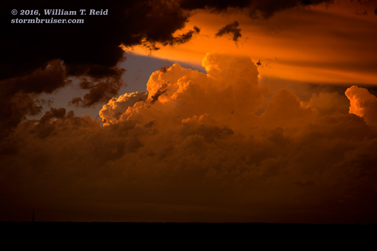
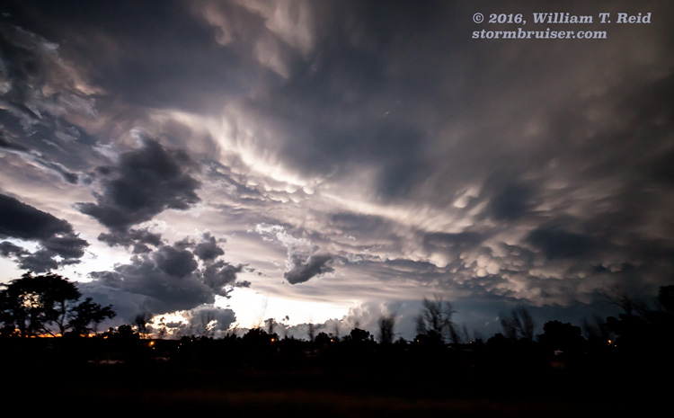
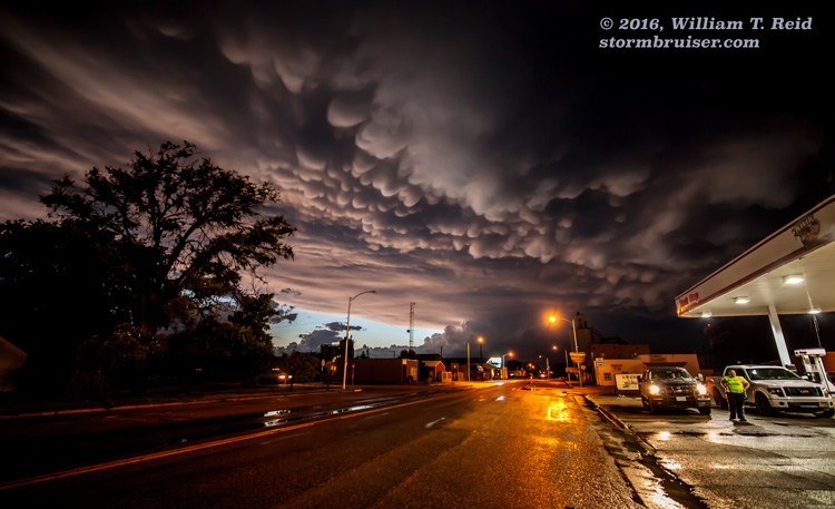
In the last couple of images above, a decent wall cloud was hanging onto a cinnamon-swirl updraft base. This was to our southeast, and the storm looked like one we should stay with. The better option to get back into position, while avoiding hail, was to go back to Arthur and south to Interstate 80. It took almost an hour to get close to the storm again, and it had a fantastic look at low-levels as we approached near Paxton. This was close to sunset, and I knew the light would be great in a matter of minutes. We found a wheat field south of the Interstate off of the Paxton exit, and had a splendid time photographing the storm and the colorful sky. The storm dropped large hail on Sutherland and provided quite the mammatus display in the fading light at Hershey.

Leave a Reply
You must be logged in to post a comment.