
Start/North Platte, NE
End/Yuma, CO
346 miles
Lunch at Valentinos in Ogallala
Our group was in good shape logistically for today’s chase. The best risk for severe and tornadoes was in a strip from the Nebraska Panhandle southward into extreme northeast Colorado (and we were starting from North Platte.) Shear was very good beneath moderate WNW to NW flow aloft. Surface flow from the southeast was moist but on the weak side. SPC’s graphic showed a 5 percent tornado risk.
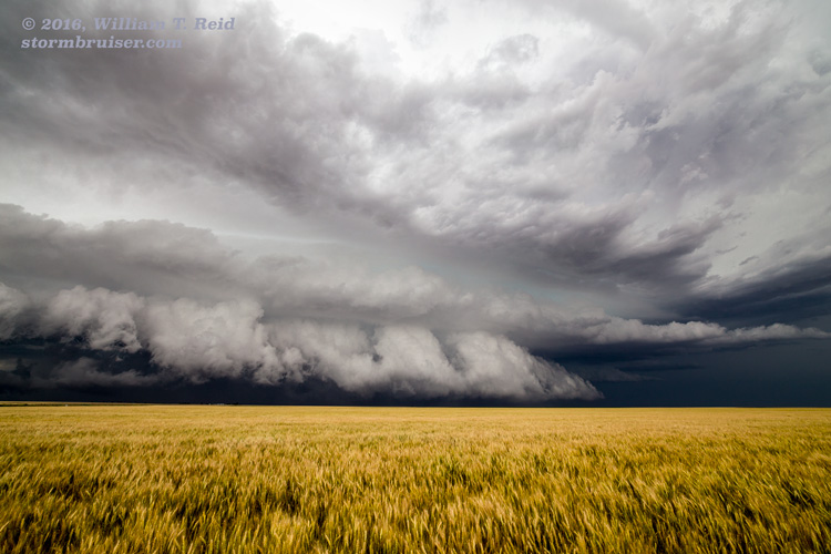
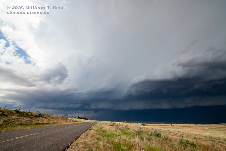
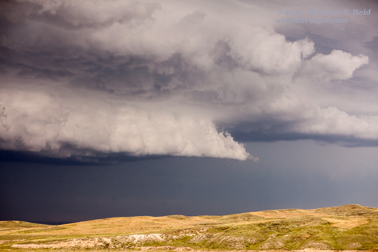
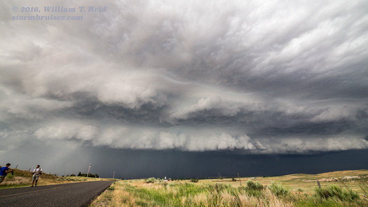
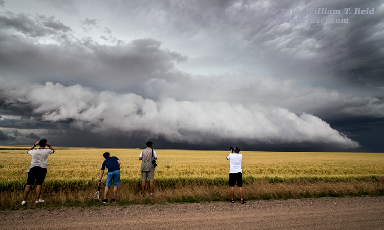
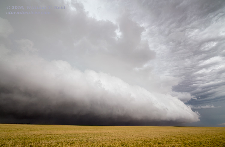
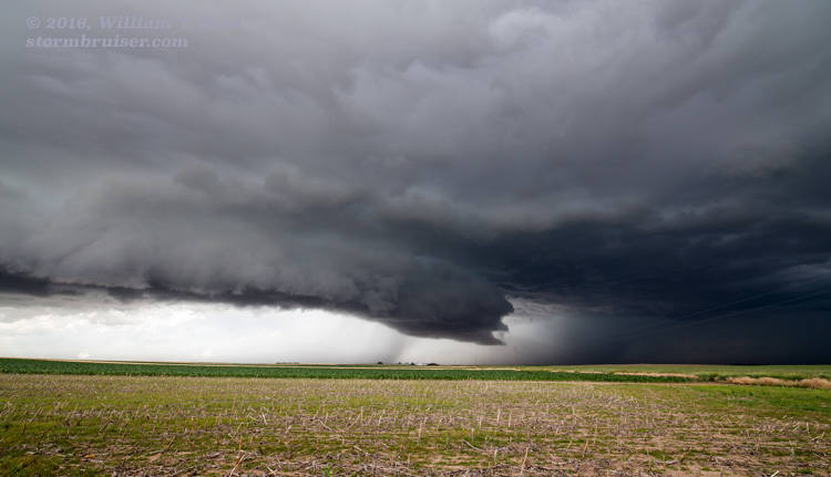
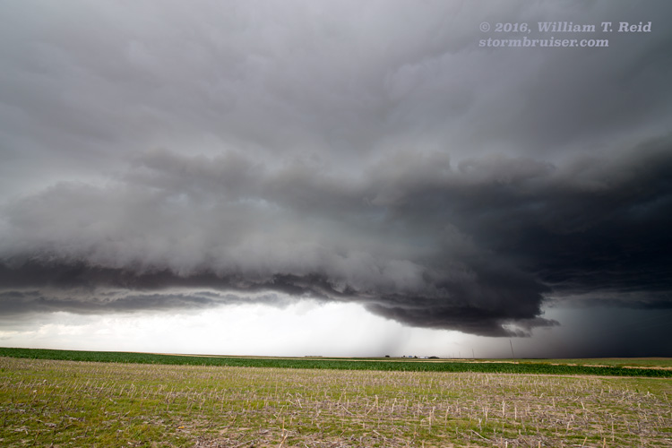
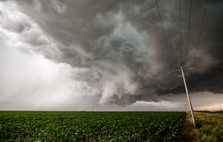
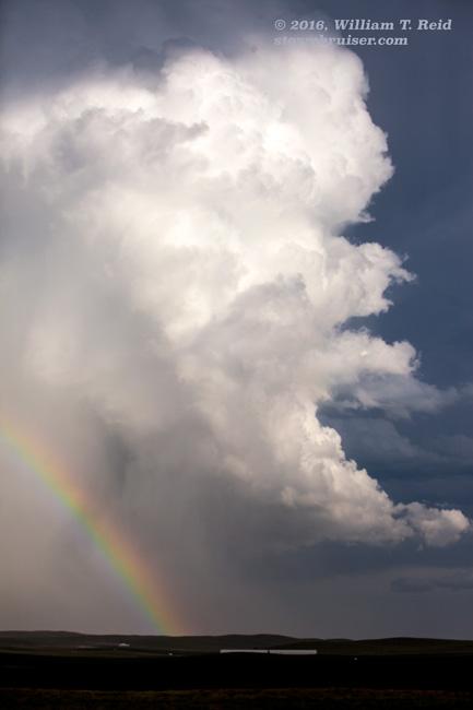
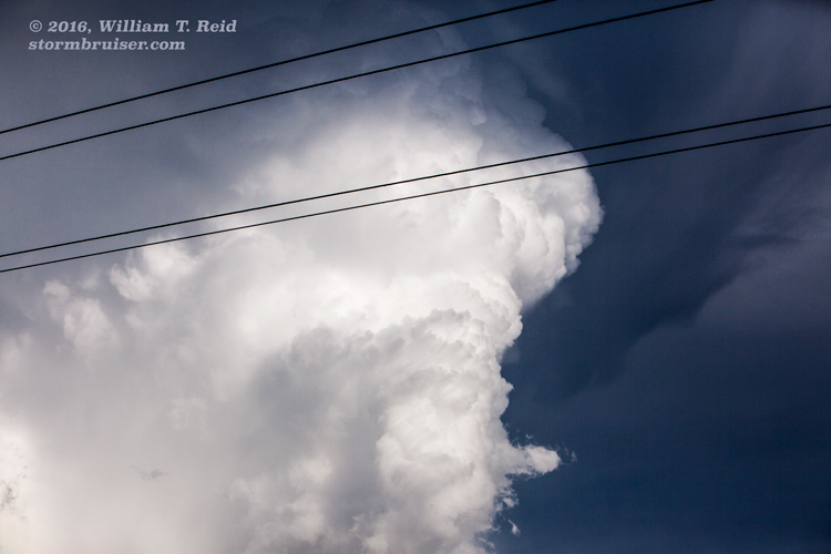
I think that we fiddled around with some initial junky stuff near Sterling, but then it became clear that we needed to be farther northeast. A big storm was coming out of Nebraska and heading towards Julesburg, CO. It was time for my driver, Jennifer, to get us on it! This was a fairly easy catch, and in maybe 30 minutes we were just south of the supercell as it loomed just north of Ovid. The structure was spectacular as the front end descended upon the town and continued south of I-76. The images below were from about 4 – 8 miles south of Ovid.
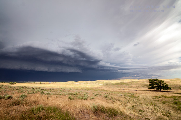

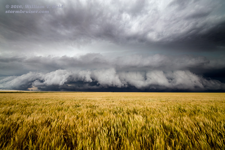
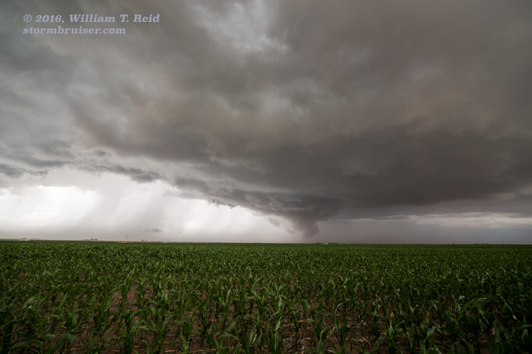
Just up the highway at Julesburg during this time, large hail and strong winds were wreaking havoc. A brief tornado occurred eight miles southeast of Julesburg which we did not observe. Baseball-sized hail was reported with the storm. This supercell weakened some, and we scooted west a little towards the Haxtun vicinity to watch another storm develop. This one had a decent wall cloud for a bit.
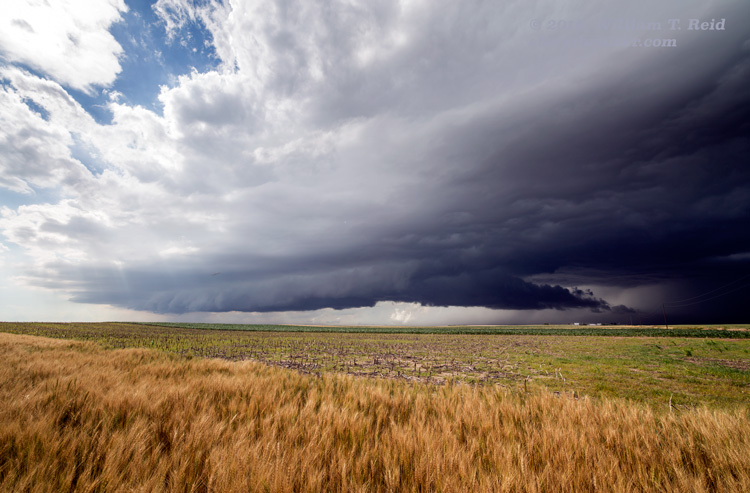
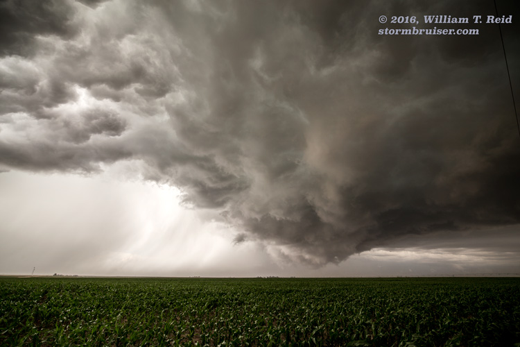
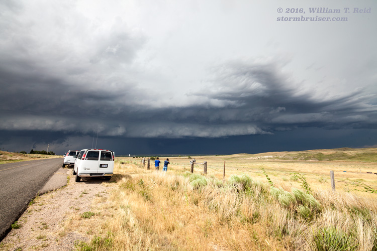
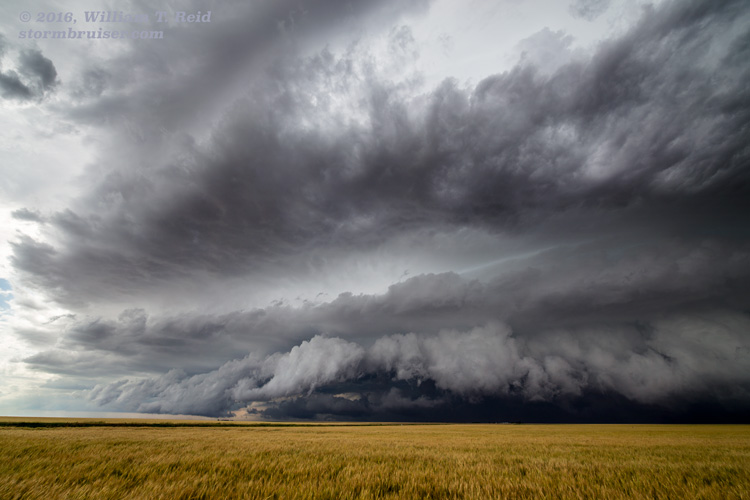
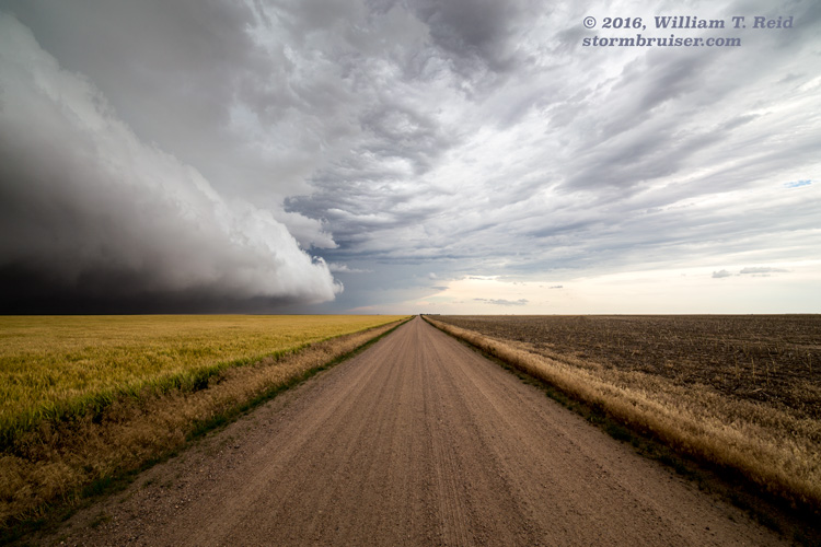
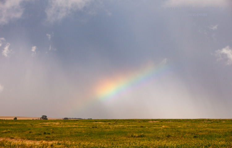
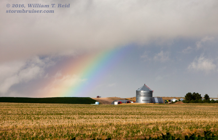
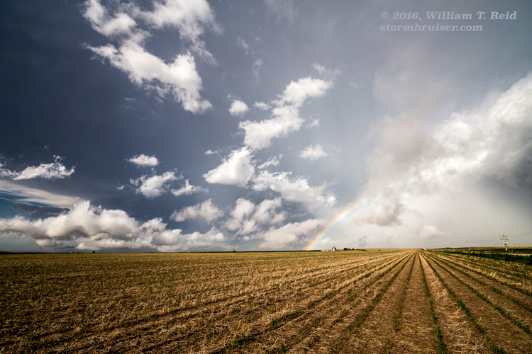
It looked like this one might be able to put down a tornado, but it, like the other one, became a little too undercut and outflowish. As the activity continued to the south, it became less organized and less appealing. We took a dirt road from 59, south of Haxtun, over to 385 north of Wray. There was a rainbow and some pretty stormy scenes to photograph, but the serious stuff was done. We got into Yuma early enough for a decent meal, too!
Leave a Reply
You must be logged in to post a comment.