Start/Yuma, CO
End/Ogallala, NE
471 miles
Lunch at the Runza in Sidney, NE
spc-mesoscale-discussion-1072 E WY/W NE 2 p.m.
spc-mesoscale-discussion-1075 NE PH 5:30 p.m.
spc-mesoscale-discussion-1078 NE PH 6:30 p.m.
spc-mesoscale-discussion-1079 E CO/SW NE/NW KS 7:15 p.m.
spc-mesoscale-discussion-1080 SW NE 7:30 p.m.
spc-mesoscale-discussion-1083 SW NE 9:45 p.m.
spc-mesoscale-discussion-1084 SE CO 10:15 p.m.
spc-mesoscale-discussion-1085 NW KS 11 p.m.
This chase day was shaping up to be quite interesting. By midday, SPC had an enhanced risk in a large area from about Goodland to Chadron. Like the day prior, shear was tremendous. WNW to NW flow at midlevels was overspreading moist, upslope southeasterly flow in the lowest levels. The tornado prospects were not especially good, as temperature/dew point spreads were forecast to be rather large. That would promote storms with outflow issues. A severe wind threat as storms congealed appeared probable, and that indeed eventuated. My job was to try to find something discrete and pretty and severe before anything linear swallowed it up.
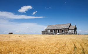
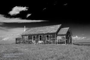
We headed up to Alliance and then Hemingford in the middle of the Nebraska Panhandle. There was plenty of nice, blue skies during the early afternoon to boost the instability. The initial development was up in southwestern South Dakota and northeastern Wyoming, but we needed to hang tough down south here. Towards 5 p.m. or so, we had some towers not too far to our north, which I liked. And, there was another agitated area to our ENE. This second area was deep into the Sandhills, northeast of Alliance and south of Gordon. I recall making a brief, aborted attempt towards the towers that were between Hemingford and Crawford. We went back to the old schoolhouse west of Hemingford, and watched that bundle of cumulus to our ENE get better and better. It was time to move.
The developing storm was perhaps 60 miles distant, and the road network was less than ideal. If the storm didn’t move, it would take about 90 minutes to get into position. Where would the storm be in about two hours? Would it continue to drift very slowly to the north? Or would it intensify, rotate strongly, and move (deviantly) to the south? I contemplated these scenarios as we approached the decision point — highway 87, north of Alliance. I figured that in order to get near the storm the fastest we should go north to U.S. 20, and then east and south (if necessary). The other option was back down south to Alliance first, and then east on highway 2, and hope that we don’t miss anything during the early stages. We would be moving farther away from it for a good 20-25 minutes. If the storm were going to produce a tornado, I didn’t want to be moving farther away from it…while it was already 50 miles distant!
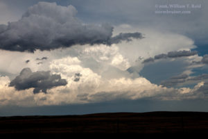
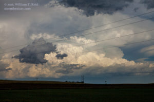
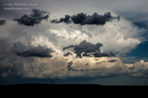
Well, about halfway in our long trek to get into position, I was wishing that we had done the south option via Alliance! The storm strengthened quickly, maybe 15-20 miles SSE of Gordon, and then began moving to the SSE. Fortunately, it wasn’t moving too quickly. As we motored eastbound on 20 from Hay Springs to Gordon, I had some good opportunities to photograph the huge cumulonimbus cloud to our southeast. Of course, if it had dropped a tornado at this point, then I would be very happy that I had not chosen the southern option! You never know…
From Gordon, we had to dive south again and go ALL THE WAY down to Highway 2. That is another hour, and we will still be on the backside of the storm as it moves farther from Highway 27. UGH. We had another couple of hours of good daylight, though. About the time that we were nearing Gordon, the activity up in South Dakota was nearing the Nebraska border. We could see the nasty, greenish shelf cloud up that way, and it meant business. The severe wind beast was in progress and getting stronger, and it was going to have its way in the northern Nebraska Panhandle in the very near future. Soon after leaving Gordon and diving south, we learned of wind gusts near 100 mph in the Chadron area, to our west! The warnings on this squall had it moving south to south-southeastward at perhaps 65 mph! Could we even get to our target storm in time before it got swallowed up? Would we be sitting ducks in the Sandhills with large hail and violent winds enveloping us? Would I be at the auto glass place tomorrow? I didn’t really want to think about that. I was focused on the impressive supercell in the road void of the Nebraska Sandhills. It was to our east, and then to our northeast as we finally reached Ellsworth at Highway 2. We could not see too much structure from the backside — we really needed to be south or southeast or east of this thing!
Eastward we went on Highway 2. We needed to get to Hyannis and Highway 61, and from there get into position! But, it was another 30 minutes to Hyannis…
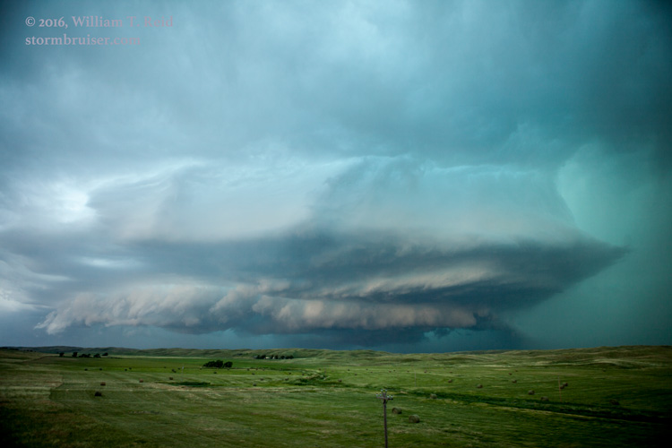
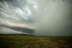
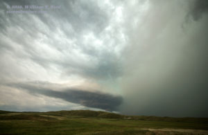
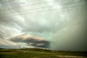
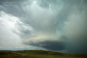
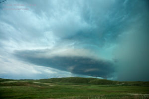
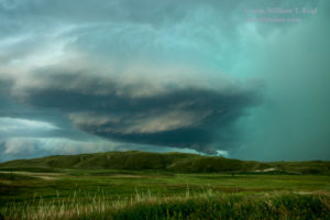
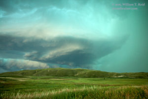
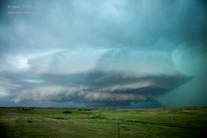
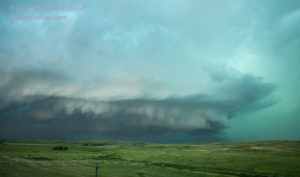
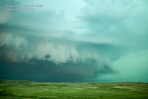
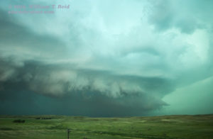
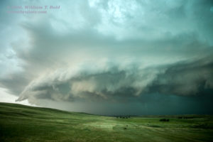
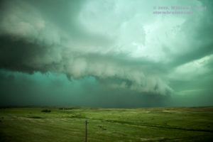
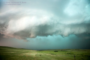
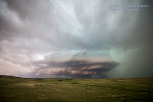
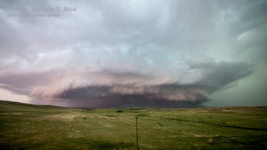
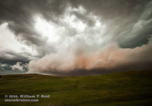
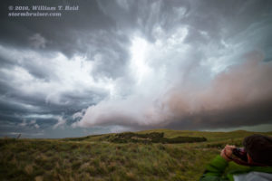
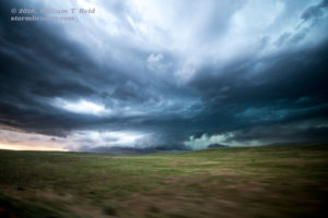
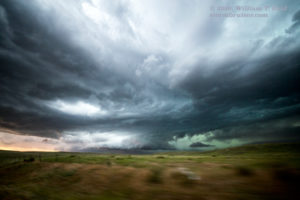
It must have taken close to three hours of non-stop driving, and we were finally in great position on the “Hyannis” supercell! We stopped about 4 or 5 miles north of Hyannis. The thing was looking great! The updraft was nicely sculpted, and the green hue behind it was striking. And, that fast-moving squall line from the Nebraska Panhandle was coming up behind it! See the SPC mesoscale discussions linked near the top to get a blow-by-blow description of the severe wind with this squall/derecho.
The shelf cloud associated with the squall can be seen behind the supercell updraft in some of these images. The view is primarily to the west and WNW.
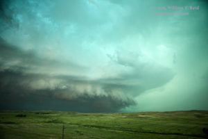
We had about ten minutes at our first stop before rain and hail threatened. The storm continued to head to the southeast at maybe 20 mph. Our road was working out nicely, but we were getting more and more vulnerable to large hail. We scooted south a mile or two, and the storm was looking more and more like a beast.
(The final two images above were with the 15 mm lens and belong closer to the top of this grouping!) It was about this time that tornadoes were reported with the storm, but no one with our group saw any. Maybe there was too much rain wrapping. Three tornados were reported, and one was NNW of Hyannis by about 8 miles. We hung in there along Highway 61 as long as we could, and then we had to dash south to Hyannis and do the zig-zag along Highway 2. The tornado sirens were going strong in Hyannis, and the end-of-the-world storm was going to smack it head-on! Was there a rain-wrapped tornado inside there? Only the rabbits in the hills northwest of town knew the answer.
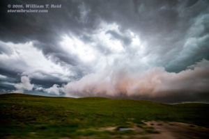
A big change occurred, though, as the storm neared Highway 2. It seemed to quickly disorganize. The squall was killing the supercell before the supercell could fully impact Hyannis! We went south on 61 and stopped to look behind us again, and soon we were blasted with very strong winds from the north. The system from South Dakota had caught up with us. The lowest levels of what remained of the supercell had a weird brownish tinge, probably due to dust and dirt getting kicked up as the windy squall swept up behind it.
I had Jennifer and Bill S. take us south on 61 at a decent pace, but it was not going to be possible to get back in front of the gust front. Winds were about 50-60 mph, but at least there wasn’t much rain yet. Down 61 we went to Ogallala for the night.

Leave a Reply
You must be logged in to post a comment.