Stormbruiser.com

William T. Reid

  • About
  • Video Links
  • Climate
  • Categories
    • Astronomy
    • Aurora/Northern Lights
    • Artsy
    • Airports (LAX and VNY)
    • Animal Day
    • Beach
    • BEST and MOST POPULAR
    • Chase Season Summary
    • Chasers and friends
    • Cumulonimbus
    • Death Valley
    • Desert
    • Desert/Mountains
    • Elevated photography
    • Eyesores
    • Fire
    • Flooding
    • Hurricane
    • Landscapes
    • Lightning
    • Local: Conejo Valley/San Fernando Valley
    • Mid and High Clouds
    • Nighttime photography
    • Old Stuff
    • Rainbows/Optical Phenomena
    • San Nicolas Island
    • Storm Video Sales
    • Stormy Skies
    • Stupid Bugs
    • Sunsets and Storms
    • Supercells
    • The City
    • Tornadoes
    • Unusual Clouds
    • Vegetation
    • Wind and Dust
    • Winter Weather
  • Contact
You are here: Home / 2016 / June 29, 2016 Strong Storms in Northeast Colorado

June 29, 2016 Strong Storms in Northeast Colorado

June 29, 2016 By Bill Leave a Comment

160629_0212_holyoke-co


Start/Ogallala, NE

End/Holyoke, CO

Lunch at Dix, NE D&B Diner


SPC Day One 20Z

spc-mesoscale-discussion-1091

SPC Storm Reports


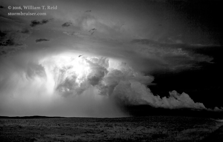
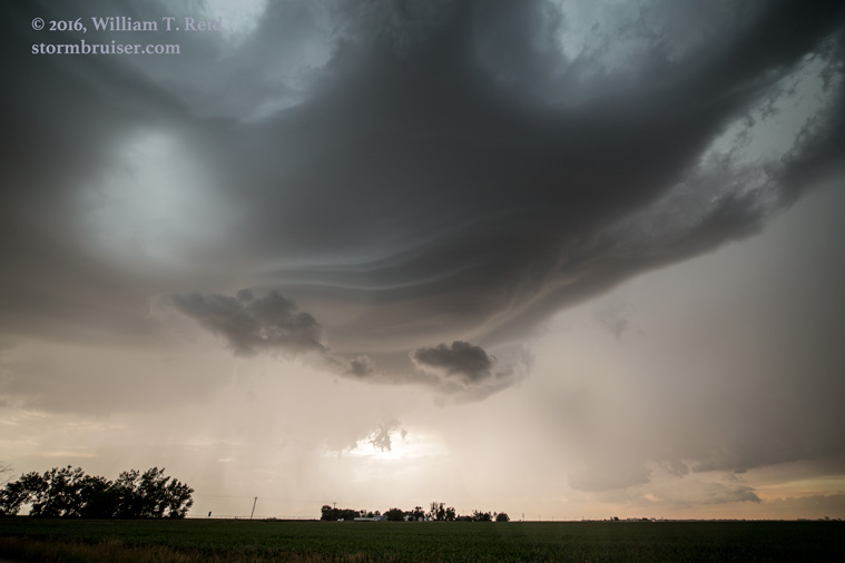
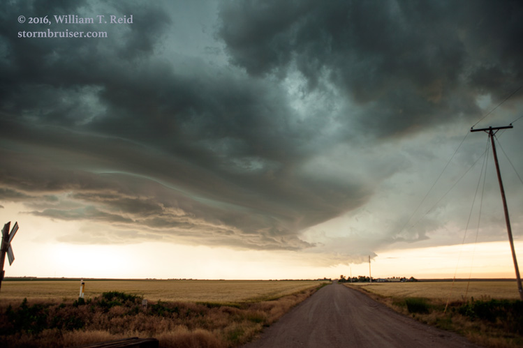
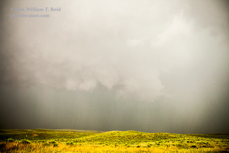
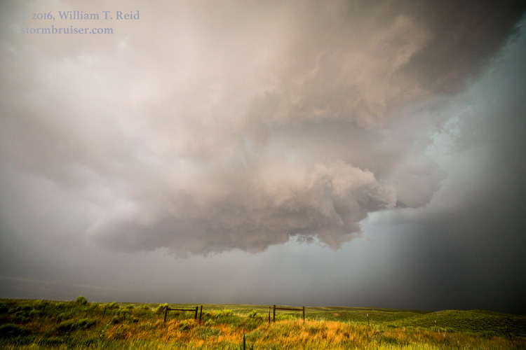
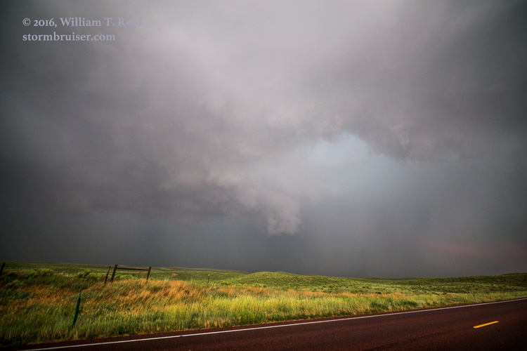
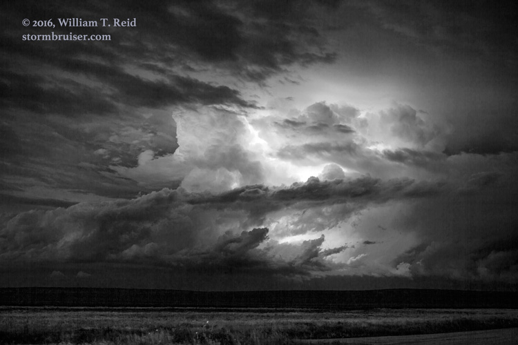
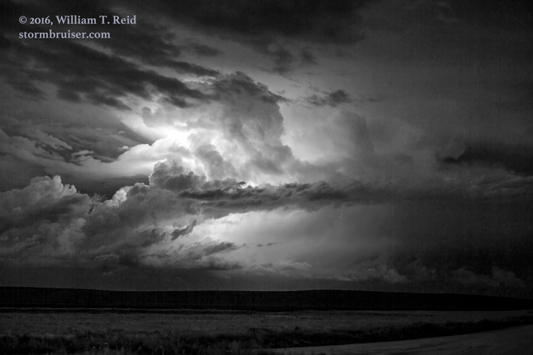
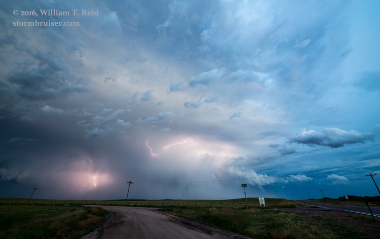
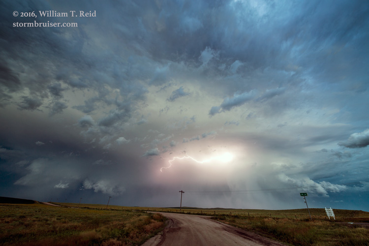
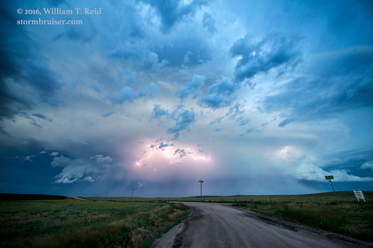
With moderate northwest flow aloft continuing above weak upslope flow on the High Plains, supercells and large hail appeared to be a good bet again in and around the Cheyenne Ridge this afternoon and evening.  Like yesterday, moisture was just a bit too meager to allow much of a tornado chance.  We found some convection by mid-afternoon in Weld County, near Keota.  It was high based and not very strong.  We went up to Kimball and saw much the same; it seemed to be a bit of a mess of weak storms.  I decided to head east on I-80 to regroup and to get into better air.  At about this time a downburst with 90 mph winds impacted a spot two miles north of Kimball, according to reports.  We missed that.


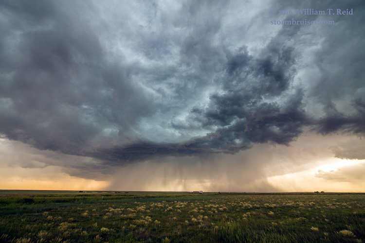
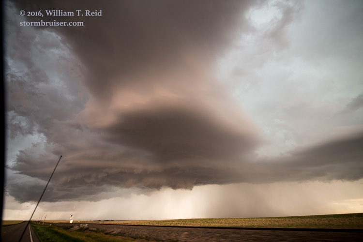
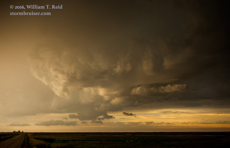
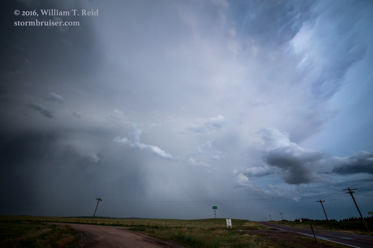
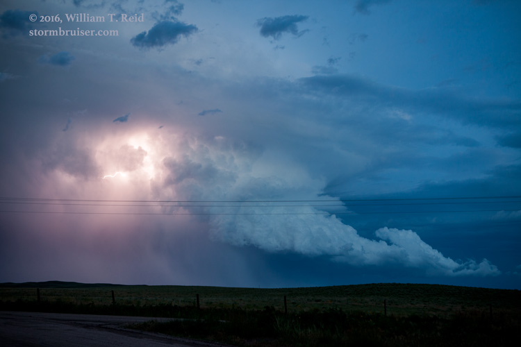
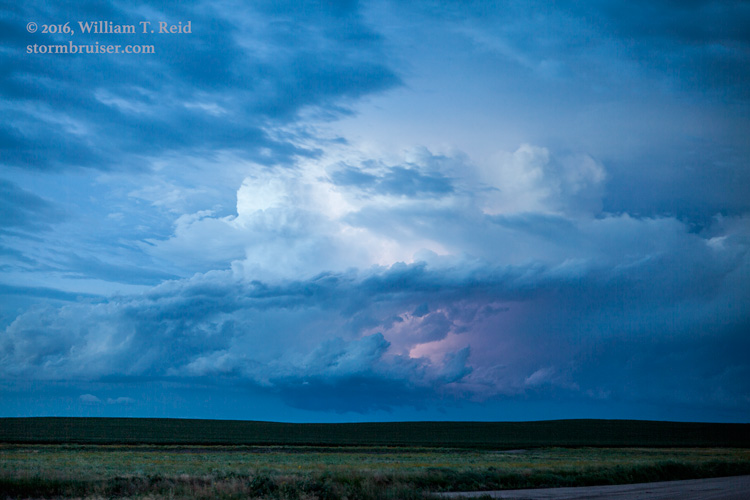
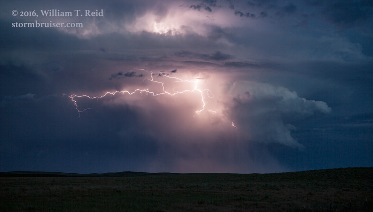
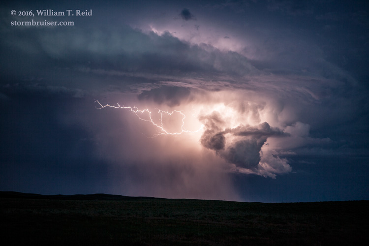
New updrafts beckoned towards Sterling, so we headed that way from Sidney.  Again, the storms were rather high-based and unimpressive.  These dragged us to U.S. 385, and south of Holyoke a bit.  A little after sunset, the activity perked up a little and we watched a couple of severe cells drift towards Nebraska.


Filed Under: 2016, Lightning, Sunsets and Storms, Supercells

Leave a Reply

You must be logged in to post a comment.

Search

June 2016
S M T W T F S
 1234
567891011
12131415161718
19202122232425
2627282930  
« May   Jul »

Categories

Archives

Copyright © 2025 stormbruiser.com · Log in