By late afternoon today, radar and satellite showed a good-sized thunderstorm well to the WSW of Pt. Conception and moving to the east. This storm was a smallish squall that was south of the primary band of moisture which was being steered into northern California. There wasn’t much instability, but the storm sported cloud tops of about 40,000 feet. It seemed to be moving a little to the right of the mid-level flow, too, which suggested some decent organization and at least weak rotation in the updraft. It was moving to the east fairly quickly, but there was no way it would still be going, three hours later, in order for me to get a good look at it, right?
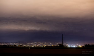
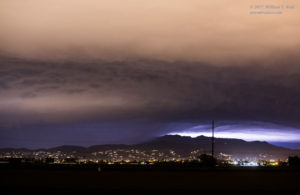
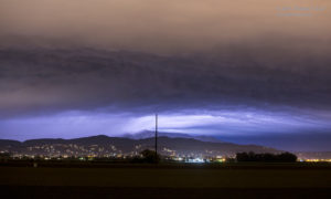
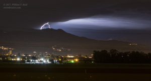
Well, it DID keep going! It was a rogue cell of sorts, and it was in its happy place as it lumbered towards Santa Rosa Island and into the Santa Barbara Channel. As it neared Ventura, I headed out to a high point in the hills near Camarillo. AM radio was crackling with static, and the anticipation level was high! As I pulled up to the spot to stop, a spectacular CG (cloud-to-ground) lightning strike appeared in the distance to the west. I was in Fat City! I set up the camera onto the tripod and started shooting — and waiting for the next one — and there WAS no next one. There were flashes behind a hill to the northwest, but the hill made it impossible to see what kind of activity I was not seeing. After 15 minutes or so, I repositioned down the hill and closer to Camarillo, on the flats of the Oxnard Plain, and stopped again to try to capture the lightning which continued to the northwest. It was mostly in-cloud, if not ALL in-cloud as far as I could tell. But there was quite a bit of lightning—-and the relatively high cloud bases showed some structure, too. Though the in-cloud lightning continued, the cell was weakening and moving quickly to the ENE, through the Fillmore and Piru areas and towards Castaic. I managed to catch some flashes and some storm structure. For a California chase in the first week of January, I can’t complain.
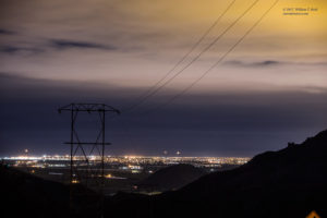
For the first image below, I was at the first stop with a view to the west between the hills (along Potrero Road). That one nice CG (seen before the camera was ready) was back there in the distance, probably over the ocean. You will have to use your imagination as to how it might have looked. The remaining images were from the southern edge of Camarillo along Los Posas Road.


Leave a Reply
You must be logged in to post a comment.