Stormbruiser.com

William T. Reid

  • About
  • Video Links
  • Climate
  • Categories
    • Astronomy
    • Aurora/Northern Lights
    • Artsy
    • Airports (LAX and VNY)
    • Animal Day
    • Beach
    • BEST and MOST POPULAR
    • Chase Season Summary
    • Chasers and friends
    • Cumulonimbus
    • Death Valley
    • Desert
    • Desert/Mountains
    • Elevated photography
    • Eyesores
    • Fire
    • Flooding
    • Hurricane
    • Landscapes
    • Lightning
    • Local: Conejo Valley/San Fernando Valley
    • Mid and High Clouds
    • Nighttime photography
    • Old Stuff
    • Rainbows/Optical Phenomena
    • San Nicolas Island
    • Storm Video Sales
    • Stormy Skies
    • Stupid Bugs
    • Sunsets and Storms
    • Supercells
    • The City
    • Tornadoes
    • Unusual Clouds
    • Vegetation
    • Wind and Dust
    • Winter Weather
  • Contact
You are here: Home / 2017 / May 7, 2017 Clayton Lightning Display

May 7, 2017 Clayton Lightning Display

May 7, 2017 By Bill Leave a Comment

170507_0991cr_Clayton


Start:  Clayton, NM

End:  Raton, NM

367 miles

Day One/20Z

SPC Storm Reports


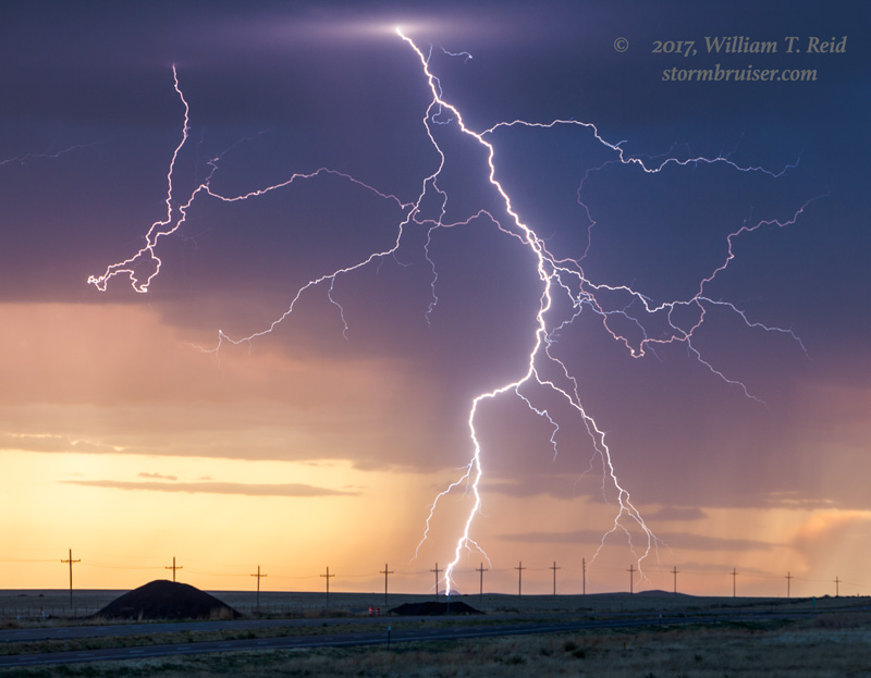
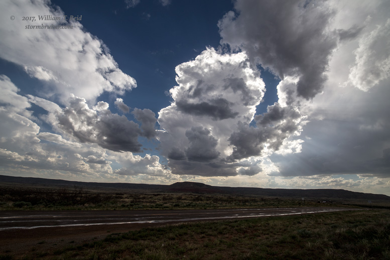
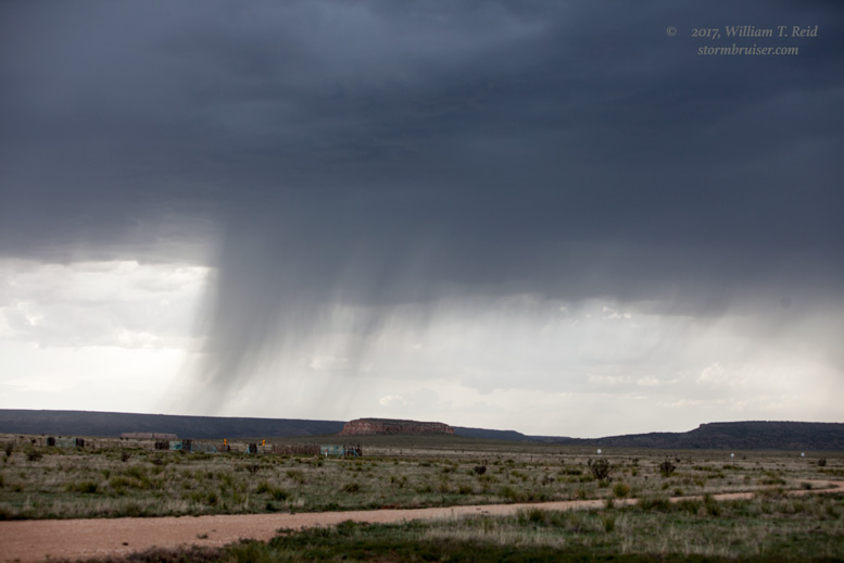
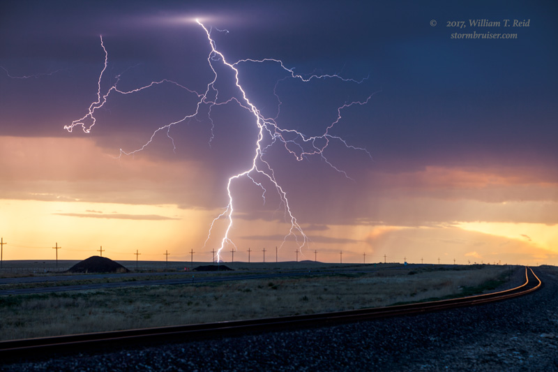
What is this?  A chance for severe weather?!  SPC showed a marginal risk of severe storms on the High Plains of NM and CO.  I targeted the area around Clayton.  Why not?  We were already at Clayton!  My copious notes indicate that we saw some high-based updrafts from Logan to Clayton.  Near sunset, near Clayton, we were racing to an electrified cell.  We made it to a spot some ten miles WNW of Clayton to catch some pretty bolts with the cameras.


Filed Under: 2017, Cumulonimbus, Lightning

Leave a Reply

You must be logged in to post a comment.

Search

May 2017
S M T W T F S
 123456
78910111213
14151617181920
21222324252627
28293031  
« Mar   Jun »

Categories

Archives

Copyright © 2025 stormbruiser.com · Log in