

Start: Oklahoma City
Lunch: Canadian, TX/Stumblin’ Goat Saloon
End: Woodward, OK
522 miles


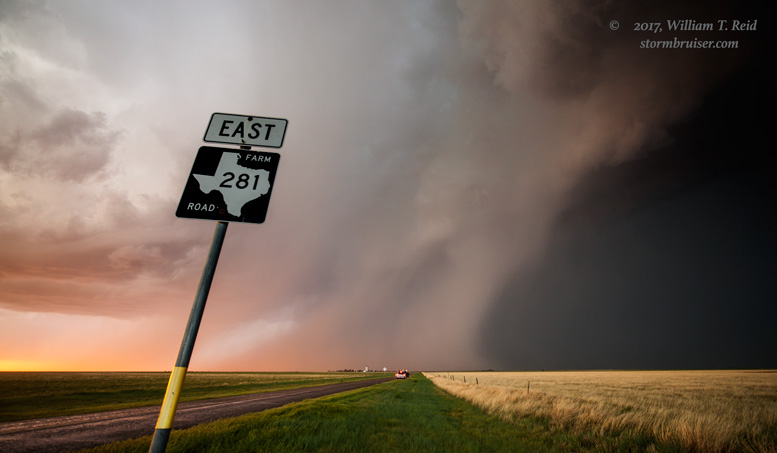
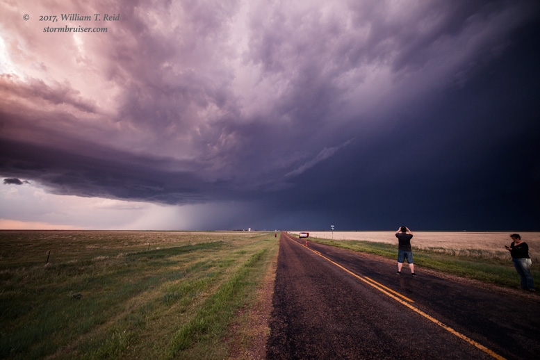
May 15th…time to start Tour 3! My drivers were Bob S. and Chris G., and we had storms scheduled to develop in the Texas Panhandle. We made it out of Oklahoma City in decent time and found ourselves looking at stuff going up somewhere west or southwest of Stinnett. I have totally forgotten the details up until the point where we saw a cell organize nicely southwest of Stinnett. Temperature/dew point spreads were fairly large, low-level moisture was so-so, and the cloud base for this storm was fairly high. We were on (east-west) road 152 between Dumas and Stinnett, and wound up heading to a viewing spot a couple of miles southwest of Stinnett to watch the rotating storm base approach. We beat the baseball-sized hail which fell west of Stinnett on 152 by 5-10 minutes.

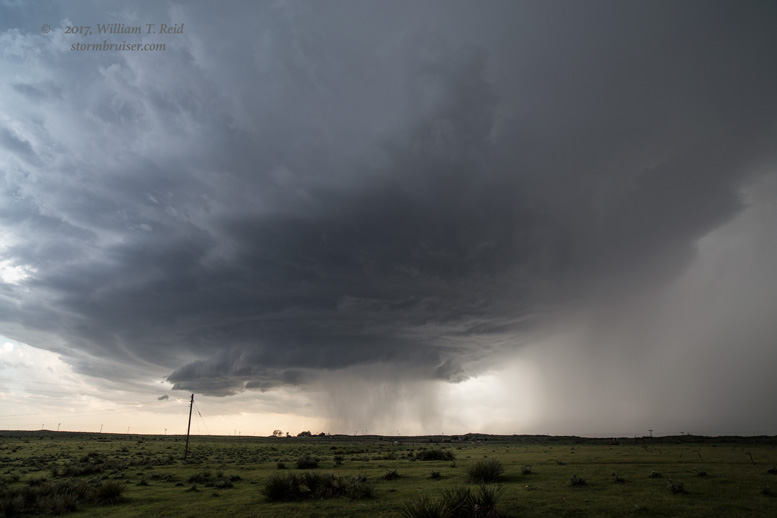
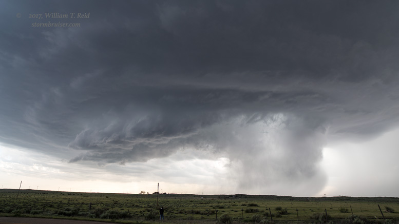
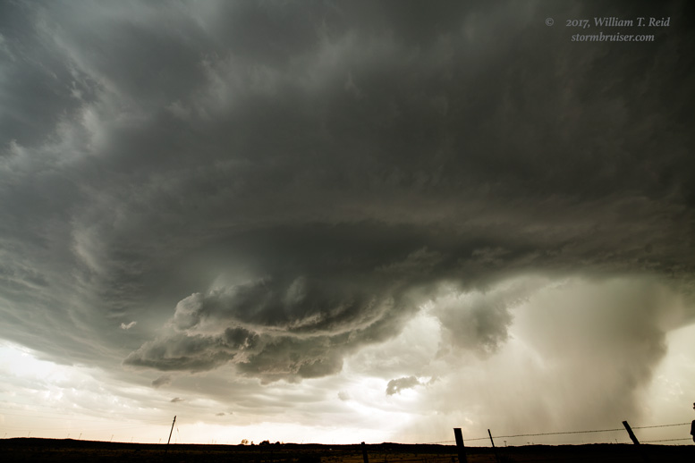
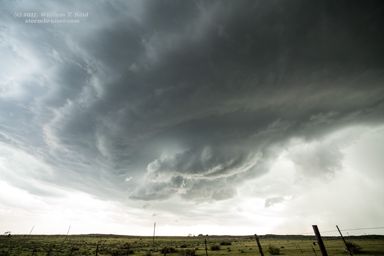

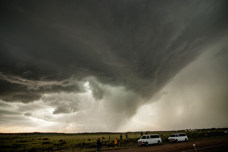
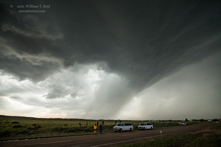
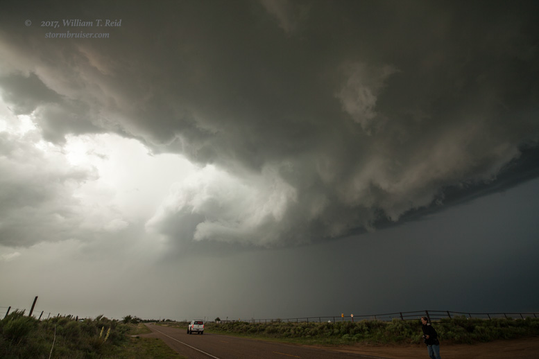
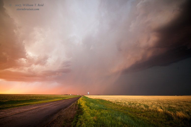
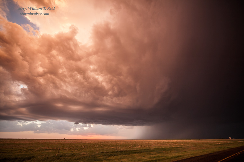
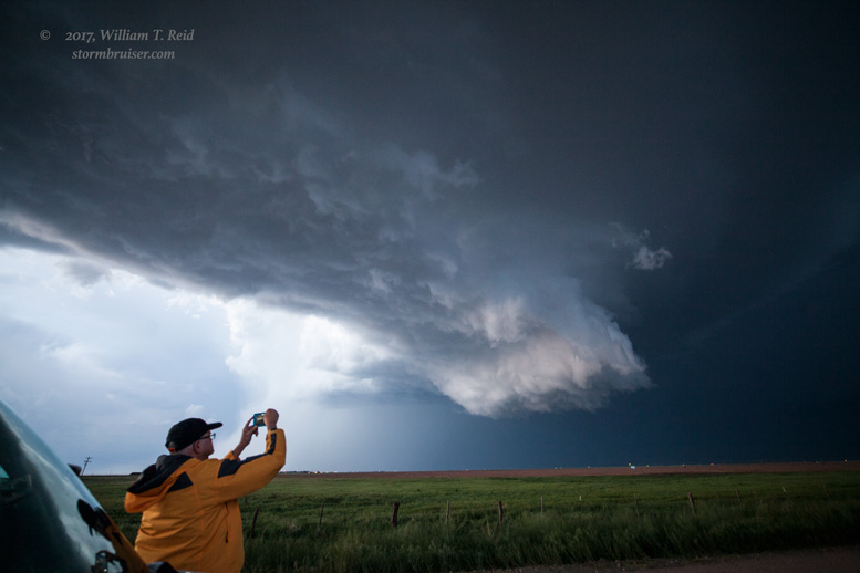
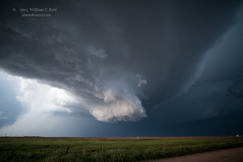
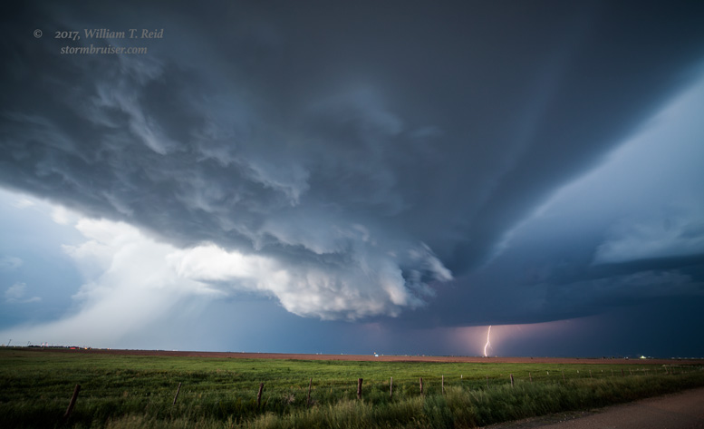
This structure was quite high-end! And it was actually a bit too close for my 15mm wide-angle lens. The storm was moving to the northeast, and this was where the road network in the Texas Panhandle goes from good to, uh, good to nothing. Ideally we would have headed a little east of Stinnett to find a north option, but the only option was north out of Stinnett, so we waited for the storm base to pass and we chased from behind. Though the updraft was rotating quite nicely and a huge RFD/clear slot persisted, this supercell had very low tornado potential thanks to the high storm base.


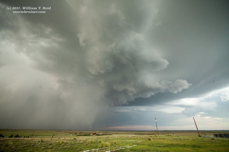

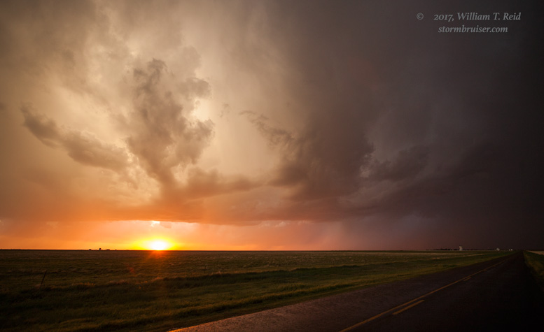
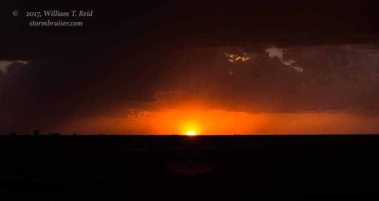
As sunset neared and as we closed in on the storm’s backside, perhaps 10-12 miles NNE of Stinnett, it was time to stop and enjoy the stormy skies and sunset light. This was a great Texas Panhandle storm in May, and a fine start to the tour!


Leave a Reply
You must be logged in to post a comment.