Begin: Sayre, OK
Lunch: Ashland, KS
End: Woodward, OK
about 350 miles
SPC Mesoscale Discussion 755 SPC Mesoscale Discussion 756
SPC Mesoscale Discussion 758 SPC Mesoscale Discussion 759
SPC Mesoscale Discussion 760 SPC Mesoscale Discussion 764
SPC Mesoscale Discussion 765 SPC Mesoscale Discussion 766
Yep, this is the one chase account that I was least interested in writing. We started out in great shape, we woke up a county or two away from where a really nice tornado-producing supercell would be later in the afternoon, and seemingly it would be almost impossible to NOT see tornados today given the High Risk and the 30-percent hatched tornado risk area all around us. But we wound up with basically NOTHING. Gad!
On the day prior, a down-day meteorologically for us, our Tempest guides and guests hung around western Oklahoma and helped some victims of the Elk City tornado of May 16.
From Sayre in western Oklahoma on May 18, I felt it was prudent to head north towards a triple-point area near Ashland, Kansas, where we stopped for lunch. A warm front was lifting northward through southwestern Kansas, and this would be the prime area for tornadic supercells, presumably. Storms started firing early in the afternoon, unfortunately. Early storm initiation often portends chase failure due to a quick transition to messy storm mode. This is kind of what happened, in Kansas at least. From our lunch spot at Ashland we headed east to Coldwater, with a storm tower or two nearby. These were moving northward at a rapid pace. I wanted to go north out of Coldwater to Greensburg, but the road was closed! That was a sign. A sign of agony and a sign of doom. A sign which should have told me: forget about Kansas and get yourself south into Oklahoma and make it easy on yourself and let storms come to you. But no, my mind was made up that we should stick with the pre-ordained Kansas target area. It was in the High Risk area with off-the-chart tornado risk percentages, so why should I change my mind in mid-flight?
Right?
I think I briefly (1/10 of a second) considered dropping south from Coldwater into northwestern Oklahoma. This was the crucial decision point of the day, of course. Since I could not go north to where I wanted to go, I headed east to Medicine Lodge in order to get north (to Pratt). Even if I had headed south out of Medicine Lodge, I think we could have gotten on the storm-of-the day near Chester, OK. But deeper into Kansas we went, while developing supercells to our northwest and north moved northward. One or two of these became tornado-warned, but it seemed the tornadoes which formed were of the brief/weak/ho-hum variety (and since we were playing catch-up, we were too far away to see these). And when the storms passed onto the cool side of the warm front, they became elevated junky storms. We had cells coming at us along U.S. 54 between Pratt and Bucklin —- seemingly ground zero for tornados today, but the storms were junky and seemingly not surface-based. They were fast-moving and ugly, a bunch of rain and hail and see-you-later.
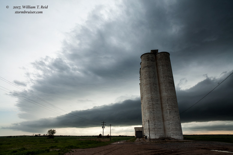
And so we were floundering by mid-afternoon while the overcast skies killed the instability. It was too late to consider the Oklahoma play once we were along U.S. 54, though I thought about it again — too late. The chase day was over by 5 p.m. We scooted down to Sitka and saw some shelfy stuff. This was the first time it was worth lifting the camera to my face today.
And so this was the one big annual bust for me. These high-risk/early initiation days are gut-wrenching killers!


Leave a Reply
You must be logged in to post a comment.