

Start: La Junta, Colorado
Lunch: Brush (Wendys)
End: Ogallala, Nebraska
458 miles
The weather pattern continued rather poor, from a chaser’s perspective. Severe weather and tornado prospects on the Great Plains were poor given the date, primarily due to inadequate low-level moisture. The flow aloft (from the WNW) and the shear were good, though. We remained on the High Plains, where upslope flow north of I-70 was transporting enough water vapor to allow a severe weather chance. From our lunch stop in Brush we continued north to the Cheyenne Ridge. I thought that this area had a slightly higher chance for a supercell than the CO/KS/NE triple-point area. It was close to a toss-up.
We waited for a good chuck of the afternoon before something finally became strong near the NE/WY border, near I-80. We positioned ourselves east of the developing storm, not far from Kimball, NE.
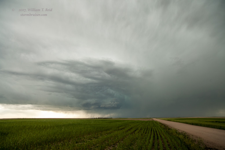
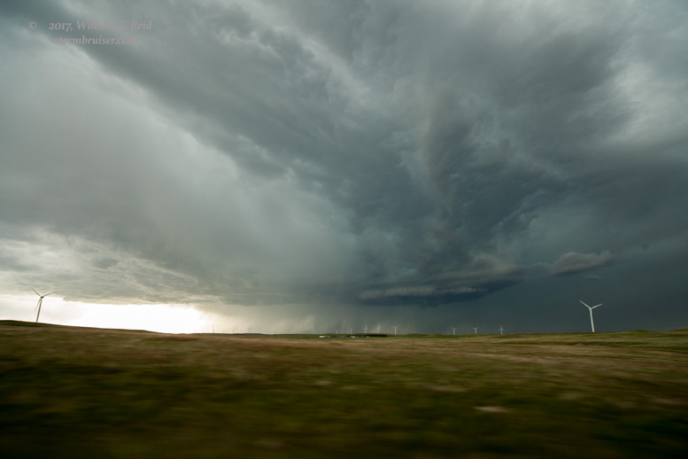


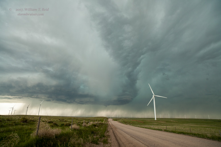

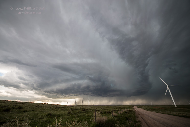
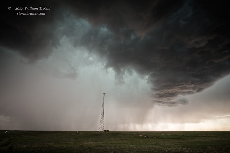
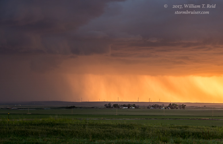
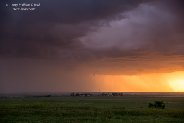
The images above with the windmills were along Road 71, south of Kimball, close to the NE/CO state line. The storm base was quite high, so tornado chances were near zero, as expected. But the great low-level turning/wind shear and marginal moisture worked its High Plains magic. The storm ramped up quickly and moved to the southeast. We continued south into Colorado to keep the updraft to our west, and the structure was fantastic at our next stop!
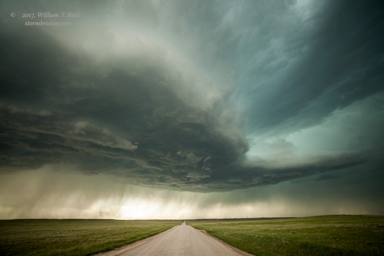


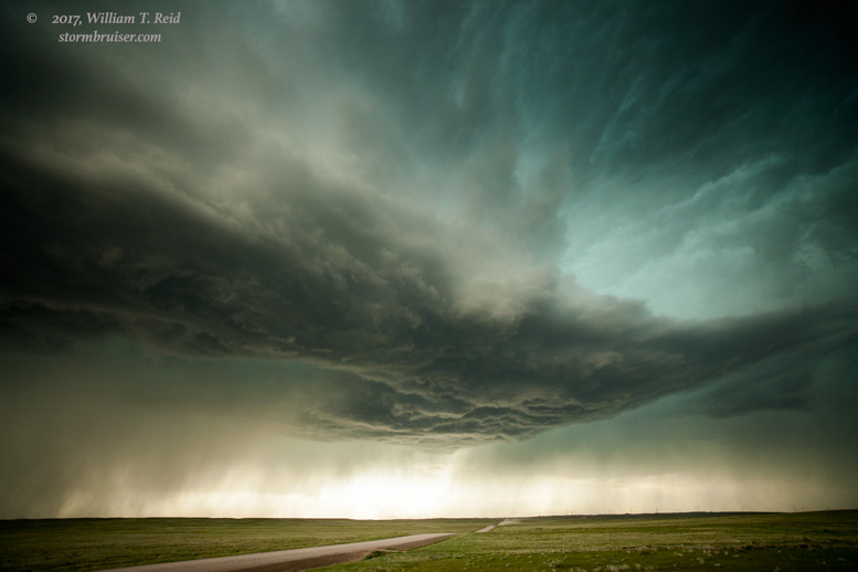
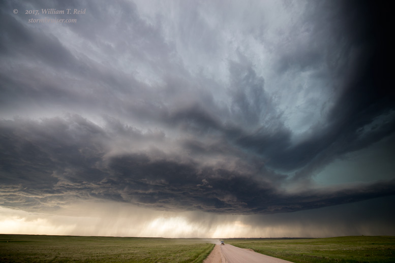

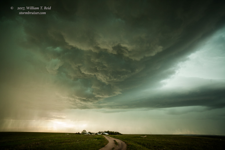
We were in a great spot to view structure, but were very vulnerable to hail as the updraft base continued to our south-southwest. We stopped about 15 miles north of Stoneham, and allowed the base to move overhead. A few CGs were way too close here — yikes. But the view straight up was too good to pass up.


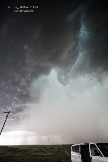
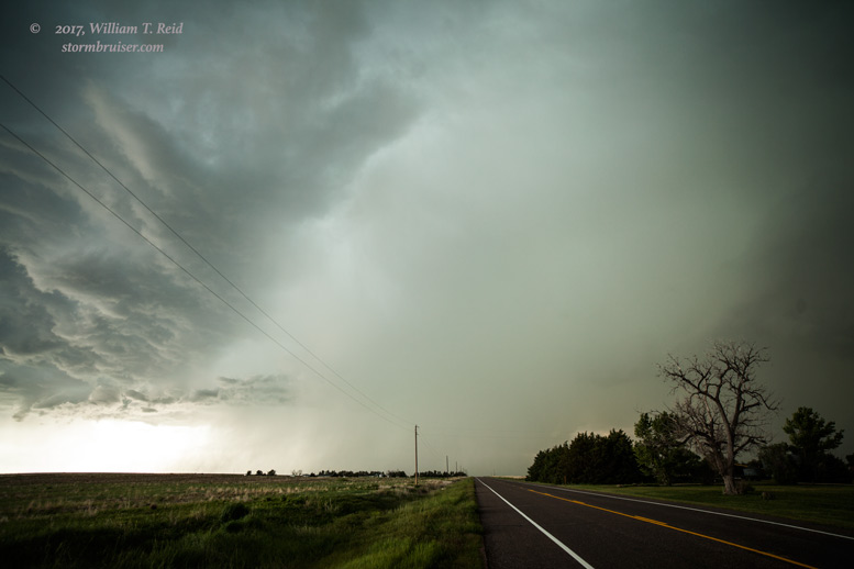
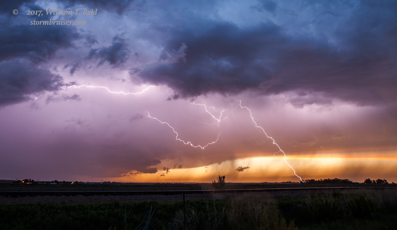
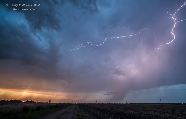
Somehow, we were not impacted by hail. As the supercell continued to move to the ESE, we had to race south to 52 and east to stay up. Unfortunately, the storm was getting rainier and messier, and structure was not nearly as impressive as it neared Sterling. We made another stop or two, and then tried for some lightning with the great evening colors.
Leave a Reply
You must be logged in to post a comment.