

We managed to stay with a pretty supercell from start to finish today, from near Edgemont, SD, and south-southeastward into the western Nebraska Panhandle. As has been the case of late, moisture on the High Plains was on the meager side. Storm bases would be high (at least starting out), tornado potential would be very low, and activity would be isolated. SPC saw fit to draw only a marginal risk area for the High Plains.
Start: Guernsey, WY
Lunch: Lusk/Pizza Place
End: Gering, NE
341 miles
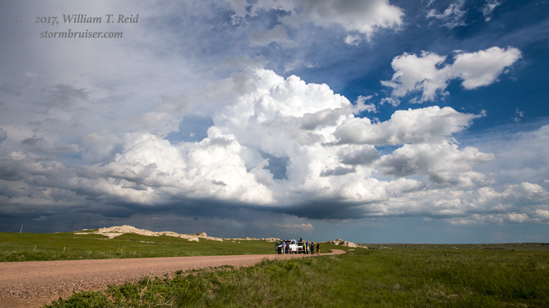
And we had quite the show for several hours! From Lusk we marched on up to Edgemont, with a view of the typical afternoon convection to the north over the Black Hills. That stuff was not quite strong enough to commit to. An updraft developed fairly quickly along U.S. 85 to the west-northwest of Edgemont, and this was an extremely easy catch for us. It started out high-based, and featured a strong updraft with a decent RFD as it moved to the southeast, on the east side of U.S. 85 near the Wyoming/South Dakota border.


The storm was dropping to the southeast, so the best way to stay with it seemed to be to head south to Lusk and then east into the Nebraska Panhandle. We stopped first at Van Tassell. The original big storm was still to our north-northeast a ways, and a couple of other updrafts were in the works nearby. I think the funnel cloud pics shown below belong with the group above, when the storm was along U.S. 85 and close to U.S. 18 (in Wyoming).


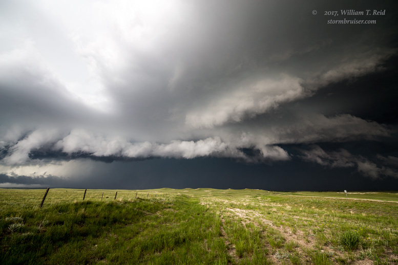
One of the highlights of the day occurred just north of Harrison, Nebraska. The “main show” supercell was approaching the little town from the NNW, with a large and heavy precipitation core (a motorist came out from there and reported big hail!). Very quickly, a fat and white lowering developed right on the leading edge of the core, where inflow was crashing into cool storm outflow. This was quite interesting!


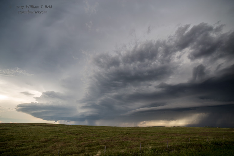
The severe storm was rumbling across the stunning and empty landscapes of the northwestern Nebraska Panhandle, and our wide-angle lenses were having a field day! The storm forced us southward to a hilltop a few miles south of Harrison, and we stopped to look back to the north again.


Our road to the south (Highway 29) made a jog to the east several miles, and this took us farther east than I preferred. The storm we were chasing was now dropping due south, which meant that it was turning even harder to the right. Another storm base was not too far to the west of it, as can be seen in the images below. The views with the two bases are towards the west. The western-most base featured a very low wall cloud for a bit. About two-thirds of the way to Mitchell, we were privy to some frequent CGs not too far to our NNW. As sunset neared, the storm bases attained more of a laminar look.


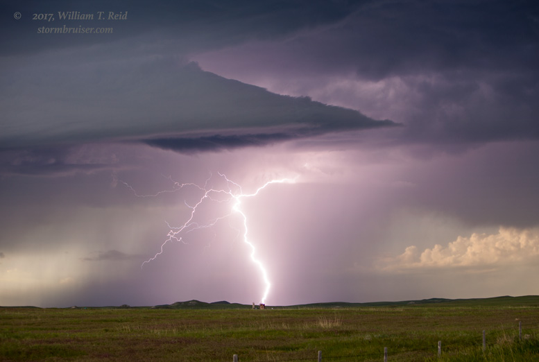


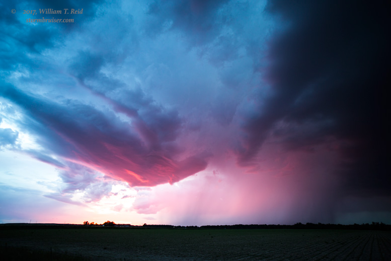
When we reached Mitchell, it was time to blast west in front of the storms to try to get some great structure. Unfortunately, the storms weakened along the way. But at Henry, Nebraska, the sunset light on the western-most updraft base was outrageous! It was great to have a long-lived severe storm this marginal-risk chase day.


Leave a Reply
You must be logged in to post a comment.