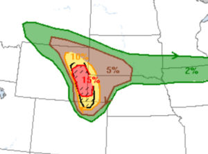
Today was Monday, June 12, and it was a rare “off day” for me and Tempest Tours. Tour 5 had finished up the day prior, and Tour 6 would begin at 10 a.m. on Tuesday here in Denver. Well, it was not a total off day for me, as I was busy getting the vans ready for the next tour. After the oil changes and the tire rotations and the van washes (some of which had been completed on Sunday), I would be free. And, today was looking like a great day to be a chaser and to be free to chase out of Denver. A potent upper-level low was translating northeastward through the Great Basin this afternoon, and moist low-level easterlies were pointed towards the Cheyenne Ridge! YES! The instability and shear were very favorable for storm rotation and even for tornadoes. SPC had a moderate risk in place by 13Z, with a 15-percent hatched tornado area outlined from about I-80 northward in eastern WY and the adjacent western NE Panhandle.
SPC Mesoscale Discussion 995
SPC Mesoscale Discussion 1001
SPC Mesoscale Discussion 1004

SPC Storm Reports

NWS Storm Survey and Report

From SPC 1630Z Convective outlook:
...Northern High Plains...
   An upper low is centered over NV this morning, with a progressive
   shortwave trough rotating through the base of the low and into UT.
   Lift and mid-level cooling ahead of this feature is expected to
   promote thunderstorm development over parts of the northern Rockies
   and High Plains this afternoon and evening.  East-southeasterly
   low-level winds over southeast WY and northeast CO have transported
   rich boundary-layer moisture back to the foothills, where daytime
   heating and approaching trough will likely result in first
   initiation of thunderstorms.  Forecast soundings in this area show
   very steep lapse rates and large CAPE values, as well as favorable
   low-level and deep-layer vertical shear.  Discrete supercells will
   be likely as activity moves off the higher terrain and into the
   adjacent High Plains.  Parameters appear quite favorable for very
   large hail and tornadoes with these storms.  Strong tornadoes are
   possible today.  This evening, several CAM solutions suggest an
   upscale evolution to one or more bowing complexes as storms move
   into western NE/SD.
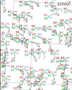
Given that my van duties would not be completed until early afternoon, and given that storm motions today would be to the north or northeast at a healthy clip, there was a time crunch of concern. If storms went up on the Cheyenne Ridge, an hour or two to the north of Denver, then I might wind up playing the dreaded “catch-up” game. But the midday surface maps indicated that the Denver area should be a decent starting point, as a boundary was lifting north near I-70. Convective initiation would likely be near Denver where the dry southerlies met the moist east-southeasterlies — see the surface map for 3 p.m. (21Z) above. Around lunchtime I let Tempest guide Bill S. and four eager guests know that I liked our position near Denver AP, and that we needed to be rolling by 2 p.m. The six of us took off in my Xterra and the guests’ rental sports car at that hour. Storms were forming along the foothills to our west!
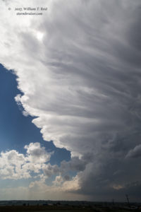
We headed northeast to Hudson on I-76 and then north towards Greeley. A couple of strong updrafts were some 15-25 miles to our west, and it seemed like the southern-most one was the one to pay the most attention to. Around the northeastern side of Greeley, we had an impressive anvil soaring above.
The updraft responsible for this anvil was to our west or WSW, and was easy to stay with as it moved to the NNE. However, another updraft base was starting to look really good, and this one was close by and to our northwest. We scooted northward another 15 miles or so, up to Highway 14 between Ault and Briggsdale. The rain-free base had a great look and a wall cloud in no time, and we were right there!
The cell looked like a good tornado candidate, but the wall cloud disappeared. However, as the storm neared our north-south road, structure remained excellent and a good-sized RFD cut (rear flank downdraft) was evident.
This supercell was headed into an environment which was very favorable for tornado development. We just had to stay close, on its east side preferably, as it continued to the north-northeast. It was dragging us into the empty Pawnee Grasslands of Weld County, though. This was a great place for tornadoes, as there was little development to impact. But, the paved road network was poor. We went east to Briggsdale before heading north again. This road was paved, thankfully.
The supercell was moving right along, and was to our northwest again now. As we neared the storm again, west of Grover by a few miles, it was looking a bit more serious with regard to producing a tornado. However, the road north was unpaved again, and rain and golfball-sized hail (perhaps larger!) were between us and the action area near the RFD. It was prudent to head east towards Grover in order to stay off of wet dirt. From Grover, a funnel cloud was now evident with the storm.
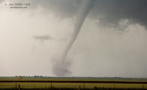
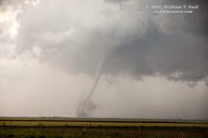
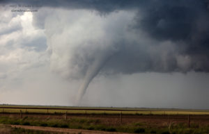
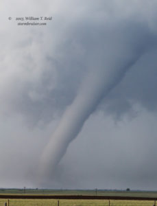
It looked very likely that a tornado was imminent. That wall cloud was spinning FAST! We headed north from Grover a few miles and stopped as a slender tornado touched down several miles to our northwest. It was headed to the NNE, so we were not going to get hit by it, but the RFD was just to our west.
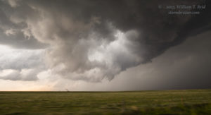
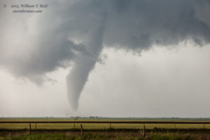
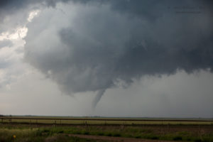
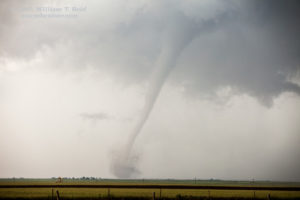
I set up the camcorder onto the tripod under the raised back hatch of the Xterra, and made sure that the thing was focused and adjusted properly. I was still not terribly comfortable with this relatively new camcorder! With that running properly, presumably, I started shooting stills — some wide and some zoomed-in. Suddenly, we were getting slammed by large hail and strong winds. There were some tennis-ball-sized stones crashing down, and all of us were outside! I hid under the protection of the hatch, and others got back inside of the vehicles. This nastiness persisted for a minute or two as the tornado to our northwest was trying to decide whether to attach itself firmly to terra firma. During a moment when I was not closely monitoring the camcorder, it was blown to the ground by a strong wind gust. I got it back up and running, but later found that the focus was way off now. At least it seemed to have survived the impact. Also, lucky enough, the large hail had not cracked any vehicle glass. I had some new dings in my Xterra, though — big deal! The slender tornado seemed to sputter a bit, but then fattened up and put on quite a nice show for at least 6-8 minutes. First, the shots with the zoom lens (70-200mm). My camera time stamps for the shots below were from 2254Z to 2300Z (about 5 p.m. MDT):
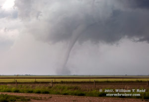
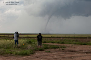
The SPC storm reports indicate that the tornado was a few miles SE of Carpenter, WY, and later two miles east of Carpenter. I figure that we were roughly 5-7 miles southeast of the tornado during this period.
And the wide angle shots (21mm lens, some cropped a little); time stamps 2251Z to 2307Z:
This long-lived tornado was eventually very near the Colorado/Wyoming border, and near the town of Carpenter, Wyoming. As it continued to move away from us, another massive clear slot was just to our north. We needed to get farther north to stay in decent position.
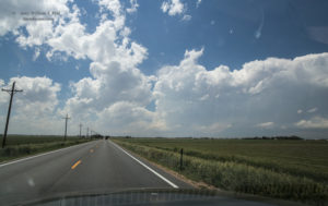
Alex helped me navigate the unpaved roads to the Wyoming border south of Pine Bluffs. We had pavement on the Wyoming side! And the low supercell base with a prominent clear slot was just up the road! We continued to the frontage road along I-80 and got a good look at this imminently tornadic cell (seemingly!).
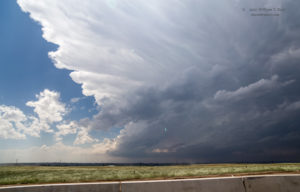
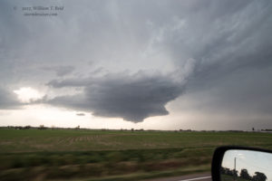
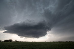
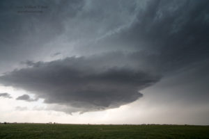
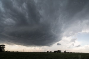
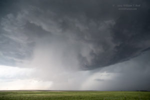
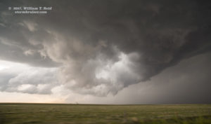
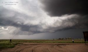
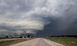
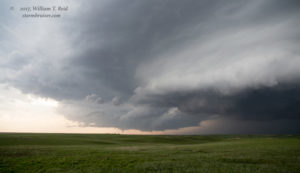
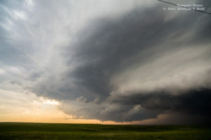
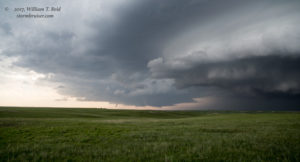
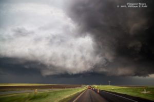
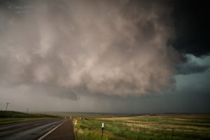
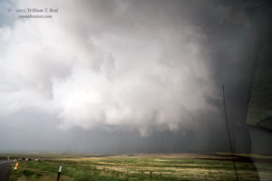
The first two above are looking north (first from CO, and then from WY), and the lower two are looking east. Our chase team was right behind this beast now, on its west side, in the area of the clear slot. I wanted to be east of it again, but could I dart east without a calamity of some sort? Let’s try! We made our way through Pine Bluffs on U.S. 30, and stopped near Bushnell. This little burg was fortunate that the storm was not tornadic when it passed overhead. We got up right beside the churning and very low base, and experienced some interesting wind changes! Luckily there was no large hail or rain to drive us out of there. These two views are to the north.
It almost seemed impossible that this updraft base had not manufactured a tornado in the previous 20 minutes. Again, the storm was moving above an unpaved road network, this time in western Kimball County. Since the storm was not producing a tornado at this time, as it headed NNE away from U.S. 30 and I-80, I elected to blast east to Kimball in order to get north quickly and back into position, hopefully! But after a few miles of driving eastbound, we had to stop to photograph the storm structure. WoW!
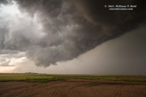
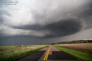
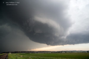
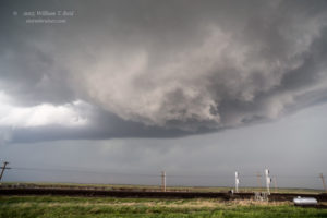
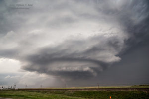
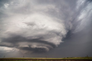
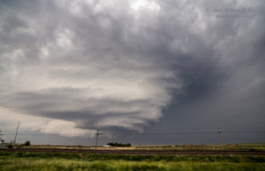
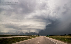
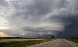
And, the structure got even better. Here are the shots looking north, along 71 between Kimball and Harrisburg, near the Kimball/Banner county line.
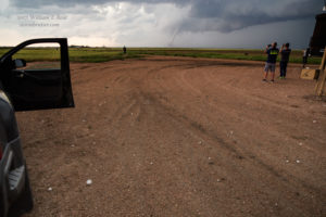
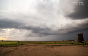
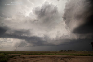
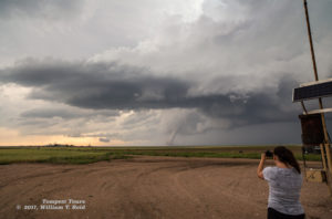
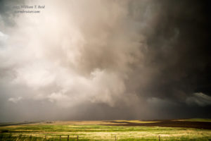
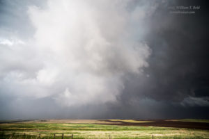
Another slender tornado can be seen near the left edge beneath this beast in the first image above (time stamp 0011Z/6:11 p.m. MDT). This was about an hour after the end of the Carpenter tornado. SPC logs show that this tornado was rather long-lived, beginning about 15 minutes earlier and 9 miles north of Bushnell, NE. At the time of this image, the tornado was southwest of Harrisburg by perhaps seven miles. We continued to the north, neared the southern edge of the impressively sculpted updraft base, and stopped along the west side of 71, in the vicinity of the county line, perhaps. Another tornado, from a different updraft base, was in progress to our west (time stamp 0020Z). The wide-angle shots below show this one, and included are looks at the main show nearby, to our north. It was a little surprising that a large tornado was NOT able to develop beneath this supercell as it crossed Highway 71. Check out that clear slot!
And, a zoomed-in shot to the west from this same location:
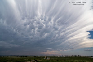
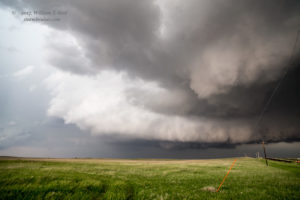
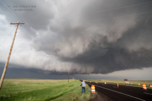
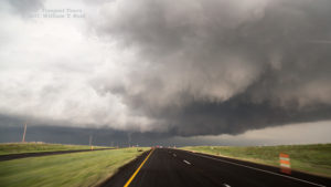
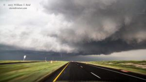
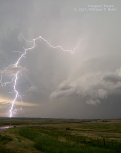
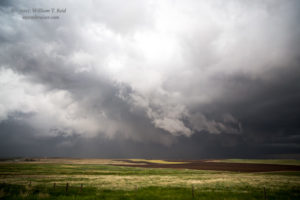
Was the storm cell that was spawning this “little” tornado to our west somehow interfering with the big sculpted beast to our north, and helping to prohibit tornado development with it? I don’t know. We continued northbound on 71 into Banner County for another 5-10 miles or so to stay relatively close to the big supercell, and we observed a small and brief tornado with it to our due north (time stamp 0035Z). We caught up to the medium-sized chase crowd and passed through a construction zone, where most of the cones had been blown over by the RFD. Though this storm base looked like the best tornado-making candidate of the day, it failed to produce (to a significant extent) again, as far as I could tell. A rain-wrapped tornado was reported 8 miles northeast of Harrisburg, which would have been the agitated area in the 7th image below. There was a little more rain involved now, and we had to stay inside of the vehicles due to a lot of nearby lightning. We remained on the top of this hillside as the storm drifted off to our northeast. It continued to tease big-time. Eventually it was time to let it go, and we got back to Denver at a reasonable hour. It sure is nice when the storm of the day makes chasing easy on an off day.






















Leave a Reply
You must be logged in to post a comment.