
Begin: Denver, CO
Lunch: North Platte Taco Johns (et al)
Finish: York, NE
517 miles
Day One for Tour 6 and Mini A out of Denver — YAY! We made the morning orientation snappy so we could hit the road. The severe risk was generally east of a line from Kearney to O’Neill in Nebraska, more than six hours away. The tornado risk was 5% in Nebraska and 10% up towards SD/ND/MN. We would have to settle for the southern play.
SPC 1630Z discussion:
 ...Northern Plains...
   An upper cyclone continues to affect the central/northern Rockies
   today, while a series of shortwave troughs rotate through the base
   of the cyclone and into the central/northern Plains.  Strong daytime
   heating and rich low-level moisture will result in high CAPE values
   this afternoon along and east of a surface front/dryline extending
   from the central Dakotas into KS.  Models are consistent in the
   development of thunderstorms along the boundary by late afternoon,
   tracking eastward across the ENH/SLGT risk areas.  Supercells
   capable of large hail and a tornado or two are initial threats, but
   most 12z model solutions suggest a fairly rapid transition to bowing
   structures, with damaging winds becoming the dominant concern as
   storms move into MN.

   Have maintained a small 10% tornado risk area over parts of
   MN/SD/ND.  Rapid recovery behind the morning MCS should result in a
   corridor of favorable environment later today.  Forecast soundings
   in this region show backed low-level winds and strong CAPE.
   However, confidence in discrete storm initiation along the warm
   front has decreased from previous outlooks, and will be re-addressed
   at 20z.
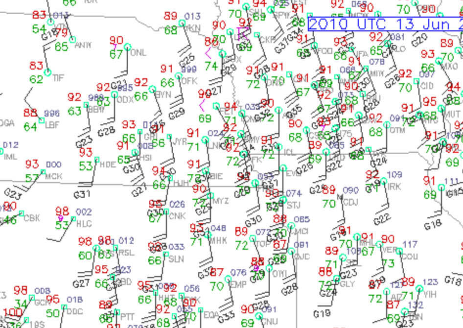
Surface winds were more backed north of I-90 in eastern SD, and that looked to be the more favorable area for tornadoes. Our target area, east of Kearney or thereabouts, had great instability and mediocre low-level turning. After the quick lunch in North Platte, we continued eastbound on I-80. I had two areas to consider: the developing line of convection along a boundary north of I-80 (around Custer County), or parts closer to Grand Island. It was not an easy or obvious choice, but I went for the eastern play as I preferred the better moisture and the (hopefully) later development that was not as apt to “line out.”
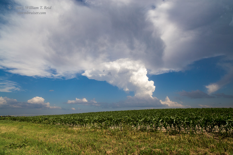
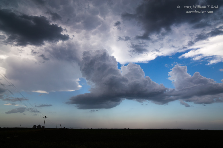
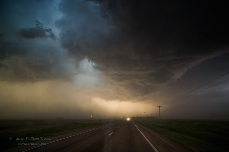
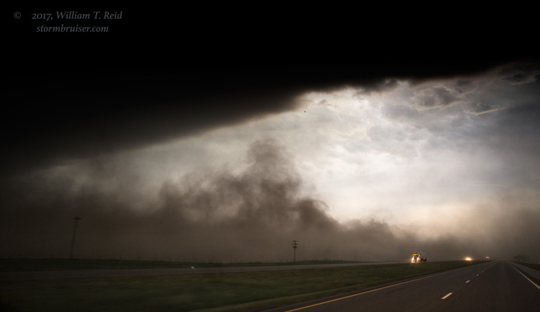
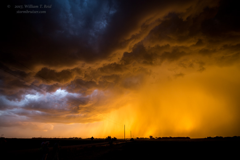
We intercepted a handful of severe storms in the Hastings area. The details are a bit of a blur three months later! A couple of storms looked to have decent supercell structure, but none came close to producing tornadoes. We were on a storm south of I-80 that became outflowish and kicked up plenty of dust and dirt, and chased us east to York.
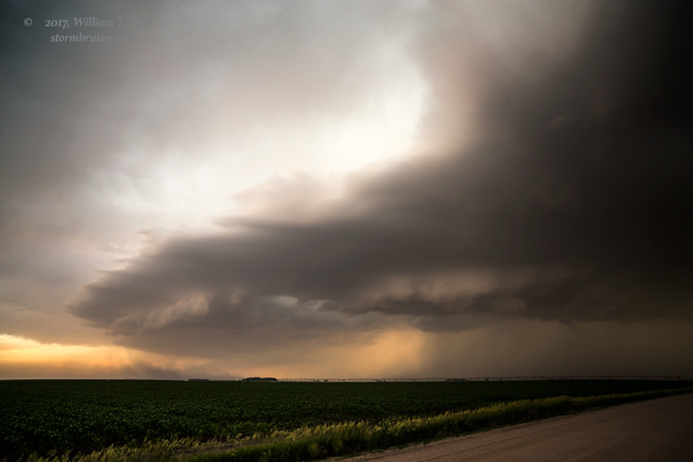

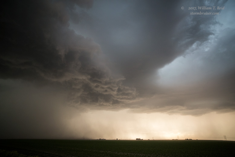
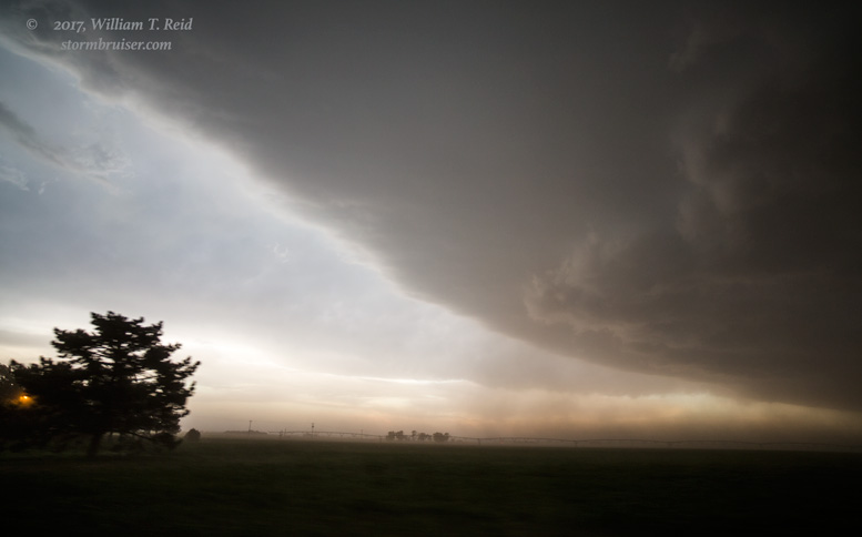

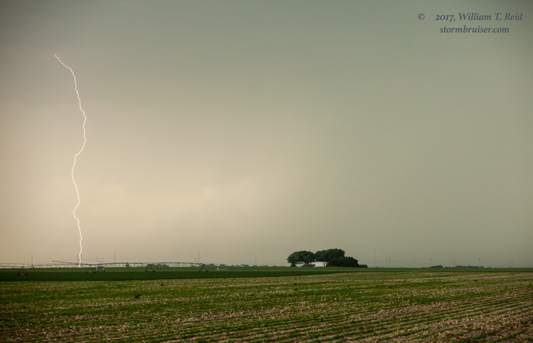
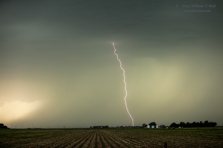

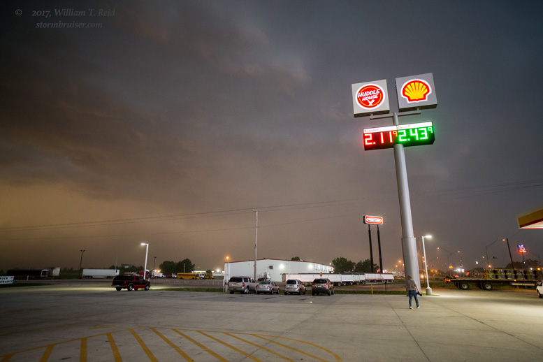
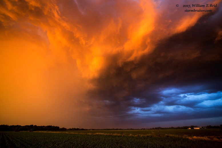
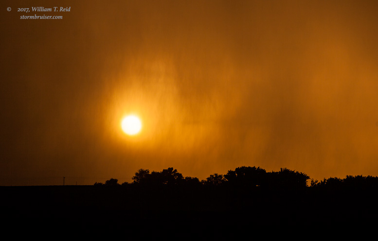
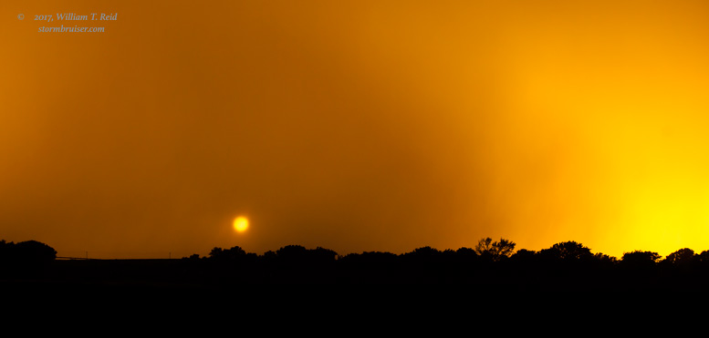
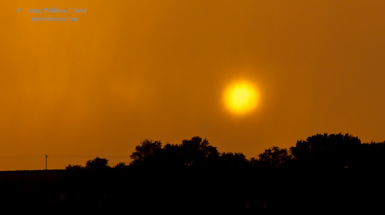
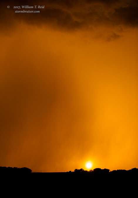
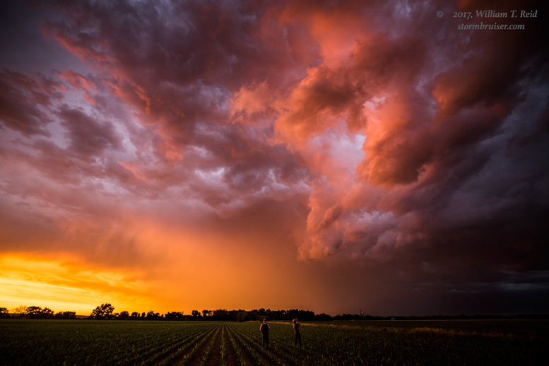
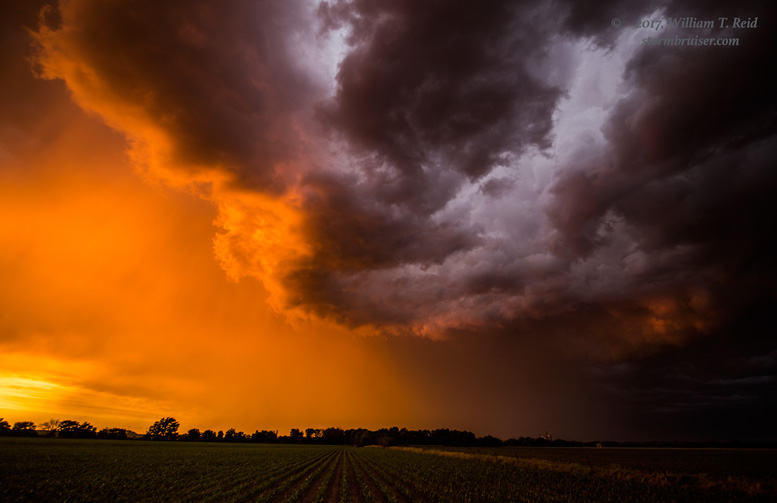
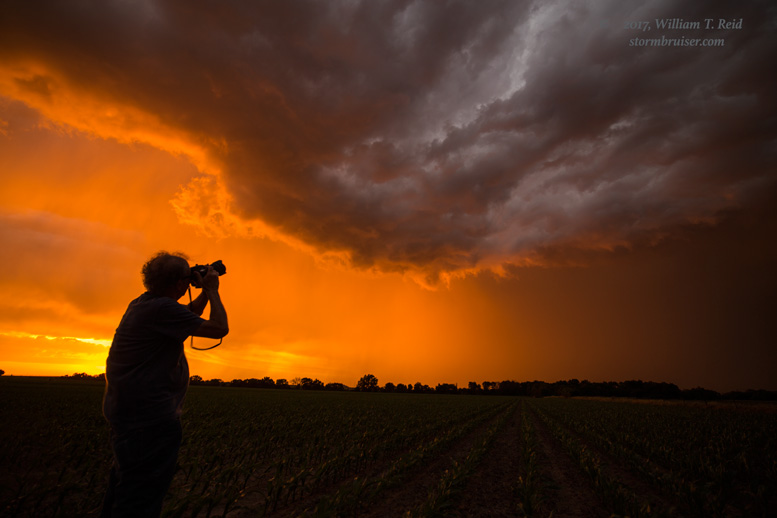
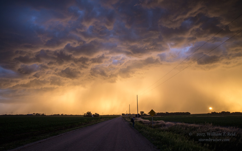
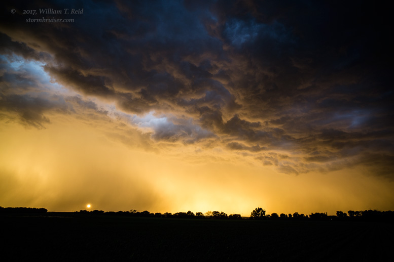
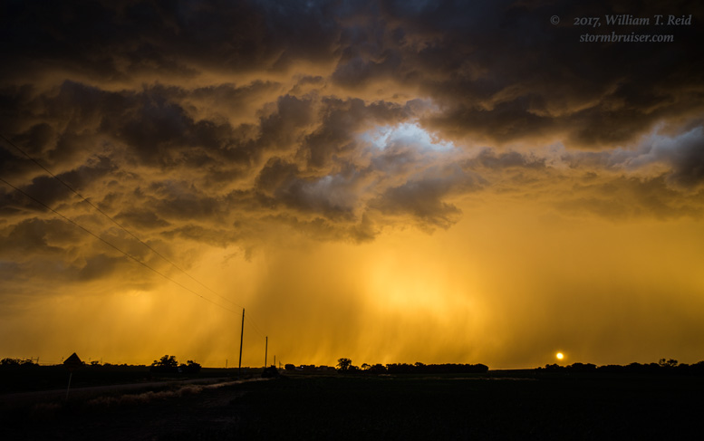
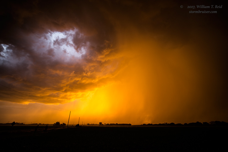
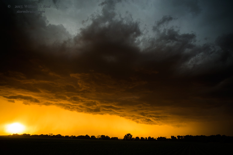
These storms seemed to settle down some. We drifted south from York and stopped a little north of McCool Junction for the sunset, and what a sunset it was. Does the phraseology “INSANELY COLORFUL SUNSET” do it justice?! From here we headed back to York for dinner, during which an intense thunderstorm with strong winds swept through. It was nice to be in Nebraska on a beautiful spring evening!


Leave a Reply
You must be logged in to post a comment.