
Start: Burlington, Kansas
Lunch: Colby Subway
End: Phillipsburg, KS
429 miles
Three days remained in the tour for the Tempest Tour 6 group and the Mini B group. SPC showed a slight risk for western Kansas, but tornado prospects were meager. Tropical Storm Cindy was south of the Florida Panhandle and was diverting the high-quality Gulf of Mexico to it at the expense of the Great Plains. I figured that we might need to be around Colby by mid-afternoon. That would be an easy drive from Burlington.
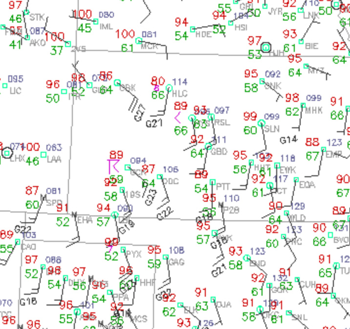
The surface map above shows conditions later in the afternoon, well after the initial convection.
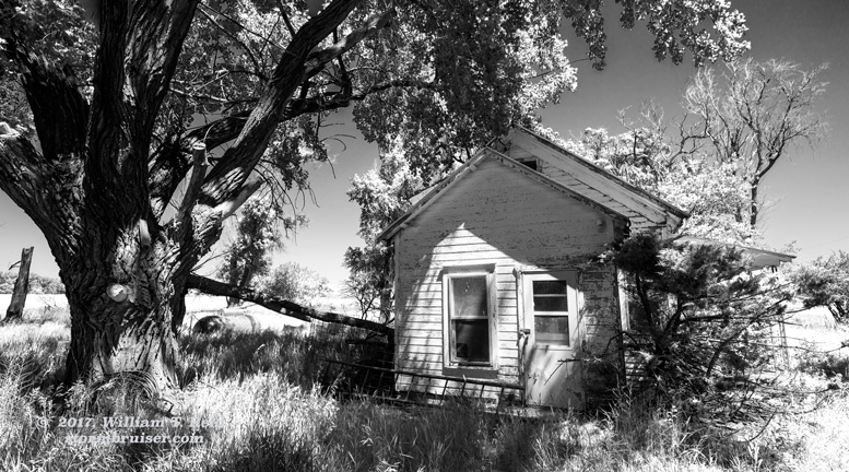
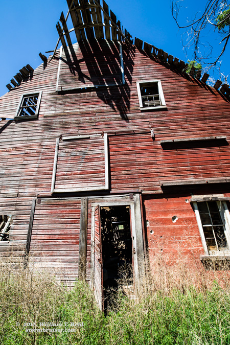
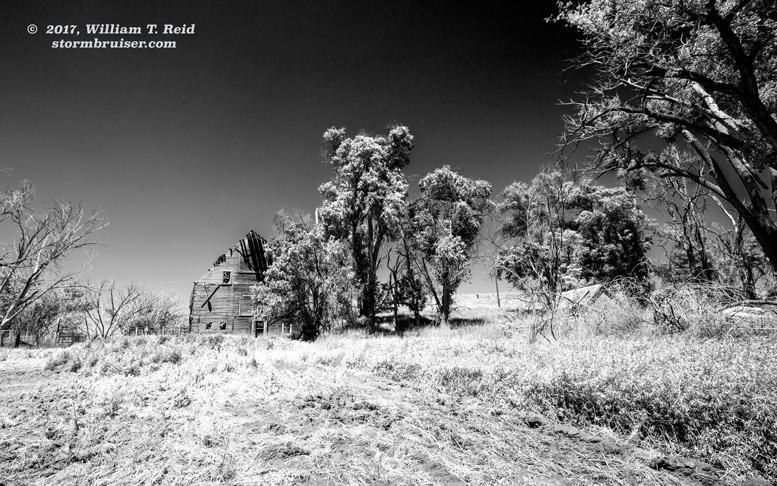
With some time to kill on the way east, I decided to check out the Kidder Massacre Site, in Sherman County, northeast of Goodland. We found a sign near the site, and little else. A few more miles east down the dirt road we came upon an abandoned farmstead that was tucked away into a little hillside.
Our lunch in Colby had to be rather quick, as storm towers were already developing to our south. Ugh. You know how much I do not like early convection. Today was quite warm and dew points were struggling to get much higher than 60F. The storm bases would be high. We monitored a cell that was northwest and then west of Scott City. It had a nice, large and flat base for a while. It was a little surprising that strong and cool outflow was not spilling out of the storm right off of the bat. The storm pushed us south a little and continued to look fairly healthy, and fairly interesting.
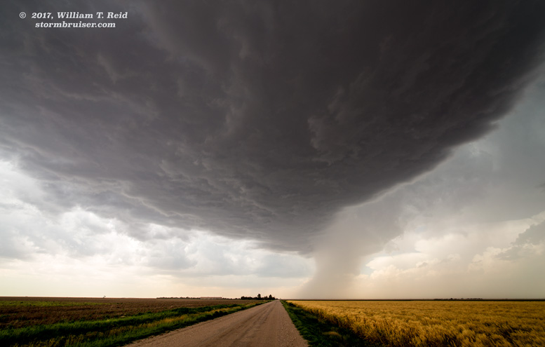
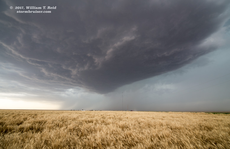
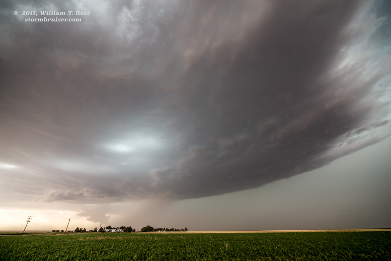
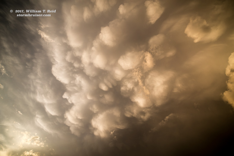
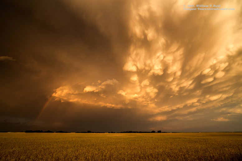
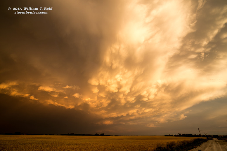
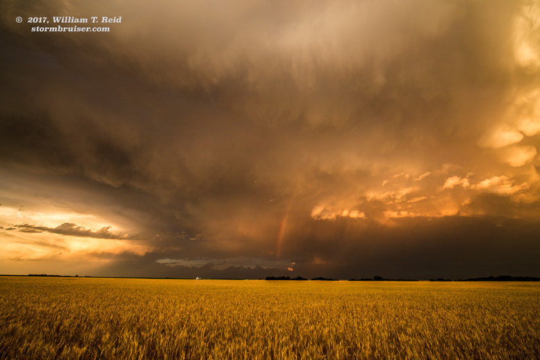
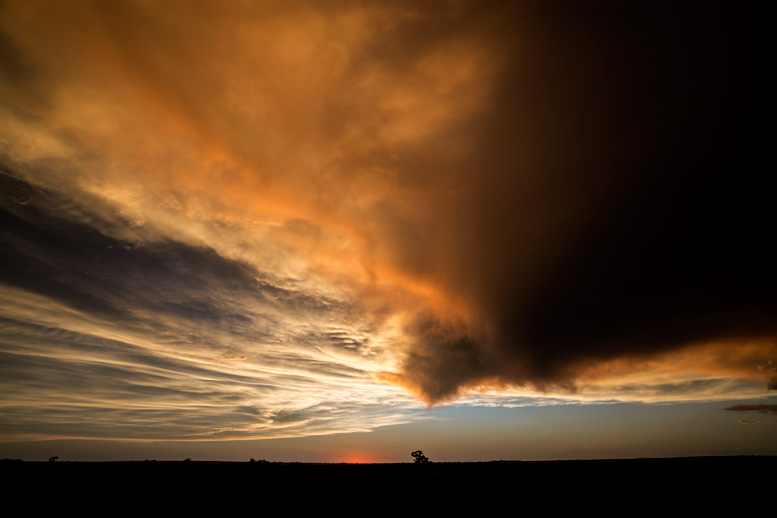
We wound up on the E-W road west of Friend near the county line, where we had observed a large tornado about 13 months prior. This time around the excitement level was quite a bit lower. I directed the tour group to the west, and we noted some dusty outflow and later some decent mammatus. These views were near Lydia and Leoti, respectively.
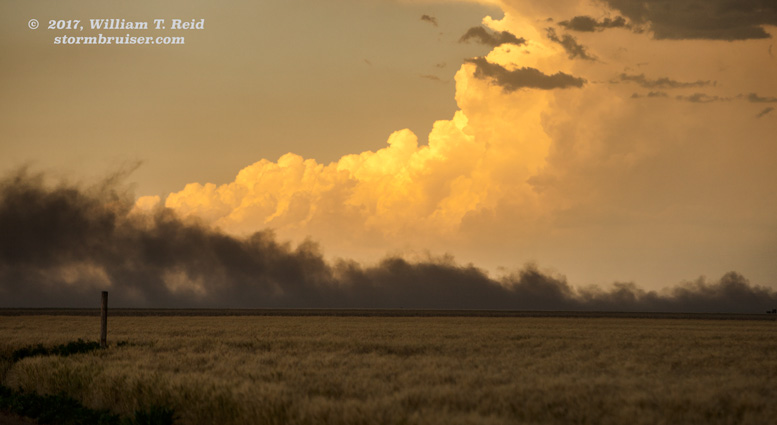
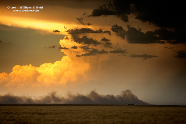


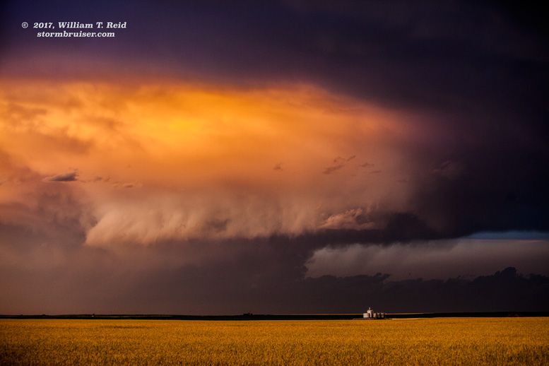
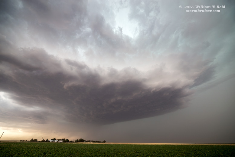
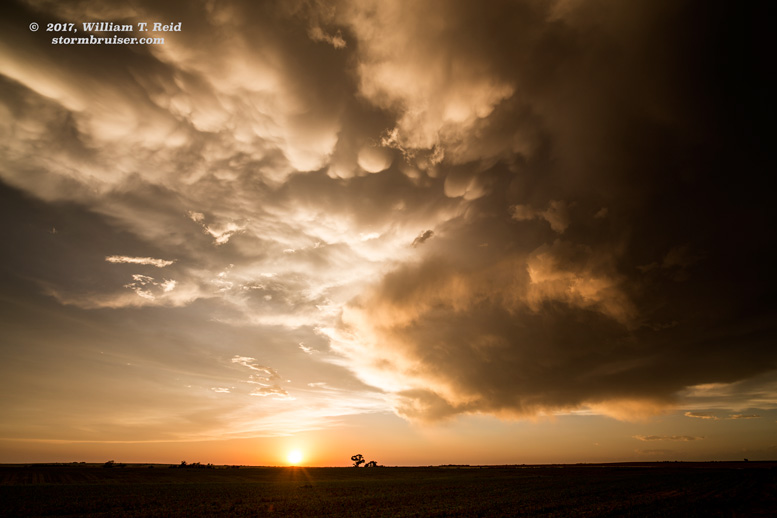
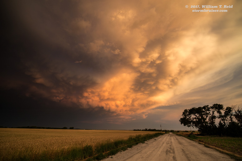
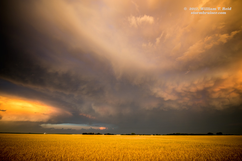
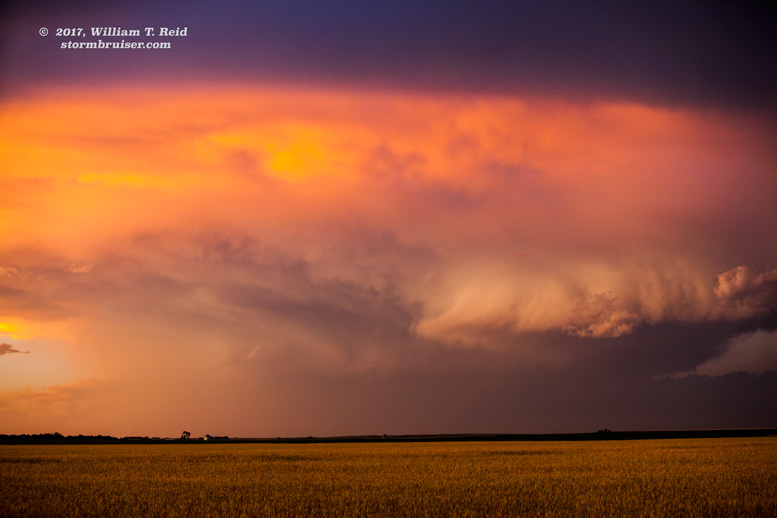
The strong-to-severe activity here in western Kansas was becoming less organized and quite junky, so I looked for storms which might have some better air for a while. We went east and north to the Hill City area. A storm over Morland was looking good, but it sputtered upon our approach. As I expected, the chase day was winding up on the lame side. Our last chance to salvage something seemed to be the near activity west of Phillipsburg, and I found some farmland with nice vistas for the nice light at sunset.

Leave a Reply
You must be logged in to post a comment.