Begin: North Platte, Nebraska
Lunch: Lincoln, Nebraska (Dickeys BBQ)
End: Saint Joseph, Missouri
537 miles
SPC Day One/20Z Convective Outlook
As you may or may not know, as a chaser, I am heavily inclined to favor chase targets on the High Plains versus the “Corn Belt” areas of Nebraska and Iowa. For me to venture near or east of the Missouri River, the (tornado) prospects have to be pretty good that way. For a day or two prior, the “Iowa play” was rearing its ugly head for June 28. This was in the middle of our Tour 7, so there were no logistical issues. We could easily do it. We chased the High Plains of western Nebraska on June 27th, and I had not looked very closely at the meteorology for the next day as I called for motel rooms in North Platte. Chris Gullikson had been directing the tour for a few days up until the 26th, and he was already heading east for Iowa. But he lives in Illinois, so that was a no-brainer! Iowa tends to be a big disappointment time-after-time for storm chasers. It is easier to just stay out west and to give the tour guests the sure thing: the pretty and severe storms on the High Plains. I had not yet decided what to do as we headed for North Platte. The forecast charts showed nice instability and shear, though surface winds would be southwesterly. Something told me that I had better not ignore the Iowa play. And, I didn’t want to be besieged by a lot of pretty Iowa tornado pictures on Facebook twenty-four hours from now, especially by Chris. I told everyone to be ready to head east early the next morning.
As we headed east on I-80 on the morning of the 28th, it appeared that southwestern Iowa would be a good place to target. SPC had an enhanced risk, a 5-percent tornado risk, and a 30% hatched hail risk covering southwestern Iowa and extending into east-central Iowa. From the forecast charts that I was eyeballing, it did not appear necessary to venture well into the state. The forecast models with the “CAMs” (convection allowing models) showed thunderstorm development in or near extreme southwestern Iowa by mid-late afternoon, with very decent supercell and significant tornado numbers forecast to be in place. I was happy!
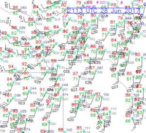
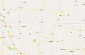
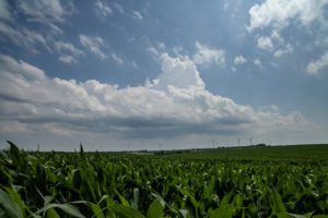
By about noon we were exiting I-80 in Lincoln and we found a fairly quick lunch stop. From there we continued east to Nebraska City, into Iowa and southeast on I-29 to Hamburg, and then east about 15-20 miles. This put us just a few miles north of the IA/MO border, in nice, gently rolling cornfields with great views of the sky and in a great road network. I felt comfortable here, there was good surface moisture convergence here, dew points were well into the 70s, and some storm towers were starting to develop to our southwest. This isn’t bad at all!
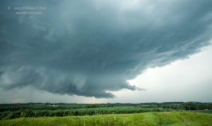
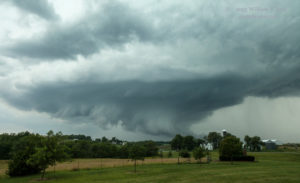
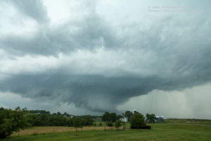
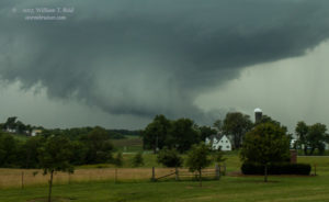
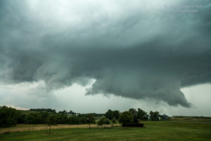
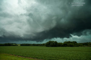
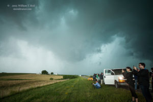
It was just after 3 p.m. CDT when the photo above was snapped. This activity struggled to get strong as it moved towards our location. The cap was rather strong, but it should be breakable this afternoon. To our distant northwest, in the haze and murk, a storm anvil materialized, and radar was showing a rapidly developing cell with some strong returns. It was pretty close to Nebraska City and moving to the east-northeast. Wow — that might be the one we want, and it will be an easy catch, I thought. I went back outside the van to look at the struggling towers, now not too far to our south. I could stick with these, or head to the new storm that was only 20 miles away. “Get in the vans!”
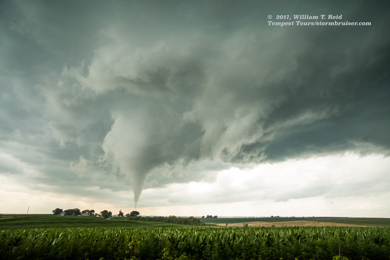
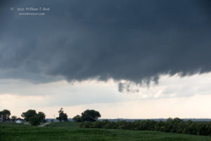
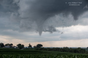
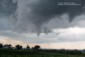
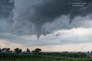
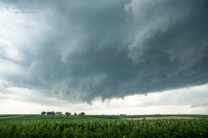
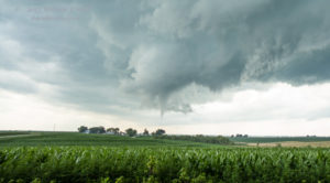
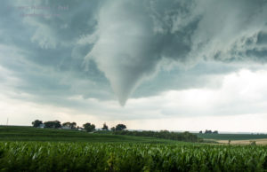
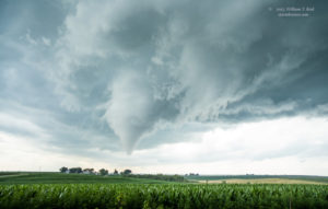
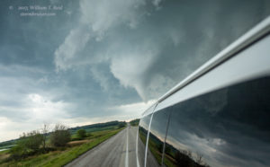
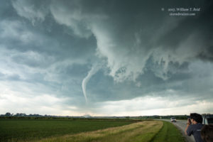
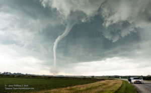
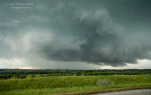
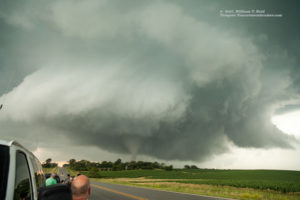
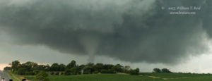
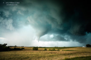
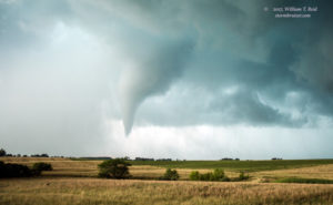
This was one of those “dream” type of storm chase intercepts. In just 15 to 20 minutes or so we would be close to a developing storm in a tornado watch in mid-afternoon. With dew points this high and with the supercell and tornado parameter numbers so good, I just KNEW that our group was in for quite the show. We headed north perhaps ten miles, with a couple of short jogs to the west via the small town of Farragut. I typically give the tour quite a bit of space from a storm early on to view the structure, but as we neared, the base of the storm already had “that look.” I needed to get our group underneath the base. We stopped a couple of miles east of a good lowered area along 350th Avenue, just north of Highway 2. This was about halfway between Sidney and Shenandoah, in eastern Fremont County. The base had a good lowered area, and it looked about ready to get serious. Maybe five minutes later, a decent funnel cloud was halfway to the ground, and I was on the phone to the National Weather Service. A tornado was about seven miles west of Shenandoah and moving towards the town! The time was 3:45 p.m CDT.
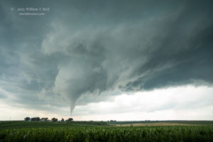
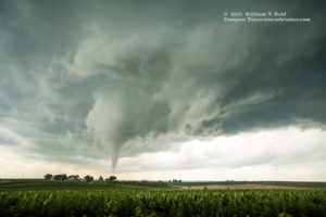
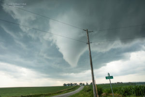
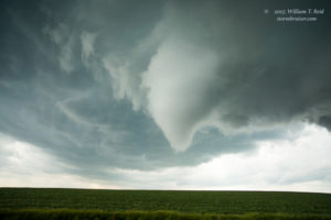
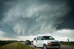
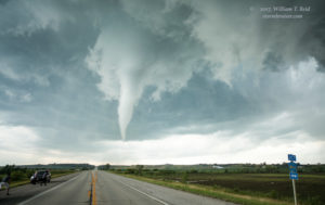
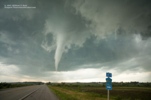
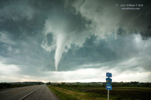
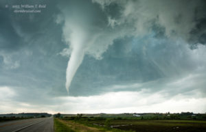
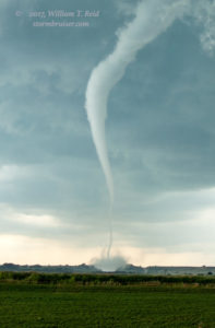
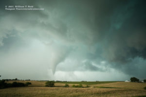
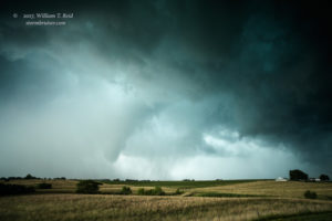
The first four images above were with the zoom lens, as the first funnel flirted with a full “touchdown.” The others were shortly afterwards, with the wide-angle lens, as the tornado became better organized. The funnel was not that distant, as these were 21mm wide-angle shots! It was right along Highway 2 and headed towards our location at perhaps 25 mph. We needed to stay safe and move a little farther to the east along Highway 2.
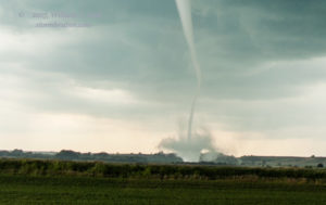
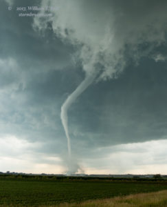
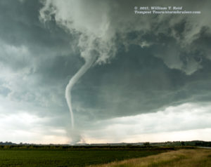
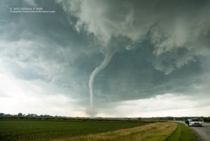
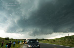
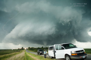
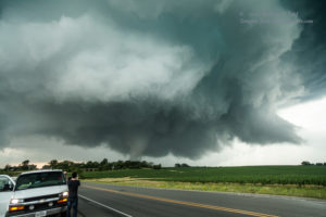
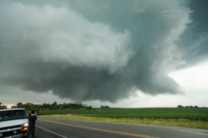
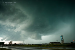
We wound up near Road M16 (aka 370th St), as evidenced by the sign along the road in the photos. This was two miles east of our first stop and is three miles west of Shenandoah Airport. The views here are to the west, and were from about 3:47 to 3:53 p.m. CDT.
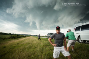
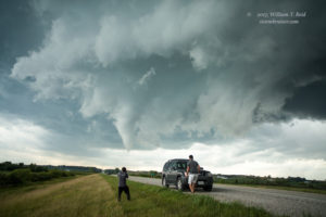
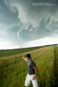
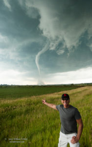
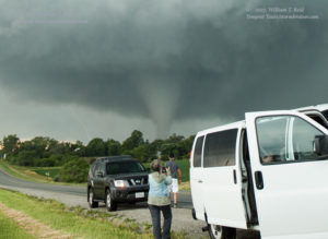
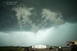
With a good-sized tornado just down the road and approaching the tour group, I was a little nervous. We went another mile and a half east and stopped along the gentle curve along Highway 2, still a little west of the airport. It was about 3:55 p.m. for the images below.
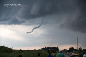
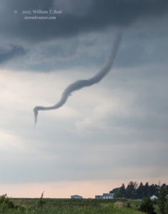
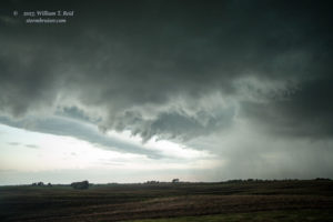
That is my friend Dallas Raines who is posing in front of the tornado. From here the tornado seemed to be weakening and dissipating a little. So, it was time to get east again to make sure that we were in position for perhaps another show. This storm would probably want to do it again. We went east past Shenandoah by a couple of miles and stopped near a hilltop. This gave us a good look at the storm structure. A skinny funnel cloud continued, adjacent to a prominent, persistent, and ominous wall cloud.
I tried to shoot some video at this stage, and I think it was here that we started to get bombarded with nearby CGs (cloud-to-ground lightning bolts). It was difficult to decide whether to stay alive inside of the van or to risk getting struck while watching the slinky funnel! The shots above were around 4:06 p.m. CDT.
I was not enamored with this vantage point, and we went a few more miles east and found a splendid hilltop with a great view of the storm. This was about halfway between Shenandoah and Yorktown and just south of Highway 2. From here I could set up my camcorder on a tripod and relax some. There was no tornado currently, and no nearby CG activity. The updraft base was a little north of Highway 2 now and to our WNW to NW. It looked like it was fixin’ to make a big tornado. The images below were taken around 4:11 to 4:15 p.m.
This was a great spot, but the base was again getting uncomfortably close and we were very vulnerable to lightning. I elected to have the guests get back into the vans and to head another mile or two east, and during this stretch another good-sized tornado developed. We had to stop quickly!
The images above were with the 21mm lens (some cropped), which provided a good look at the wall cloud structure with the tornado. The time was about 4:19 p.m., and the tornado was perhaps five miles WNW of Yorktown. Again we scooted a couple of miles to the east, and the tornado had vanished. I was surprised that this was not a long-lived tornado.
During the next couple of re-positionings to the east, past Yorktown and to Clarinda, our eyes were diverted to the south. Intense convection was in progress in that direction, perhaps 12 miles distant. Our nearby storm continued to look quite healthy, and quite potent. It had stopped producing tornadoes, however. Why was that? Well, the newer storms towards the south were intercepting the really good, really moist surface winds. We watched the massive wall cloud to our northwest for a few more minutes — probably longer than we should have — before diving south from Clarinda.
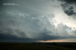
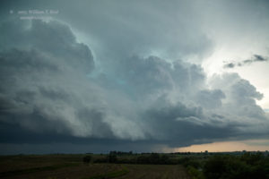
The first two images above are looking south, and the last four are looking to the northwest. As we headed south on U.S. 71 to Braddyville, on the IA/MO line, the radar and our eyes told us that another tornadic supercell was in the works. As we headed south, the action area was already to our south-southeast, though. It would be difficult to get into good position again.
The storm was moving to the east, and maybe to the east-northeast. A river was paralleling our road on the east side, and there were few options east before Braddyville. It looked like I had to head all of the way south to Road JJ in Missouri, just south of Braddyville, before I could get east. I was not aware of the road east out of Braddyville, which might have saved us several minutes. The storm was strong and wrapping up nicely to our east, but we were on the wrong side and precipitation was hiding the stuff that we wanted to see. This was aggravating now, and the terrain and road network were not nearly as good as one hour ago!
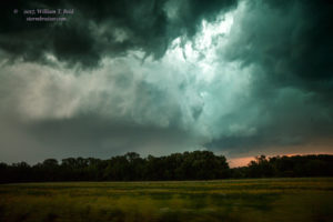
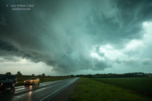
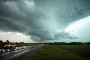
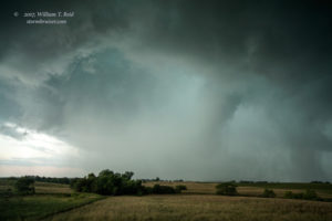
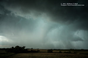
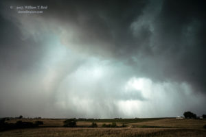
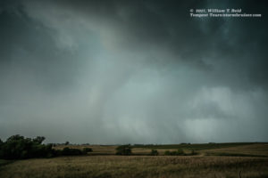
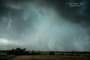
As we headed east on Road JJ, we were treated to occasional views of the impressive mesocyclone that was now to our east-northeast. The road jogged north a mile and then south a mile on the way to Hopkins. These were valuable minutes lost, and we could not make great time anyway on this narrow and wet road on the edge of Missouri. Finally, we were moving through Hopkins, Missouri, and the supercell was to our east-northeast still. Road 148 headed back into Iowa to the northeast, and that could get us kind of close to the updraft base. I knew that the storm was cranking and rotating hard at this time, and probably had a significant tornado with it. Here are the images I was able to capture between the trees.
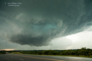
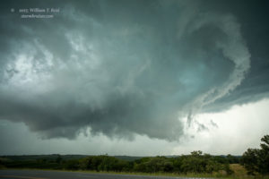
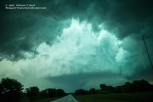
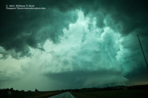
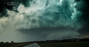
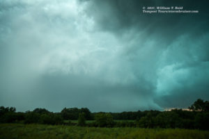
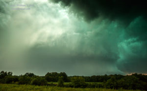
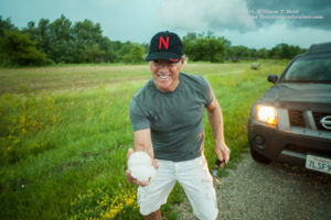
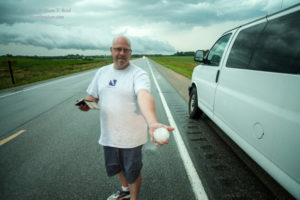
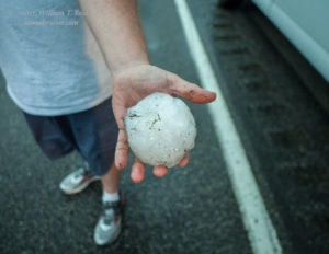
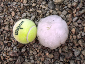
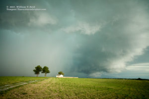
These looks are through the windshield and looking NE to ENE. The “barrel” updraft is visible in the clear slot of the massive RFD. A lowering and perhaps a tornado are attached to the storm base. This was truly a beast of a storm! It was south of Bedford, Iowa, by a few miles, and the time was about 5:12 p.m. CDT. I was discouraged with the trees and poor road network and our poor positioning as the storm continued to move to the east. We stopped in a relatively open area to get some shots of the storm to the east, and here we found giant hail in the grass along the road, some a good 3-to-4 inches in diameter!
There were some new cells nearby now, and they looked interesting, but they were not strong.
I elected to try to get back in front of the “main event” storm. We went to Bedford and then east. The radar suggested that this target storm was currently not nearly as strong, as a number of cells developed east-west along the state line. We had to wait near Irena, Missouri, for about 20 minutes for a storm’s hail core to clear our route to the south. We finally came out on the south side of the strong storms, but the activity was a bit disorganized and cool outflow from the north was in progress. There was still plenty of daylight remaining. Whereto next?
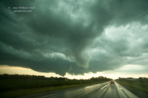
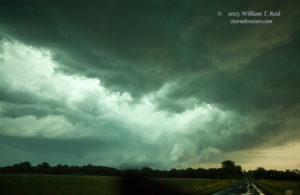
New storms were going up to our west, in extreme northwestern Missouri. It was time to check those out. West we headed to Maryville and a really quick pit stop. I don’t think we had had one since lunch — yikes! A very electrified storm cell was approaching Maryville, and I was anxious to get into position and out of the way of its heavy core! The images below were at about 8:10 p.m. CDT, and south of Maryville by a few miles.
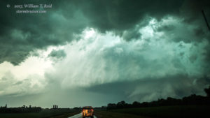
Mother Nature had one more treat for us. About six or seven miles south of Maryville, another tornado developed to our west. This one quickly wrapped in rain, but it was visible again several minutes later in its weakening phase as the precipitation thinned some. This was from about 8:20 to 8:25 p.m. CDT. Another very nice supercell was organizing to the east at this time, but we did not observe a tornado with this one.
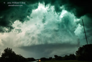
We went up and down U.S. 71 a few times to watch storms, south of Maryville. One base, directly overhead, spun scud around at a rapid pace which looked surreal. It was soon dark, and time to head south into Saint Joseph for the night. It had been an interesting and entertaining 24 hours since I decided that we were going to go to Iowa!


Leave a Reply
You must be logged in to post a comment.