
Start: Saint Joseph, Missouri
Lunch: Marysville, Kansas (Pizza Hut/Subway)
End: Wichita, Kansas
456 miles
SPC Day One Convective Outlook (20Z)

Though SPC showed two areas with a five percent tornado risk (one near Sioux City and one near Emporia), this chase day was not much of a tornado day. I elected to go for the Kansas play, probably because the moisture was better there, and it was more convenient than northeastern Nebraska. After lunch in Marysville, we dove south into east-central Kansas. Storms were a bit slow to develop, which was fine by me. It seemed that much of this spring was plagued by early development and the resulting junky mess. By late afternoon we were hanging out in Eureka, Kansas, and watching a storm tower take shape just to our north. This one dragged us east to Yates Center, and it had a good look to it northwest of that town a bit later.

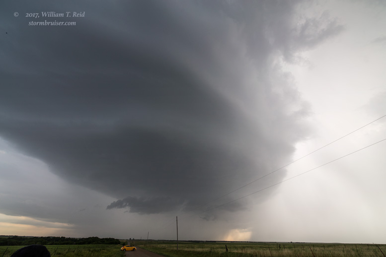
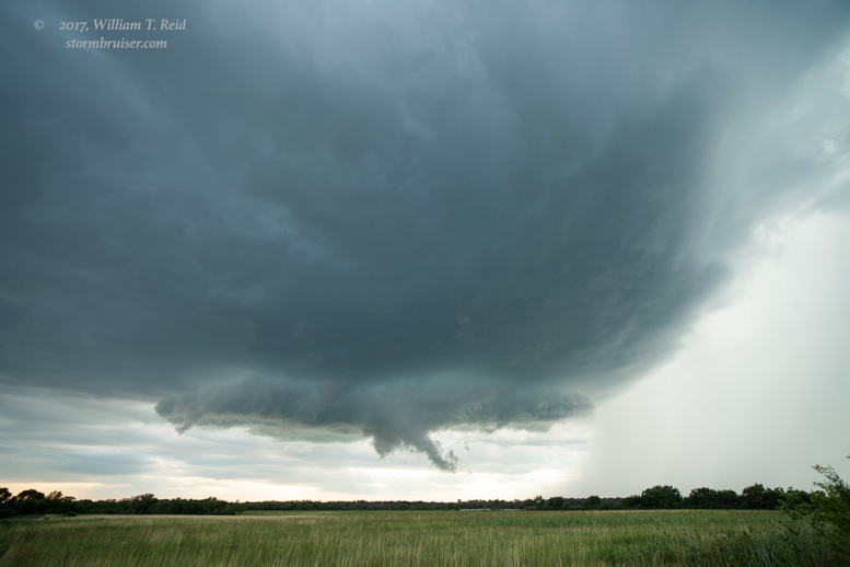
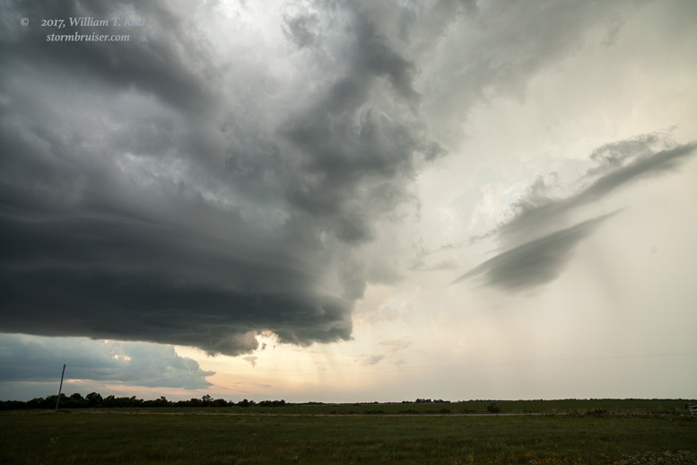
We made a couple of stops some 7-12 miles north of Yates Center to watch a storm or two organize to our west. It looked like our first one, on the east side, was struggling some. Another one on its west side became the dominant storm, and it was soon a supercell. The thing wasn’t moving eastward very quickly, which was nice. It eventually took on a very decent spaceship appearance.
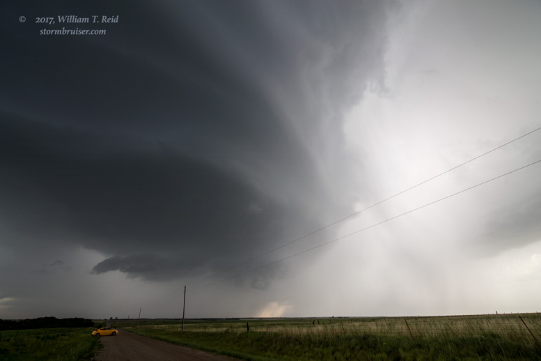
I thought we had something quite special, and perhaps we could get a tornado out of the thing. It started to sputter slightly, though, and then anvil rain was upon us and lightning was a bit close. We scooted south a few miles for the next look.
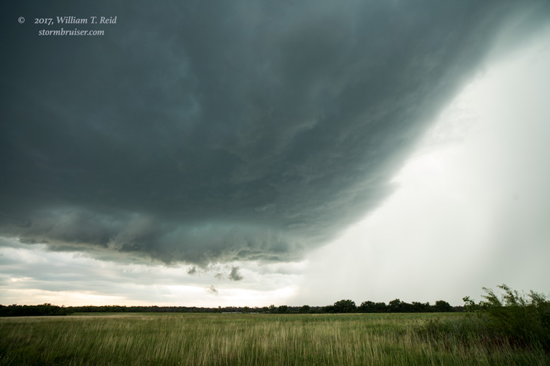

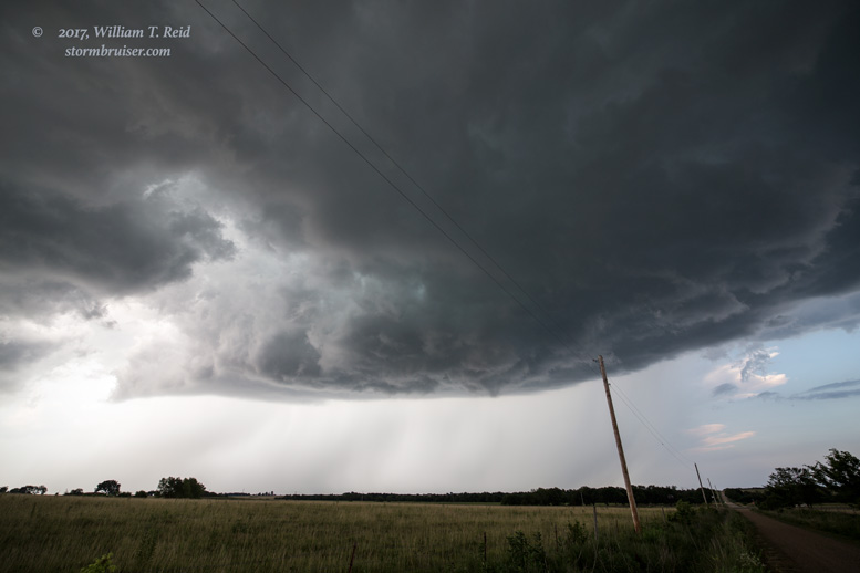
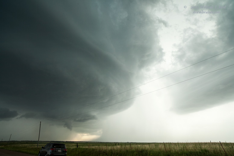
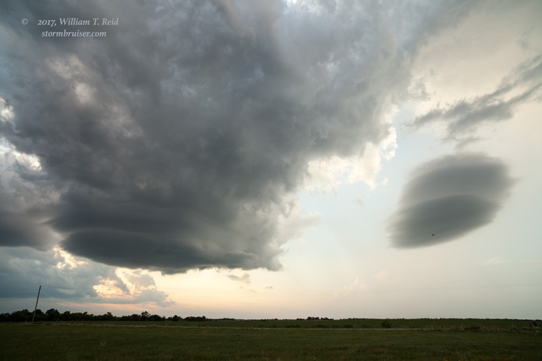
It was still a nice spaceship with a large laminar base, and it sported a large RFD cut as it moved more to the southeast, across U.S. 75. But, it was not setting the world on fire…yet. It was moving to our northeast, so we had to go back south to Yates Center and then east again to get another look at the structure.


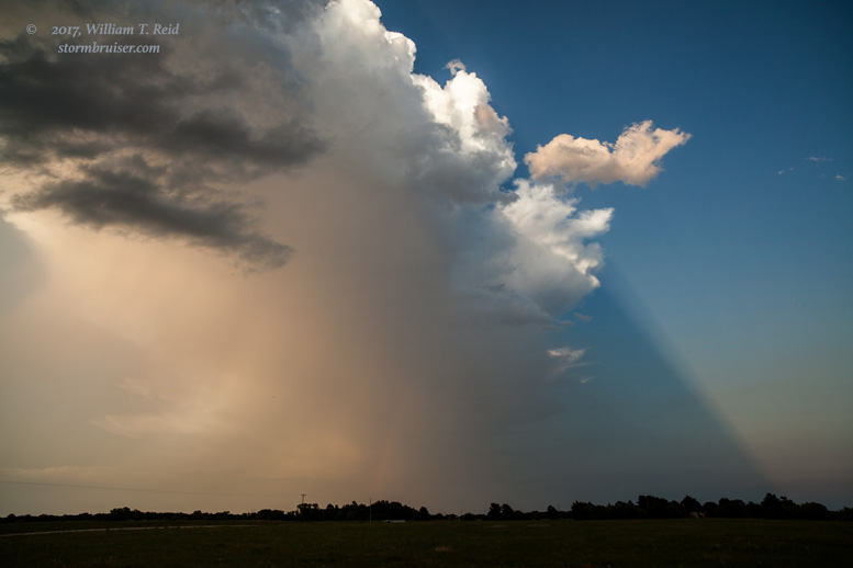

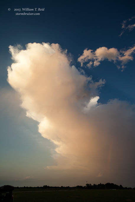
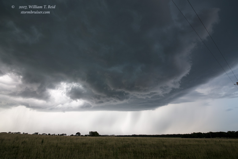
There was still nice low-level structure with the storm, now to our north-northwest. I set up the wide-angle/tripod for time-lapse, and that is when the storm decided to shrivel up at warp speed. It turned into an orphan anvil with no updraft in the next 20 minutes or so. Time to go home.
Leave a Reply
You must be logged in to post a comment.