

Start: Wichita, Kansas
Lunch: Liberal, KS (Subway/McDonalds/Longjohn Silvers)
End: Dalhart, Texas
564 miles
This was the final chase day for Tour 7. My drivers (Ron and Brian) were directed westbound from Wichita. Today would be a High Plains chase day, as we had to be back in Denver on the following day. Good moisture was along and south of I-40 for the most part (the moist part?). But in order to get back to Denver midday, I had to ignore the enhanced slight risk along the Red River (OK/TX border).
SPC Day One Convective Outlook (20Z)

There was decent upslope flow south of the Raton Mesa, but marginal moisture meant high storm bases and a tendency towards cold outflow. However, when we came upon this strong and isolated cell west of Clayton, it was teasing us with a wall cloud and not too much outflow.

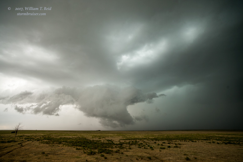

This storm moved ESE. Our road to reposition, via Clayton, went ENE. We bravely cut right in front of the core, made it to Clayton unscathed, and then dropped south. The storm had a nice shape and a good-looking base now to our WSW.


That seemed to be the best look of the day for us. The storm continued to the ESE, towards the NM/TX line. Here are some views, back to the north for the most part.


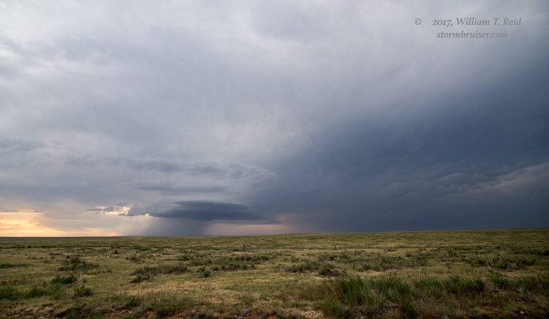
The supercell took us into the Texas Panhandle, southwest of Dalhart. Once we got into good position again for a look at the structure, the storm was fading fast. We had a little low-level laminar stuff going on and a pretty sunset, and then it was time to head to Dalhart for the night.


Leave a Reply
You must be logged in to post a comment.