

You can always count on western Nebraska to come through in early July!
Start: Denver AP
Lunch: Fort Morgan
End: Cozad, Nebraska
453 miles
SPC Day One Convective Outlook (20Z)

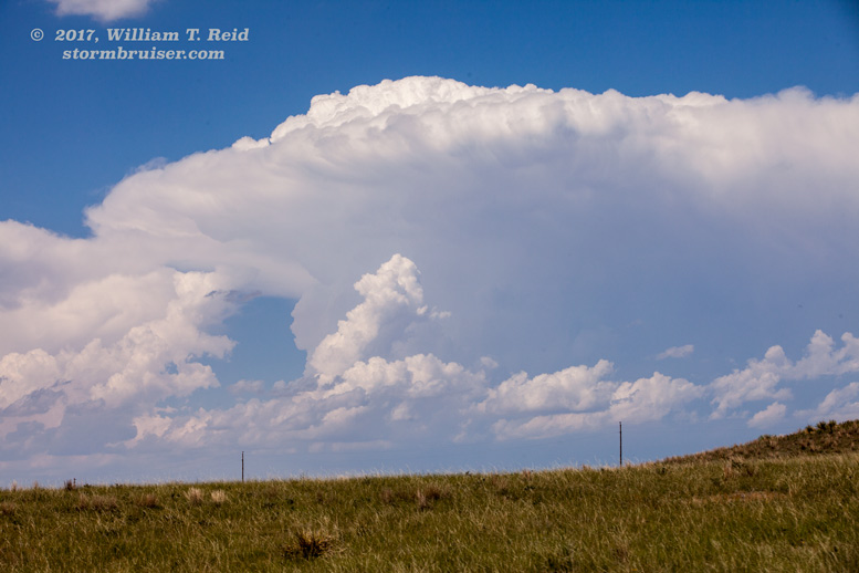
Tempest had a “tour turnaround” day on July 1, and that was a great day for one of these as the central High Plains were quiet for the most part. Tour 9 began on July 2, and moisture was returning to the central Plains beneath modest WNW flow aloft. We got out of Denver late morning, lunched in Fort Morgan, and headed for the Ogallala area. SPC had a slight risk here, but tornado chances today were extremely low as low-level moisture was just too sparse still. Regardless, there was more than enough instability and shear for severe weather.
This day started out somewhat disastrously as I left one of my camera bags at the base hotel in Denver —- outside! I failed to stick it inside of the van as we loaded everything right before leaving. I discovered that it was not in the van in the mid-afternoon when we stopped to watch some storms north of Tryon, Nebraska. The bag had a camera and a couple of frequently-used lenses, so I was sick. I called the hotel. Thank goodness — someone had found it and gave it to the front desk clerk! They kept it safe for me and I got it back at the end of the tour — whew! Meanwhile, decent storms were developing in the Sandhills. My other camera bag contained a camera and two lenses, so I was not out of business!


The storms took their sweet time to organize and get strong. They dragged us southeastward through Stapleton, North Platte, and then east on I-80 to Gothenburg.


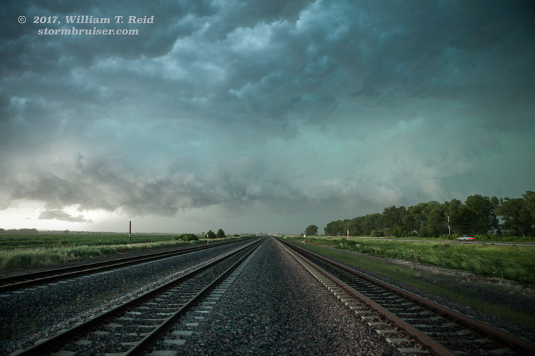
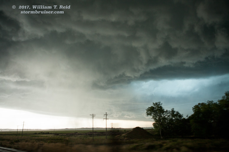
We raced south from Gothenburg to get back in front of a strengthening squall. Back out in front, between Gothenburg and Farnham, we were treated to some nice laminar structure on the leading edge, and some wall cloud-like stuff where outflow and inflow battled.


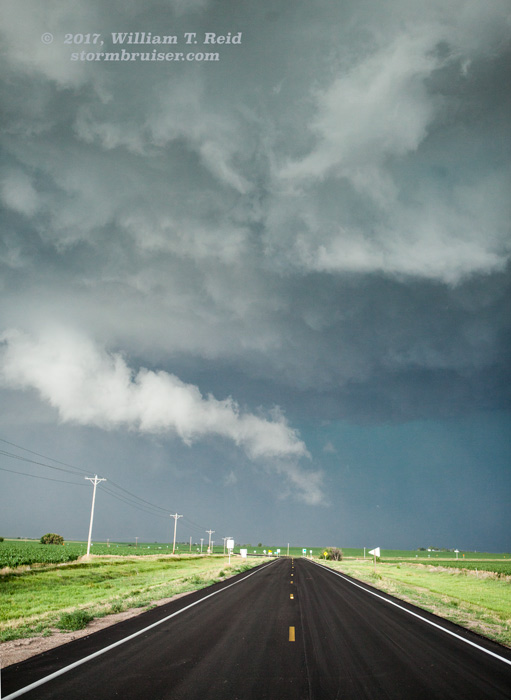
We shifted eastward towards Eustis and had even more spectacular storm structure around sunset! This storm caused very strong wind; but, on its east side, we were in relatively calm conditions while photographing the storm.


Leave a Reply
You must be logged in to post a comment.