Begin: Belle Fourche, SD
Lunch: Rapid City/Wendys and Taco Johns
End: Thedford, NE
372 miles
SPC Mesoscale Discussion 672 SPC Mesoscale Discussion 673
SPC Mesoscale Discussion 675 SPC Mesoscale Discussion 677
We will start the discussion of this day by mentioning that the following day (June 9) was a cap bust in eastern Wyoming. So, the group photos from June 9 at Hemingford are shared in this post (above).
On June 8, I noted in the morning briefing at Belle Fourche (north of the Black Hills) that supercells and severe weather appeared quite likely in the vicinity of the Black Hills, and perhaps also east of the hills a county or two. Instability was quite good with dew points in the low-mid 60s, and shear was just good enough for supercells. SPC threw in a “5 percent” tornado risk oval along I-90 in western SD in the 1630Z Day One convective outlook. Hopes were high that we might have a really nice chase day as we headed to Rapid City for a fast-food lunch. Rapid City was a good place to wait for development.
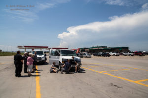
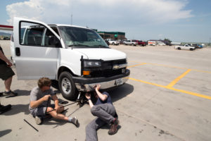
After lunch it was obvious that the lead van’s air conditioning was not working, and we were inspecting the radiator at a truck stop (see pics above). The lead van had impacted a deer at 65 mph on the prior evening, and we had radiator issues. We poured some leak-stop stuff into the radiator and crossed our fingers. It was very warm and a little humid, and we had to drive with the windows down in Van One.
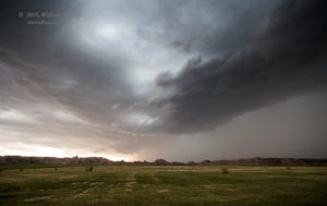
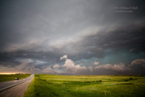
Well, the van functioned just fine on this day, thankfully (except for the a/c). In the images above, a developing storm is in view to the west. It was on the north end of the Black Hills, near Sturgis. We watched it grow and grow from a shady roadside stop on the northeast side of Rapid City. Soon, it was warned and was an obvious supercell. I wasn’t really interested in it, though. The data that I was perusing suggested that the severe weather environment and tornado potential were better to our east about 50-75 miles, and moisture convergence was improving towards Kadoka and vicinity. As the storm shear and radar couplet and storm tops to our west increased to impressive levels, I told the guests that it was time to head to the east. Storm towers were just starting to bubble to our ESE, around the Badlands. A LOT of chaser icons were attached to that Sturgis-area storm. It wasn’t easy to drive away from it, and I was hoping like heck that it would not produce a tornado.
Perhaps the main reason that I opted for the eastern play is that I really do not like to chase supercells in and around the Black Hills. If the storm heads into the hills, then it is virtually un-chase-able. Sometimes storms like to form on the hills, and then they sputter when they move to the lower terrain. It seemed to me that a storm forming in the good instability near the Badlands, without the help of elevated terrain, would be much preferred.
Interstate 90 worked perfectly to get us toward the convective development, and in an hour we were stopped at the exit for the Badlands between Wall and Kadoka. Healthy updrafts were just to our south and were spitting out a lot of CGs (lightning). Instead of heading south to Interior, we drifted east on I-90 and stayed northeast of the activity. At Kadoka it was time to drop south (on 73), and by the time we reached Highway 44 (east of Wanblee), a decent supercell with a big wall cloud was to our west! We stopped a few miles west of the junction of 44 and 73.
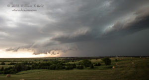
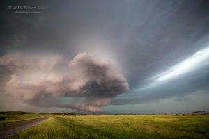
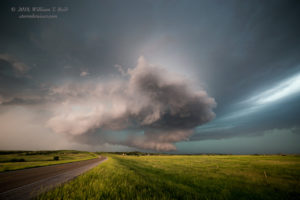
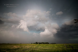
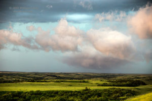
The wall cloud dissipated as we stopped to watch and take pictures (above). The activity had strengthened quite a bit, so the 2 or 3 cells that we had been watching were now merged together, and a lot of precipitation was apparent. This was causing a little coolish outflow, and I figured that any tornado prospects were diminishing quickly. The storm was in really good air, though. The main updraft on the south end, along Highway 44 and just east of Wanblee, was starting to dominate and was moving somewhat slowly to the ESE. We scooted east on 44 a few miles.
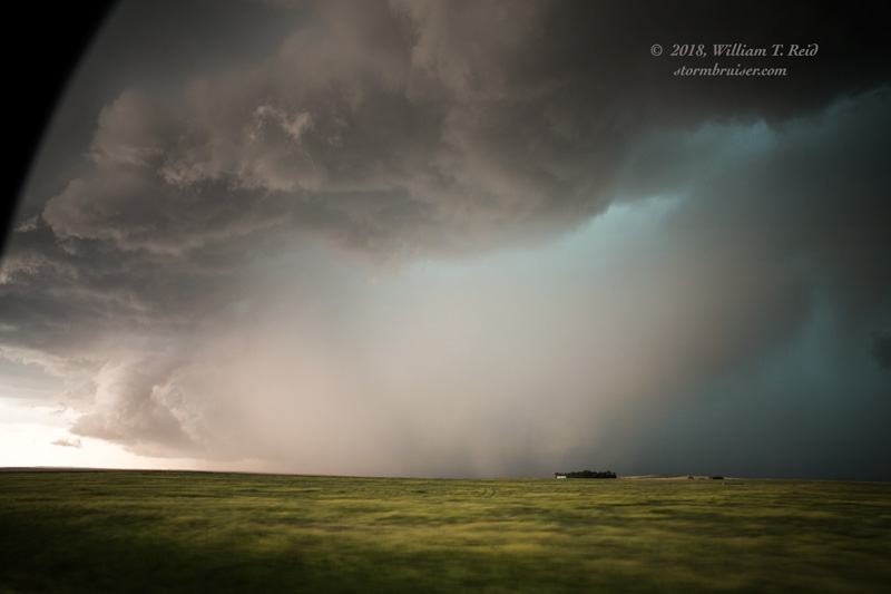
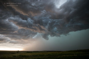
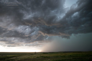
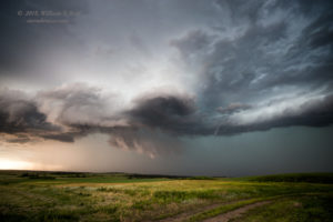
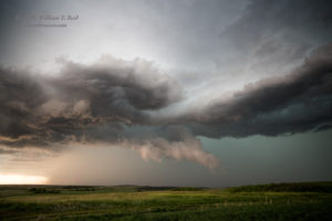
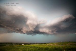
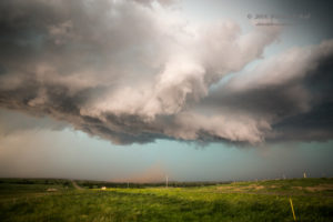
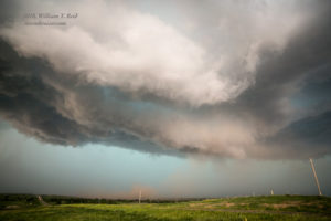
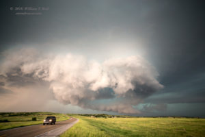
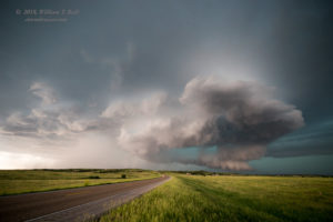
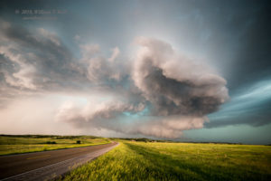
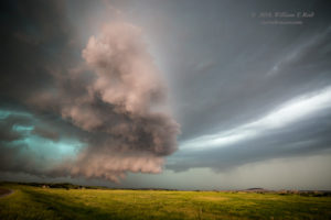
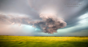
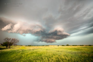
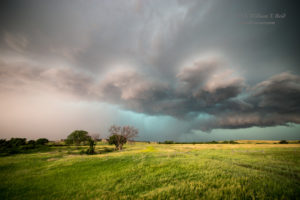
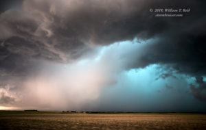
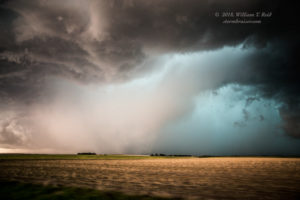
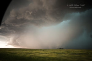
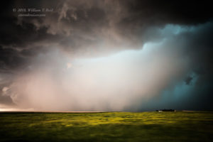
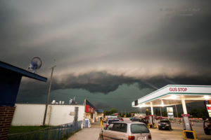
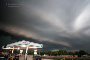
The base began to look a lot more organized, and a ragged lowering was soon above some dust (see pics above). This was looking a lot more like RFD wind, and perhaps a lurch towards tornado development, rather than cool outflow and undercutting. Great! We moved farther east on Highway 44, to a point about halfway between 73 and 63. The view to the west now was stunning, with a massive wall cloud beneath the massive laminar-undersided updraft base. WOW! The entire sky to the west was rotating cyclonically now, as the storm tried hard to “tornado.” But was the slight coolish outflow and undercutting from 20-30 minutes ago working against a tornado at this point? Perhaps.
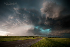
The base and wall cloud began to move more to the southeast, and was a little south of 44 now. We went to 63, turned south, and stopped quickly to watch. The RFD to our west and WSW was really wet, and now we were on the receiving end of a tremendous lightning barrage. I thought I was videoing this, but my camera was not recording–ugh! I did get some stills, though (last two above). Highway 63 dropped south, right in front of this intense supercell. We had a view to the WSW into the notch, but the RFD (rear-flank downdraft) area was a mess of precipitation. Was anything happening inside there?
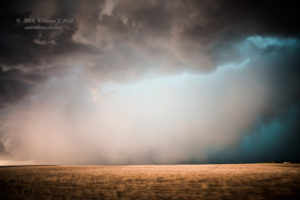
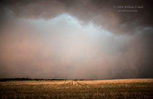
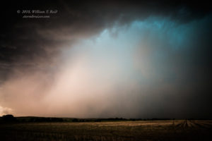
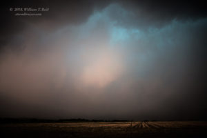
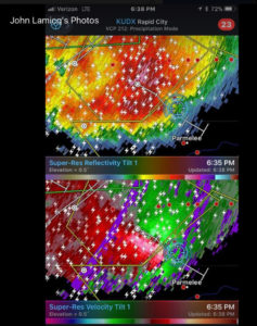
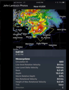
I wasn’t sure. We stopped about halfway to Norris (just a few miles south of 44), and stared at the wet mass to our west. The CG barrage was over, and storms often go into a tornado phase when a big uptick in lightning ceases. That time was now. Something looked to be stirring a couple of miles to our west, and my enhanced photos (below) suggest a nastiness of some sort in there. Additionally, the Rapid City radar was indicating a very tight and strong couplet with the storm. There might have been a significant tornado in progress at this time to our west.
Radar images above courtesy of Tempest guest John Lamacq.
After a couple of minutes, rapidly rotating precipitation curtains were emerging to our southwest, not too far away. We needed to get out of harm’s way NOW! Atomized rain, usually only associated with tornadic storms, was around us. We blasted south on 63 towards Norris, through the fast-moving rain curtains and strong and gusty west winds. Upon stopping a little east of Norris on 63, we looked back and observed a less-organized updraft base, with nothing that looked especially threatening. The radar showed a much-weaker couplet.
The storm became less organized and less discrete from this point. It chased us to Parmelee and then Mission, where we squeezed in a pit stop as the leading edge approached.
The storm was now quite outflowish, and we raced south on U.S. 83 to stay on the dry side. Our quick McDonalds stop in Valentine was cut short as the storm came upon us again, and we managed to stay ahead of it all of the way to Thedford.
GoPro footage for the event by TT guest Cathy Gregg
Recap with pics and video by TT guest Lesleyanne Ryan
The third video in Lesleyanne Ryan’s account is of the strongly rotating base and wall cloud just west of 44 and 63, as the storm was just starting to crank. This was before the CG barrage and the possibly rain-wrapped tornado.
Note: the nice initial supercell which was near Sturgis had a good look for a while, but it did not produce a tornado, and it moved SSE-ward into the Black Hills! It fizzled after an hour or two and left chasers in that vicinity with nothing to chase just as the supercell between Wanblee and Norris was going strong.


Leave a Reply
You must be logged in to post a comment.