I have some catching up to do before getting to June 18. On June 12, Tour 6 and the Mini A group “chased” the pretty high-based supercell near Hugo, CO. The overall weather pattern was somewhat poor, though, and the 13th was a bust. Here are a few details for June 13 to June 17th, during which time I was not in storm chase mode for the most part. Scroll down a little for the excitement of June 18!
June 13 Begin: Burlington, CO/lunch Julesburg (Lucy’s)/End: Kadoka (lousy convenience store dinner at Martin, SD)
There was an outside chance of a big-time supercell in the Sandhills of Nebraska on this afternoon (SPC upgraded to a slight risk at 1630Z and maintained it at 20Z). Some late-morning elevated storms were near the NE/SD border around Valentine, and these had moved on, but maybe an outflow boundary from these would help to break the cap during the afternoon. We made our way north from Ogallala to Hyannis after lunch. A promising updraft or two or three developed to our west, and then fizzled fairly quickly. Another one went up back down towards our lunch town of Julesburg, but I didn’t like the environment down that way very much. The tour group needed to be way up into western North Dakota on the following afternoon. The tornado prospects were looking decent up there on the 14th. After a little bit of back and forth around Hyannis mid-afternoon on the 13th, I gave in, acknowledged that the cap was going to win today, and pointed the tour northward to the Dakotas. A check of the SPC Storm Reports show no hail reports after 21Z on the 13th on the Great Plains, except for a lone report in New Mexico.
June 14 TT Begin: Kadoka, SD/end: Bismarck
I had to fly home from Denver for the weekend on the 15th, so Chris Gullikson took charge of the tour group. I had an easy day and got a room in Gordon, Nebraska, early in the afternoon to recharge prior to my drive to Denver on the next day. Some strong thunderstorms rolled through Gordon around mid-afternoon and caused some dusty outflow. Chris and company waited for development a little north and east of Williston. They eventually found some severe storms near Stanley and Beulah, with a weak tornado (landspout?) near Ray, ND. A severe storm midday near the Canadian border threw out a lot of worked-over air which effectively put the kibosh what was thought to be a day with good tornado potential. And, the cloud-seeders were not on the side of the chasers, either. This entry by Tempest guest Lesleyanne Ryan has additional details.
June 15 TT Begin: Bismarck/end: Douglas, WY
I flew home from Denver, and Chris found some marginally strong/severe storms for the tour group in northeastern Wyoming (SPC MD), especially near Wright. Entry for this day by TT guest Lesleyanne Ryan.
June 16 TT Begin: Douglas, WY/End: Chamberlain, SD
Tempest chased severe storms and supercells from west of Valentine to the Winner, SD, area (see SPC MD)…after dealing with a flat tire near Lusk. Entry by TT guest Lesleyanne Ryan.
June 17 TT Begin: Chamberlain, SD/End: Wray, CO
Mini Tour A group returned to Denver with Bill S. on the 16th, and the 17th was the first chase day for the Mini Tour B group. They headed to the vicinity of Haxtun, CO, and watched a splendid tornadic supercell develop. (SPC MD here.) The Tour 6 contingent with Chris G. approached from the east along I-80 and I-76. The tornado or tornadoes with this storm (around Julesburg) quickly became wrapped in precipitation, apparently (second MD by SPC!). Lesleyanne’s account is here.
June 18, 2018
Begin: Wray, CO
Lunch: Bennett, CO/fast food
End: Fort Morgan, CO
Blog entry for this chase day by TT guest Lesleyanne Ryan
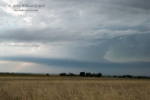
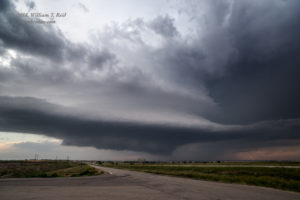
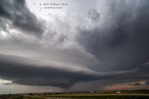
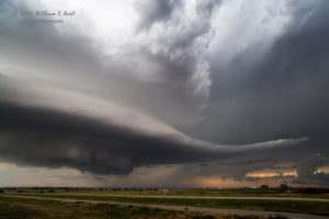
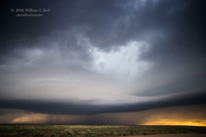
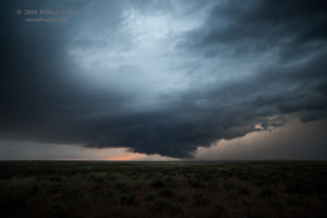
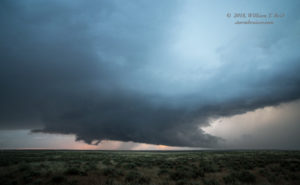
The models and CAMs (convection-allowing models) on this chase day had me eyeing the Palmer Divide and vicinity. The tour group began in Wray, and met me for lunch at Bennett. I had just flown back to Denver from L.A. during the morning. We killed time along I-70 at Bennett and Strasburg. Some updrafts not too far south of I-70 sputtered. I was hoping that something could get strong here, as the severe-weather parameters were not too shabby. But eventually I was forced to look elsewhere for a good storm, and one was looking pretty good to our northwest, near Boulder. It dumped some large hail on the city and moved to the east. We caught it near Fort Lupton, and it sported a nicely-sculpted updraft base.
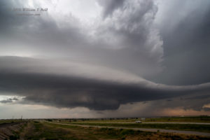
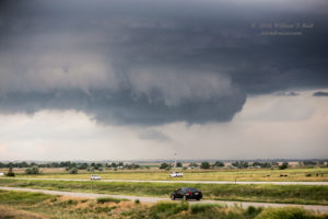
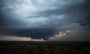
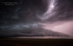
In the last image above, the storm made a feeble attempt at tornado formation, near Keenesburg, perhaps. A second supercell developed a little northeast of the original one. It had a low base and nice wall cloud, but it, too, remained tornado-less.
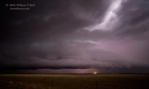
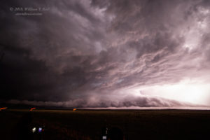
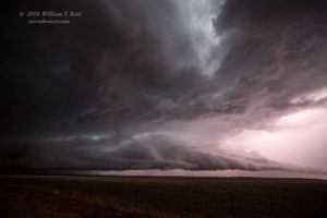
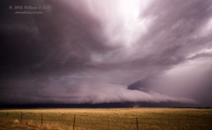
We were near Roggen for the images above. The storm chased us farther ENE along I-76. We found a locale north of Wiggins in front of the rain and hail to capture some structure shots in the lightning flashes.
After hanging out under I-76 during the hail dump, we ventured into Fort Morgan for the night.


Leave a Reply
You must be logged in to post a comment.