Stormbruiser.com

William T. Reid

  • About
  • Video Links
  • Climate
  • Categories
    • Astronomy
    • Aurora/Northern Lights
    • Artsy
    • Airports (LAX and VNY)
    • Animal Day
    • Beach
    • BEST and MOST POPULAR
    • Chase Season Summary
    • Chasers and friends
    • Cumulonimbus
    • Death Valley
    • Desert
    • Desert/Mountains
    • Elevated photography
    • Eyesores
    • Fire
    • Flooding
    • Hurricane
    • Landscapes
    • Lightning
    • Local: Conejo Valley/San Fernando Valley
    • Mid and High Clouds
    • Nighttime photography
    • Old Stuff
    • Rainbows/Optical Phenomena
    • San Nicolas Island
    • Storm Video Sales
    • Stormy Skies
    • Stupid Bugs
    • Sunsets and Storms
    • Supercells
    • The City
    • Tornadoes
    • Unusual Clouds
    • Vegetation
    • Wind and Dust
    • Winter Weather
  • Contact
You are here: Home / 2019 / June 14, 2019 Southwest Kansas Nearly Severe

June 14, 2019 Southwest Kansas Nearly Severe

June 14, 2019 By William Reid Leave a Comment


Start:  Dalhart , TX

Lunch:  Hooker, OK/Mr. Burger

End:  Hugoton, KS

414 miles

SPC Day One Outlook/20Z

SPC Mesoscale Discussion 1061

SPC Mesoscale Discussion 1064


Chase account by TT guest L. Ryan


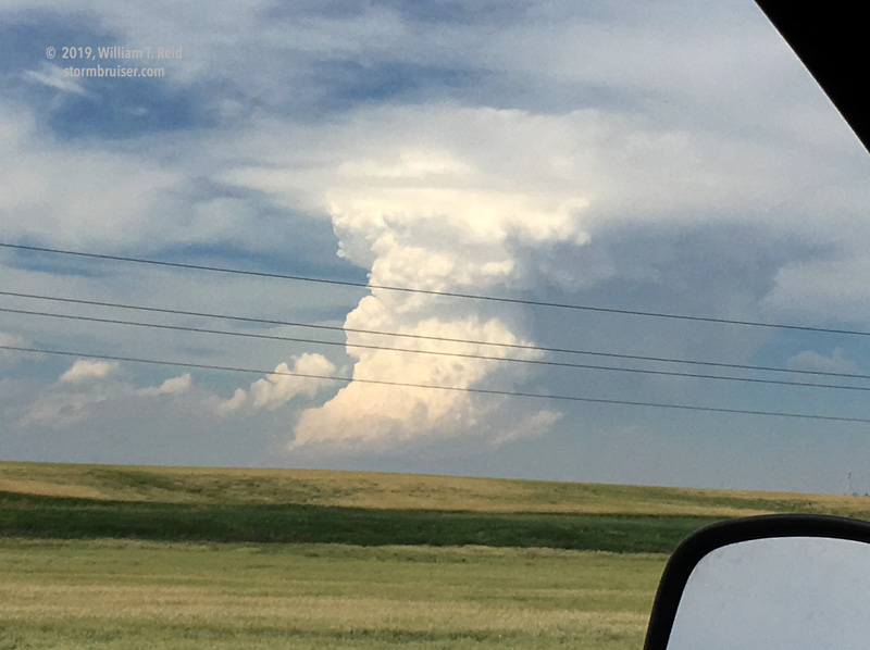
Today was looking a little better for severe weather and maybe an outside chance for a tornado.  I was thinking that the Liberal, KS area looked like a good starting point.  Dew points were easily into the low 60s.  After lunch in Hooker, we headed north, and north and north — an area of good convergence was up in western KS, with a cumulus field.  A very nice and isolated updraft went up near Leoti, and I managed a couple of iPhone shots of it.  These are looking NNE, from a little east of Syracuse.


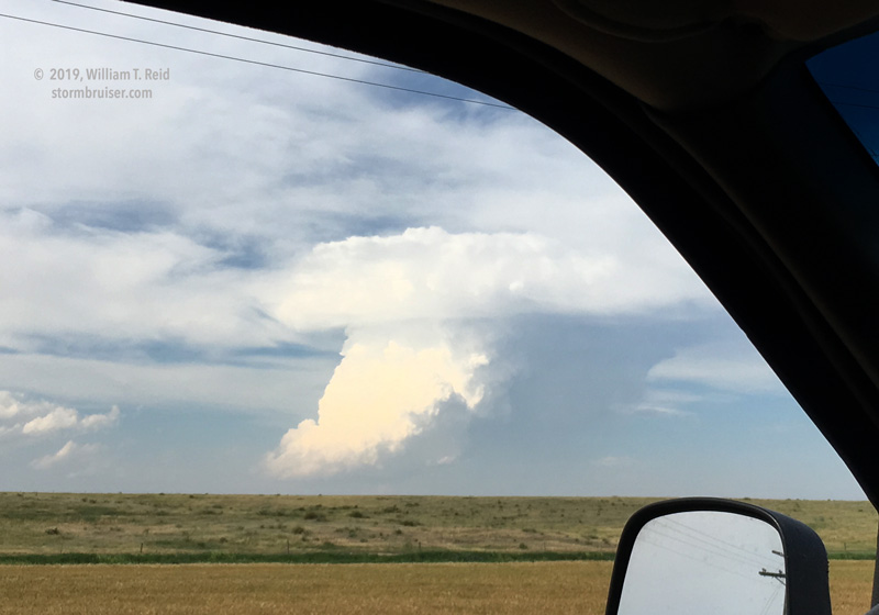
This storm was moving into an environment which had pretty good tornado potential.  We just needed to catch up!  But it looked good for only 20 minutes or so, and then it stopped trying.  The strong cap turned it into a blubbering mush blobfest.  I guess the only good thing was that it decided to go mushy before we wasted another hour or more trying to get to it.

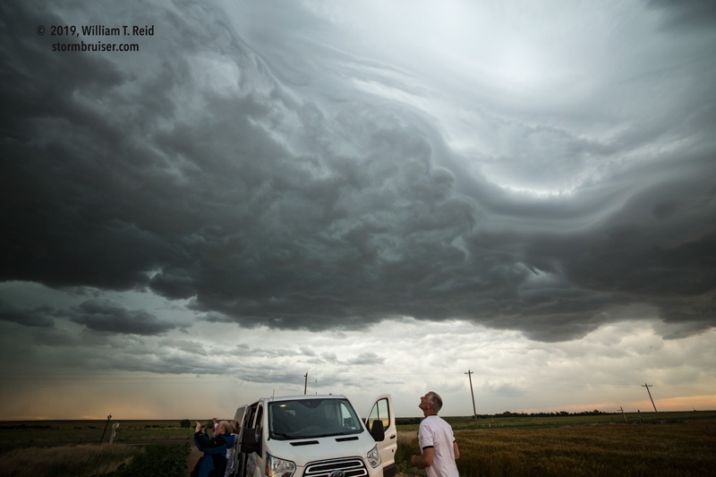
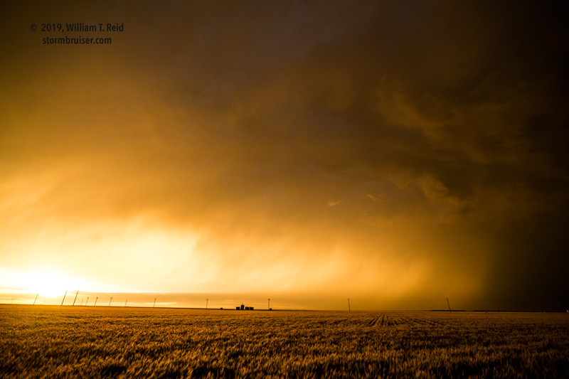
Back to the southwest, more storms were brewing, much like coffee.  These were high-based and visually interesting, and the one near Manter and Johnson had a good CG spurt or two.  But, none that we watched could really get cranking.  The consolation prizes, as often happens, were the rainbow and nice light on the storm at sunset.


text

Filed Under: 2019, Cumulonimbus, Rainbows/Optical Phenomena, Sunsets and Storms, Supercells

Leave a Reply

You must be logged in to post a comment.

Search

June 2019
S M T W T F S
 1
2345678
9101112131415
16171819202122
23242526272829
30  
« May   Jul »

Categories

Archives

Copyright © 2025 stormbruiser.com · Log in