
Start: Dalhart, TX
Lunch: Meade/Subway
End: Hugoton, KS
603 miles
SPC Mesoscale Discussion 1116 SPC Mesoscale Discussion 1120
SPC Mesoscale Discussion 1121 SPC Mesoscale Discussion 1123
SPC Mesoscale Discussion 1126 SPC Mesoscale Discussion 1127
Chase account by TT guest L. Ryan, including some super time-lapse and tornado video
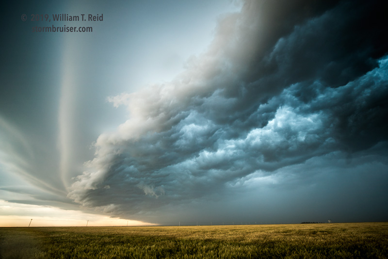
SPC drew a large “enhanced slight” risk from central Kansas to Big Bend, TX, this morning. From Dalhart I directed Bill and Bob northeastward towards south-central Kansas. An MCV was drifting through central Kansas, and mid/upper flow would be good just to the south of this circulation. The air was rather cool and moist from Dodge City to Pratt midday, but skies were clearing. Good low-level turning with height and narrow temperature/dew point spreads suggested some tornado potential with any discrete updraft. CAMs suggested some storm development by mid-afternoon.
We did a quick Subway lunch at Meade and continued to the ENE on 54. I had my sights set on Pratt and vicinity. As we blew eastward past Greensburg, Bill S. turned my attention to new development a little back to our NNW, in some nice sunny skies. Hmmm. I looked quickly at the parameters just in front of that little cell, and the shear and instability were not bad at all. Let’s get north!
From Haviland we blasted north. Well, kind of. Our road turned to wet dirt. Overnight rains had made this road a little dubious, but we made it north and west to Kinsley, via Fellsburg. Our organized storm, to our northwest, was looking pretty good and there could be no road issues now! What a disaster that would have been, had we been forced to turn around due to a muddy road.
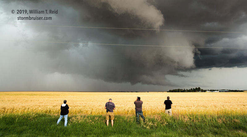
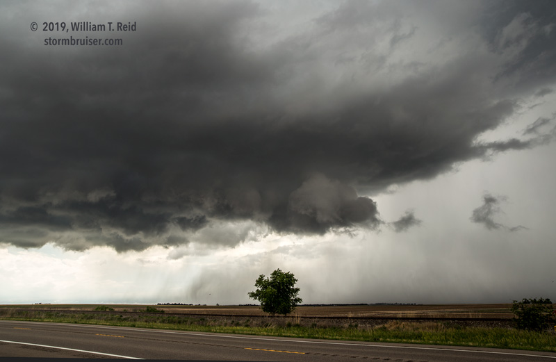
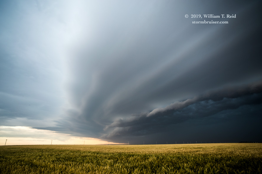
We had the perfect approach from Kinsley. The storm was maybe 10-15 miles northwest of the town. A paved road got us 90 percent of the way there, and then the last mile or so was dirt, and then mud. We stopped on the slick surface and had a VERY low storm base to gawk at from WNW to NW to NNW! YAY!
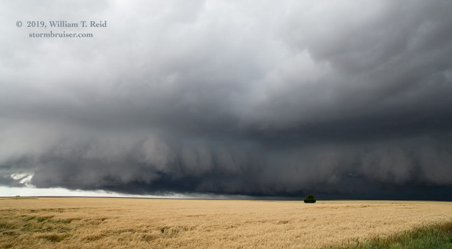
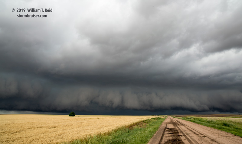
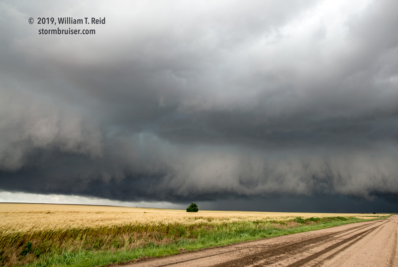
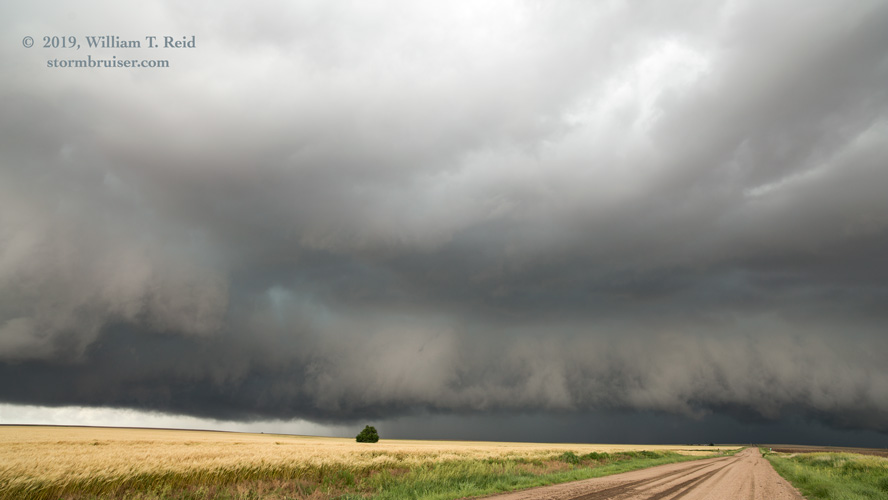

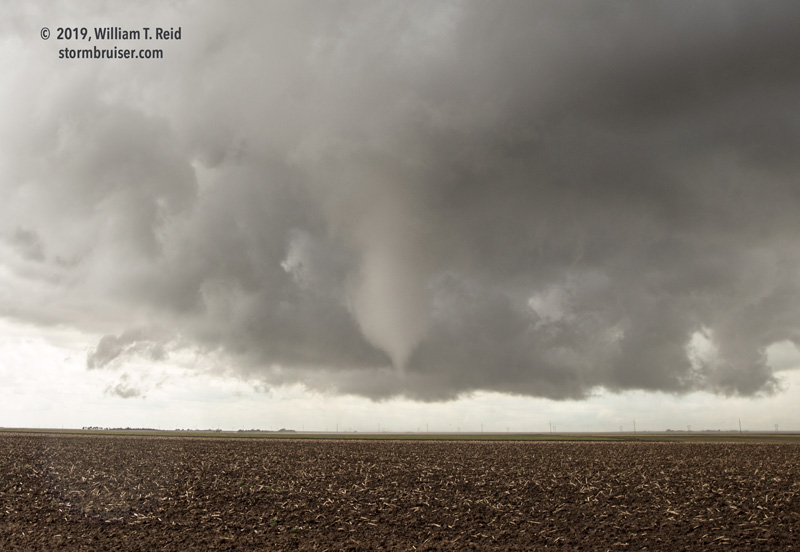
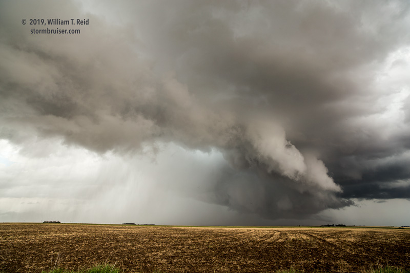
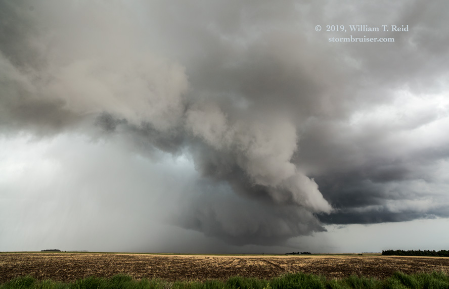
It looked like a giant, somewhat linear wall cloud. But, there was a kink in it, with an even lower “wall cloud” base to our northwest. This is where inflow seemed to be focused, and there was some good motion there. With the base this low, you just KNEW that we were going to get something out of this storm. In the photos above, the unpaved road heads due north. The last image shows some suspicious activity just to the left of the tree — perhaps some rotating rain curtains, perhaps a developing tornado. The time was 2:30 p.m. CDT (about 1930Z). It was really early in the afternoon, as far as tornadoes go, and we were already in Fat City, with no one else around! We backed up to the south a tad to get out of this muddy part.
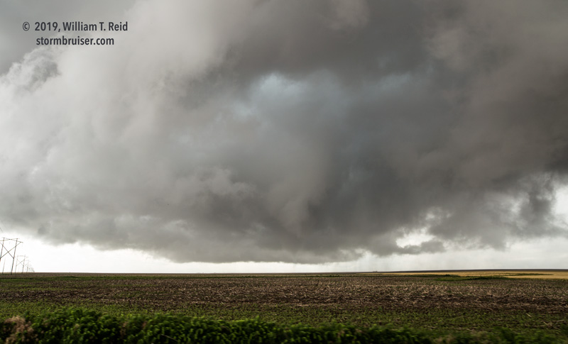
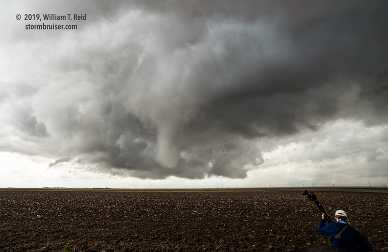
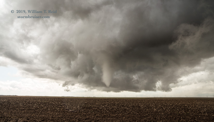
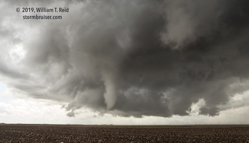
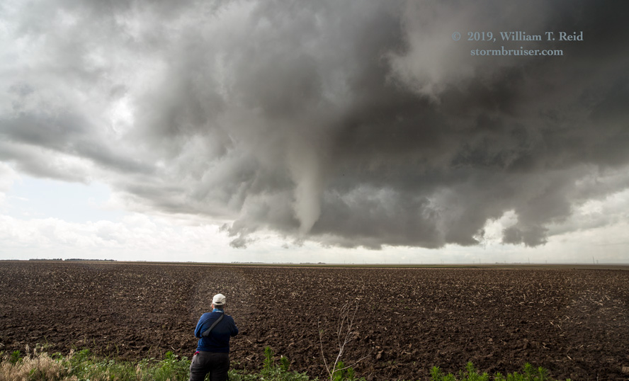
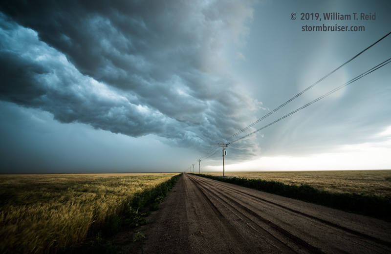
Our lowered area with the kink sagged southeastward a bit, and a nice funnel cloud descended. The ground was much too moist for dust around here, so, except for a brief few seconds, the connection to the ground was not obvious. The views of the tornado (pics above) were generally towards the WNW. We were WNW of Kinsley by about 8 miles. The tornado lasted a few minutes.
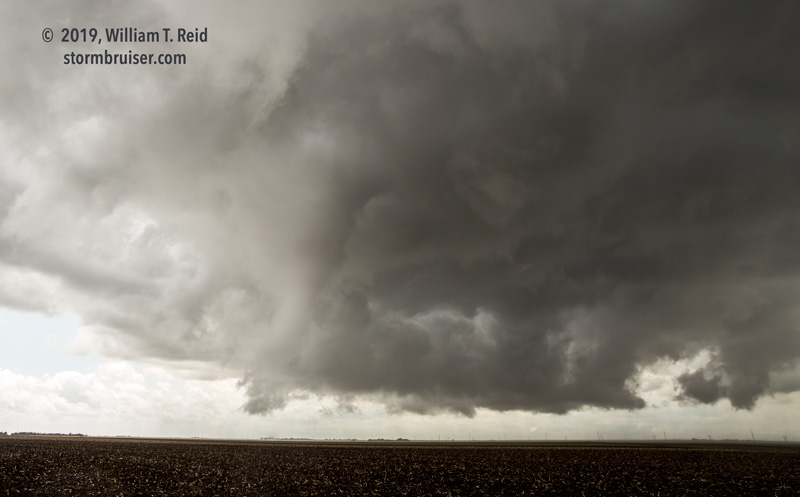
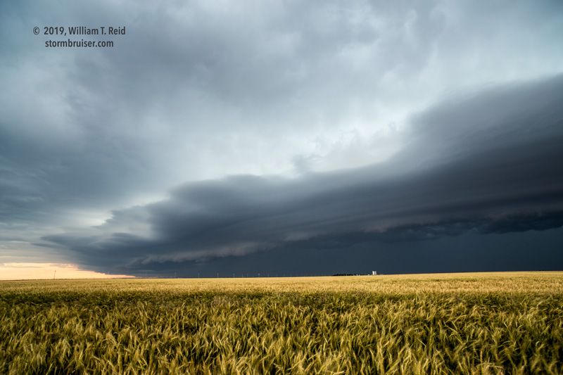
We scooted south to our E-W road after the tornado dissipated. We were vulnerable to another tornado at close range for a little bit, but our tornadic circulation fizzled. The area to watch now was to our NNE. We headed to Kinsley and eastward several miles, and it looked like that meso with the low base north of town was going to go to town — see the pics below.
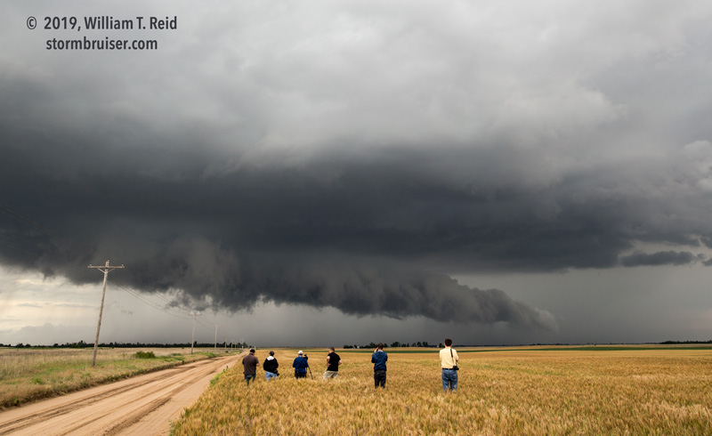
Sadly, that was IT for tornadoes in all of Kansas this day! We stayed with the storm a little bit, and it quickly croaked. Another good-sized updraft beckoned towards Pratt — let’s get that!
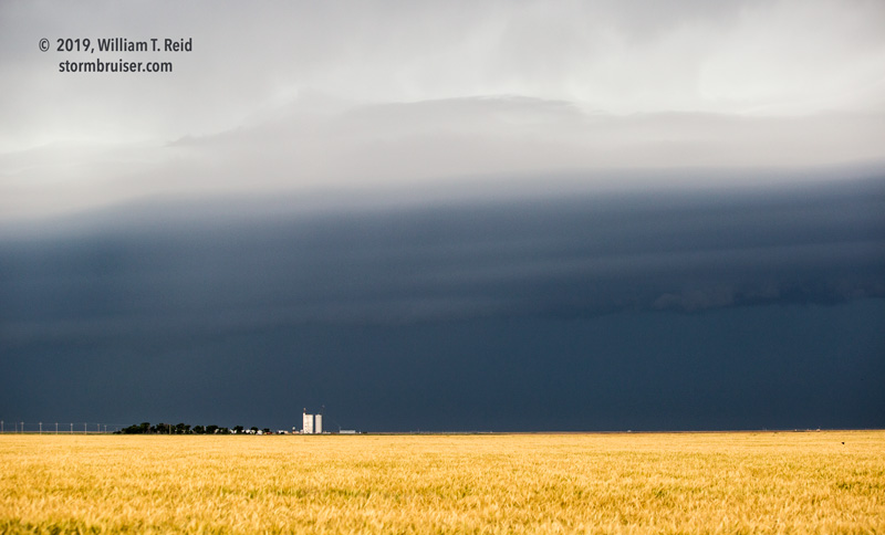
The Pratt storm looked good from our vantage point on its west side for maybe a half hour as we played catch up. For whatever reason, it was not tornadic, and it became rather mediocre, both visually and on radar. It was still mid-afternoon, and I was not enamored with the activity to our east. Let’s try our luck out west!
Some strong stuff was moving out of southeastern Colorado, and we managed to get ourselves in front of this squall line (near Richfield). The squall was fast-moving, and it seemed to intensify some as it approached our hangout in Hugoton.
Leave a Reply
You must be logged in to post a comment.