
Start: Denver
Lunch: Torrington, WY/Arbys and Subway
End: Gering, NE
379 miles
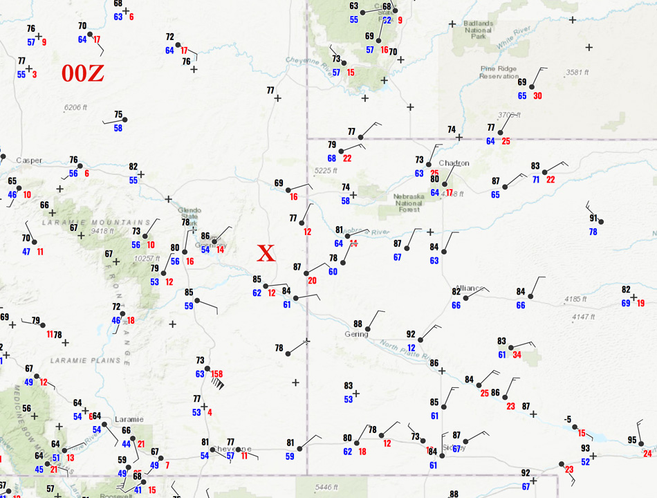
00Z (6 p.m. MDT) surface weather map above. The red X shows where the storm was (approximately) when it was about its best.
Tour 8 made is way northward out of Denver on Day One. We had lunch in Torrington and then went up to Lusk. I was generally considering areas farther north, but that idea was not looking as good. We stopped near a park in Lusk to check the latest weather data and forecasts, and I decided that the best play was back to our south a little. At Jay Em (between Lusk and Lingle on 85) we had a developing storm tower to hone in on, to our WSW. (Or did we “home in” on it? We weren’t very close to home.) This one had some thunder and moved just east of 85 and sputtered out.
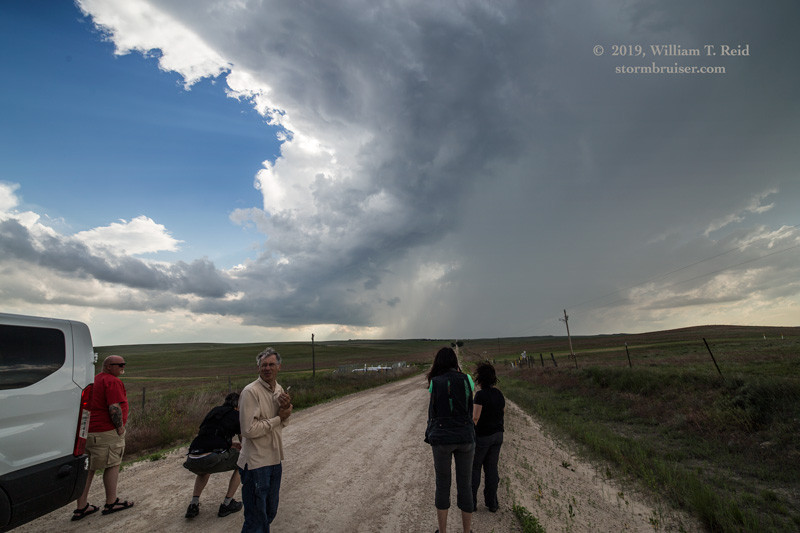
Another storm developed a little farther WSW of Jay Em. It took its time to get strong, but eventually it was rotating a bit and moving deviantly, to the south or SSE, very slowly. It was too far west of 85 for my liking, so we tried the unpaved roads southwest of Jay Em. These worked out well.
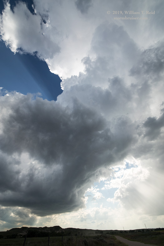
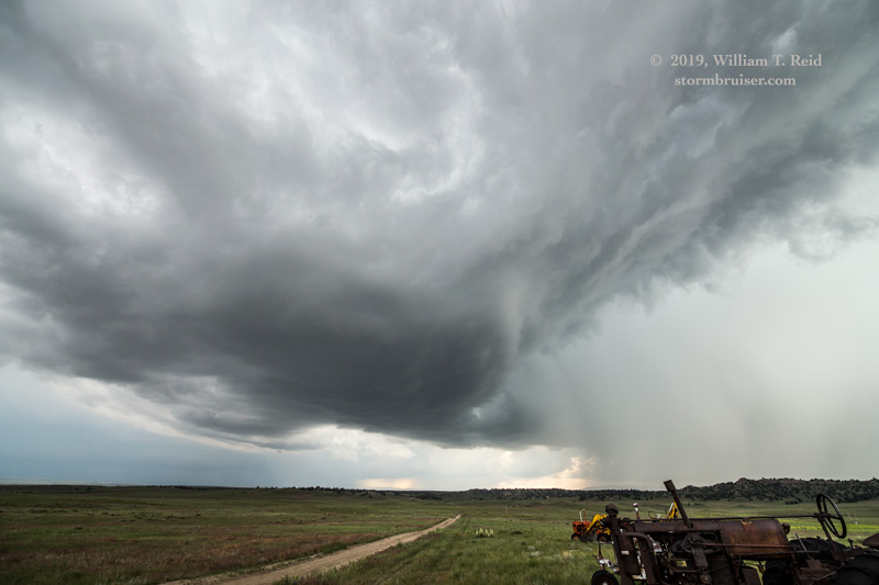
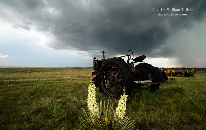
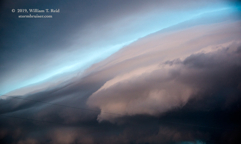
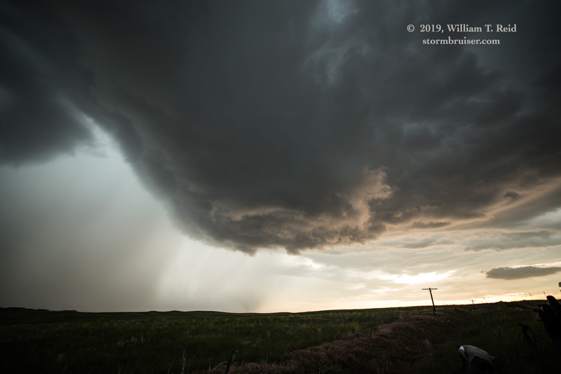
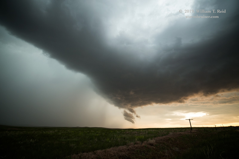
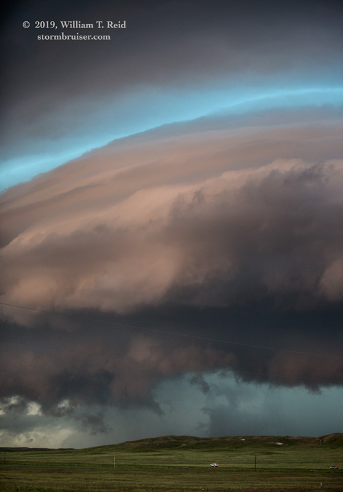
The storm base lowered some and assumed a nice laminar look NNE of Fort Laramie by maybe 12 miles. Some scud developed beneath the interesting lowering, but any low-level rotation was very weak. The views below are mostly to the north and northeast.
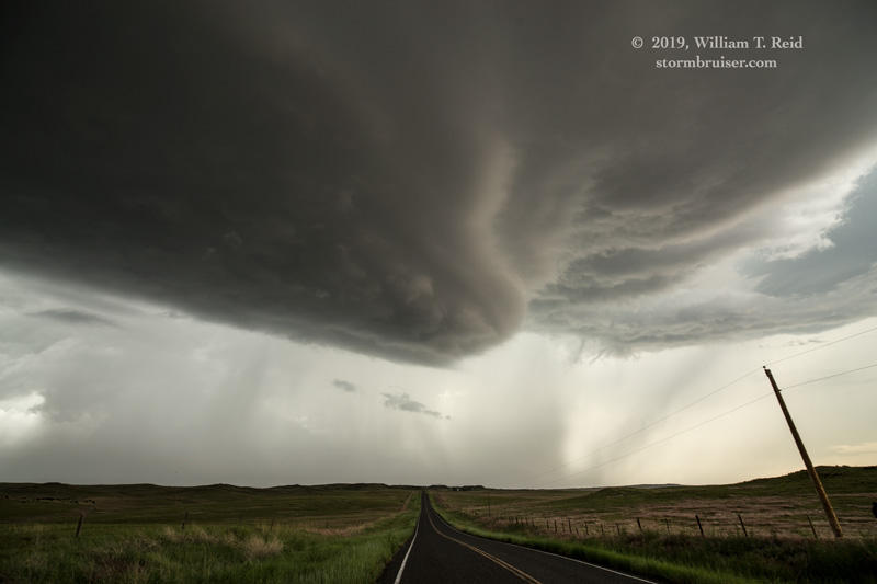
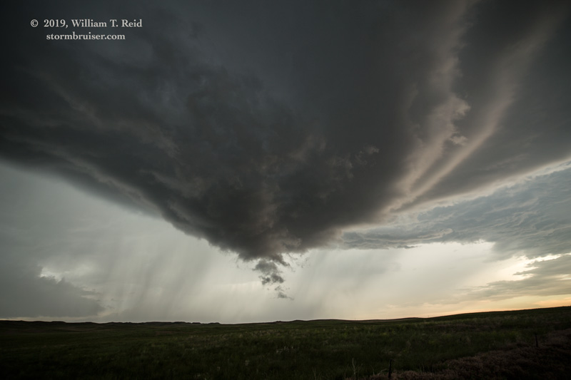
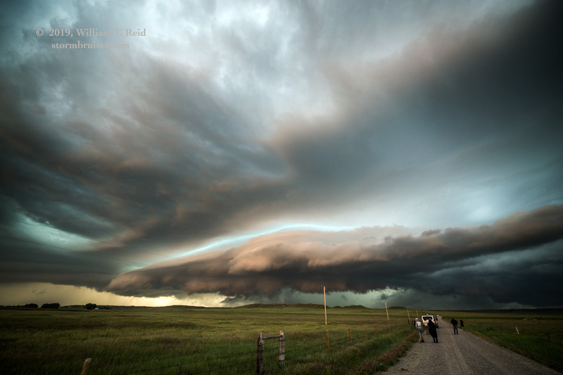
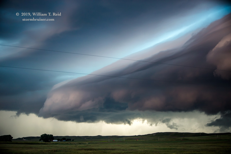
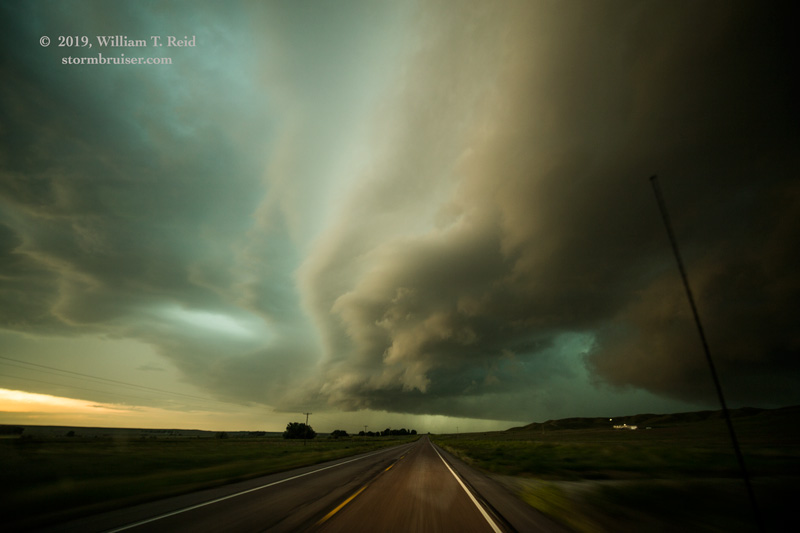
Sunset was nearing, as was another strong and outflowing semi-beast of a storm to our southwest. We needed to get back east of our more-discrete storm. That entailed heading south to Fort Laramie, ESE to Lingle, and back north again. By the time that this was accomplished, the cell had much more of a linear and outflowish look. It was pretty, though! It crashed over us as we headed back south to Lingle, but the hail was small and the chase day was done.
Leave a Reply
You must be logged in to post a comment.