Start: Valentine, NE
Lunch: Scottsbluff, NE/Taco Johns
End: Wheatfield, WY
SPC Mesoscale Discussion 1365 SPC Mesoscale Discussion 1366
SPC Mesoscale Discussion 1367 SPC Mesoscale Discussion 1368
SPC Mesoscale Discussion 1369 SPC Mesoscale Discussion 1375
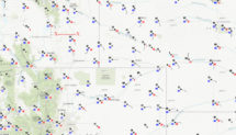
20Z surface map above
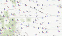
01Z surface map above
My wide-angle/15mm real time video (Part 1)
My wide-angle/15mm real-time video (Part 2)
(look for Part 3/rope-out stage in the comments section of the Part 2 video. The above links will take you to a Facebook page.)
Chris Gullikson’s “green bucket” time-lapse video (on youtube) of the tornadic Chugwater supercell.
This was the second-to-last chase day for Tour 8, and the second-to-last chase day of the tour season for me. The setup was looking pretty good for supercells (and perhaps even tornadic supercells) in the “upslope” regime of eastern Wyoming. Upper-level winds were excellent, and moisture and sunshine on the high terrain meant great instability. With dew points pushing 60F in and around the Cheyenne Ridge, where elevations are near 6000 feet, a chaser gets a warm and fuzzy feeling inside. We started westward out of Valentine and aimed towards Scottsbluff…and probably west or southwest a little from there. The CAMs (convection allowing models) were relatively consistent on predicting a good-sized supercell tracking eastward through the Chugwater area by 00Z or so.
After lunch in Scottsbluff, I was beginning to feel less certain about the prospects later on around there and in southeastern Wyoming. The southern Nebraska Panhandle was still very cloudy and cool. I need sunshine! There would be no decent storm near here today, given this cool and stable air. Ugh. And, now the HRRR model seemed to be backing off some on its nice “Chugwater supercell” thinking. The skies were still partly cloudy in southeastern Wyoming, so sunshine was not too big of an issue to our west. But I figured that this cool low-level airmass that was moving westward into my target area would be detrimental. I looked at other areas — the Palmer Divide; the Sandhills back in western Cherry County, where we had been just two hours ago. The Palmer Divide had good moisture but so-so shear. The western Cherry County play looked halfway decent. I looked again at southeastern Wyoming. Dew points of 60F and afternoon sunshine around Cheyenne — you just don’t walk away from that! I decided to stick with Plan A. Chris Gullikson supported that thinking. I am glad that he was not too keen on straying somewhere else! Chris mentioned that the cool and cloudy conditions in the southern Panhandle, which persisted well into the afternoon, could be beneficial as the impressive low-level moisture was not mixing out. SPC also noted this in an afternoon mesoscale discussion.
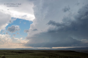
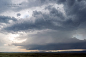
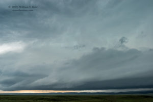
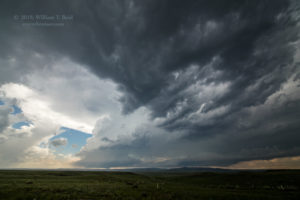
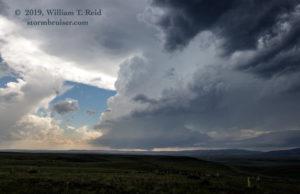
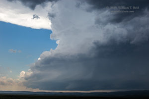
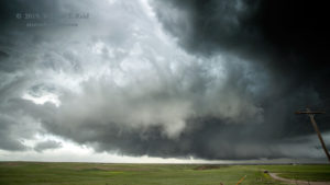
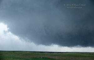
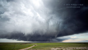
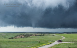
We zigged and zagged to Chugwater, via Hawk Springs and Road 313. A good-sized storm was near the mountains almost due west of Chugwater. That was what we wanted! The road network around here is lousy, though, so we plopped ourselves onto a high point along the dirt road some 4 or 5 miles west of Chugwater and waited for the storm to near us and Interstate 25. The updraft was maybe more than 30 miles distant, but we had some decent views. Light anvil rain fell here, and soon the very low storm base came above the distant hills.
The storm moved ESE to east, so the base (and its action area) was eventually to our WSW. An obvious funnel cloud protruded for a minute or so, and the storm became tornado-warned. Slowly, slowly, slowly, it approached I-25 and the area not too far to our southwest. I was glad that we were on this storm, with the nice very clear skies to its east and southeast! What was there to worry about?! The easterly inflow was at least 15 knots, and the storm had great structure!
The base was to our southwest, and it was time to reposition. We made our way east to I-25 and the southern edge of Chugwater. Should I continue to the east a little, and get onto that nice plateau just to the east of Chiugwater? That would be a pretty good area to monitor the supercell, to maintain a good look at its structure, and to stay with it as it continued east of I-25. I was thinking that this would be the most prudent maneuver. But there was another play: we could get ourselves south a little, get right in front of the storm base, and watch the storm as it moves right up to the interstate. This second strategy was a bit risky, though. Once the storm moved east of the Interstate here, we would be basically out of luck for a while as far as getting back into position just east of the storm. The hail core would be between us and Road 313 eastbound out of Chugwater. There was a chance that we might miss any “show” if the storm decided to go into tornado-mode a few miles east of I-25.
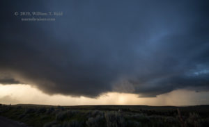
I decided to “go for the gold” and to head south from Chugwater. The next exit was about 7 miles away. Would this be too far south? Too far north still? In 20 or 30 minutes, would I be behind the storm as it started to wrap up, just east of I-25, hiding big tornadoes from chasers on its west side? That was a real possibility. At our exit onto West Bear Creek Road, the storm was looking good. The base was looking REALLY good! I wanted to find a nice high spot for the group to watch, and drove west about 1.5 miles. A few chase teams were about, a couple near I-25. This was the place to be! Our unpaved road, right on the southern border of Platte County (with Laramie County to the south), curved quickly up to splendid hilltop, with a perfect look at the storm base, just to our NW. Yes!
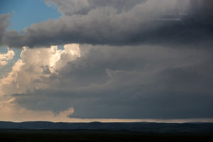
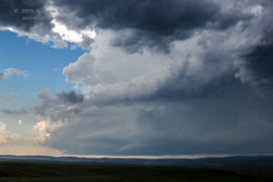
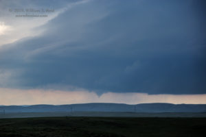
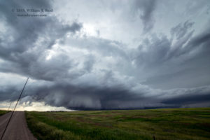
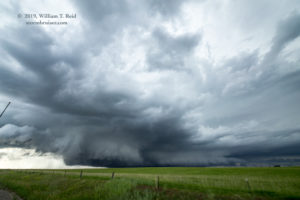
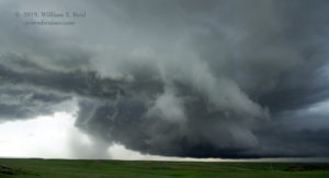
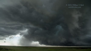
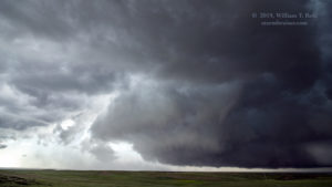
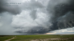
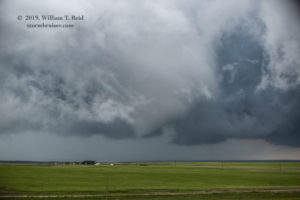
The images above show a very well-organized and low storm base. The storm was just 3-5 miles west of I-25, and southwest of Chugwater by 9-10 miles. Up to this point, the storm had produced only a brief tornado or funnel cloud.
No more than a few minutes after reaching this vantage point, the supercell decided that it was time. A weird blob of precipitation materialized on the west side of a really low storm base. Quickly, curtains of precipitation were noted circling around a common center beneath the base. A large clear slot worked its way just to the south of this organized chaos. We were on the southern fringe of the RFD surge, and mild west winds of 25-40 mph hit us, with the atomized rain, too.
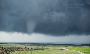
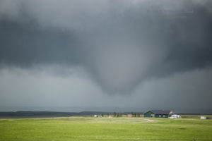
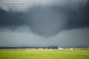
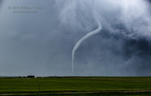
If ever a storm was going to produce a tornado in the next minute or two, it was this one! A funnel descended just to our north, maybe 1.5 to 2 miles away, and we had our first one for sure. Well, it didn’t condense all of the way to the ground, but I’ll take it!
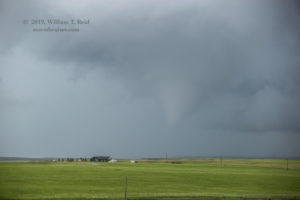
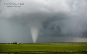
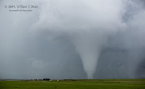
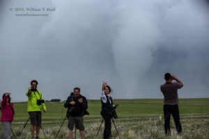
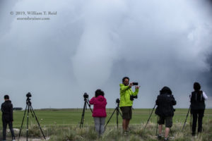
The storm base drifted very slowly to the east, and I repositioned my tripod onto another nearby high point. I was shooting wide-angle video with the 15mm lens, and shooting stills with the 70-200mm lens. I also took occasional still images with the 15mm lens/Canon 6D. The storm had paused briefly after that first funnel disappeared, and then a beefier tornado planted itself not too far from a ranch house and cultivated area to our NNE.
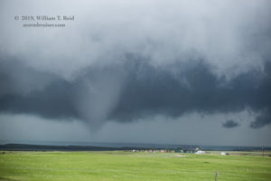
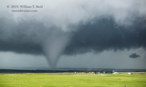
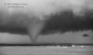
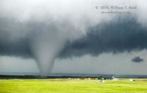
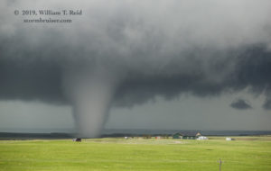
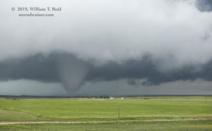
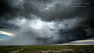
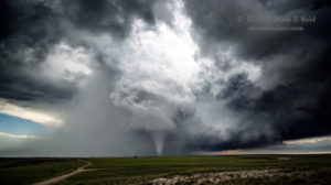
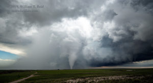
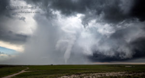
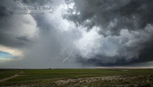
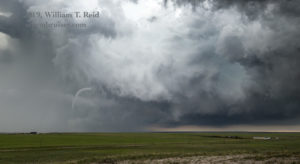
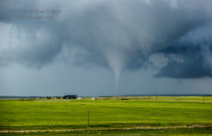
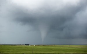
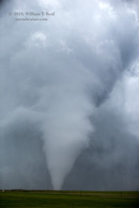
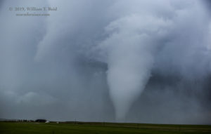
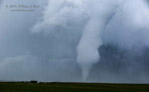
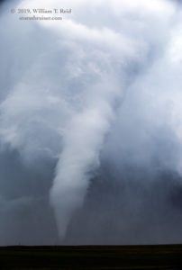
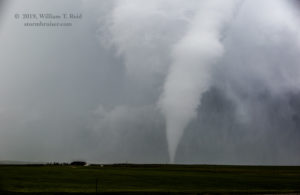
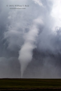
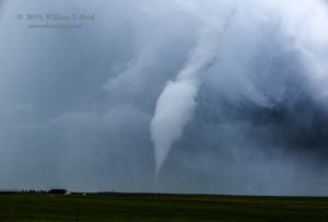
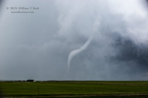
As this tornado lifted, I figured that it was time to reposition. The action was to our NNE, and likely drifting away from us. “Be ready to roll in a minute or so,” I announced. As often happens when I think it is time to move, the storm quickly sticks another tornado onto the ground. This was the third tornado and longest-lived! (Or, you can consider the entire unfolding event here as one intermittent tornado. The same mesocyclone and storm base were responsible for it all.) About two miles away, a stout cone tornado sat more or less in the same spot for at least 7 minutes, right behind that same ranch house!
The images above were with the 15mm lens, and some are cropped a bit. As is obvious, the RFD was cutting a massive swath into the updraft and updraft base, and our perspective towards the northeast was perfect for watching and documenting the entire lifespan of the tornado, from stout cone to slinky rope-out.
The images below are from the same timeframe (the tornado #3 timeframe), but with the 70-200mm zoom lens.
This was certainly a photogenic tornado, and we were very fortunate to be able to enjoy it from a perfect location, without any nuisances such as rain, lightning, low clouds, and strong wind. Thank goodness that I was not fiddling around at the same time east of Chugwater, or (egads) down near Limon or up in Cherry County!
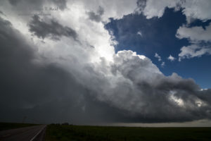
Once the tornado roped out for good and permitted a reposition, we went back north on I-25 to Chugwater and east a mile or two. The impressive updraft tower was to our southeast, and a hail core was to our east, along our road.
We went through the small hail and emerged in perfect position to see our storm quickly fizzle. But who cared?! We had managed not to miss the show!
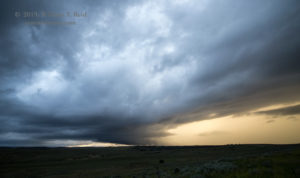
Other big storms were developing up beyond Wheatland a little. We headed that way and watched a supercell or two come up to I-25. These were not that impressive visually up until sunset, and we headed to the motel in Wheatland with our happy camera flash cards filled with tornado pictures.


























Leave a Reply
You must be logged in to post a comment.