LINK to Part One, which has links to the other parts of this study.
Here is another web site entry on Death Valley weather records. This entry is somewhat of a mishmash of anything and everything that I have dug up which might otherwise go unnoticed, and which might interest someone who wound up here.
In 2017 I visited the Death Valley National Park Service archives facility at Cow Creek. I was permitted to wade through a lot of somewhat-organized correspondence, photographs, and news articles what have been saved through the years. I need to find the similar collection for Pacific Coast Borax Company!
Below are the thumbnails for the iPhone images that I took on that visit, with perhaps a short blurb describing just what it is all about. I tried to keep these in chronological order, by decade.
1930s
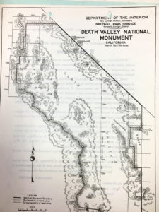
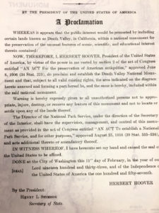
Old map and the beginnings of Death Valley National Monument (above)
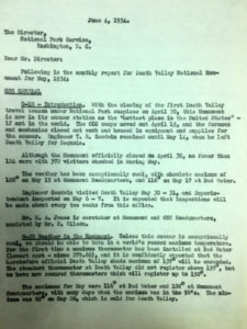
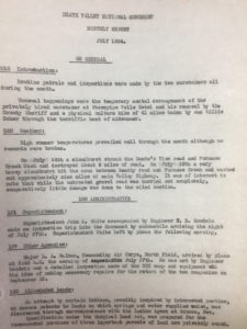
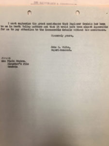
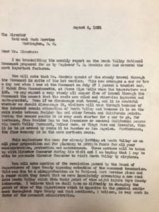
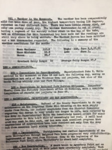
Below are reports from the superintendent to the NPS director in Washington D.C. for summer months in 1934 and 1935. There is mention of a new weather station at Badwater in 1934, and a maximum thermometer which could register up to 150F. And, superintendent John R. White says in the report for May 1934 that he thinks that the “heretofore official Death Valley shade maximum of 137 degrees will be exceeded.” What reading of 137F is being referred to?! Why did the supervisor of the new Death Valley National Monument consider this “shade maximum” to be official?!
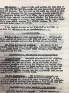
The temperature and rainfall figures provided in these reports from the superintendent during the 1930s are presumably those from Cow Creek. Cow Creek is where the original NPS headquarters was located. In the report for November, 1935 (below), it is noted that the weather instruments were out of order in November of 1934. Cow Creek weather records begin on December 4, 1934.
I have not unearthed any documented evidence for this yet, but it appears that the National Park Service favored an official cooperative climate station at Badwater when DVNM (Death Valley National Monument) was first established. There was already a cooperative station at Greenland Ranch, so at the time it may have seemed more reasonable to establish a station which was not really close to Greenland Ranch (i.e., at Cow Creek). A new station at Badwater, likely the hottest place in Death Valley, was a great candidate since the NPS appeared to be interested in establishing a new official world high-temperature reading in Death Valley. Below are the climate forms for Badwater:
Badwater 1934 May Badwater 1934 June
Badwater 1934 July Badwater 1934 Aug Badwater 1934 Sept
So, the NPS established a station at Badwater by mid-May of 1934. The first entry is for May 17, 1934, and a couple of other weekly readings were made during May. The June form is curious, as it shows daily readings, but the maximums are lined-out. There were six readings for July, including a maximum of 131F late in the month, but the maximums here are also crossed out. The six dates with observations in August and the six for September are not crossed out, and appear reasonable. Why were there problems with the maximums in June and July? Is the entry of 131F on July 31, 1934, legitimate? (The previous observation at Badwater was on July 22, so the reading on July 31 would cover the previous 9-10 days. Greenland Ranch had a maximum of 125F on July 27, 1934.)
The Badwater climate form for September, 1934, is the last form for Badwater. I figure that the DVNM superintendent determined that it was too difficult and/or expensive to maintain and make daily observations at the Badwater station, which was about 20 miles south of Furnace Creek. It was then decided, presumably, to move the Badwater station to the new Cow Creek facilities, three miles north of Greenland Ranch. The instrumentation may have been damaged while at Badwater or during the move to Cow Creek, given the superintendent’s note that the instruments were “out of order” during November of 1934.
1940s
Below are selected monthly memos, or reports, from the DVNM superintendent. Weather was often the main concern, whether it was cloudbursts and road damage, or dust storms or heat waves.
In early June, 1942, the Park Service moved operations to Wildrose, in the Panamints. High temperatures during the summer are about 20 degrees F cooler here compared to the Furnace Creek and Cow Creek area. The move to higher terrain in summer was likely an annual occurrence during the 1930s and 1940s.
The memorandum for December, 1943, states that the Pacific Coast Borax Company personnel at the ranch were not very helpful (and were sometimes “unnecessarily discourteous”) when it came to Death Valley visitors who required assistance.
The form for July, 1948, states that daily humidity readings were taken via the dry and wet-bulb thermometers. The July 1948 RH readings ranged from 3 to 14 percent. The time of the readings was not provided, but was probably at the usual observation time of 5 p.m.
The memo for December, 1948, notes that Mr. W.D. Caldwell of the U.S. Weather Bureau visited the station on the 14th and installed a hygrothermograph. Where are these charts?!
1980s
The exchange of letters below offers some good information on the ground temperature instrumentation in May, 1981.
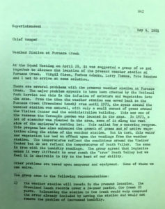
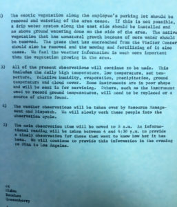
Also in May, 1981, the NPS was very concerned about the influence of nearby plants and irrigation on the weather station. The solution was to leave the station where it was, but to try to cut back on the nearby irrigation and plant growth.
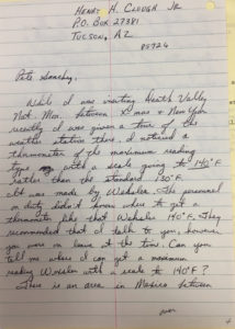
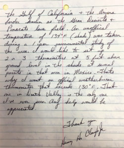
The letters below indicate that the maximum thermometer at the Death Valley weather station went up as high as 140F in the early 1980s.
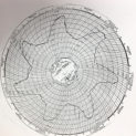
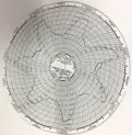
The letter below requested ground temperature charts. Two of these from the last half of July, 1972, are shown. Not shown is the one which would have included July 14-15, 1972, when the ground temperature reached 201F.
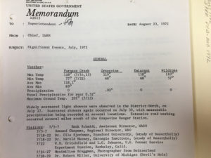
The two memos below, for July and June of 1972, reference the record high ground temperatures.










Leave a Reply
You must be logged in to post a comment.