At about 9:45 a.m. PST on Sunday, January 26, 2020, a helicopter carrying Kobe Bryant and his daughter, six friends and a pilot, crashed into a hillside in Calabasas, California. The flight was headed from Santa Ana to Camarillo for a basketball game in Thousand Oaks. It appears likely that poor weather and poor flying conditions were a big issue with regard to the crash, as heavy clouds and fog were in the area. Since I grew up in nearby Woodland Hills and now live in nearby Westlake Village, and I am very familiar with the area and the local weather. (I was the cooperative weather observer for the NWS in Woodland Hills for almost 20 years, and have been the weather observer in Westlake Village for 6 years!) This study will look at the local weather conditions around the time of the crash.
A weather system was moving roughly from the WNW to the ESE through Ventura and Los Angeles counties during the late morning. The system was rather weak this far south, though, and little or no rain was expected with it. The system was acting on a somewhat deep layer of marine air, which had spread into the coastal and valley areas of the two counties in advance of the weak weather front. I was working as weather observer during the morning at San Nicolas Island Airport (KNSI), about 80 miles south of the incident, and during the morning the ceiling decreased from about 500 feet at 7 a.m. to 200 feet between 9 and 10 a.m. The elevation here is 500 feet, so cloud bases were well below 1000 feet above sea level. The visibility at San Nicolas Island airport dropped to under one mile, and there was light drizzle around 10 a.m. Conditions gradually improved after 11 a.m. as the ceiling got a little higher. The conditions at San Nicolas Island provide an idea as to the behavior of the cloud ceiling during the morning out over the ocean with the “front,” uninfluenced to a large extent by land. The elevation of the crash site in Calabasas is around 1100 feet.
San Nicolas Island (elevation 504 feet) observations:
The numbers above show the date and time, the temperature and dew point (e.g., 54F and 52F at 6:53 a.m.), the relative humidity (93%), the wind direction and speed in miles per hour (NW 16 mph), the visibility (10.00 statute miles), any weather (such as fog, drizzle, mist), the sky condition (OVC005 means an overcast layer at 500 feet above ground, BKN009 means a broken ceiling at 900 feet), and the station pressure and sea level pressure and altimeter readings.
Keep in mind that the helicopter pilot was planning on following the Ventura Freeway (U.S. 101) westward from Woodland Hills through Calabasas and Agoura. (A handy-dandy map of this area is below.) The terrain changes quickly from generally flat in the southwestern San Fernando Valley (where Woodland Hills is) to very hilly in Calabasas and Agoura. The freeway rises up from elevations near 900 feet in Woodland Hills to about 1150 feet on the Calabasas Grade, down to 800 feet near Las Virgenes Road, and then back up to 900 feet on the east side of Agoura. On both sides of the freeway, in close proximity, are hilltops from 1500 to 1700 feet in elevation, or about 500 to 900 feet above the freeway. If you are flying through here and are not sure where the freeway is, then you had better be above 1700 feet elevation! It is not unusual to see air traffic using this corridor with the freeway as a guide.
Let’s look at some other airport observations for Sunday morning, starting with Camarillo (KCMA), on the Oxnard Plain and about 25 miles west of Calabasas.
Camarillo Airport (KCMA), elevation 75 feet
Camarillo Airport was the destination for the flight. This airport is on a low coastal plain, at an elevation of only 75 feet above sea level. The cloud ceiling increases slowly during the morning, from about 1300 feet at 8 a.m. to 1600 feet at 9:o5 a.m. the visibilities aren’t too bad at all, and flying conditions are VFR (good!) since the ceiling is above 1000 feet and the visibility is 3 miles or greater. Note that the wind shifts from ESE at 10:55 a.m. to SW at 11:55 a.m., and the visibility improves, suggesting a frontal passage.
This next one is for Point Mugu (KNTD, elevation 10 feet), on the coast and maybe 7 miles SSW of Camarillo Airport:
Visibilities are also good at Point Mugu, but the ceiling is about 200 to 400 feet lower compared to that at Camarillo before 10 a.m. The observer at Point Mugu also entered a “few” low clouds at 800 and 900 feet. At Oxnard Airport, west of Camarillo, the sky and visibility conditions were quite similar to those at Camarillo. The observations at Point Mugu were taken by an observer, and the cloud heights are estimates because the ASOS (weather instrumentation) was inoperative at the time. I know this because I also work part time at Point Mugu Airport, and I spoke with the observer there around sunrise. The observations from Camarillo and Oxnard were automatic, unless the air traffic controllers “augmented” the observation, which is not typical.
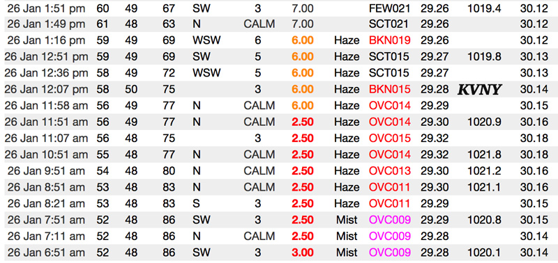
And lastly, here are the observations from Van Nuys Airport, elevation 797 feet:
At Van Nuys, the visibilities were rather poor (about 2.5 miles), but they were certainly adequate for a helicopter that was flying just beneath a ceiling of 1100 feet. A weather condition of “mist” is given when the visibility is under 7 miles and the temperature-dew point difference is less than five degrees. It doesn’t necessarily mean that misty precipitation was occurring.
Around 9 a.m., the helicopter was in a holding pattern near Glendale because of other air traffic. If the helicopter pilot were checking these airport weather observations for 9 a.m., he might have not been too concerned about making it through the hilly Calabasas and Agoura corridor, as the ceilings at Van Nuys and Camarillo seemed to be sufficiently high. Sufficiently high, that is, if the ceilings were no different between Van Nuys and Camarillo. If the pilot had looked at the Point Mugu cloud report, and if he knew that the freeway was as high as 1150 feet elevation through the Calabasas Grade and he knew that the hilltops were several hundred feet higher (which I am almost certain that he did know), then any comfort level provided by the ceiling reports at Van Nuys and Camarillo airports would have, or should have, diminished considerably. Point Mugu is adjacent to the western end of the Santa Monica Mountains. With a ceiling of 1200 feet above sea level there, that would not provide enough room at all to make it through Calabasas and Agoura, by going visual, under the overcast, if the ceiling and overcast layer were the same (relative to height above sea level) as at Point Mugu.
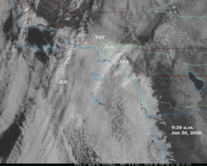
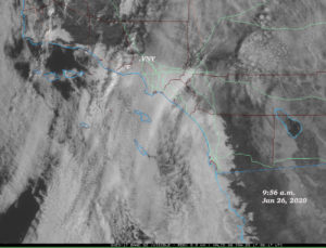
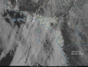
Lets take a look at the visible satellite images:
You can click on the images to enlarge them. The times of these three visible images are 9:36, 9:56 and 10:16 a.m. The crash occurred at the letter “c” (approximately!), between the times of the first two images. You can see a N-S line of lumpier-looking cloud tops moving over the low overcast. This is probably some mid-level altocumulus. I had observed mid-level clouds briefly through the low overcast from San Nicolas Island around 8 a.m. The band of mid-level clouds is moving from west-to-east and is over Calabasas in the last image at 10:16 a.m. It is not easy to differentiate the low clouds from the higher clouds. The primary message here is that the low overcast wasn’t changing too much in the Calabasas area during this time frame, at least as viewed from space. The mid-level clouds were not permitting much sunshine which might help “burn off” the low clouds any. A “burn-off” of stratus clouds is a very common weather scenario in the coastal valleys during the mid-morning hours. But this day was not one of those types of days. The band of mid-level clouds may also be indicative of the main axis area of the “wave” or “disturbance” which was moving through the area at this time. This disturbance could have been enhancing or maintaining the low cloud deck to some extent. Once it moved east of the area after noon, the low clouds started to clear out.
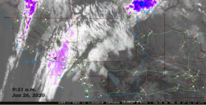
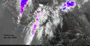
The two images above are wider, infrared satellite images. These show the middle and high clouds better, with the purple areas the highest and coldest cloud tops. Again, the “c” marks the crash site in Calabasas. The images at 9:21 and 10:21 a.m. indicate that the coldest cloud tops were a bit east of Calabasas around the time of the crash. This high cloud layer, combined with the low cloud deck, would have made any murky and foggy surface conditions that much darker. I wasn’t there, but it seems that the conditions were akin to a gloomy rainy day, but without the rain.
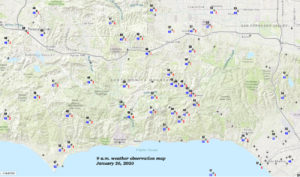
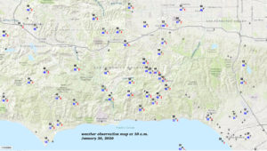
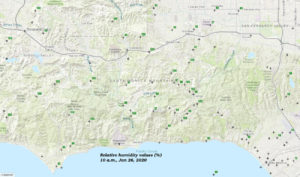
Below are weather maps showing the area along the Ventura Freeway from Thousand Oaks on the west to Van Nuys on the east, and the Calabasas crash site near the center, marked with the “c.” The first map shows temp and dew point and wind gust, if any, at 9 a.m. The second map is the same for 10 a.m., and the third map shows relative humidity values at 10 a.m. Many of these stations are relatively new Southern California Edison (SCE) weather stations that have been installed to monitor conditions closely during high fire danger. The stations are mounted high on utility poles and generally have excellent exposure.
The maps tell us that not too much changed from 9 to 10 a.m., that winds were very light everywhere, and that the humidity was at or near 100 percent along the Ventura Freeway from Westlake Village to Calabasas. Relative humidities were a little lower in the western San Fernando Valley.
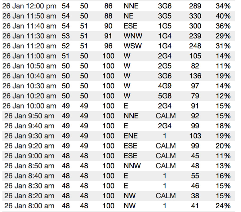
One of the SCE stations is near the top of the Calabasas Grade right along the Ventura Freeway, and it is called “SCE Calabasas Rd.” Its elevation is 1153 feet, and it is less than two miles ENE of the crash site. The helicopter almost certainly flew over this station shortly before the crash. Here are the 10-minute observations for this station, from 8 a.m. to noon:
Each line shows the date and time, the temperature and dew point, the relative humidity, the wind (direction and speed), the solar radiation in watts per square meter, and the percent of possible solar radiation. Around the time of the crash (9:45 a.m.), the solar radiation values were low and were falling, and the “percent of possible” values were dropping. The dropping percentages of possible solar radiation may have been associated with the mid-level and high clouds that were moving overhead. Or, they were getting lower because the low clouds and fog were getting thicker. Or both. Also, a light westerly breeze commenced here shortly after 10 a.m. The crash occurred shortly before the wind shift.
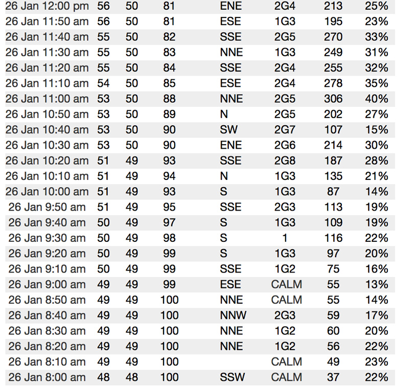
Another SCE station was very close-by, this one called SCE Las Virgenes. It is north of the crash site by maybe a mile and a half.
The SCE Las Virgenes station similarly showed quite low solar radiation values and “percent of possible” values at the time of the crash. The wind was very light at both of these SCE stations.
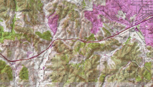
Let’s post a map of the terrain around the crash site:
You will have to click on this one to make it large enough. The map shows the relatively flat terrain of Woodland Hills in the upper right, and the hilly terrain west of there. The crash site is marked by the “c” and is a little to the left of center. You can see how the hills hug the freeway closely, and that the freeway makes a turn to the southwest at Las Virgenes Road/Brents Junction in order to go around some hills. It is not a straight shot through the corridor, so a pilot that is relying on seeing the freeway for navigation could be in trouble if he suddenly cannot see the freeway.
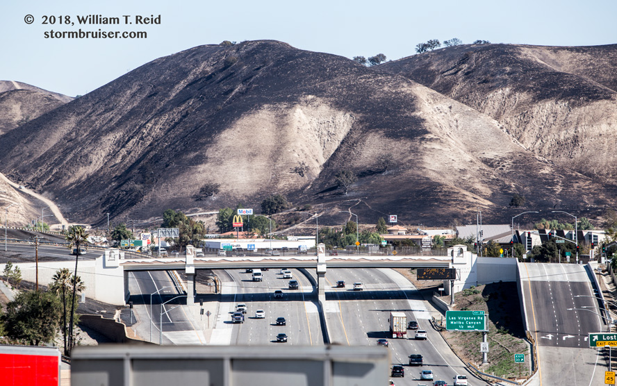
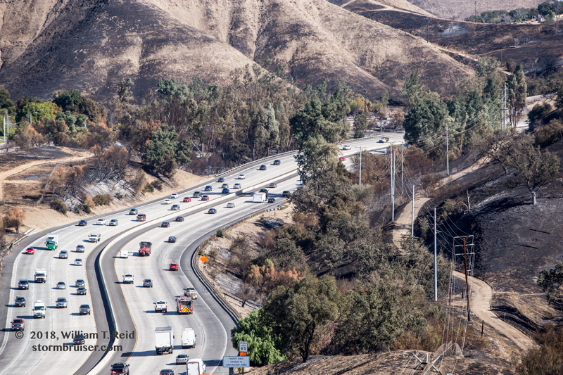
The image below is the area where the crash occurred. This picture was taken shortly after the Woolsey fire of November, 2018, moved through. The view is to the ENE along the Ventura Freeway, and the helicopter crash was maybe 1/3 to 1/2 of the way up the hillside on the far right. The photograph was taken close to due west of where the crash occurred. Just to reiterate, the burned hillsides are due to the Woolsey Fire of 2018, and not the helicopter crash.
This image is taken near the top of the hill that is in the image just previous to it. It is a look down a bit and towards the east, along the Calabasas Grade portion of the Ventura Freeway. This was also taken a few days after the Woolsey fire. The grade of the freeway is not very steep, but this provides a good idea of the terrain between the top of Calabasas Grade (on the east, towards the top here) and Las Virgenes Road (on the west, behind me). You can see that the terrain opens up a bit near Las Virgenes Road (upper photo) compared to the narrower part along that grade.
This link is to an interview of an eyewitness along Las Virgenes Road, close to the crash site. The witness provides an excellent description of what he saw and heard with regard to the crash, and he also provides a good description of the fog and low clouds at the time.
Kobe Bryant helicopter crash witness gives an intelligent and detailed account of what he saw
byu/Grande_Yarbles invideos
My brother (Steve) lives in Agoura off of Kanan Road, about three or four miles west of the crash site. He reported to me that the weather was indeed foggy as late as 10 a.m. It is pretty rare for foggy conditions that late in the morning. I asked him if visibility appeared to be less than 1/2 mile at 10 a.m., and he said “Yes.” He said there was no drizzle or need for windshield wipers. He learned of the crash at noon and it was still foggy. Steve is fairly weather savvy and observant, in part because of his brother, so I think we can trust his observations. The elevation of his home is around 950 feet.
So, we have many trustworthy reports of fog and very low ceilings in the Agoura and Calabasas area when the crash occurred. Agoura is a little higher in elevation than the Las Virgenes Road location where the interviewee/eyewitness was (950 feet versus 800 feet elevations). I think we can make a good assumption and say that there was a solid cloud deck in the Calabasas and Agoura area at around 900 feet above sea level, plus or minus 100 feet. This would put parts of the Ventura Freeway in the fog, and most of the hillsides in the fog. The relative humidity values of 100 percent along the Ventura Freeway support this notion.
The helicopter pilot only knew the visibility and ceiling measurements at the area airports (Van Nuys and Camarillo), both more than ten miles west and east of the Calabasas area. These reports suggested that the ceiling might be sufficiently high above the freeway and above most hillsides through Calabasas and Agoura. But, the Point Mugu observation was not as favorable.
Shortly after the helicopter exited the relatively easy and safe flying area around the western end of Woodland Hills, conditions likely deteriorated rapidly along the Ventura Freeway west of the Parkway Calabasas exit (which is just east of the top of the grade). I have driven this route thousands of times, and it is not unusual for weather conditions to worsen with regard to visibility or rainfall rates on the west side of the top of Calabasas Grade. One reason may be because marine air has a direct route at low elevations here from the ocean through Malibu Canyon and along Las Virgenes Road. This narrow “marine air corridor” is probably the lowest (elevation-wise) for marine air to sneak into inland areas along the Santa Monica Mountains between the Oxnard Plain and Cahuenga Pass (near Universal City). Thus, it is not surprising when I see a little more stratus or fog in this area along Las Virgenes Road near the Ventura Freeway.
I suspect that the helicopter pilot suddenly found himself in low clouds and fog with little warning and little time to turn around, and/or with no room to turn around, as he flew along the Ventura Freeway from the top of the grade to Las Virgenes Road. He was flying fairly low to begin with, probably below the tops of the nearby hills, and then he found that he could not see the freeway, and he could not see the hillsides. He knew that the freeway turned to the southwest up ahead at Las Virgenes, and that if he did not also turn, he would wind up against the hillside just north of the freeway. The eyewitness said that the helicopter was slowly turning around counter-clockwise (to the left) and heading back to the east in the vicinity of the freeway and Las Virgenes Road, and that there was no suspicious sound or noise of a mechanical nature; no mechanical problem was noticed.
The ceiling at and near Las Virgenes/Ventura Freeway junction was likely under 200 feet, and probably close to 100 feet. Apparently there was not dense fog right there, where the eyewitness was along Las Virgenes and south of the freeway, but the visibility was poor. If this eyewitness account is correct and the helicopter was just above the base of the low clouds, then it would have been at around 1200 to 1400 feet above sea level, and still well below the nearby hilltops. All but the bottom-most portions of the hills were shrouded in cloud and fog. I don’t know if the pilot could have stopped forward motion and gone straight up, but in that tight situation, with no visibility, that was about the only way out.
Disclaimer — this analysis is, of course, just my best guess on what might have occurred.





Leave a Reply
You must be logged in to post a comment.