A few days ago I wrote up an analysis of the weather conditions in the Calabasas area around the time of the Kobe Bryant helicopter crash on Sunday, January 29, 2020. That analysis is here. The main takeaway is that the low clouds and fog were unusually thick and low to the ground into the late morning hours in Calabasas and Agoura, and conditions here were much worse for flying than adjacent areas of Woodland Hills and the San Fernando Valley, and much worse than the conditions at Camarillo Airport (the final destination). The pilot probably did not expect such terrible flying conditions, and he got into trouble and it was very difficult to safely escape. The official or unofficial descriptions of what the helicopter was doing just prior to the crash vary a little, but apparently the aviation radar showed the helicopter near the Las Virgenes Road exit at the Ventura Freeway. The helicopter goes south a bit, it goes up in altitude about 900 feet, and then it quickly descends and crashes at an elevation of about 1085 feet. The chopper speeds are quite high, more than 100 knots for the entire final few minutes of the flight. These two sites provide a good summary of the flight path and other details.
Bizarre flight path of Kobe Bryant’s helicopter before it crashed into mountain
The pilot was in “Special VFR” mode and trying to fly below the cloud deck, and using the Ventura Freeway as his guide to the west. The radar return to the air traffic controllers was lost as the helicopter was too low to follow. Given the descriptions of the bad fog and low clouds in the area around the crash, and given the left-hand turn at Las Virgenes Road, and given the crash itself, it can probably be assumed that the pilot could NOT see the Ventura Freeway at some point along the freeway in Calabasas. Given the tall hills adjacent to the freeway, the pilot must have known that he was in a bad situation fairly quickly. So the screaming question is: “Why in the name of SAM HILL would he be traveling at over 100 knots in this area when he was so low and could not see anything??!!” That just makes no sense at all to me. One would think that the aircraft would be slowed considerably as weather conditions deteriorated and as the freeway below vanished in the fog. But, still today, three days after the accident, the authorities are saying that the helicopter was traveling at a high rate of speed (and descending) when it hit the hillside. This link is a short and sweet account of the helicopter movements in the final moments.
In my weather analysis entry, I linked to this interview of an eyewitness:
The eyewitness appeared to be very credible and detailed, and he said that the helicopter was moving at a slow rate of speed (about 5 mph) toward the hills on the east side of Las Virgenes Road as it moved above him, in the clouds, crossing Las Virgenes Road. It hit the hills and crashed about 25-30 seconds later. The elevation of the road and the observer is slightly under 800 feet, according to topographic maps. Again, the aircraft hit the hillside at about 1085 feet, though I am not sure if that figure is for the first impact place or where the bulk of the aircraft wound up.
The eyewitness (or earwitness) account was at odds with the official description of the very fast helicopter speeds just prior to the crash. At SERIOUS ODDS!
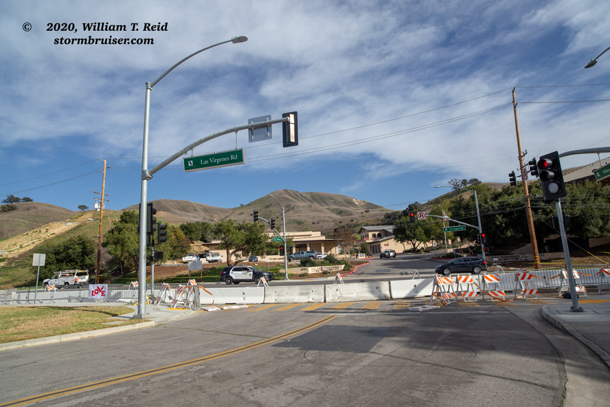
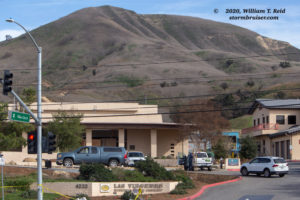
I had a chance to visit the area near the crash site today. The police had opened the roads and the crash debris had been removed from the hillside. I found the church along Las Virgenes where the eyewitness interview was. A TV news van was here, and it was apparently the best spot from which to see the crash site. There wasn’t much to see on the hillside now. The impact spot was perhaps 400 yards distant (less than a quarter mile).
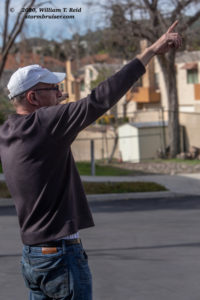
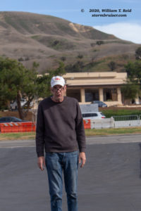
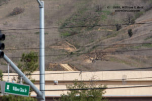
I took a few photos, not sure exactly where to zoom in on, though there was a brown scar on the hillside that looked suspicious. Other people around weren’t sure, either. I was about to head back to the car when I saw a guy by his van, next to the church, and he looked familiar. It was the guy in the interview! I got brave and went up to him to say that I saw his EXTRA TV interview and that I used it in my web site analysis. But right after I said “Excuse me, sir…,” the guy looks at me and says “Oh, Hi Bill!” It was Scott Daehlin, a guy that I had worked with for several years, about 4-9 years ago when I worked part-time at Albertsons!
I thought that the guy looked and sounded familiar when I first watched that video!
Anyhow, Scott provided a detailed account of everything that he saw and heard, and of course it was very similar to the account that he provided on-camera to the EXTRA TV interviewer. Scott is indeed very credible and very honest, and his version of the events just prior to the impact are drastically different from the “high speeds just before impact” narrative.
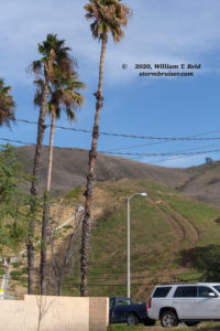
Scott was next to his vehicle in the church parking lot when he heard the helicopter nearly overhead. He could not see it, though, because the cloud base was so low. How low was it? Well, Scott said that the base of the clouds was at about the level of the top of the nearby palm trees along Las Virgenes.
Yes, these palm trees. They are maybe 6-8 stories high, or about 75 feet above the ground. That is one heck of a low cloud base, so of course only the lowest-most part of the nearby hills were NOT in the clouds, were NOT in fog.
Scott said that the chopper was very low. He could not see it, but it sounded so low that he expected to see the clouds above showing the effects of the helicopter blade wash. An acquaintance who was near Scott at the time of the incident told him that he was indeed able to barely see the shady outline of the helicopter as it moved overhead and slowly to the east. (Scott said that he could practically walk at the same pace as the helicopter overhead.) This acquaintance was standing closer to Las Virgenes Road. The sound of the crash due to impact with the nearby hillside was about 25-30 seconds after it passed by Scott and Las Virgenes Road. Scott could not see much at that moment as he was now on the wrong side of the church parking lot, but the acquaintance saw some smoke on the hillside.
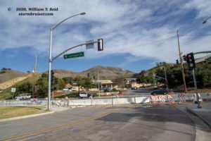
Scott pointed to the spot on the hillside where the debris was. These are views to the east, from the intersection of Las Virgenes and Willow Glen, right in front of the Church in the Canyon and across the street from the Las Virgenes Water District building (which is visible in these photos).
And, again, none of Scott’s account jives with the current official explanation of the final movements of the helicopter.
Check out this AUDIO of the helicopter moving overhead and then hitting the hillside.
You can hear the sound of the helicopter close by, and then the sound of the crash. But, there might be an edit in the audio which omits some elapsed time between the closest approach to the home and the crash. What it doesn’t really sound like is a helicopter at really low levels that is traveling at more than 100 knots. This security camera audio and video also gives a good look at the sky condition, and the low overcast! At this point there is no dense fog, but the cloud base is quite low, as expected.
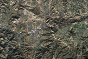
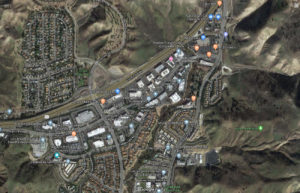
This tragedy occurred in a relatively narrow valley environment, along the Las Virgenes Creek and drainage. It isn’t quite a “canyon” environment, such as the nearby dramatic Malibu Canyon, but the north-south creek area is pretty much surrounded by nearby hills. I don’t know if the movement of the aircraft can be tracked when it is so low to the ground in a “hole” such as this area. Can the official “fast speeds” of the aircraft just prior to the crash be trusted? Maybe the helicopter rose, and then descended, and then hovered or moved slowly just above the ground to look for a place to land. The Google satellite maps below, a wide and a zoom, show the area, including the Kobe Memorial crash site on the east side of Las Virgenes and south of the Ventura Freeway.
My hunch is that the fast helicopter movements are wrong, or that they occurred just prior to the slow eastward movement as described by Scott. How can the NTSB discount these eyewitness accounts of very slow hovering and eastward drift just prior to the crash? Scott said that he has been interviewed by the New York Times, but not my NTSB yet.
I suspect that the pilot knew he was in a very bad spot, and that he felt he was not able to safely get out of this “hole” because he could not see any of the nearby hillsides. It looks like he descended to very close to the cloud base as he drifted slowly to the east, as Scott’s acquaintance could barely see the helicopter in the cloud above. Perhaps the pilot was looking for a safe place to land, but below him were a lot of condos and utility poles and wires and commercial areas. He may have been barely able to make out surface features as he drifted to the east. The hill rises quickly to the east of Las Virgenes, and he hit the hillside in the fog inadvertently as he continued to look for a place to land. There were no flat areas free from structures and wires and poles and trees.
It will be interesting to see if the “sound” of the crash (from the security camera) can be attributed to a fast-moving helicopter or a slow-moving one.
Finally, I will go back to my initial thinking — the “really fast speed of the helicopter” narrative just prior to the crash just does not make any sense. I think that the pilot knew exactly what he was doing, but the obscured hillside came upon him too quickly.

Leave a Reply
You must be logged in to post a comment.