
Start: Canyon, TX
Lunch: Clarendon, TX/Shonda’s Snack Shack
End: Woodward, OK
SPC Mesoscale Discussion 547 SPC Mesoscale Discussion 548
SPC Mesoscale Discussion 549 SPC Mesoscale Discussion 550
SPC Mesoscale Discussion 551 SPC Mesoscale Discussion 552
SPC Mesoscale Discussion 553 SPC Mesoscale Discussion 554
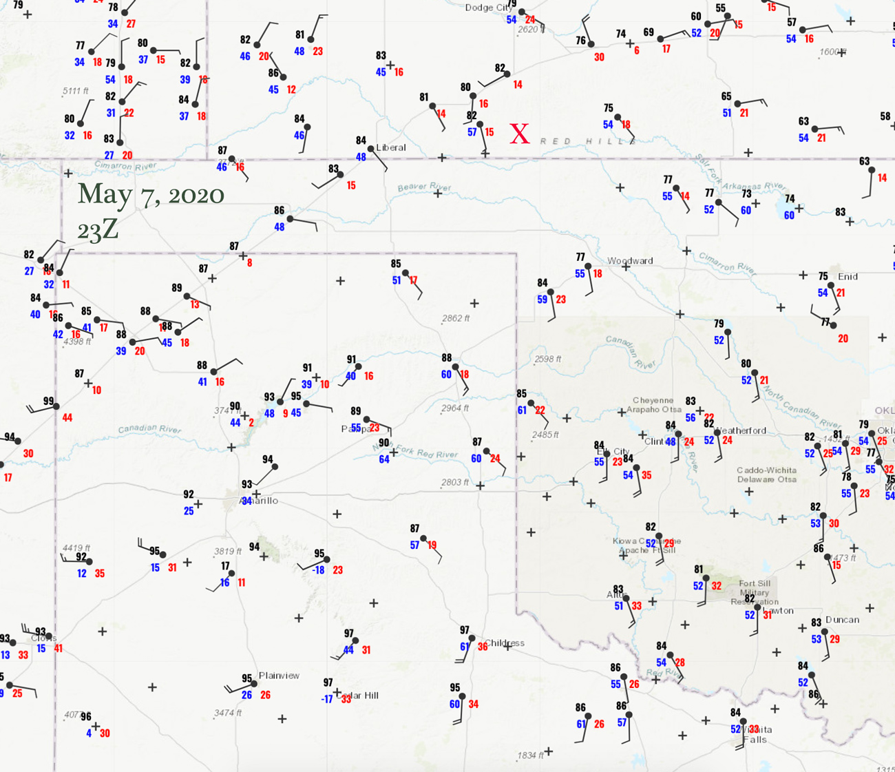
23Z Surface map
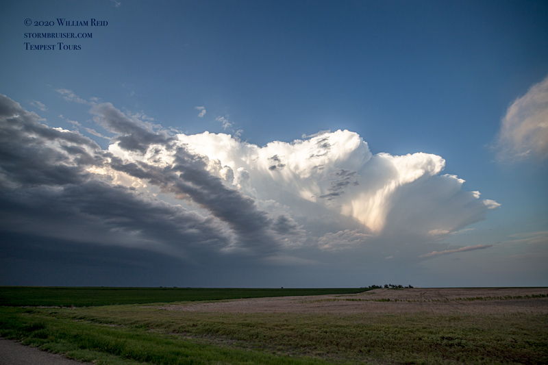
Big-time springtime shear and abundant instability were teaming up in the southeastern Texas Panhandle this afternoon. The chasers all knew where be! SPC showed an enhanced slight risk and a not-too-bullish 2 percent tornado risk. A 5-percent tornado risk was added for central OK for an anticipated strong line of nighttime storms, but we were not concerned with that. Chris and I were hanging out near Clarendon during the mid-afternoon, where some cumulus were bubbling away. The models were consistent in advertising a big and beastly supercell to track ESE from near Childress by late afternoon. And, right on schedule, a storm developed very close to Hedley and Childress and the spot where we were hanging out with Chris’ drone. I looked at models and looked at the very high base of this new storm, and I mulled over SPC’s thoughts on tornado prospects. The dew point was only 61F at Childress, and was no better east of there. Surface winds were mostly southerly in the path of the projected supercell. So while mid-level rotation would be very strong and large hail appeared likely, a relatively high storm base and mediocre low-level turning with height were working against tornado development.
There was no doubt that we would, or could, enjoy a very nice (and perhaps a very spectacular) supercell chase from about Childress to Quanah and beyond this day. But there was another severe weather area to consider. Storms were expected up north near the OK/KS line (approximately N and NW of Woodward) by about sunset, and these would be spreading into northwestern Oklahoma. (A little surface circulation was apparent between Liberal and Dodge City.). The instability was not as good compared to our nearby area, but temperature and dew point spreads would be a bit smaller. Thus, storm bases would be lower, and perhaps a tornado threat would exist.
I elected to blast north to the secondary target area. I was just not that keen on chasing a high-based storm with every other non-COVID-fearing chaser in the region.
So, as the nice and big supercell developed in our rear-view mirrors, Chris and I headed north on U.S. 83 into the northeastern Texas Panhandle…towards an area with nary a cloud. We crossed all of our fingers that I had not made a bonehead decision.
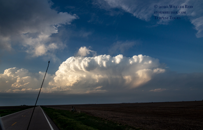
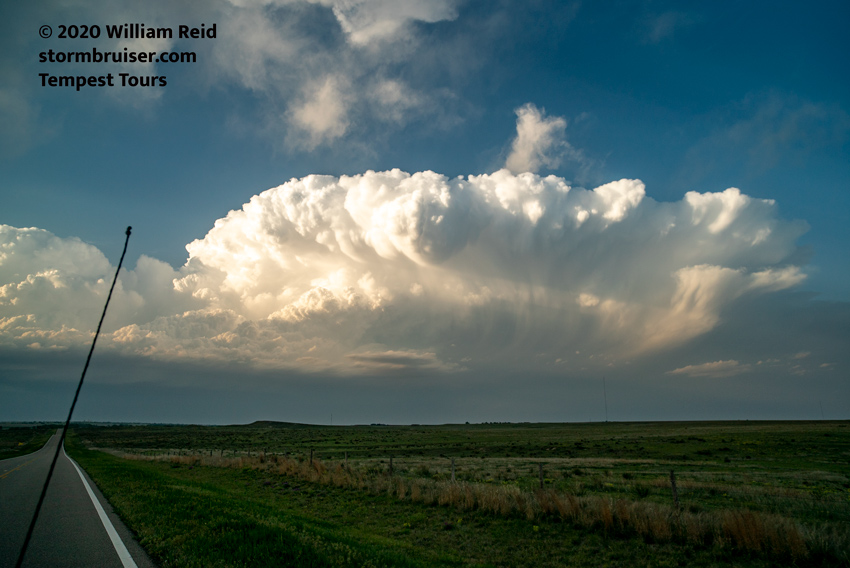
We could keep close tabs via radar and social media on the big Texas storm. It started dropping large hail from Loco to Lockett and Archer City, as expected. It sported a large and prominent wall cloud, with rotation, for a bit in northwest Texas. No surprise there, either. I was kind of expecting tornado reports, but they never came. The storm was outflowing and undercut at least a little, which was predictable. Meanwhile, as we sped northward through the Oklahoma Panhandle, we had a Kansas supercell in our sight! Dead ahead!
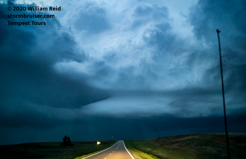
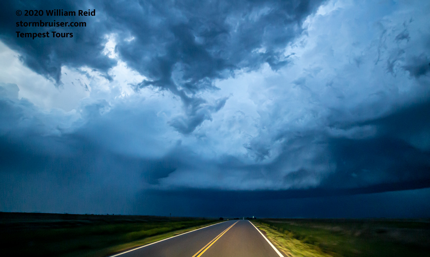
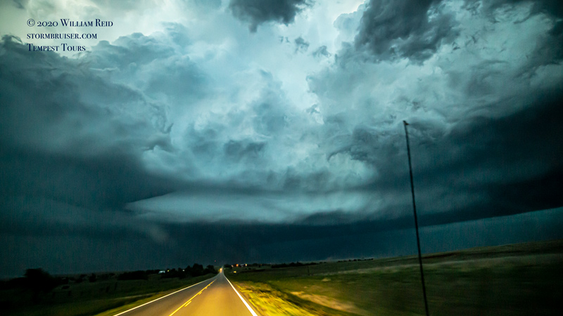
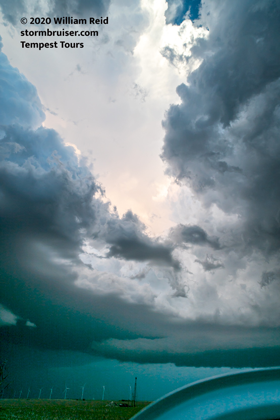
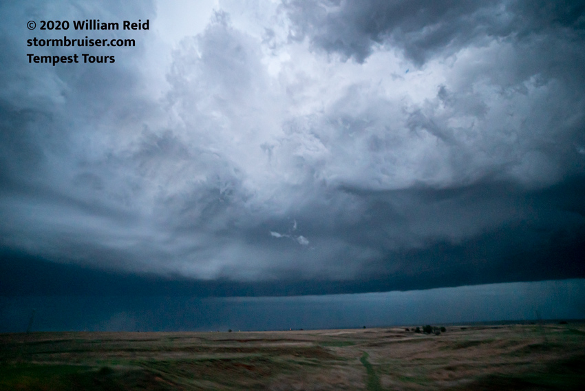
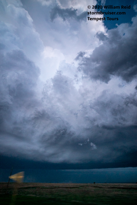
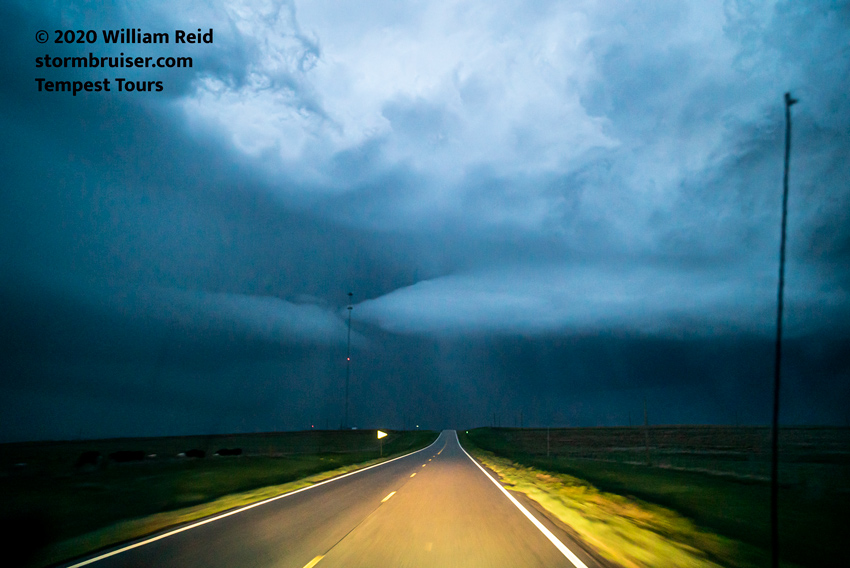
The first views of the nice and isolated storm were from the Oklahoma Panhandle, north of Beaver. We finally got close at Meade, Kansas, as the strongly rotating and laminar-sided storm base hovered just to our N and NNE. A great horseshoe-shaped updraft base was booking it to the southeast. We had only a shallow wall cloud, if that, so the storm was not looking like a tornado candidate.
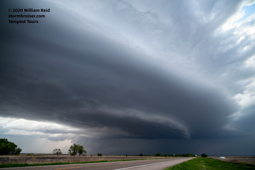
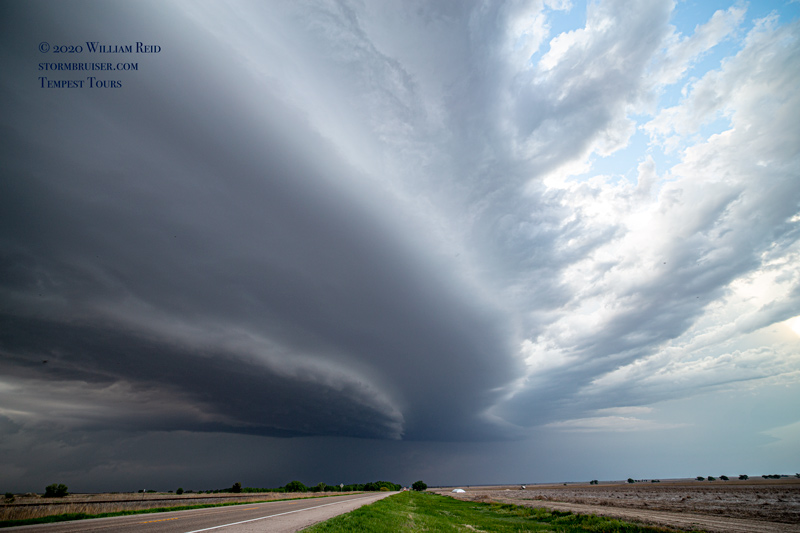
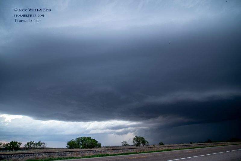
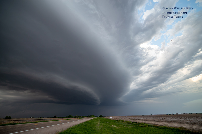
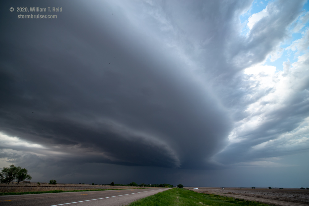
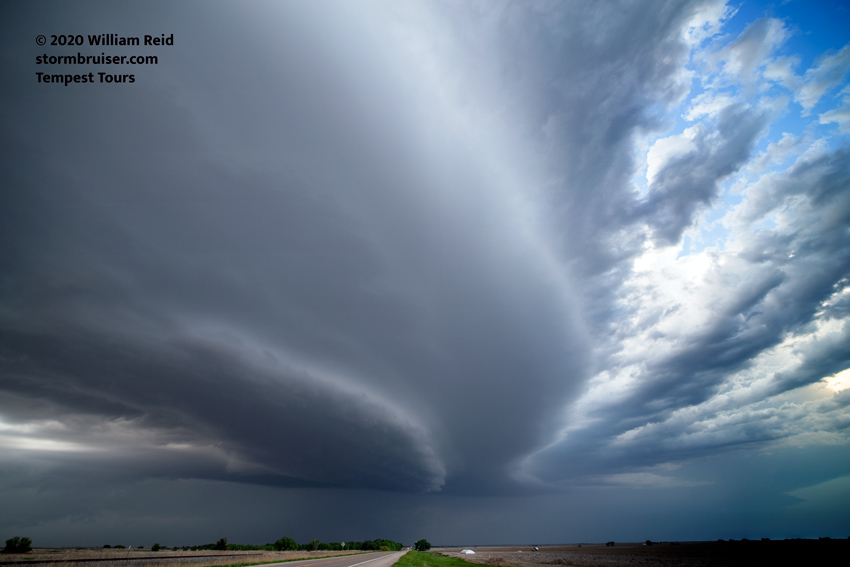
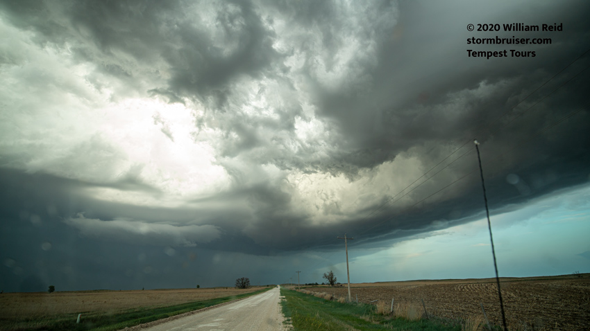
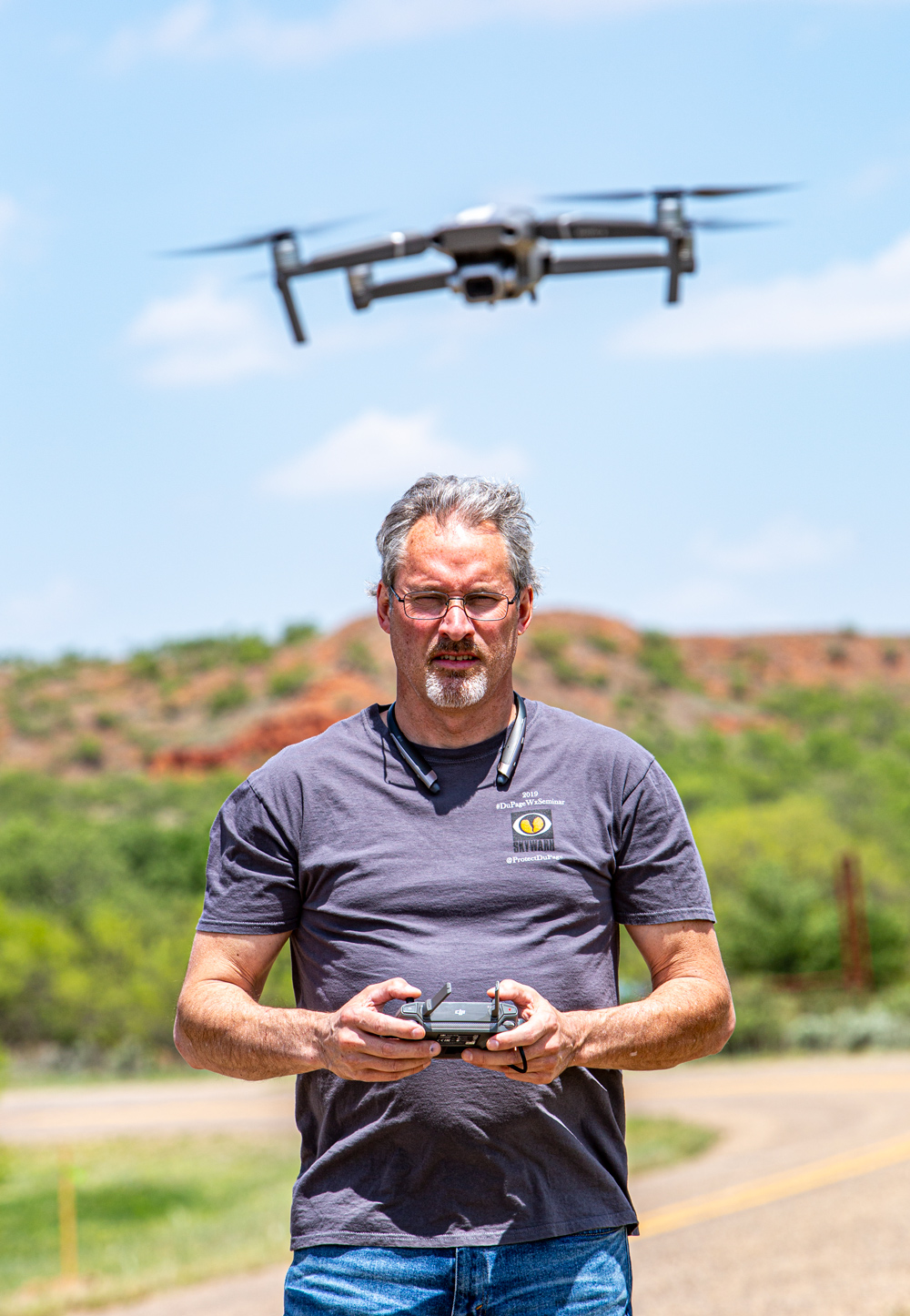
It was a bit difficult to stay close to the storm given the road network. We incorporated a dirt road east out of Fowler and made it to 283 (our south option) before the hail core. The images below are looking to the east (for the most part) towards the backside of the supercell updraft. We came up behind the updraft near Ashland, and found two-inch hailstones on Highway 160. Chris and I had a swell time with this beautiful storm, and we encountered just one other (local) storm chaser. I am glad that things worked out the way that they did!


Leave a Reply
You must be logged in to post a comment.