
Start: Oklahoma City
Lunch: Amarillo/Dyers BBQ
End: Lubbock
646 miles
SPC Mesoscale Discussion 566 SPC Mesoscale Discussion 567
SPC Mesoscale Discussion 568 SPC Mesoscale Discussion 570
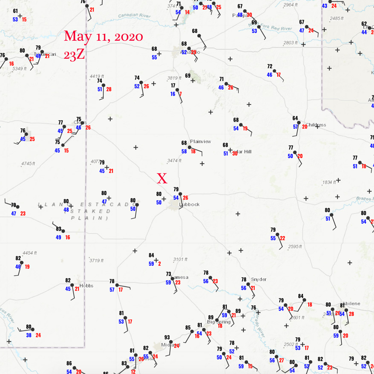
23Z Surface map
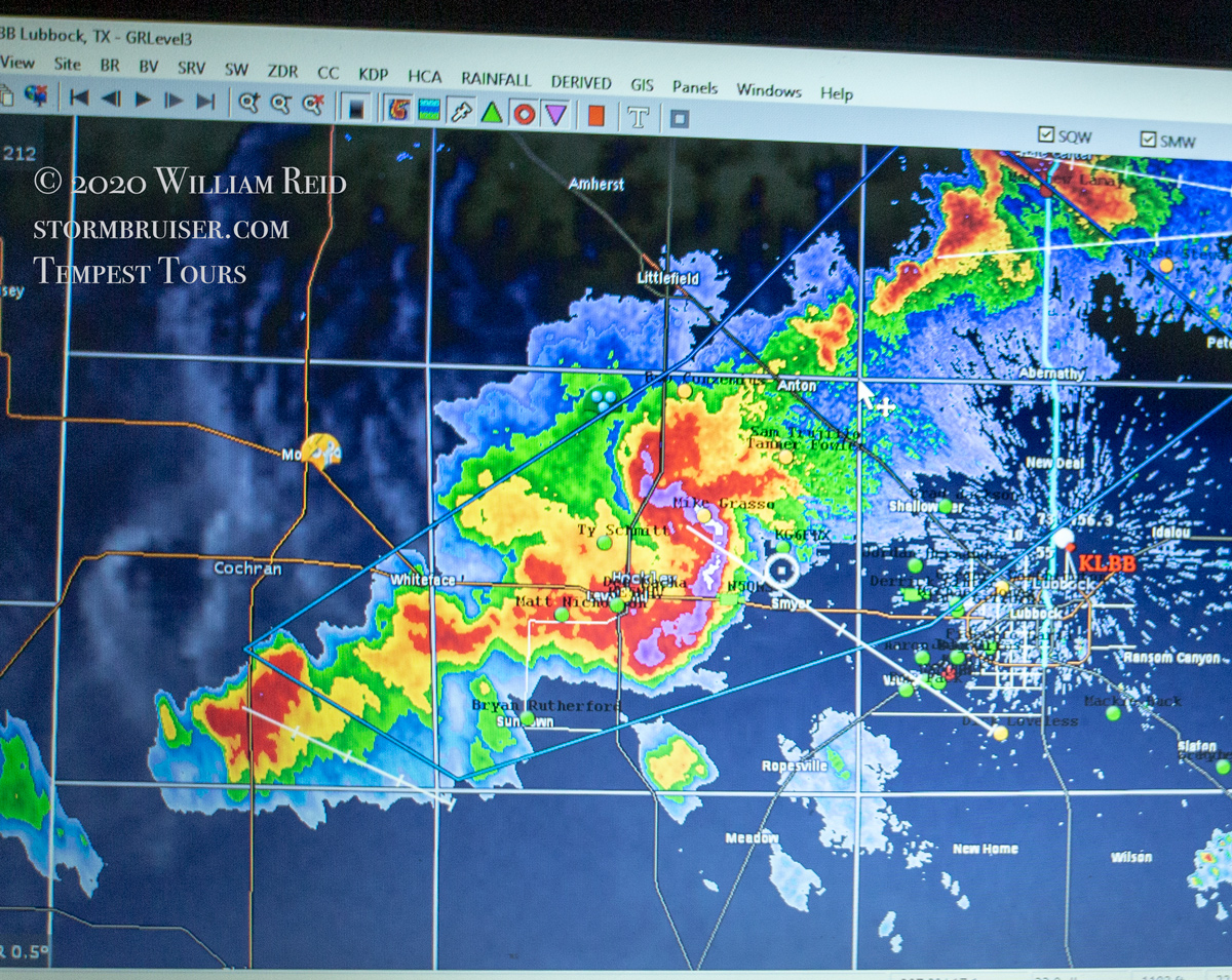
The first day of Tour 3, with Bob C., was out of Oklahoma City. The previous three days were hard down days chase-wise, so it was really nice to see a slight risk area along the NM/TX border. SPC gave the area west of Lubbock a 2 percent tornado chance. The 23Z map above shows mid-50 dews at Lubbock, and decreasing west of there to the NM border. The southerly wind at Lubbock comes up against cooler ESE winds at Plainview, which suggests a boundary or front. This was the area that I liked. Initial development would be out west on the dry line, near the NM border. Upper level winds today from the west were good enough for supercells. The boundary might help some for a tornado, but cloud bases would start out very high.
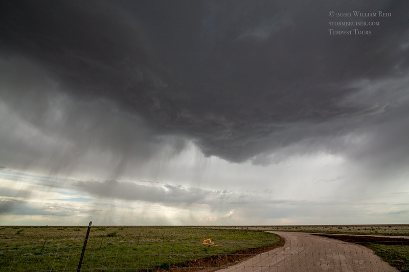
We watched the early high-based cells mature as they drifted to the east. These were first on the NM side, west of Stegall. From Needmore to Anton the high-based activity continued, but overall organization and structure were ho-hum.
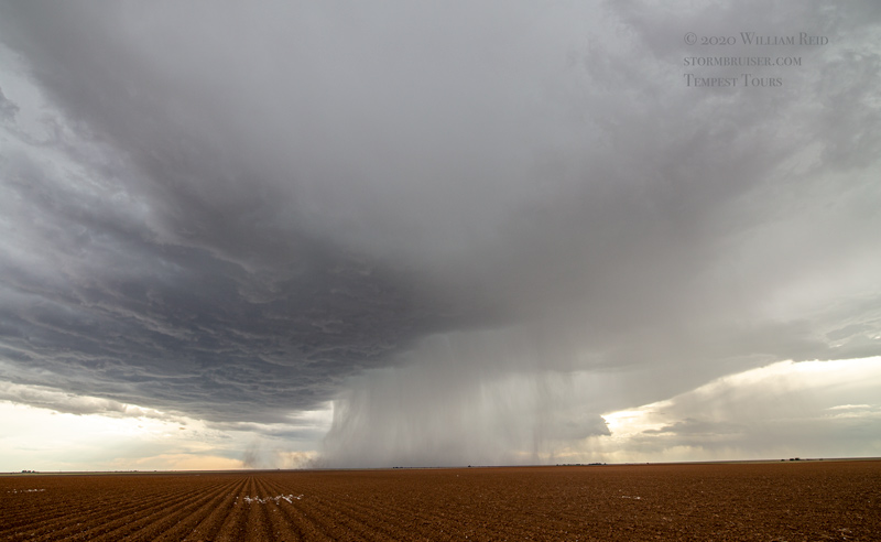
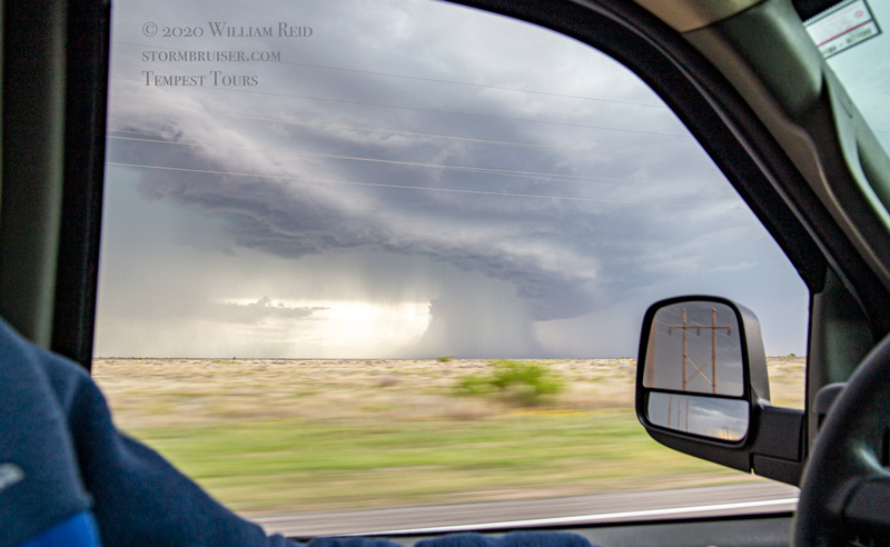
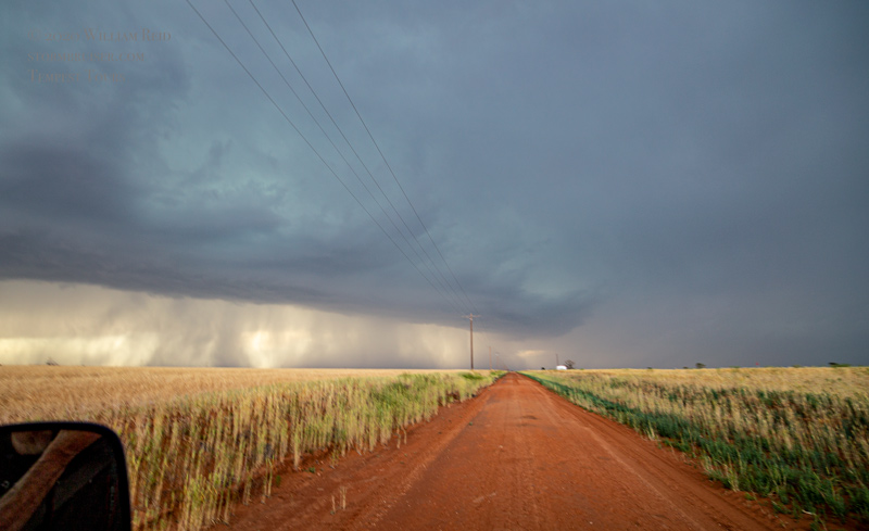
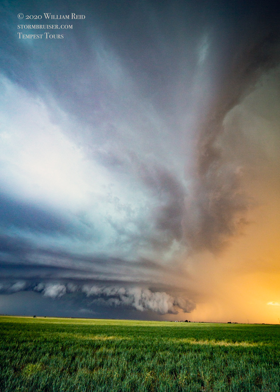
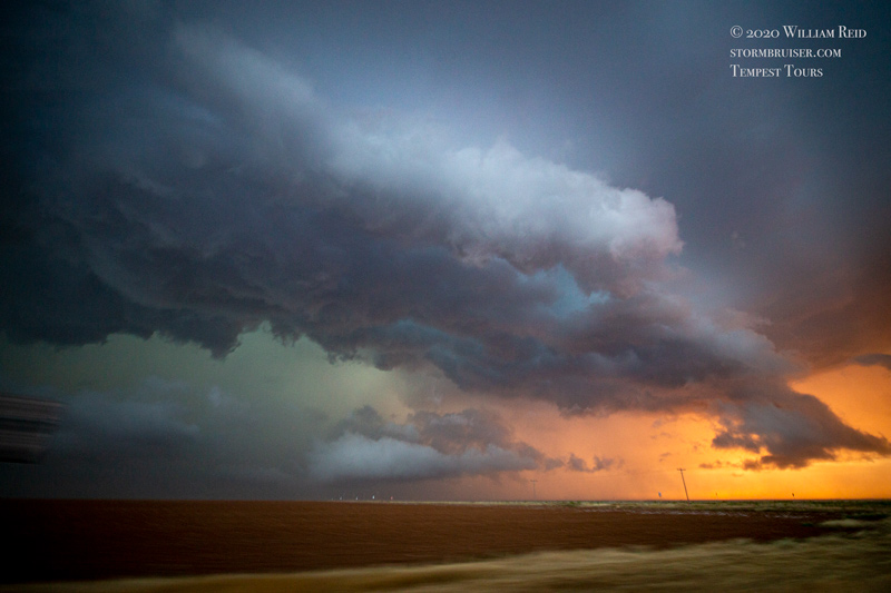
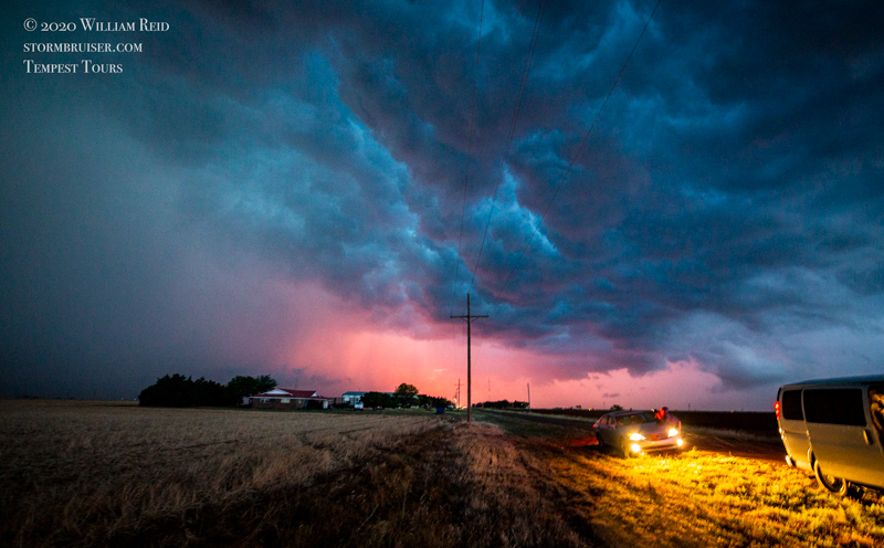
I elected to head north from Anton on FM168 in order to get ahead of this cell which we had been closely monitoring for quite a while. There were some indications visually that it might be coming together a bit better, but it was getting close to sunset time. It was time for something interesting! We went only a couple of miles north, and I looked back to the southwest where some other mediocre development had been. Well, things were looking a lot better in that direction now! The radar showed a nice tail-end cell coming up on storm top. We turned around quickly and headed south from Anton in order to get ahead of this. A supercell was rapidly developing, and we were able get into position fairly quickly!
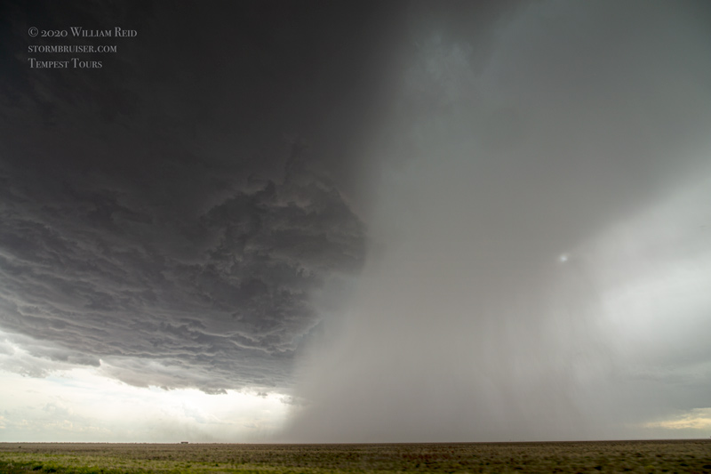
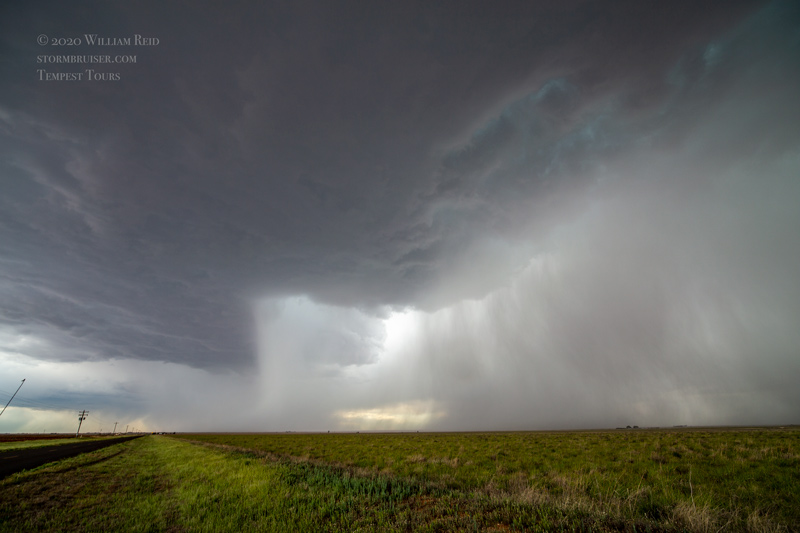
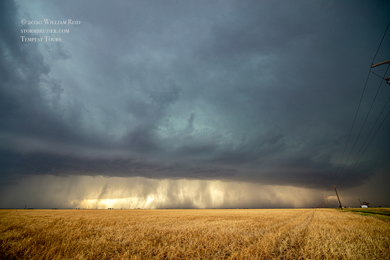
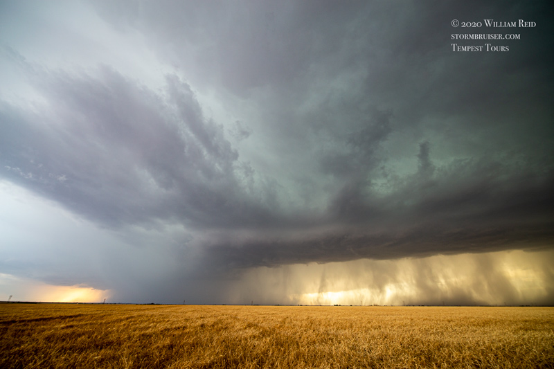
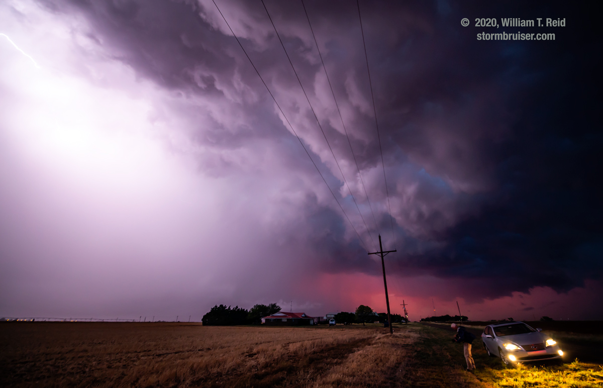
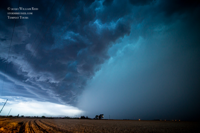
The first image below is a shot during the approach, looking southwest. The remainder are views to the west, right in front of the supercell, a little more than half of the way from Anton to Smyer.
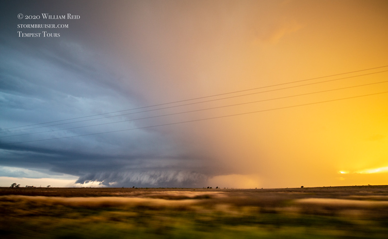
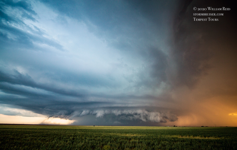
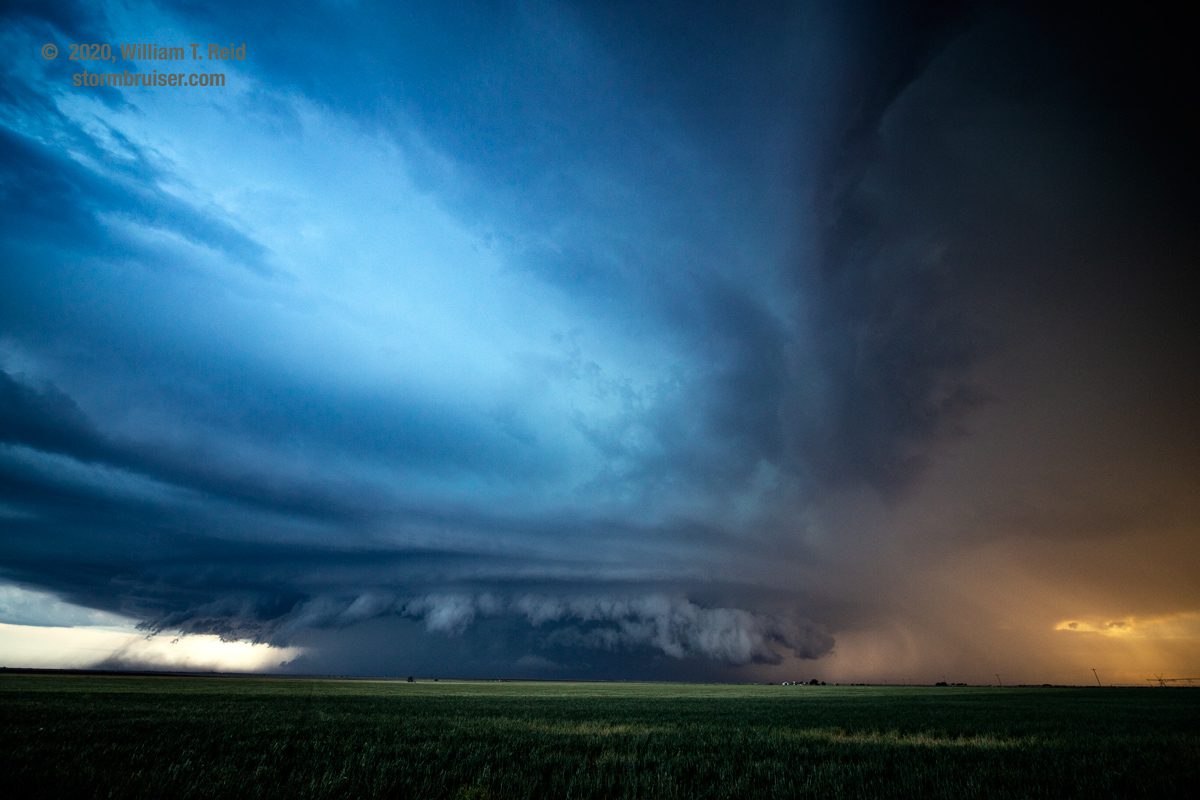
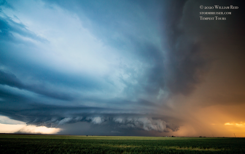
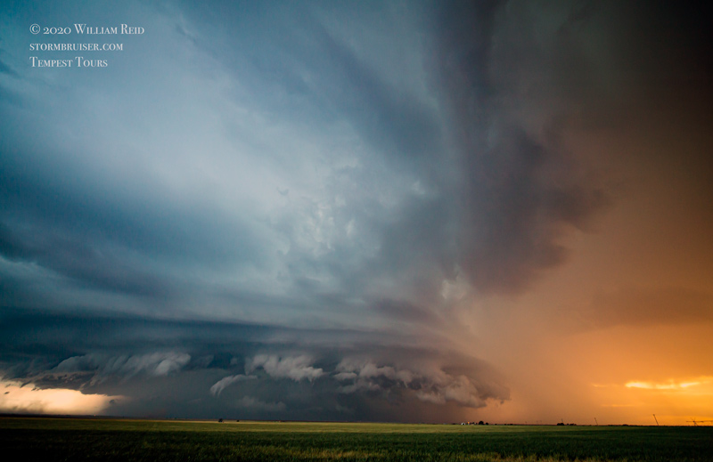
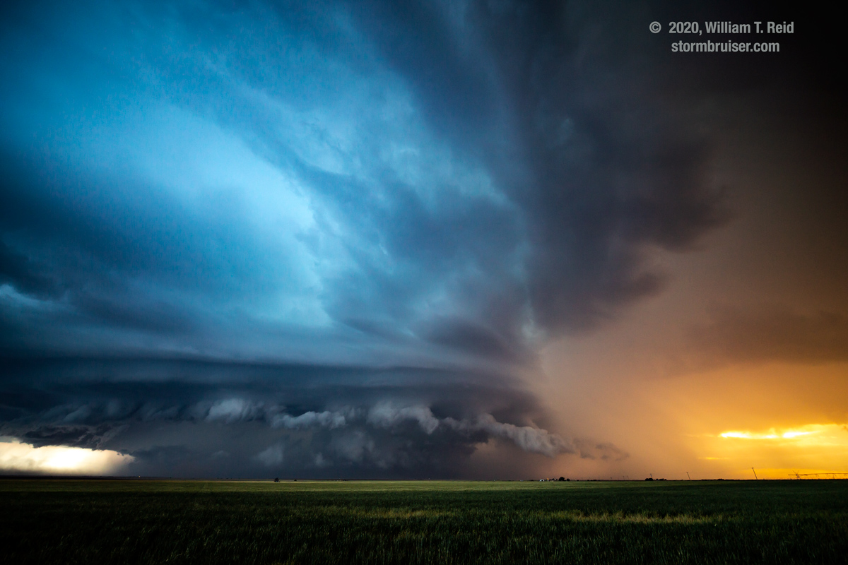
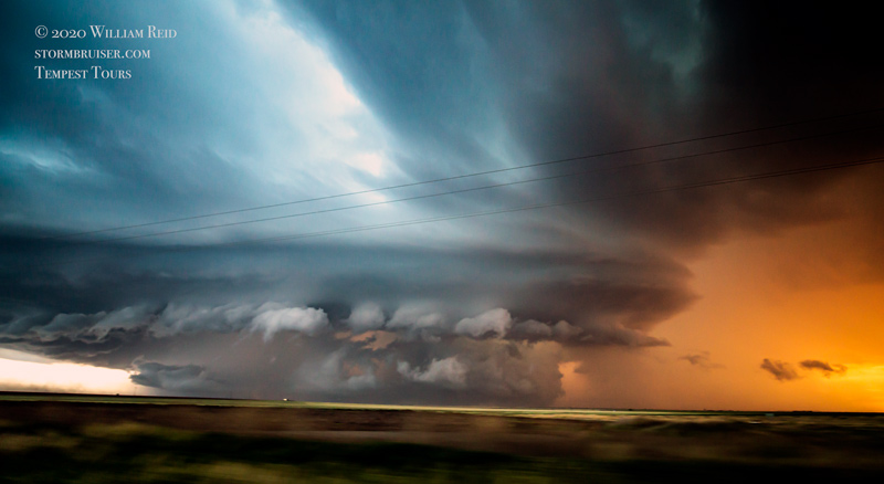
The sunset light was fabulous, and the storm base was rather low and menacing! There was a suspicious area where a tornado would be lurking, if there was one, but plenty of precipitation was obscuring that part on the north side. This storm must have found that boundary.
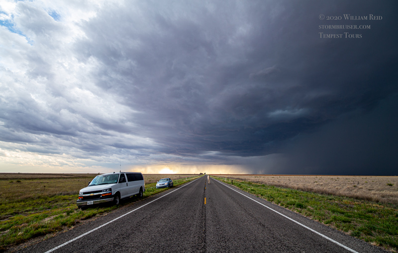
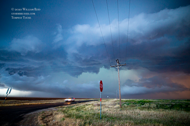
We went south again to avoid getting the business-end of the storm. Near Smyer, some pinkish sunset light was poking through to the north, while a wet core loomed to the west. We headed into Lubbock and found a motel in heavy rain and minor floodwaters.
Leave a Reply
You must be logged in to post a comment.