
Start: Woodward, OK
Lunch: Waynoka, OK/Miss Jamie’s Malt Shop and Pizzeria
End: Clinton, OK
about 350 miles
SPC Mesoscale Discussion 581 SPC Mesoscale Discussion 586
SPC Mesoscale Discussion 588 SPC Mesoscale Discussion 590
Video and time-lapse by TT guide Bob Conzemius
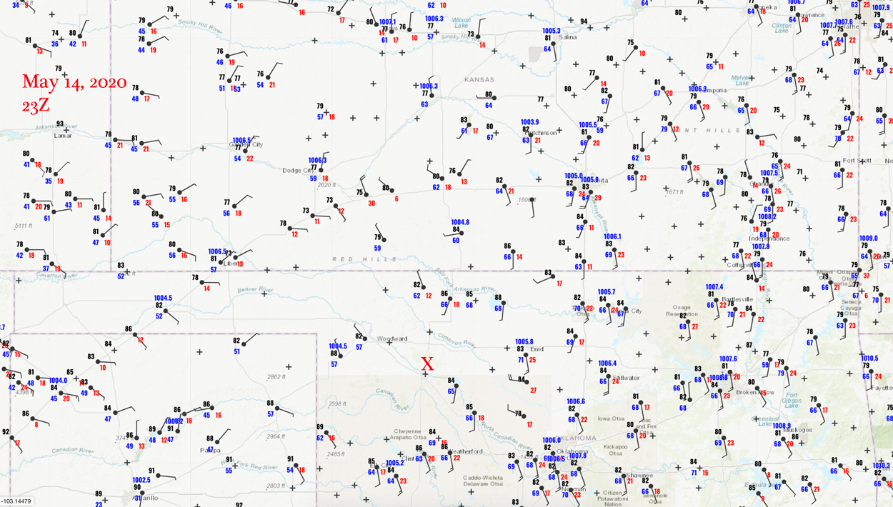
Surface map 23Z
Video and time-lapse video by Tempest guide Bob Conzemius
SPC favored eastern Kansas today as far as tornado threat, with a 5% area from Emporia eastward. We were starting the day in Woodward a little earlier than normal in order to get ourselves into eastern Kansas in time. After an hour or two of driving and looking at the weather data, I elected to blow off the Kansas play. There was also a risk of severe back where we started the day, around Woodward. SPC added a slight risk there with the 1630Z update. And, I just was not seeing enough good things shaping up in eastern Kansas to warrant the much longer drive. Since the next day was looking like a northwest Texas day, it made the decision to stay in northwest Oklahoma a lot easier. We turned around when we got to Cherokee. (A relatively low-end and brief tornado did eventuate near Council Grove, KS, around sunset.).
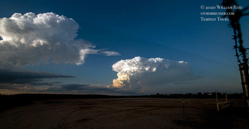
So, we had quite a bit of time to kill in northwestern Oklahoma, as the good stuff would probably not occur until close to sunset. We first headed towards the eastern OK Panhandle, as at least one model (the NAMNEST) was showing a big supercell tracking eastward out of the western OK Panhandle by late afternoon. That scenario looked a lot less likely by around 5-6 p.m., and I decided to drift south from about Slapout into the northeastern Texas Panhandle. Some puny cumulus were bubbling near Higgins, but could not get strong. Finally, a decent one developed to our ENE a ways, and we scooted eastward on Highway 60 towards Seiling, OK.
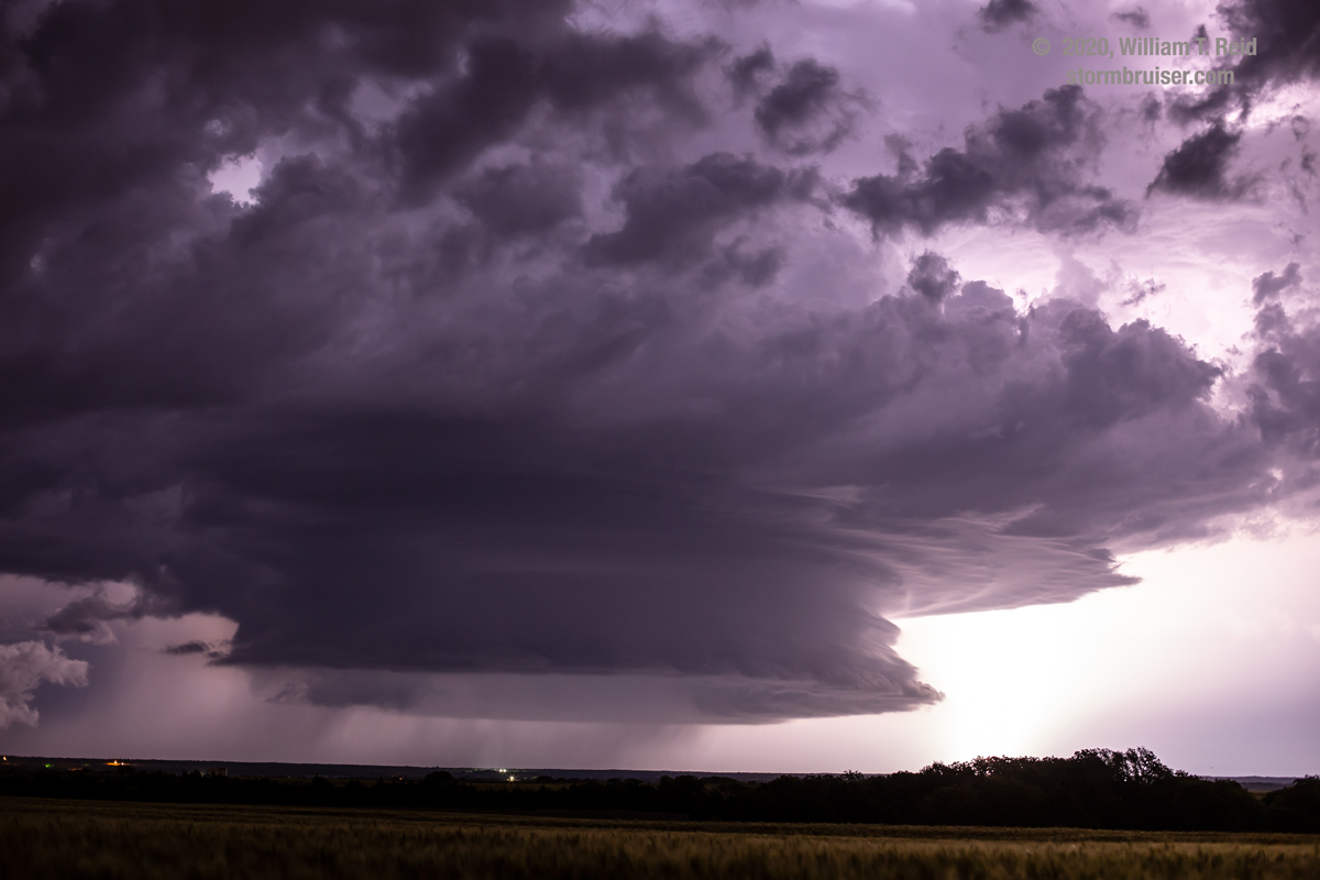
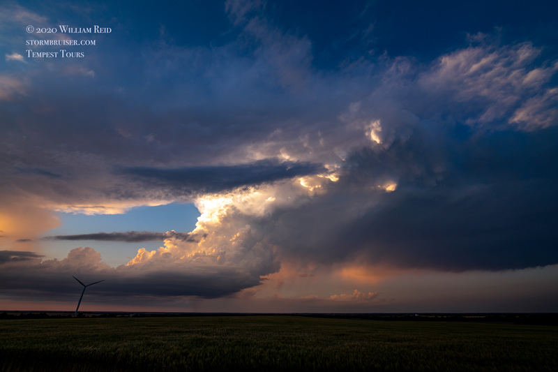
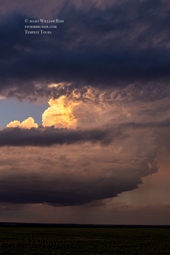
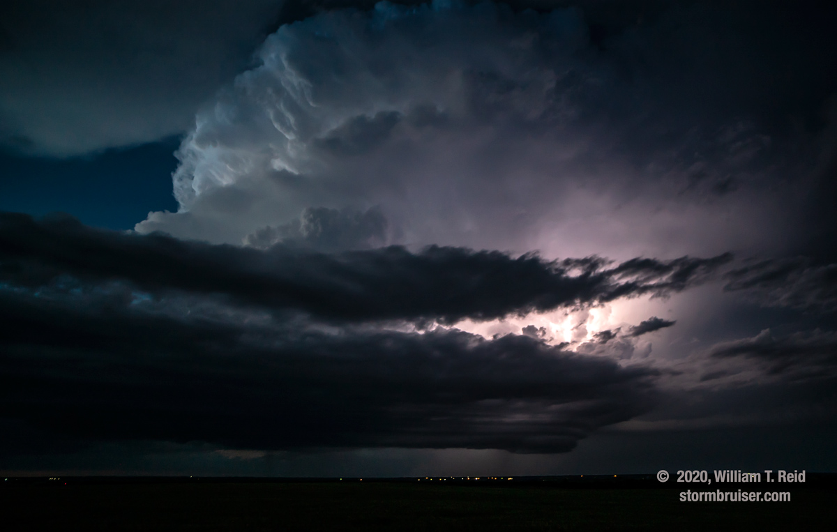
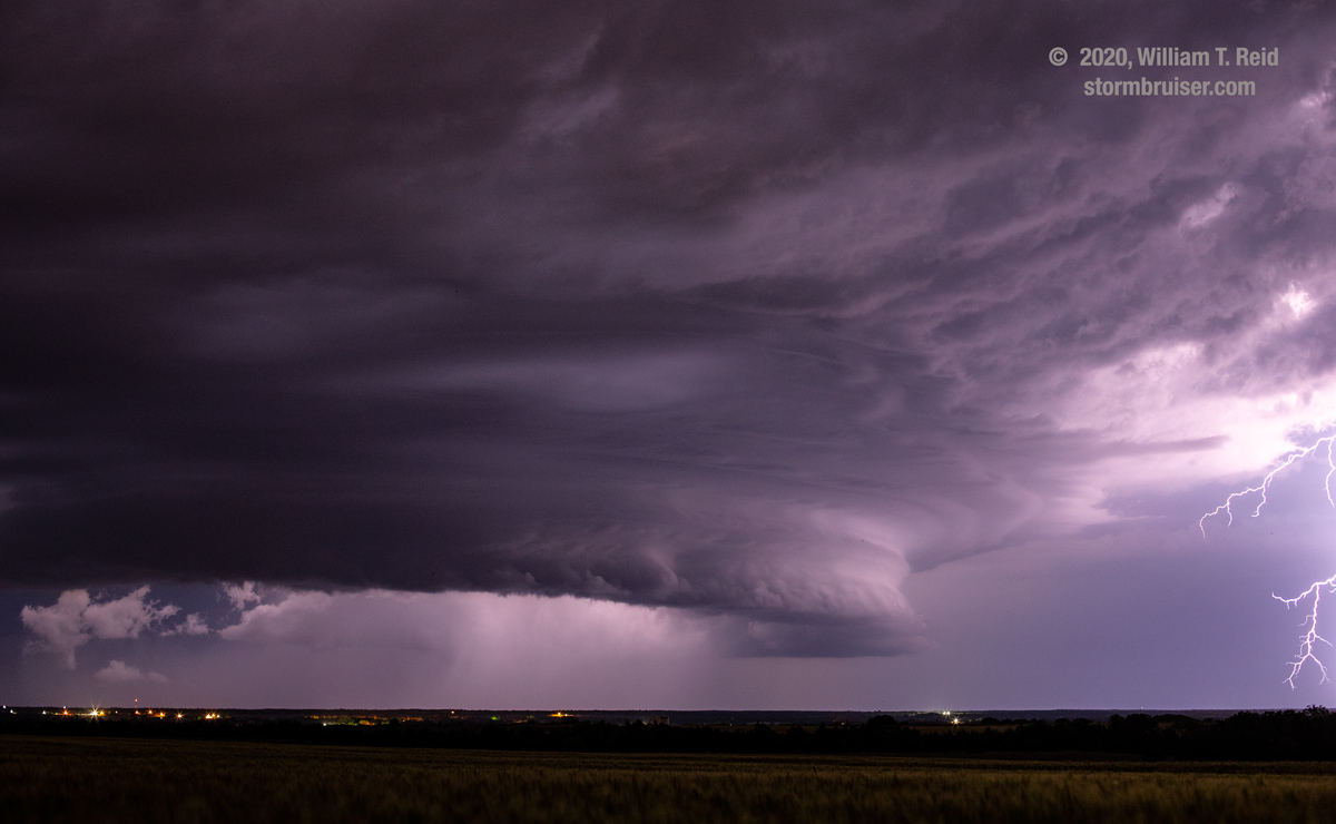
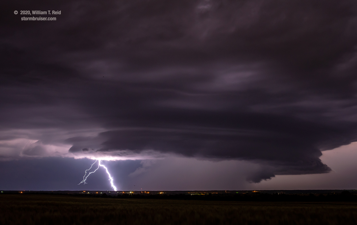
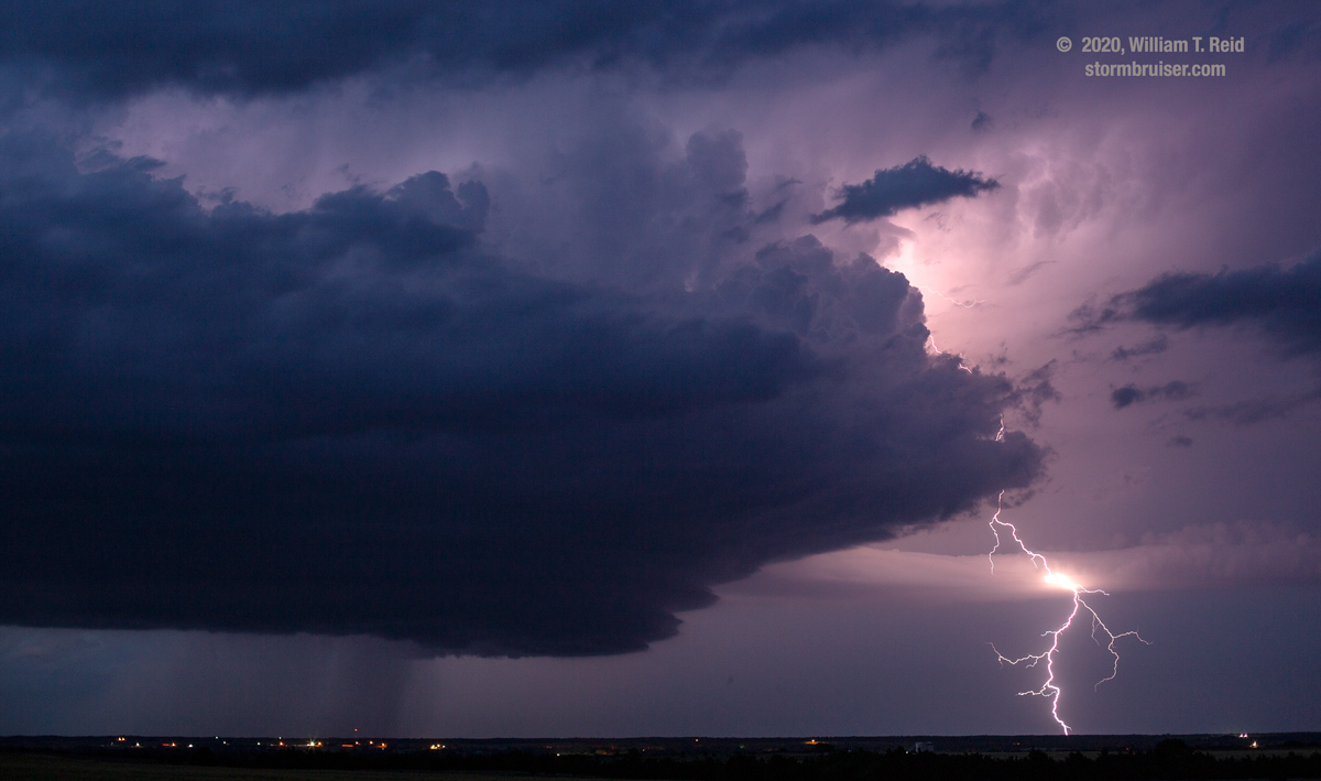
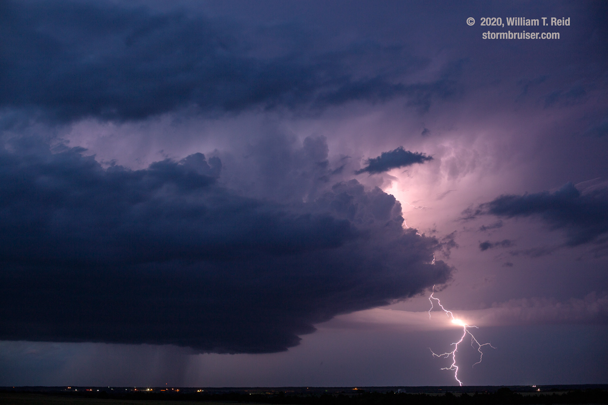
This storm was rather robust and slow-moving, and we got just south of it around sunset. At dusk, a prominent and sculpted lowering/storm base was not too far northeast of Seiling. This was good stuff and it made the decision to stay in Oklahoma a good one!
Leave a Reply
You must be logged in to post a comment.