
Start: Clinton, OK
Lunch: Binger/Meeks 152 Diner
End: Wichita Falls, TX
about 400 miles
SPC Mesoscale Discussion 596 SPC Mesoscale Discussion 598
SPC Mesoscale Discussion 600 SPC Mesoscale Discussion 602
SPC Mesoscale Discussion 604 SPC Mesoscale Discussion 607
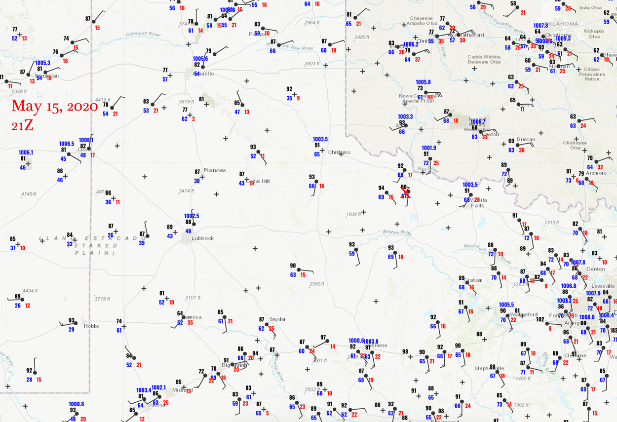
Surface map 21Z
We had a nice enhanced severe risk with primarily a large hail threat today in the vicinity of the Red River (OK/TX border). After lunch in Binger, a strong boundary was nearby and surging towards us from the ENE. This boundary helped to get a line of storms going in southwestern OK during the early afternoon. We weren’t going to have much fun with this activity, so we headed south into northwest Texas, where the airmass had not yet been disturbed. CAPE values were quite good (near 4000 J/kg), and wind was strong from the east towards late afternoon. But, the setup was not particularly favorable for long-lasting and discrete supercells.
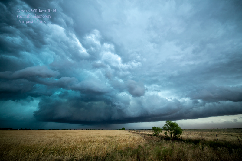
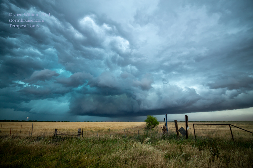
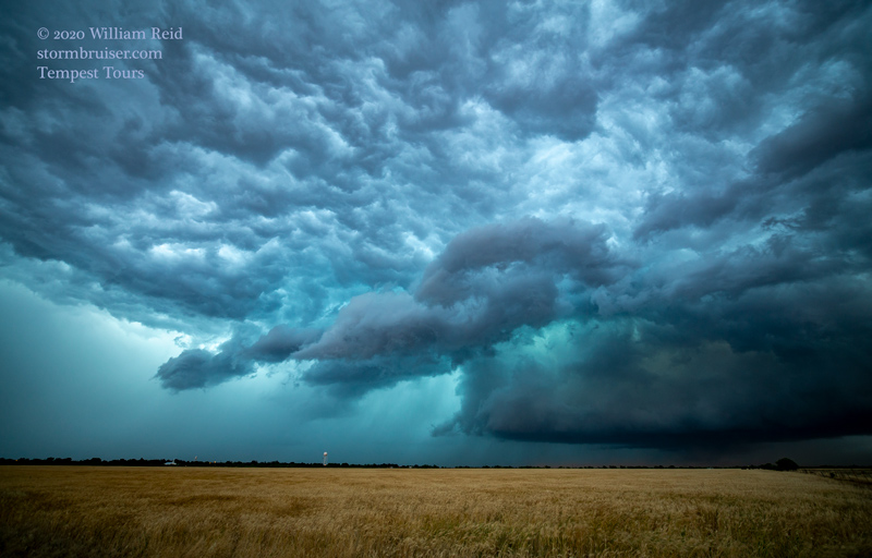
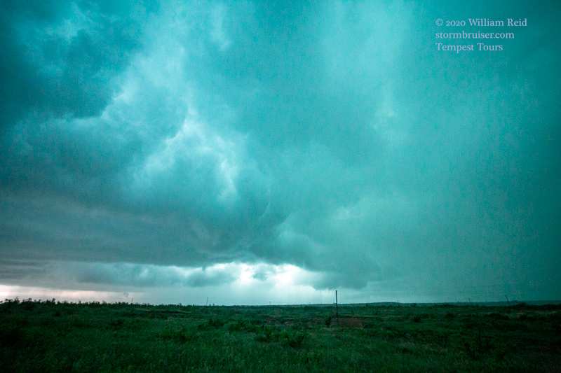
We found some rather poorly-organized storms near Crowell, TX (first two images below). A bit later, east of Crowell, a prominent storm base took shape not too far to our north (next three images). The storm looked briefly like a tornado-producing candidate, and we headed east a little more to stay with it. But we transitioned quickly into GET EAST mode (in a rather quirky road network) in order to stay ahead of some other heavy precipitation cores. We utilized some seldom-used paved roads in southern Wilbarger County, south of Vernon and Electra. We could not stop at all to admire the bleak, wide-open spaces.
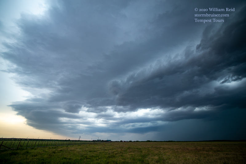
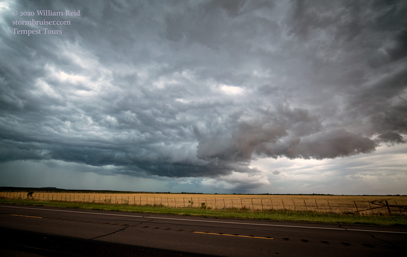
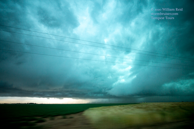
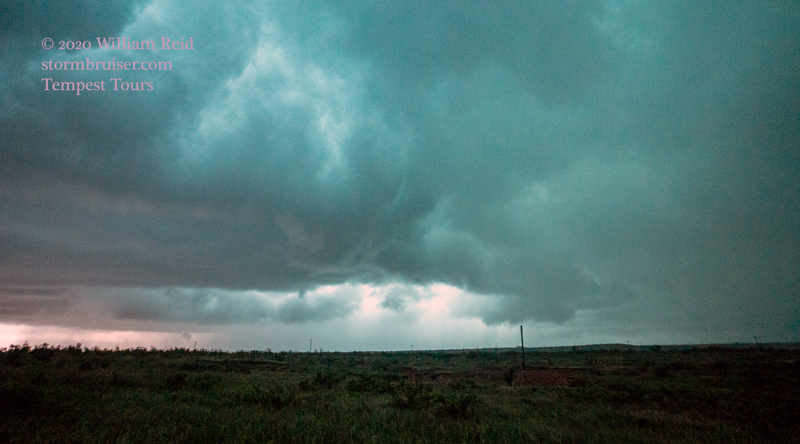
A storm no more than 15 miles to our south or SSW became tornado-warned, and we had a chance to get a bit closer to take a look (final three images below). It looks like we had an RFD cut and action area going, but we saw no tornado. During the rather frantic 30-45 minutes or so before dark, Bob narrowly missed plowing into a bunch of bovine that cut across the road — great work, Bob! He saved us from much consternation. Convergence in our vicinity was off the charts as moist easterly winds were surging into Wilbarger County. Heavy rain developed and escorted us into Wichita Falls for the night.
Leave a Reply
You must be logged in to post a comment.