Stormbruiser.com

William T. Reid

  • About
  • Video Links
  • Climate
  • Categories
    • Astronomy
    • Aurora/Northern Lights
    • Artsy
    • Airports (LAX and VNY)
    • Animal Day
    • Beach
    • BEST and MOST POPULAR
    • Chase Season Summary
    • Chasers and friends
    • Cumulonimbus
    • Death Valley
    • Desert
    • Desert/Mountains
    • Elevated photography
    • Eyesores
    • Fire
    • Flooding
    • Hurricane
    • Landscapes
    • Lightning
    • Local: Conejo Valley/San Fernando Valley
    • Mid and High Clouds
    • Nighttime photography
    • Old Stuff
    • Rainbows/Optical Phenomena
    • San Nicolas Island
    • Storm Video Sales
    • Stormy Skies
    • Stupid Bugs
    • Sunsets and Storms
    • Supercells
    • The City
    • Tornadoes
    • Unusual Clouds
    • Vegetation
    • Wind and Dust
    • Winter Weather
  • Contact
You are here: Home / 2020 / May 28, 2020 More Severe Storms in Texas

May 28, 2020 More Severe Storms in Texas

May 28, 2020 By William Reid Leave a Comment


Start:  Boerne, TX

Lunch:  Kerrville/Rio Rancho

End:  San Angelo, TX

421 miles


SPC Day One/20Z

SPC Mesoscale Discussion 753    SPC Mesoscale Discussion 755
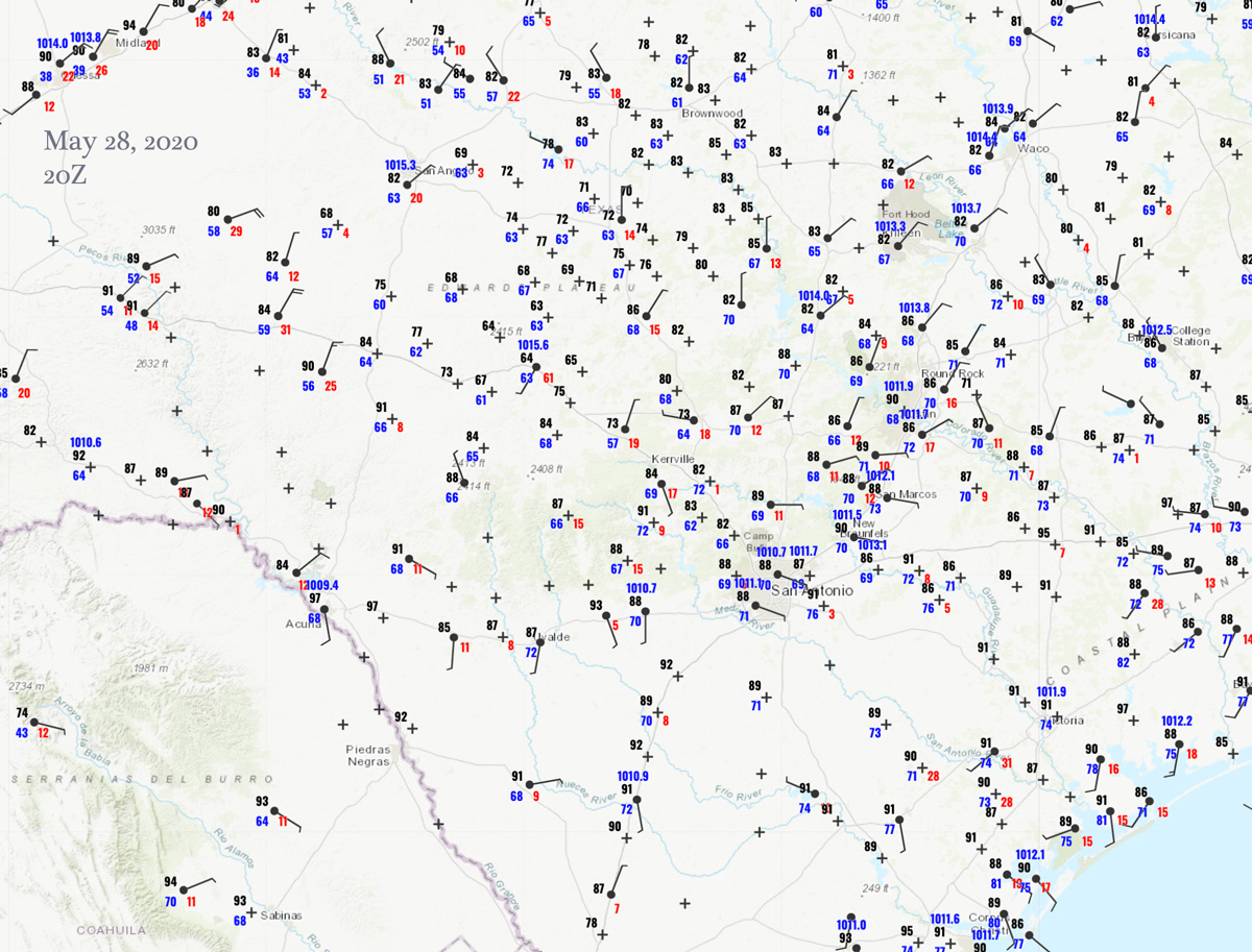
Storm Reports


Surface Map/20Z


An upper-level low was headed east, near northeastern Texas, providing some mediocre NW flow over the central Texas.  Instability was quite good, with CAPE values above 3000 J/kg along and south of I-10, where dew points were near 70F.  The overall wind profile was poor for well-organized and long-lasting supercells.

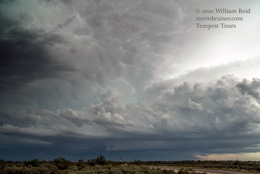
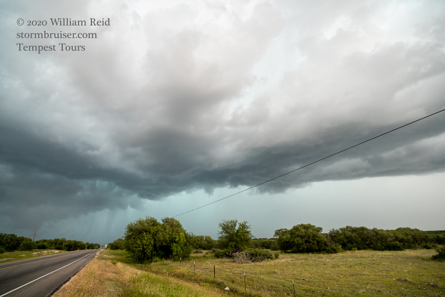
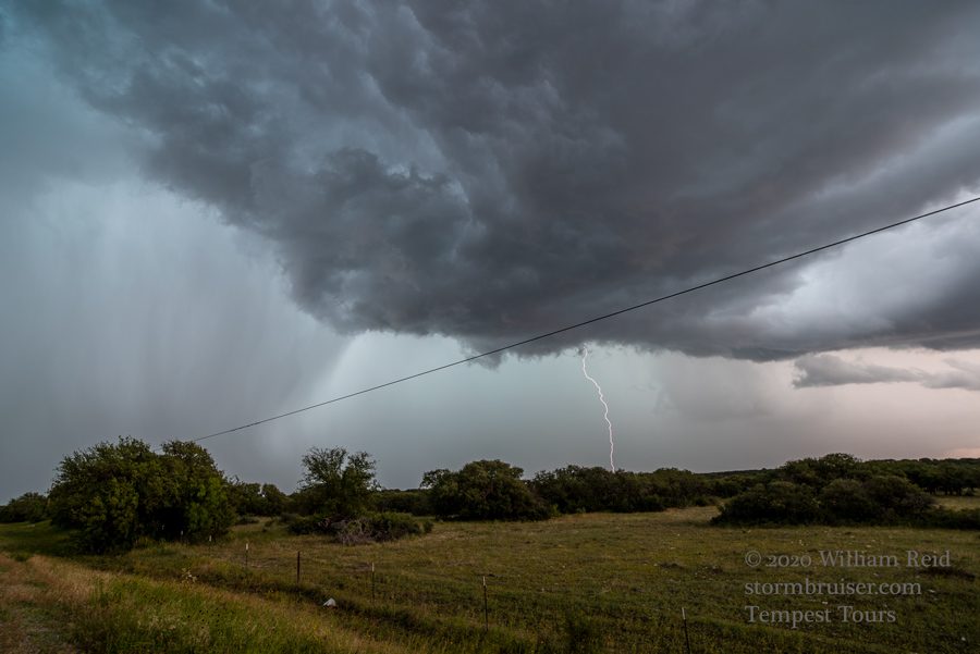
Surface moisture convergence developed midday near Menard, and we watched a heavy and marginally severe storm north of town (first two images below).  An additional storm or two pushed us southward towards I-10.  This activity was rather prolific with the CG lightning (third image).

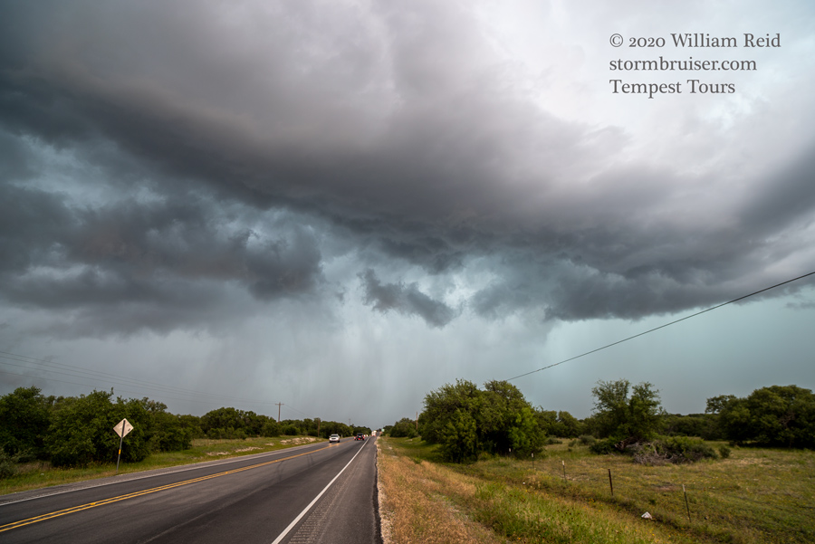
We headed farther south for mid-late afternoon development, between Rock Springs and Del Rio.  We wound up beneath a hailer or two (with stones up to 1.5 inches in diameter).  North of Del Rio, a big storm to the south (last image below) looked healthy and somewhat organized for a bit, but it was better suited for chasers in Mexico.  We made our way back north to San Angelo for the night.


Filed Under: 2020, Sunsets and Storms, Supercells

Leave a Reply

You must be logged in to post a comment.

Search

May 2020
S M T W T F S
 12
3456789
10111213141516
17181920212223
24252627282930
31  
« Mar   Jun »

Categories

Archives

Copyright © 2025 stormbruiser.com · Log in