
Start: Cozad, NE
Lunch: Valentine/Subway and Frosty Drive-In
End: Wall, SD
593 miles
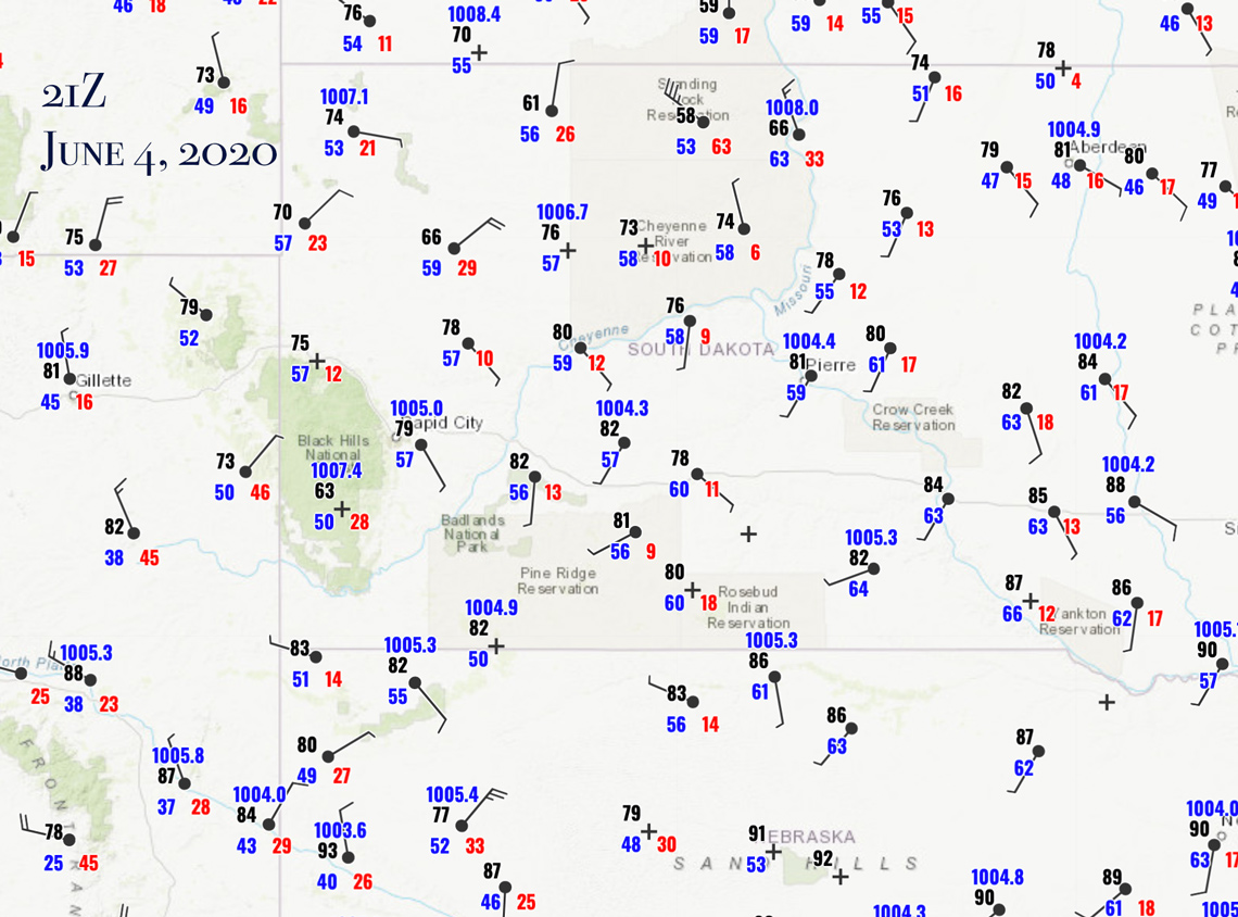
21Z surface map
Tornados were tough to come by on the Plains this May and June, but on June 4 the prospects looked a little better than average…for 2020. SPC drew narrow 5-percent swath for tornados along I-90 in South Dakota from about Belle Fourche to Murdo. Still, dew points were mostly in the upper 50s during the mid-afternoon. That usually does not get it done in June in western South Dakota.
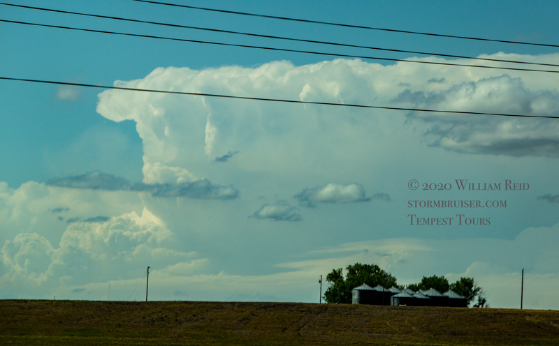
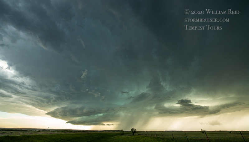
We made our way north from Valentine to Philip. By this time, a good-sized cumulonimbus had developed to our NNW, somewhere in the vicinity of Mud Butte, where surface moisture convergence was good. Awesome! This one was isolated, discrete, spinning, and moving southeastward! It would be an easy intercept for us north of Howes, but hopefully it would not “tornado” too soon, i.e., before we got close.
Well, that part wound up not to be an issue, as when we did get close, we were soon met by cool outflow from the north.
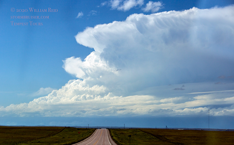
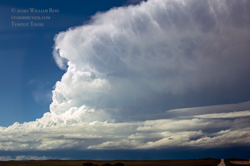
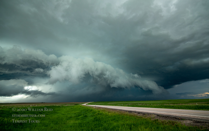
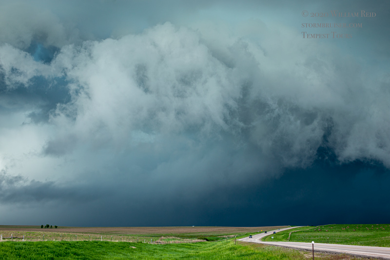
That was a long way to go only to be disappointed. The storm was strong and looked rather fierce, but it was never going to recover and become a tornado candidate. It was not going to be easy to stay with, either, so we blew it off near Howes and headed south for something else.
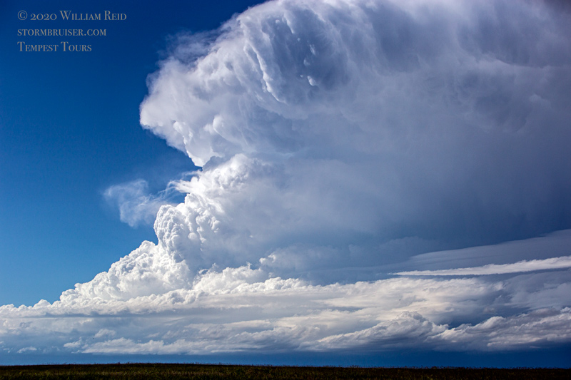
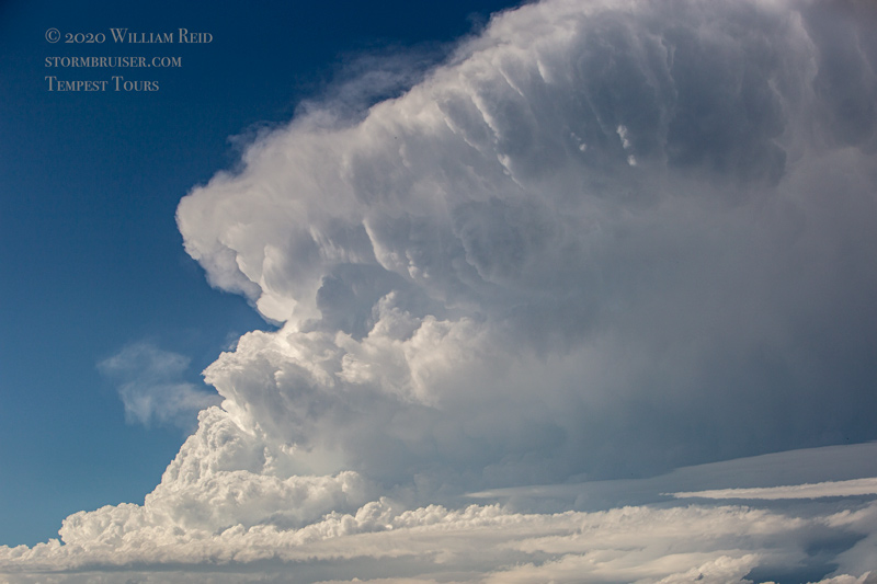
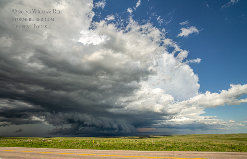
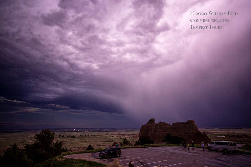
Something else turned out to be a supercell near the northern Black Hills. It was moving to the east into good air, and we headed south via Elm Creek to I-90 for an intercept. Unfortunately, this one sputtered upon approach. We continued south into the Badlands, and an offspring became a supercell and gave us a fairly decent show from west of Interior.
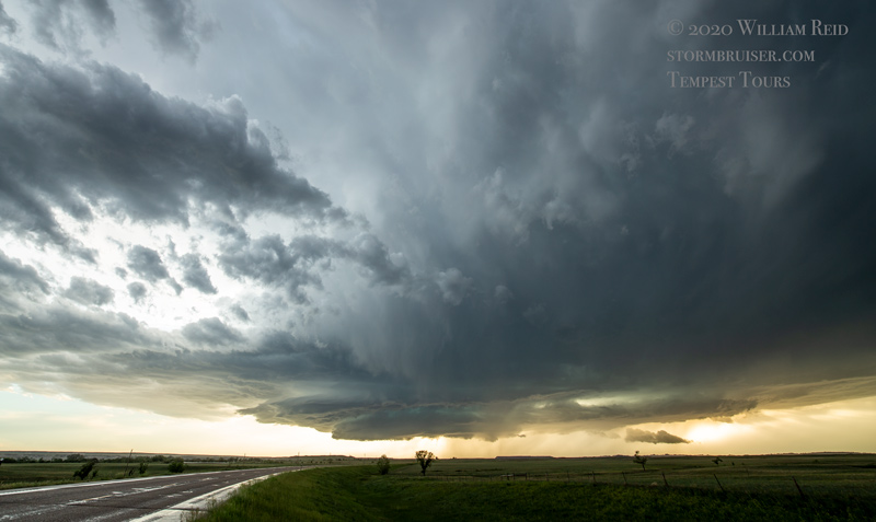
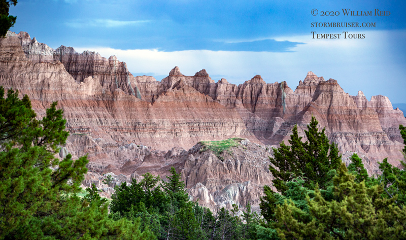
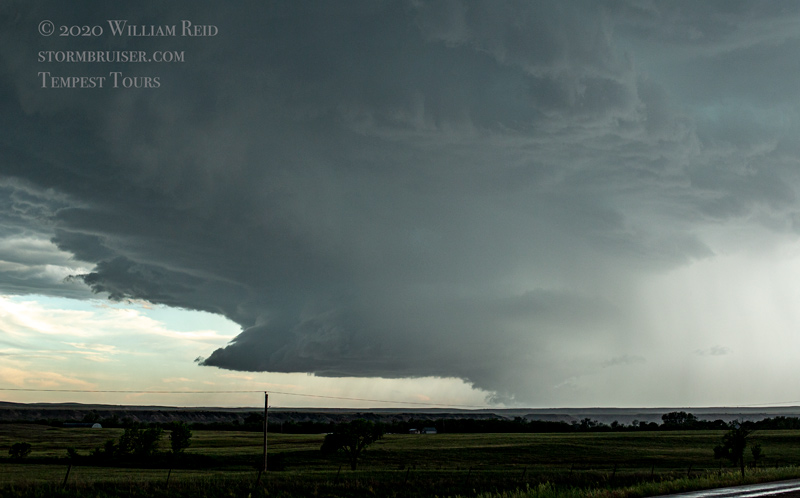
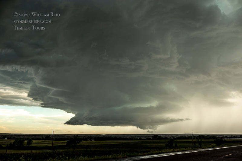
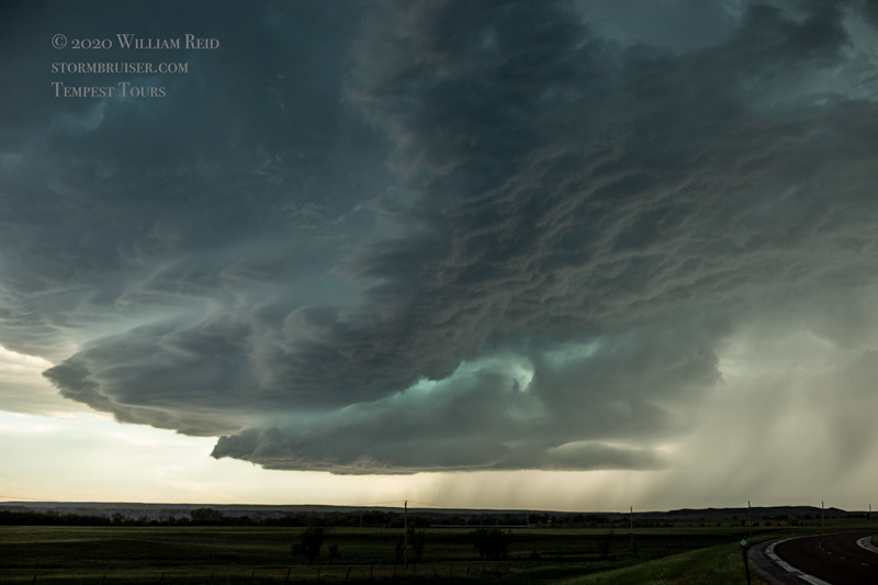
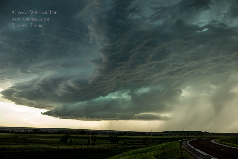
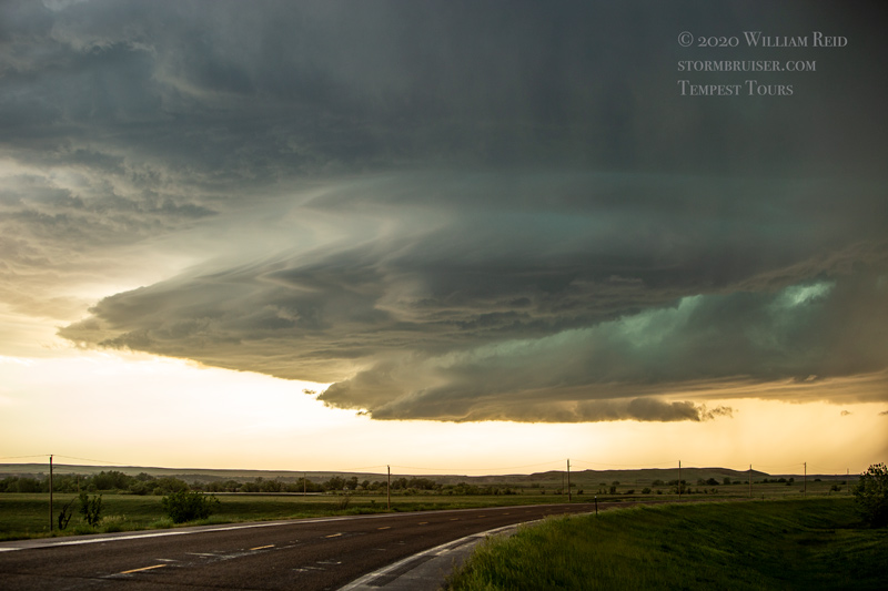
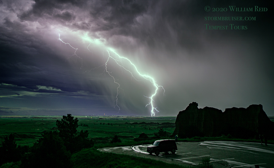
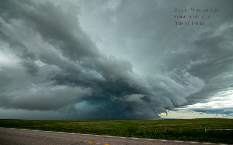
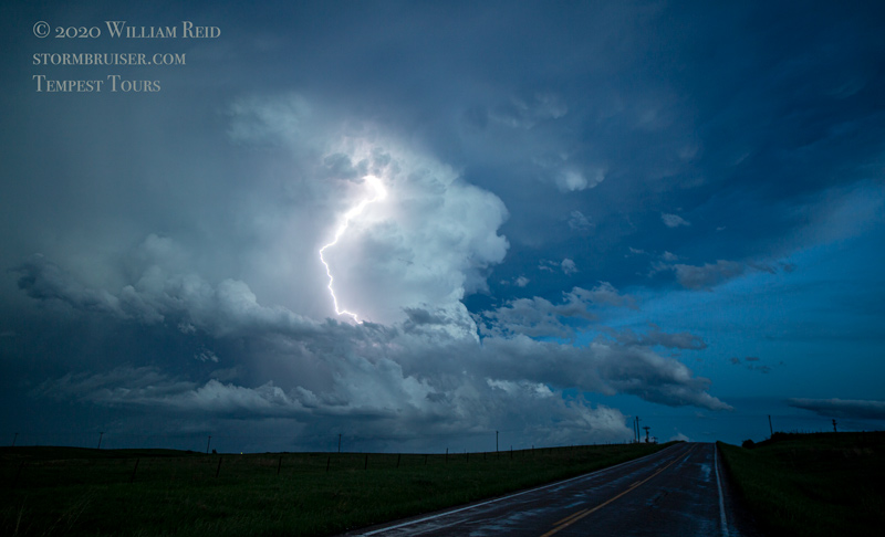
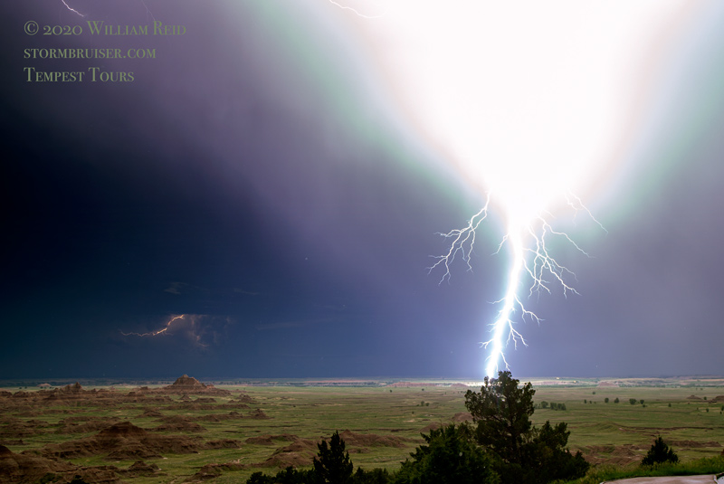
The road network wasn’t too good for us as this storm moved to the southeast. We wound up on a hill near Potato Creek and watched lightning in the updraft as it pulled away. Later, we stopped north of Interior at a Badlands viewpoint to photograph another high-based storm which threw lightning around like candy.
Leave a Reply
You must be logged in to post a comment.