

Start: Glendive, MT
Lunch: Circle/Wooden Nickel Cafe
End: Plentywood, MT
363 miles
SPC Mesoscale Discussion 911 SPC Mesoscale Discussion 912

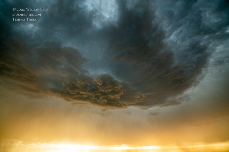
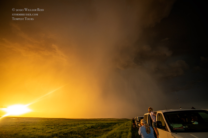
Southeasterly flow in and into eastern Montana was magnificent this chase day, and a some nice upper-level energy was expected to move into western portions of the state by evening. But, low-level moisture was, and I am being generous, LAME. So, SPC showed only a marginal risk of severe on the plains of eastern Montana. High-based storms were expected, and high-based storms are what we got. We were up along Highway 2 east of Glasgow for starters, and killed time at Fort Peck and Fort Peck Lake. We wound up a little west, and then south of Glasgow to view development well to our south. A couple of high-based cells moved towards us, and we scooted up to Glasgow AP when it neared.
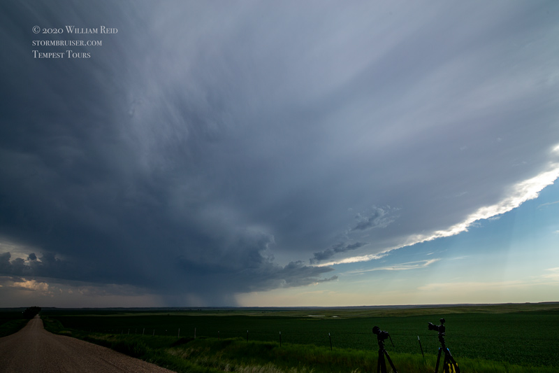
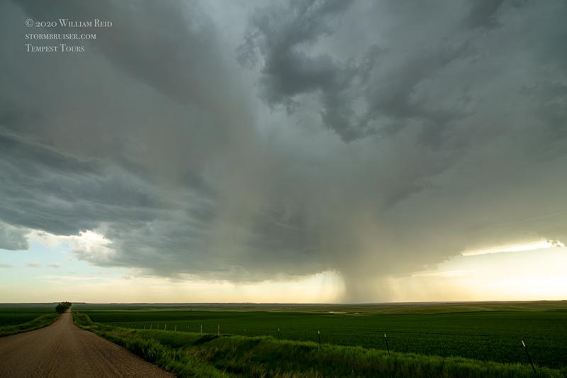
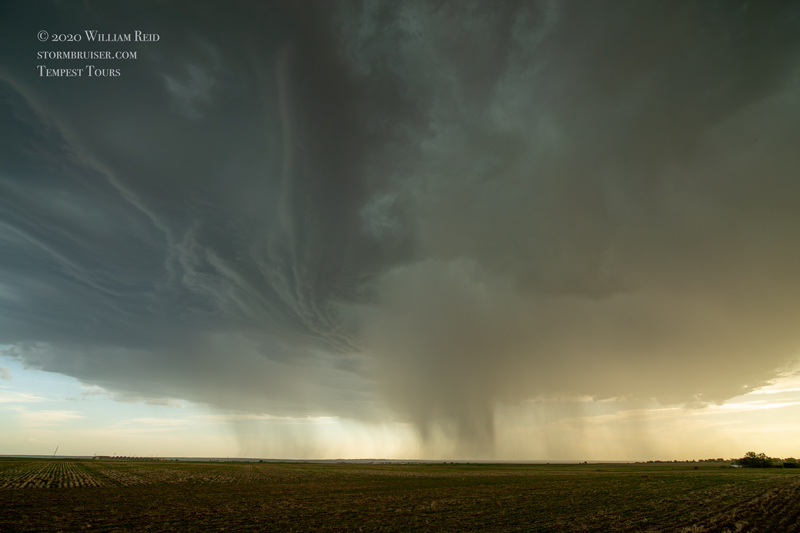
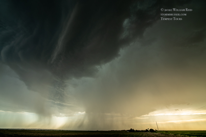
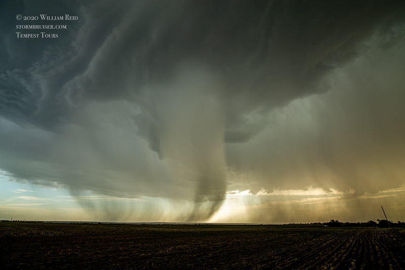
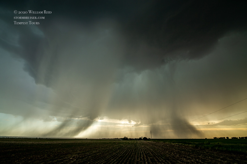


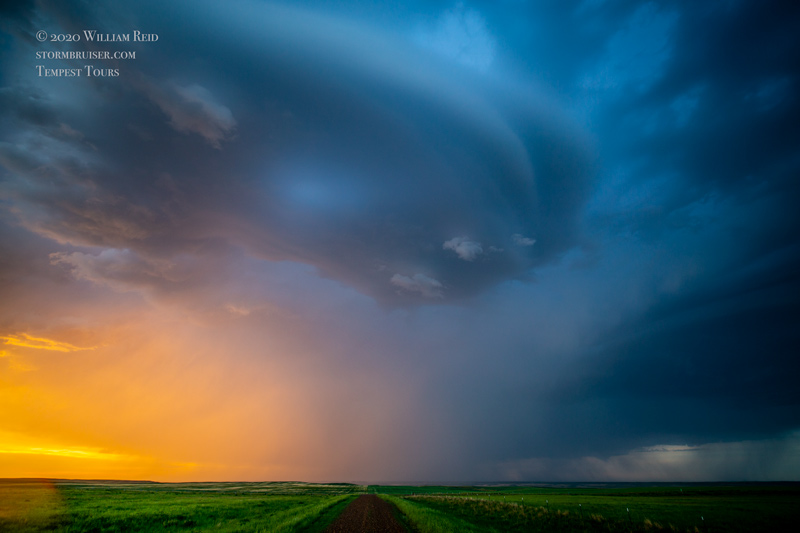
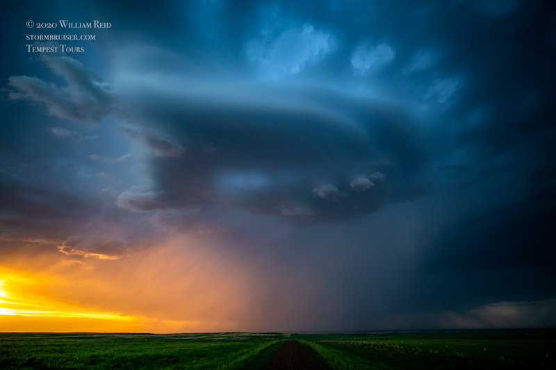
A storm followed us northward along Highway 24, all of the way to Opheim (almost to Canada!). The base remained high, and lightning was not very frequent with the storm. We went east on 248 to Glentana and looked for a decent place to shoot the storm as sunset approached. The Glentana idea failed, and we went just another mile or two east to a hilltop. This looked good, and we were treated to some very nice colors and a little high-based structure and organization and broad rotation. I tried valiantly to catch a lightning bolt, but they were just too infrequent.

Leave a Reply
You must be logged in to post a comment.