
Start: Denver, CO
Lunch: something really fast along I-76
End: Dodge City, KS
629 miles
SPC Mesoscale Discussion 944 SPC Mesoscale Discussion 945
SPC Mesoscale Discussion 947 SPC Mesoscale Discussion 949
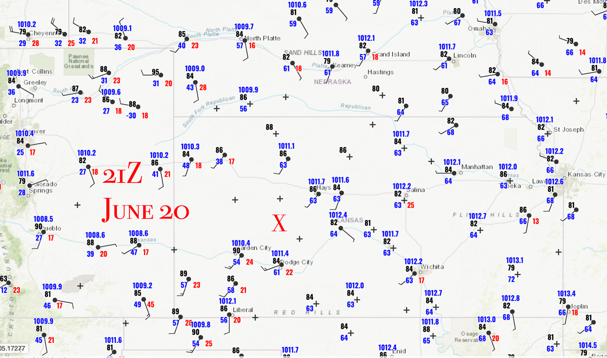
21Z Surface Map. Red X marks the spot of the nice supercell near Jetmore, KS
June 20 was the arrival day for Tour 6. Brittany and Chris G. and the gang and I got out of Denver around 9 or 10 a.m. and headed up I-76 towards western Nebraska. SPC’s Day One outlook suggested that we needed to get well into central Nebraska. On the drive up I-76 towards Sterling, I was looking at data and thinking that it might be prudent to head due east from Brush or Sterling instead of continuing to Ogallala and North Platte. The area from about McCook to Dodge City showed some supercell promise, too, but SPC did not seem to be too keen on the Kansas prospects. Well, I was a little wishy-washy and unsure about the right play here. I elected to stay on I-76 to I-80 and beyond. Upon arriving in Ogallala, I knew that I should have taken one of those earlier eastward options. Kansas was looking better than Nebraska.
We quickly dashed south from Ogallala towards an area with good instability and surface convergence in the vicinity of Wakeeney to Dodge City. That area was rather distant, but there was enough time to get on something before sunset. From Bird City and MacDonald, KS, a new and good-looking updraft teased us not too far to our northeast, near McCook. It looked to be in a decent spot for a tornado threat, and so we diverted north to McCook. As we arrived, the storm weakened quickly. Well…that was a waste of about 90 minutes!
Another cell went up east of McCook, but I ignored that one and was determined to get down into Kansas. Storms were developing there now, and a decent supercell developed somewhere northeast of Jetmore, I think. We had a long way to go. A left-mover came off of it and looked nice to our east as we headed south from Wakeeney. Would we ever get down there in time?!
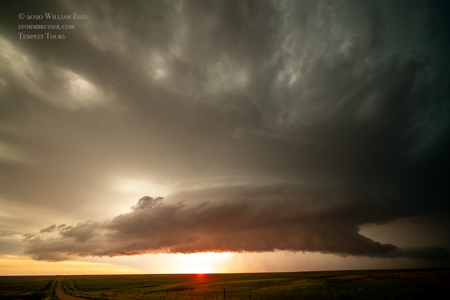
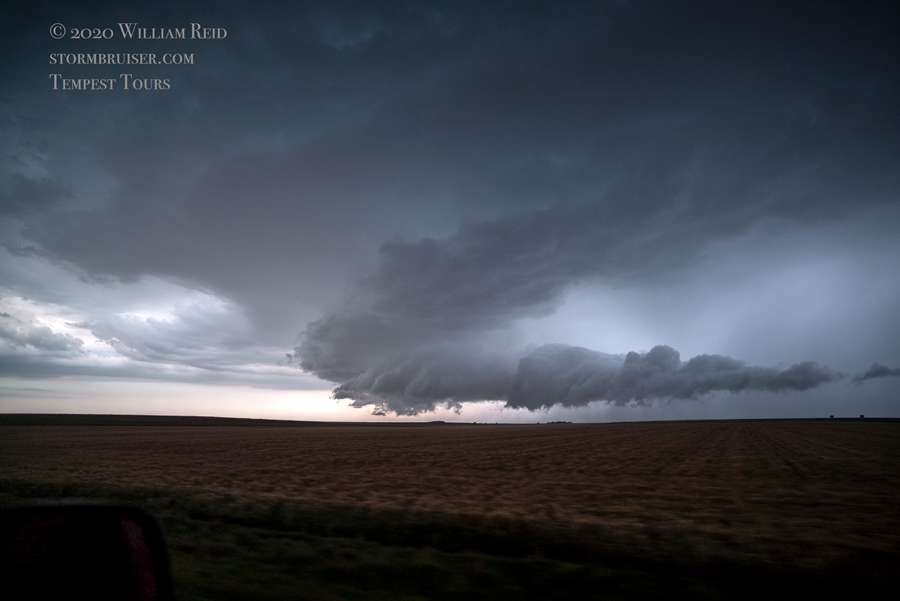
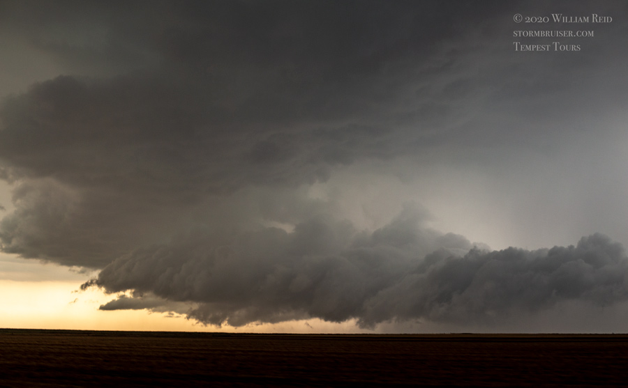
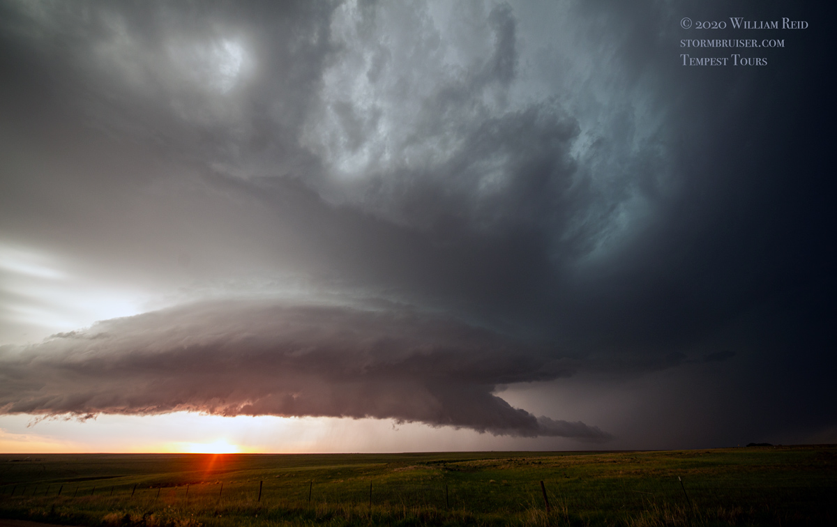
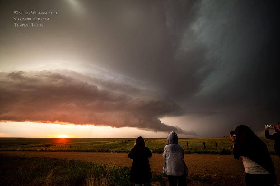
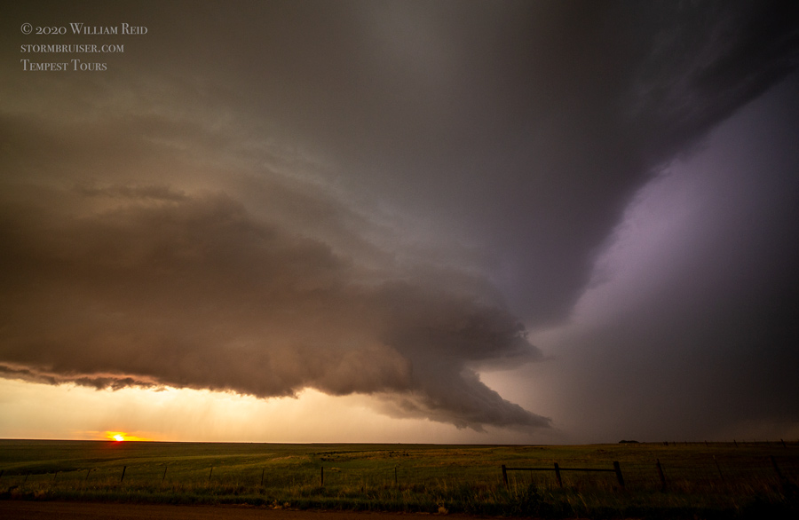
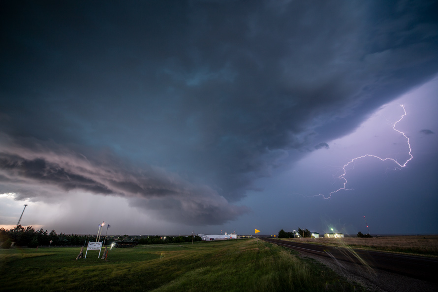
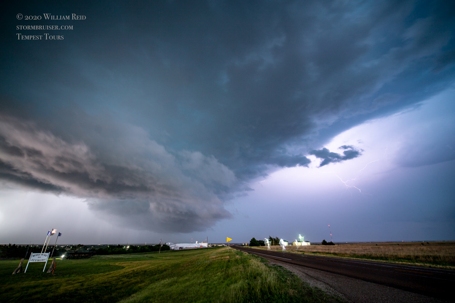
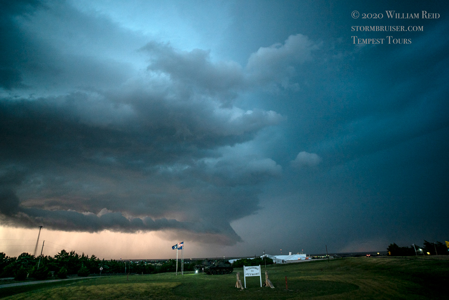
Fortunately, a new storm developed to the northwest of Jetmore. We could drop south, right in front of this one, from Ness City. I was concerned that its hail core might drift onto 283 and make it difficult or dangerous to get into position, southeast of the slow-moving supercell. This storm turned out to be quite robust, and fortunately we remained a few miles east of the hail core on 283. We stopped north of Jetmore, with a great view of the sculpted updraft region right at sunset. We missed a tornado event in central Nebraska, but I know no details on that one. (This time lapse video by chaser Dean Cosgrove shows first the McCook cell which fizzled (from the east side), and then a really pretty (formerly tornadic?) storm moving southeastward out of the Sandhills.). The south side of Jetmore provided a hilltop to view more storm structure and lightning at dusk, and the supercell conveniently pushed us southward towards our motel in Dodge City.
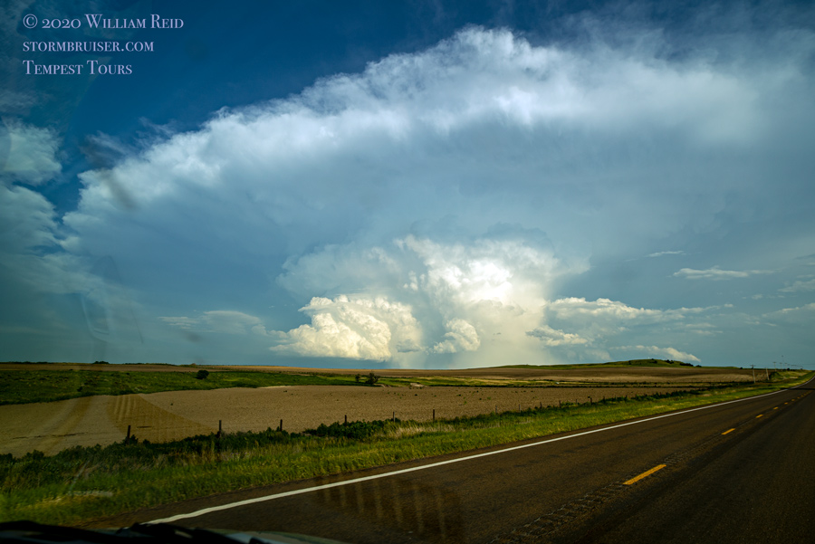
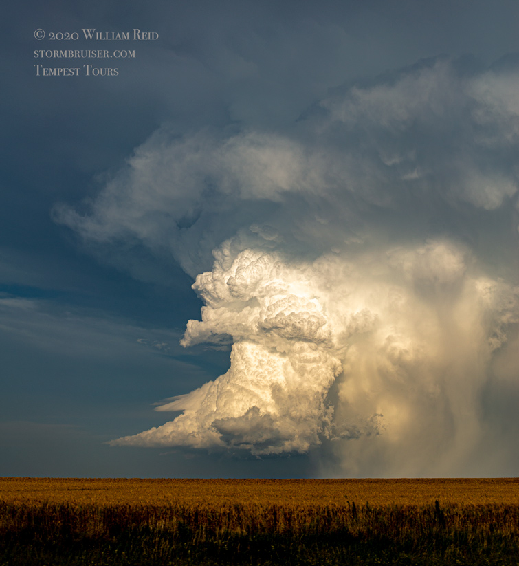
Below are the McCook storm (as it developed), the left-mover east of Ransom (updraft on the north side, two pics), and then the Jetmore supercell, first looking west at the east side of the base, and then looking WNW to NW at sunset.


Leave a Reply
You must be logged in to post a comment.