
Start: Denver
Lunch: Douglas, WY/Arbys
End: Belle Fourche
598 miles
SPC Mesoscale Discussion 1036 SPC Mesoscale Discussion 1037
SPC Mesoscale Discussion 1041 SPC Mesoscale Discussion 1043
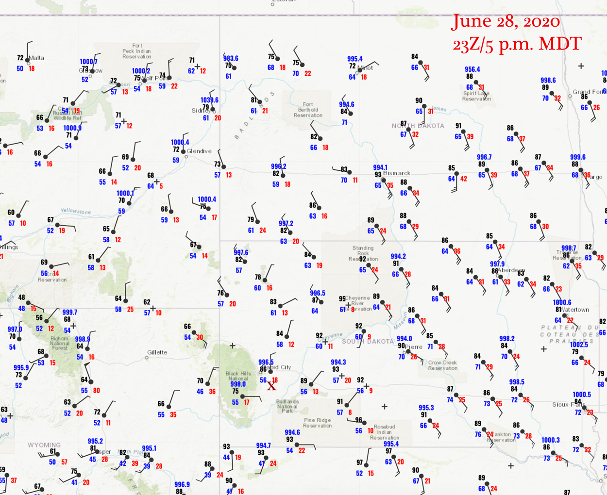
23Z Surface Map
The area to be on this chase day was central North Dakota, along a N-S boundary where dews were near 70F. But, alas, we were beginning a tour out of Denver, and we had to settle for a closer target where the moisture was not nearly as good. (At least a couple of tornadoes occurred in North Dakota near sunset on this day.). We had lunch up at Douglas, WY, and then continued north a bit to Bill and beyond. A decent high-based storm went up to our west and showed some decent structure southeast of Wright.

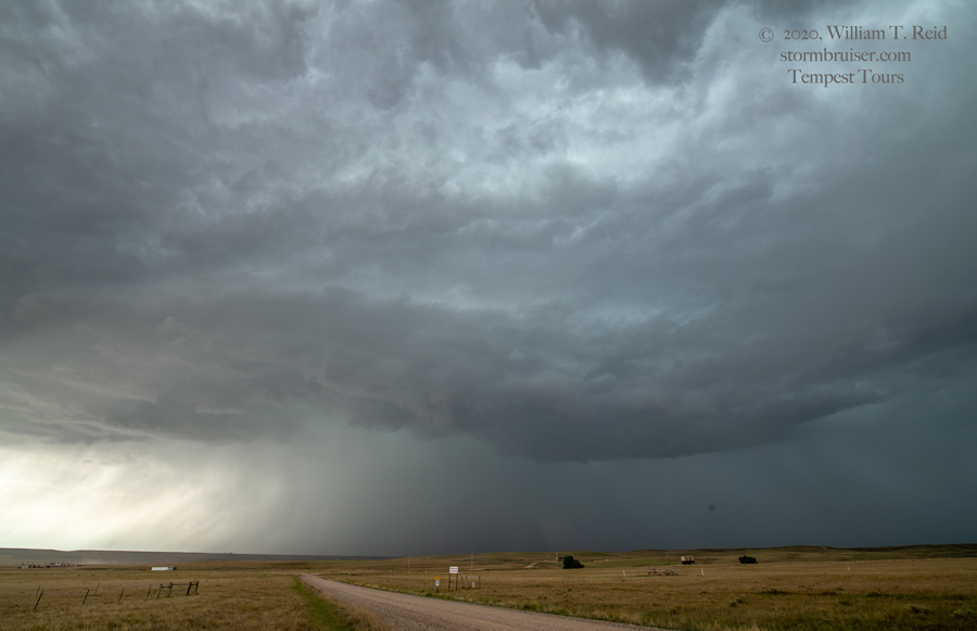
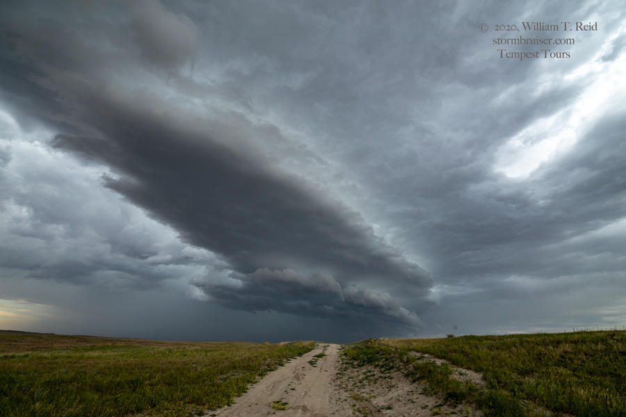
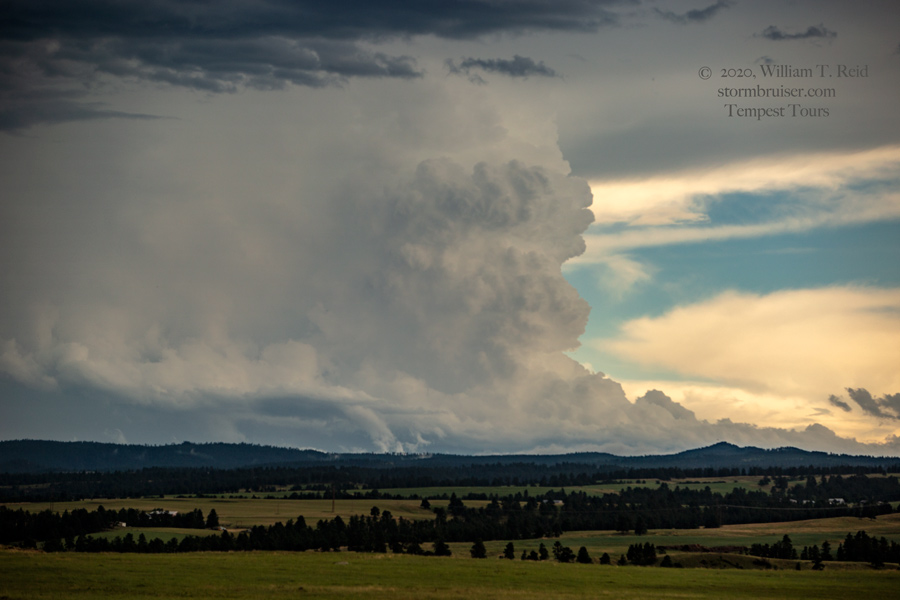
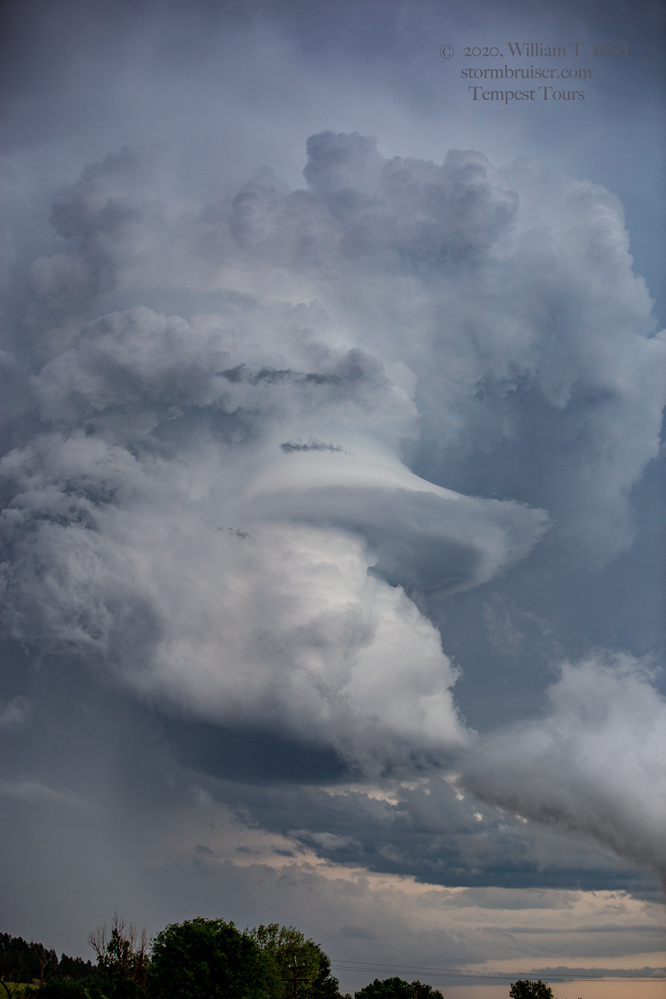
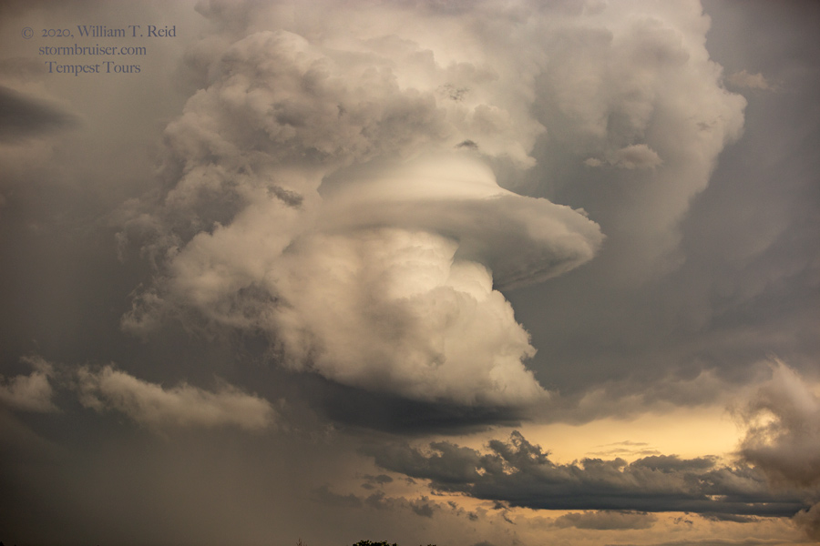
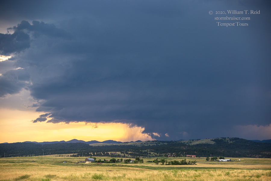
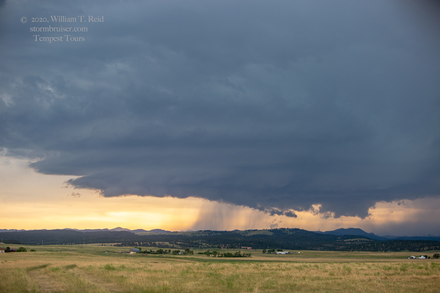
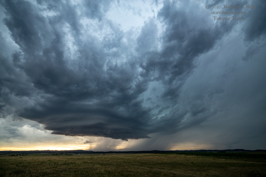
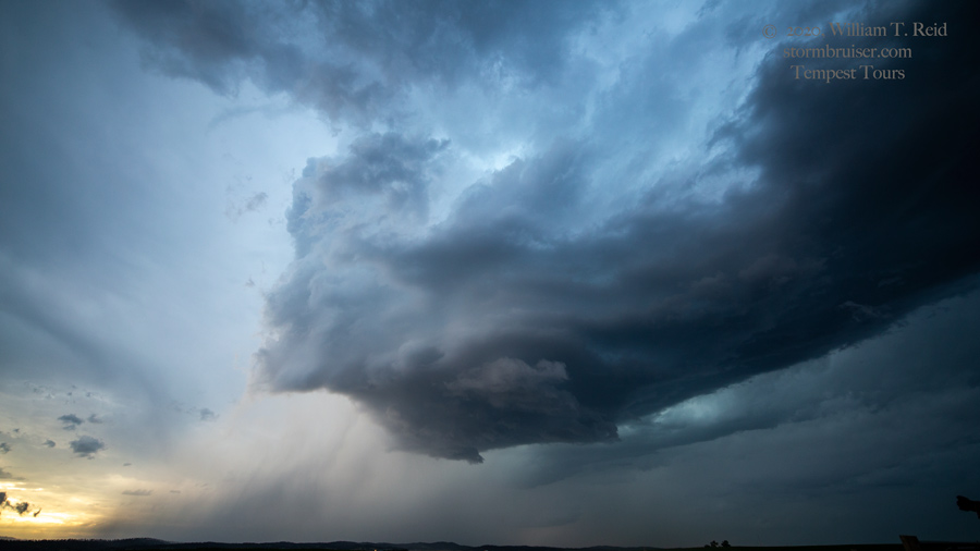
Our Wright-area storm fizzled, and it was time to get northeast and east a bit for the next batch of storms. We went around the Black Hills on the north side (via Sundance and Spearfish), which afforded a good view of a strong CB updraft to our southeast (first pic below). This one was rotating rather strongly, and reports of large hail began to come in as it neared I-90 near Piedmont, SD (between Sturgis and Rapid City). I thought that we might be in for a good show, as we would be able to get to Piedmont about the same time as the storm. But, the darn thing was shriveling and dying a horrible death right then and there. We did, though, find some near-2-inch diameter hailstones along I-90. The 2nd and 3rd photos below show the updraft on the north side of I-90 as it was dying.
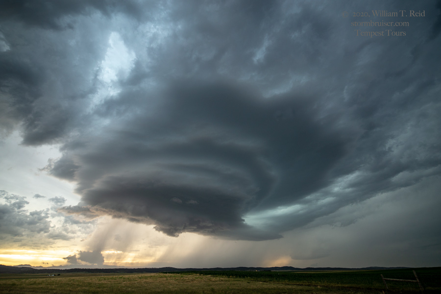
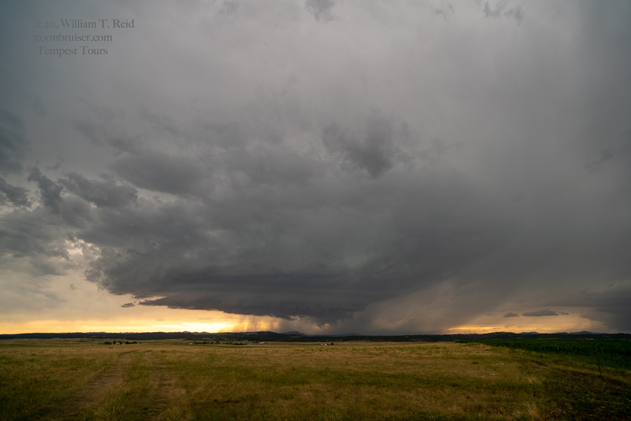
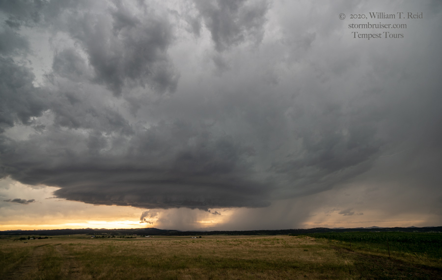
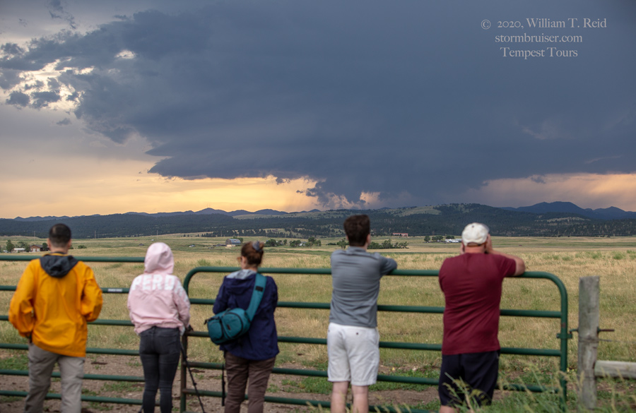
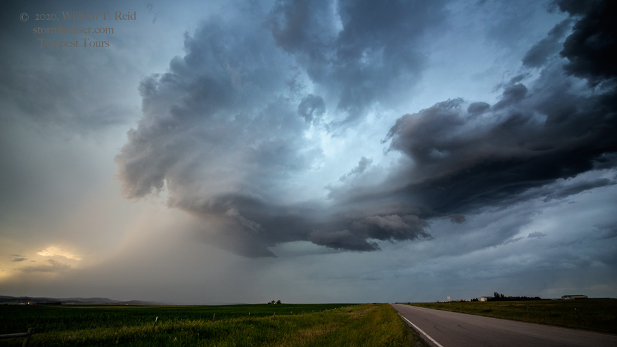
That was a bummer. With another hour to go before sunset, we continued to Rapid City and then south a little to catch another storm as it came off of the Black Hills. This was a very decent supercell, and it showed some interesting lowerings to our west. We were near Highway 79 at Ajax, which is a little nothing place north of Hermosa. Some nice striations showed on the rotating updraft, but like the previous storm, it sputtered as it moved over the lower terrain.


Leave a Reply
You must be logged in to post a comment.