Start: Belle Fourche, SD
Lunch: Belfield, ND
End: Garrison, ND
about 550 miles
SPC Mesoscale Discussion 1052 SPC Mesoscale Discussion 1054
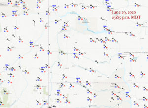
This chase day was challenging. There were a couple of areas in western North Dakota to consider. It appeared that, with better moisture (dews into the low 70s), the area near the Missouri River and along a warm front would have the better tornado chance, especially towards sunset. This was approximately in the Watford City/New Town area, where river crossings are very few, and the logistics of chasing and staying with a good storm are not easy. Another prime area was farther SW, near Beach, ND. This was close to the SD/ND/MT triple-point, and also close to the meteorological triple-point surface low. This “SW play” looked great, except that dew points were closer to 60F. Any storm base would be fairly high, and the tornado chance would not be very good. So what should I do? I did what I usually do — I played the middle ground and waffled a bit.
U.S. 85 north of Belfield to Watford City was the middle ground. There is a great swath of essentially roadless territory west of 85 to the Montana border, except for Highway 16, a N-S road close to Montana. Unfortunately, there are no roads to 16 from 85 between I-94 and Watford City, a distance of about 50 miles. It is worse than the Sandhills. Almost. And, I was not familiar with Route 16. It was near the ND badlands, though. Was it a reasonable highway to chase on?
During the mid-late afternoon, it was becoming apparent that a good supercell was likely near I-94 and near the ND/MT border. If that occurred, it could (and probably would) be awesome. But it also was likely to move into that void area with no roads. If I committed to it and headed west out of Belfield to Beach, it would be an easy intercept. But, it was a big risk. We would likely have no chance of getting NNE in time later for what looked like the better tornado chance. Storm movement today would be approximately NNE to NE at 25-35 mph.
I could not blow off the Missouri River/warm-front play. With the Beach-area storm developing, I elected to head to Watford City and then west, and then south on 16, towards the now-very-impressive Beach supercell! I was still waffling. We got a peak or two at this Beach storm along 16 (south of 68 a few miles). But, it was still quite distant. It looked very nice on radar, and reports of a rotating wall cloud popped up, I think. This road was a big problem, though—it was pretty much down in a little narrow valley and I could not see what was happening to my south very well. We drove maybe 8 miles south of 86 on 16, and by then there were a couple of storms down south and SSE, and it was looking wetter and messier. Turn around! We headed back north and east to Watford City and Plan A. The Beach supercell was indeed a very impressive storm, with a lowering which looked quite close to producing a tornado at times, according to chaser Skip Talbot. But, it was not able to pull it off.
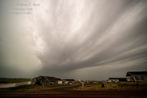
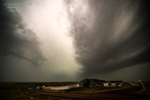
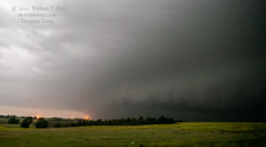
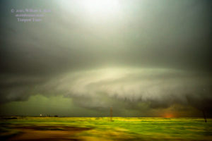
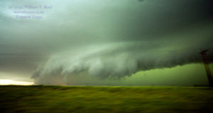
A little east of Watford City, we waited for a severe storm to approach from the SSW. The earlier activity had thrown a tremendous anvil over the region. And, with dew points into the 70s, the air was heavy and a bit murky. Some lightning picked up nearby, but I couldn’t really see what this severe-warned storm (with a funnel cloud report) was doing. We headed east on 23 and 73 all of the way to Highway 22. To our south we finally had a look at a decent storm base, a lowering…hmmm…a wall cloud…but it wasn’t looking really well organized to me. We were against the river now, and had to go north and east (to New Town) to get across and to stay ahead of this activity. It looked rather poorly organized so far, both on radar and visually. Here are some pics from this part along 23 from Schafer to Johnsons City (east of Watford City).
We were at the mercy of the river and the lousy road network now, as expected. One optional “play” today would have been to hang out along the river, be patient, and wait and wait and wait for that great warm-front storm to approach. A chaser with this plan would be much better able to position appropriately as the storm neared and crossed the river. As it was now, I could only head towards that one bridge — just west of New Town.
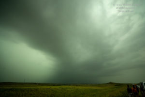
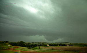
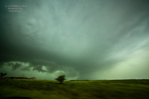
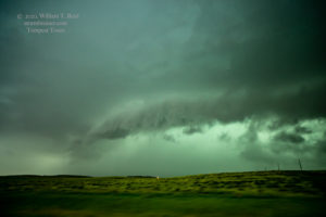
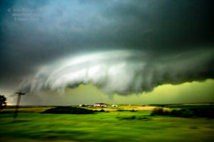
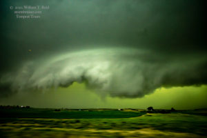
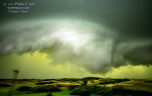
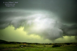
We got north on 22 and boogied east on 23. The river crossing was maybe 6 miles to our east. A much-better looking storm cell was now coming up to — you guessed it — the Missouri River at New Town. It was bearing down on us quickly. Rotation was strong! It was green! I had three options now. I could bail out back to the west. Or I could stop and watch and then get slammed by a wall of precipitation and who-knows-what lurked inside. Or, I could continue to the east and hope that we could clear any dangerous area in time. I chose that last option. We headed east, and watched as a very intriguing lowering in the green storm to our south surged towards our road. It did not look like an optimal time or place to stop and watch! I took a bunch of stills, looking south, while on the move.
The images above were taken during the span of about two minutes. Of course, I wish I had stopped at about the time of the last photo, as a suspicious funnel/maybe tornado looked to be in the works, back to our SW or WSW. It was quite dark, even though this was prior to sunset. My camera aperture was wide open at f2.8, the ISO at maybe 400, and still the shutter speed was a slow 1/20 or so. That is why these are rather blurry.
A tornado warning was issued, if I recall correctly. For our location. A big and wet RFD was surging northward, and it seemed best to get the heck out of the way to the east! But, could we make that Missouri River bridge before the RFD? It would not be very prudent to be on that bridge during destructive winds! Let’s Go!
Naturally, when we get to the area just before that bridge, we get stuck right behind a dumb slow-moving truck. Why is he going so slowly?! Come on! Well, the blast of rain and wind came through, and it was only medium bad. We made it across and through New Town. But, we were quite a ways out of position on this storm now, with nothing worthwhile to go after. We stopped east of New Town a bit and I called for rooms as our chase day was done!







Leave a Reply
You must be logged in to post a comment.