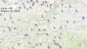
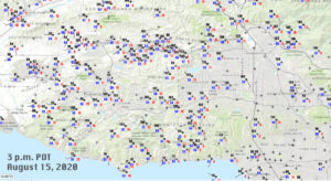
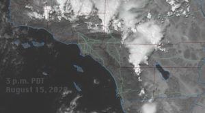
Temperatures soared in the local valleys today as onshore flow to the deserts was weak, the marine inversion was very shallow, and a hot upper high was dominating Southern California. The day was somewhat unusual as mid-level moisture provided a lot of altocumulus clouds during the morning to about noon. These moved out to the NNW, leaving lots of sunshine for the afternoon. (A line of high-based thunderstorms developed mid-morning from about Santa Rosa Island northward into Santa Barbara County, with plenty of lightning.) Otherwise, the day was rather normal for a hot summer day. A westerly sea breeze developed rather early through the Thousand Oaks and Agoura areas. The Cheeseboro RAWS station had a WSW breeze at 10 mph as early as 10:40 a.m., and this gradually increased thereafter to WSW 15 mph G19 mph at 12:40 p.m. But, this sea breeze brought zero relief as temperature here climbed from 102F at 10:38 a.m. to 108F at 1:38 p.m. PDT. My Westlake Village station reached a high temperature of 108F at 1 p.m. High temperatures reached 112F at Chatsworth and 111F at Woodland Hills/Pierce College an hour or two later as the sea breeze reached the western San Fernando Valley. The surface maps below are for 1 p.m. and 3 p.m., respectively.
I went on a little “heat chase” from Westlake Village eastward along the Ventura Freeway during the hottest part of the afternoon. Here are the (almost) minute-to-minute temperature observations, taken along the freeway in the slow lane, with a handheld digital Kestral thermometer. These instruments are very reliable and very sensitive, so the temperature tends to bounce around a lot as it updates every second or so. The readings here are generally averages taken over a 10-15 second timeframe as we passed by each freeway exit. For example, a reading of 112F generally meant that the instrument readings were ranging from about 111F to 113F or so for that observation.
AUGUST 15, 2020 TEMPERATURE READINGS
TIME/LOCATION ALONG U.S. 101/TEMP (F) (times are p.m., PDT)
Westlake Village
1:25/Westlake Blvd./105F
1:27/Lindero Can/107F
Agoura Hills
1:28/Reyes Adobe/108F
1:29/Kanan/110F
1:30/Chesebro/111F
1:31/Liberty Canyon/112F
1:32/Lost Hills/112F
Calabasas
1:33/Las Virgenes/112F
1:35/top of hill near Mureau/112F
1:35/Parkway Calabasas/112F
Woodland Hills
1:36/Valley Circle/113F
1:37/Fallbrook/115F
1:38/Shoup/116F
1:39/Topanga Canyon/114F
1:40/DeSoto/113F
1:41/Winnetka/112F
This change of temperature, reaching a maximum in Woodland Hills and then falling off a little towards the eastern end of Woodland Hills, was and is quite typical for this time of day in summer. However, I WAS a LITTLE surprised at the big jump up to 116F at Shoup. My Kestral actually showed a little above 117F for a few seconds! This spot must have been where the sea breeze front was located. It is called the western San Fernando Valley convergence zone.
The hottest “axis” of temperature is along the sea breeze front. This is a convergence zone, where the westerly “sea breeze” bumps up against a (usually) weaker easterly (sea) breeze which emanates from the Cahuenga Pass area. The hottest parts of the San Fernando Valley on summer afternoons are wherever this “sea breeze front” is located between the hours of about 2:30 and 3:30 p.m. local time (PDT). Of course, this is “generally speaking” for most afternoons! The sea breeze usually does not make it as far east as Balboa Blvd. It usually stalls out around mid-afternoon between about Shoup Avenue and Tampa Avenue, so that the hottest localities in the San Fernando Valley, on most summer days, are those between Shoup and Tampa, in the western San Fernando Valley — Woodland Hills and Tarzana on the south, Chatsworth and western part of Northridge on the north, and West Hills, Winnetka, and the western part of Reseda in the middle.
The Conejo Valley area (Thousand Oaks/Westlake Village/Agoura) typically sees the westerly sea breeze develop close to noon. So while temperature tends to continue upward in the western San Fernando Valley from noon to 2 or 3 p.m. (prior to the arrival of the westerly sea breeze), temperature tends to level off for the remainder of the afternoon in the Conejo Valley once the westerly sea breeze has moved through.
So, that is your little local weather and climate lesson for the day.
On the way back to the west this day, I took Victory Blvd. westward from Winnetka. The temperature along Victory was generally a little lower compared to the freeway, in large part because the difference in nearby ground cover. Along Victory, grass and trees are much more prevalent. Compare that to the wide and hot asphalt swath environment along the freeway. The greener suburbia environment along Victory was generally a couple of degrees cooler than the freeway. Temperatures along Victory were about 109-111F from Mason to Fallbrook, and then it jumped up to 110-112F for the most part from Fallbrook to Valley Circle (around 2 p.m.). This was about the same time that the official NWS stations in Chatsworth and Woodland Hills (Pierce College) were hitting highs of 112F and 111F, respectively. Along Valley Circle, on the western edge of Woodland Hills, it continued at 110 to 112F. After a McDonalds stop, I measured 112F to 113F in Calabasas, 109F at Las Virgenes and Kanan along the Ventura Freeway, and back down to 106F at Lindero and 103F at Westlake at 2:30 p.m. The weak sea breeze was working to bring the temperature down nicely in Thousand Oaks already.
The high of 108F in Westlake Village is about as high as I have measured here in the past 20 years or so. I will have to double check! But, anything close to 110F in the Thousand Oaks area is fairly unusual. Long-term reliable temperature records in this area are scarce, but annual high temperature values here tend to run some 3-6 degrees lower than those in the western San Fernando Valley. Agoura Hills high temperatures tend to be somewhere in between those in the Thousand Oaks area and Woodland Hills, unsurprisingly, on these hot days with a “normal” sea breeze. On hot days with Santa Ana winds, the high temperature pattern is usually a bit different, but again the western San Fernando Valley tends to be a little warmer than the Thousand Oaks area.
The highs of 111F and 112F today in the western San Fernando Valley are about what one would expect every few years or so on the hottest day of the year. (Update: Woodland Hills also made it to 112F, with a late afternoon push!) All-time record highs are 114F at Chatsworth and 116F at Pierce College in Woodland Hills. Yes, the Pierce station had an official high of 119F about 14 years ago, but that reading is about 2-3 degrees too high as the station was using a “bad” radiation shield for a couple of years around that time. I was at the Pierce station when the 119F occurred, and I was measuring 116-117F with my handheld psychrometer around the weather station area. We changed the radiation shield a few months later (back to the MMTS shield that was not being used at the time) and immediately the high temperatures on sunny days came down about 3 degrees (F) compared to surrounding stations. UGH. I would say that the high temperature for Pierce College on that date with the 119F should be reduced to 116F, which ties a previous maximum there of 116F. Authentic high temperatures of 114F to 116F in Woodland Hills occur about one or twice every 25 years or thereabouts. Today’s 112F at Chatsworth was quite impressive, and only a couple of degrees off of its all-time high. Woodland Hills tends to be a degree or two hotter than Chatsworth, on average! That explanation will have to wait for another blog post.


Leave a Reply
You must be logged in to post a comment.