Chase video of this event by Tempest Tours guide Bob Conzemius
Video of Lockett tornado by Tempest Tours guide Matt Phelps
Dashcam 10X timelapse video of the chase during the tornadic phases by Bob Conzemius
Start: Clinton, OK
Lunch: Mangum, OK/Holy Grill Cafe
End: Wichita Falls, TX
329 miles
SPC Mesoscale Discussion 406 SPC Mesoscale Discussion 408
SPC Mesoscale Discussion 409 SPC Mesoscale Discussion 410
SPC Mesoscale Discussion 412 SPC Mesoscale Discussion 413
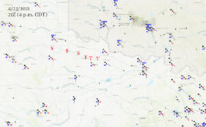
21Z Surface Map and approximate path of the supercell and the tornado locations.
Wow — Wow — Wow!
Our 2021 Tempest Tours season began on April 22 out of OKC. The first day for Tour 1 (with guides Bob Conzemius and Matt Phelps) was drab and cool, but a severe risk developed over northwest Texas on the second day out. SPC painted an enhanced risk along the Red River from about Quanah to Wichita Falls, with a 5 percent tornado risk. SPC was highlighting the risk for very large hail, more than 3 inches in diameter, courtesy of an (anticipated) intense supercell or two. Overall (bulk) shear was excellent, and the low-level shear was not particularly strong. However, there was an east-west boundary just south of the Red River which could and would be a very favorable feature for increasing tornado potential. The forecast target area was looking rather uncomplicated — get on a dry line storm in the vicinity of Childress and Paducah and stay with it as it moves east along that boundary (and into mid-60 dew points and backed surface winds). Storm chasing and forecasting is so easy, right?!
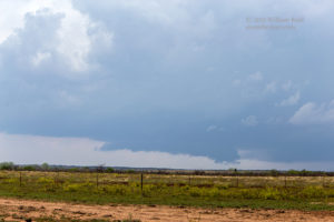
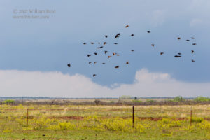
We lunched at the Rattlesnake Festival in Mangum, OK. Skies were overcast and drizzly at Mangum, and we broke out into the better air with clearing not too far south of the Red River, around Quanah. And, right on schedule, an agitated area of cumulus clouds…or, an area of agitated cumulus clouds…was in the vicinity of Paducah, not too far to our southwest. We took Road 104 west and then southwest to Paducah. Upon arrival, a good-sized storm was a bit northwest of town. There may have been a second updraft south of this one, but who can remember all of these details six months later?! The best way to play this was to stay ahead (east) of the activity and to see which storm might become dominant. Fairly quickly it became obvious that this one northwest of Paducah was the storm to monitor most closely.
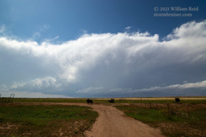
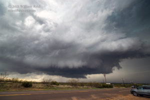
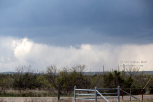
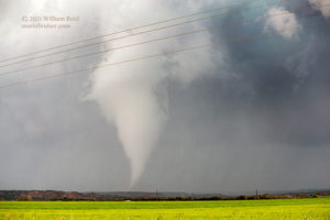
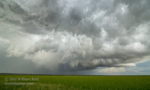
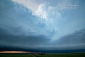
That second image above is a bit out of sequence, and should be the last one. It was taken west of Quanah and looking SSW.
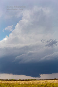
It would not do us much good to head north on 83 out of Paducah. The storm was moving east, it would soon be along 83, and then east of 83, and then we would be playing catch-up without a handy east option in this rather poor road network. Playing catch-up to storms is never advised. We went back northeast on 104 and had a good (though somewhat distant) view of the updraft base. Road 104 took us northeast of the storm’s forward flank precipitation area as a wall cloud developed to our southwest. Should I have taken U.S. 70 out of Paducah? It was kind of looking that way. This storm seemed to prefer the uninhabited and roadless area along the Pease River in Hardeman County.
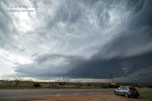
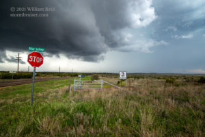
The base of this storm was quite low, the radar presentation looked great, and now we were getting rained on. We were not in especially good position. I had Matt and Bob scoot us quickly eastward into Quanah and then south on 6 towards Crowell. This would put us pretty much due east of the storm, which was now a high-end supercell! There was a good number of chasers waiting along this road for the storm, and I recall heading south and looking for that perfect viewpoint. There were some low hills and trees, and the first few high points either had too many chasers or just didn’t seem that good. We wound up stopping along Star Valley Road, about halfway between Quanah and Crowell and about two miles north of the Pease River.
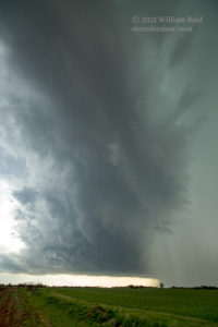
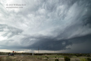
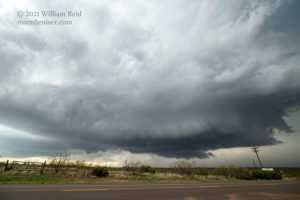
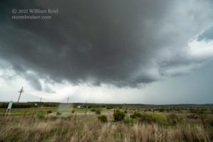
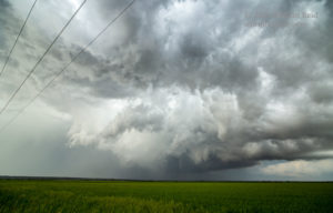
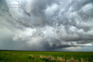
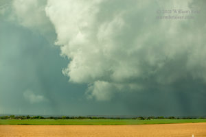
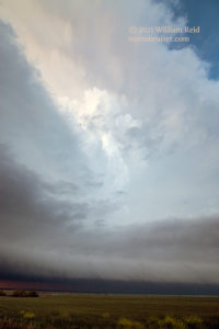
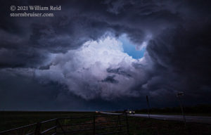
The images above show the low-level structure as the supercell approached from the west. It looked like the action area (RFD area and associated tornado potential) would go just to our north, but quickly the low clouds above were swirling around quite vigorously. We might need to move quickly…we might not want to be here…the RFD was coming at us.
Well, we hung in there at this intersection for another minute or two, and then the hail came down. Some stones were a bit larger than one inch in diameter, so it was time to get ourselves south and reposition on this thing. While directly beneath the action area, it was a bit difficult to determine exactly what was happening, but it certainly did seem that a tornado might be in the works nearby. I did not observe a “for sure” funnel cloud from this location.
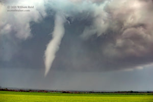
Shortly after jumping back southbound on 6, we came to a slow crawl (as opposed to a fast crawl) as the road was clogged with chaser traffic. Dang! Occasional hail was impacting the right side of the vans, too, and I was concerned that the stones might get a lot bigger. Fortunately, we started to move again. A mile or two later (just south of the Pease River, near e-w Road 248), with plenty of chasers stopped along the road and intently looking to the NNE, we ourselves looked back. Tornado! We stopped.
This tornado must have formed very shortly after we left our previous viewing location at Star Valley Road, and it must have formed not too far to the east of there. It moved east into the rather empty areas just north of the Pease River in southeastern Hardeman County, roughly between Margaret and Medicine Mound. The tornado likely lasted 7 minutes or thereabouts, roping out perhaps 4-5 miles to our northeast. The storm continued to the east and we had to stay close. We will call this “Tornado #1.” It was in Hardeman County, starting about 11 miles south of Quanah, and occurred around the timeframe 2243Z to 2250Z (5:43 to 5:50 p.m. CDT).
Fortunately, the road network improved quite a bit on the south side of the river. Bob’s dashcam video (linked above) shows that we took an unpaved road to the east first (CR 246), and 3.5 miles later a jog south a mile to paved road FM 3103. A minute later we were in Margaret and then eastbound on FM 98, just south of the Pease River.
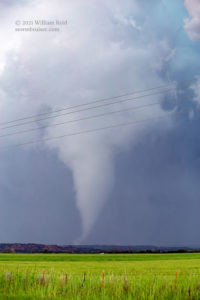
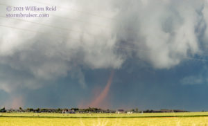
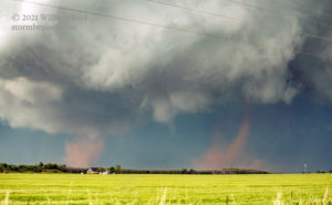
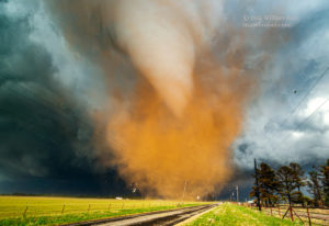
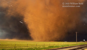
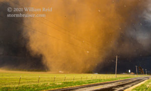
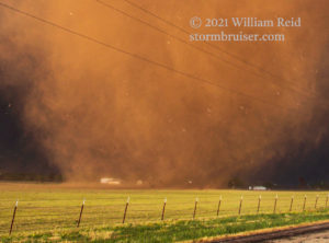
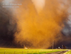
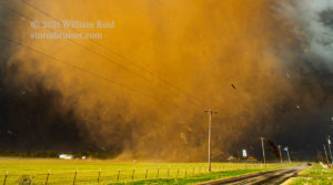
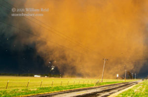
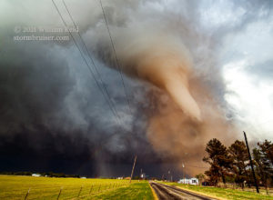
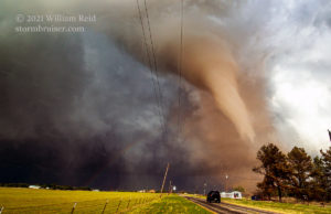
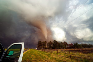
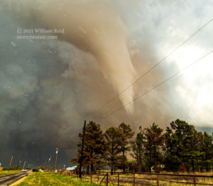
FM 98 worked out quite nicely and allowed us to get close to the action area once again. There is a jog along FM 98 about five miles east of Margaret. Thereafter, 98 heads ENE-ward to Rayland, another five miles distant. It was along this stretch west of Rayland where we observed the prominent wall cloud and a couple of weak and dusty tornadoes (#2 and #3) in progress simultaneously (first four images below). These were to our NNE or NE. My camera time stamp has these two dusty tornadoes (Tornadoes #2 and #3) occurring about 20 minutes after the end of Tornado #1. The NWS Storm Reports indicates a tornado 5 miles NNW of Rayland at 6:08 p.m. CDT, and that appears to be accurate for the start of the #2/#3/#4 tornado triad.
My images of the twin dusty tornadoes (i.e., there was little or no condensation funnel with these) were taken while we were in motion. Unfortunately, they were just off to the left of the frame in Bob’s dashcam video. At the time, I was still intent to catch back up to this action area, or even get back in front of it a little. Chasers on the east and northeast side of the updraft had a good look at these twin tornadoes with high contrast. The contrast for us (southwest of the tornadoes) was poor, so I was not inclined to stop. There are plenty of good videos of these tornadoes online and on YouTube. Here is one link from a local TV station which provides a good look at the “dusty” ones with high contrast. (The same link later provides excellent clips of the tornadoes near Lockett, with some radar information, too.)
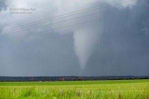
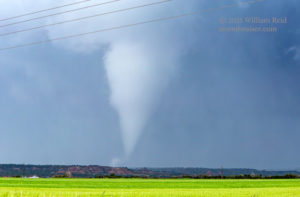
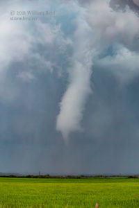
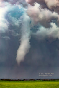
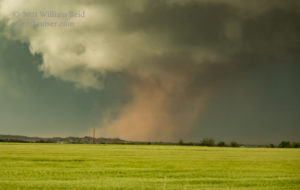
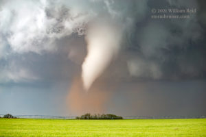
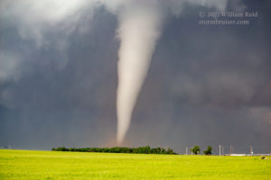
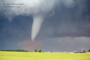
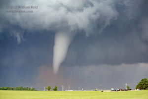
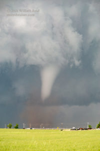
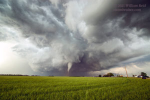
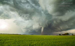
We cruised into Rayland shortly after the photographs of the twin tornadoes were taken. After another mile ENE and yet another jog one mile to the SSE, we had U.S. 70 at our disposal. However, another stop was required as the second very photogenic tornado of the day was now in progress! We stopped on the curve from FM 98 to U.S. 70, approximately 1.5 miles ESE of Rayland. This white tornado comes nicely into view on Bob’s time-lapse dashcam video at timestamp 4:40. Our stop at this location was just a few minutes after the twin dusty tornadoes. The white Tornado #4 developed out of the same part of the storm, around 6:15 p.m. CDT. It persisted for about five minutes, and from a meteorological perspective it was basically a continuation of weak Tornadoes #2/#3.
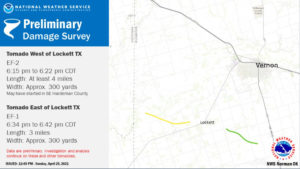
The first nine images above were with the zoom lens (70-200mm), and the final two were with the 15mm wide-angle lens. The views are generally to the NNE and NE. This tornado was fairly similar to the first one in terms of looks and longevity. The NWS survey shows a timeframe from 6:15 to 6:22 p.m. CDT for this one (our Tornado #4). It was rated EF2, starting near the Hardeman/Wilbarger county line (the dusty-twin tornado phase) and then moving eastward. If it had lasted a little longer then it would have impacted Lockett. See the yellow track courtesy of the NWS image below. Again, Tornadoes #2, #3 and #4 were basically from the same wall cloud or action area.
Tornado #4 (the first Lockett tornado) dissipated some four miles or so to our ENE. We were back quickly into the vans, and I had Matt and Bob continue to the ENE on U.S. 70. We were about five miles WSW of Lockett. It looked to me like the action area and the most dangerous part of the storm was perhaps a few miles to our northeast, maybe (or hopefully) just north of Lockett. I was examining the maps and our road options. I REALLY wanted to get farther east in fast fashion. I did not want to continue playing catch-up, if possible. Now, the storm was NOT generating a tornado, seemingly. Our road, U.S. 70, was taking us to the ENE, right up towards the nitty-gritty, right up beneath the updraft base and action area. Another look at the map —- we could continue ENE past Lockett a couple of miles (leaving U.S. 70, which diverted northeastward towards Vernon and into the very big hail, or worse!). From there, we could zig-zag south and east quickly on FM 433 to U.S. 183/283, a good highway which could get us quickly SSE if necessary. It was not the safest of plans, but there was no tornado for the moment. We could easily see what was going on with good visibility all around. Let’s make the mad dash into and out of Lockett and try to get into a better position, perhaps just southeast of this supercell…well…that was what I was thinking!
That brilliant plan of action was cut short fairly quickly.
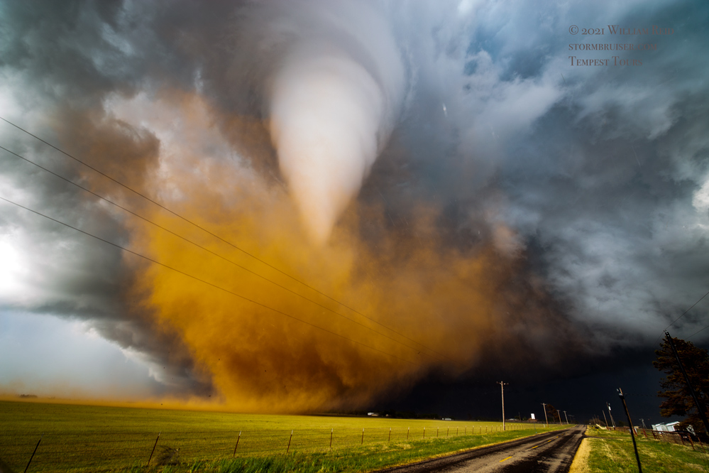
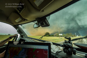
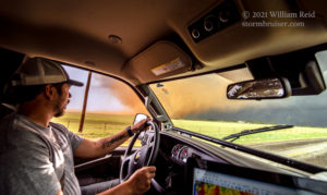
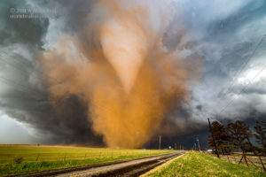
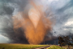
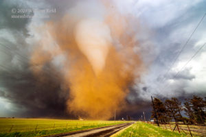
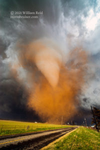
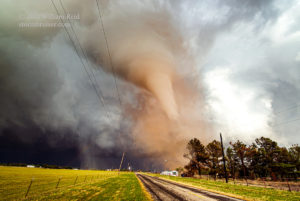
We stopped briefly halfway to Lockett as some rain curtains rotated left-to-right across 70. We then made our way through tiny Lockett in good time, and angled onto 433. FM 433 took us a mile ENE and then a mile SSE. The road was void of chasers, which seemed a little weird. Maybe it was more disconcerting than it was weird. Anyway, the get-ahead-of-this-thing plan was looking okay as nothing much looked to be going on. Bob was driving the trailing van, and in his video, linked above, he announces to his group that a tornado does not appear to be imminent! (Go to minute 3:00 in his “tornado” video link.) A few seconds or so later Matt and I, in the lead van, observe a dusty plume moving quickly from right to left, right in front of us…less than 50 yards ahead of us. I initially think that this is some RFD wind gust or a gustnado, but seconds later we are watching a good-sized swirl of brown-reddish-orange dust in the bare and recently plowed field on our east side! A tornado is developing in the field right next to us! This was very close to FM433 and County Road 132 W, western Wilbarger County, two miles east of Lockett.
Now, that was a bit of a surprise. The moral of this story is to look up more than usual when right under the base of a tornadic supercell.
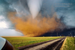
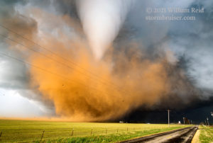
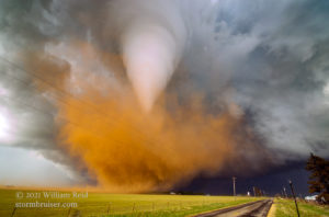
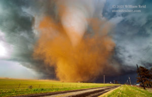
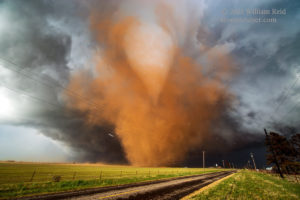
As luck would have it FM 433 turned back to the ENE less than a half mile ahead. This was ideal! This big dusty vortex was no more than a quarter mile to our northeast, and it would be crossing this road, just ahead of us! I snapped a couple of wide-angle shots, one with Matt at the controls, and I told him to keep going. There was a line of annoying trees on the left to clear, and then STOP! I stepped out of the van and into the wind with the Canon 6D and 15mm Zeiss combo.
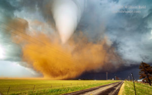
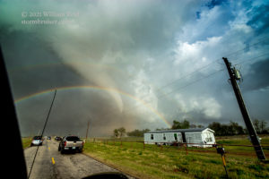
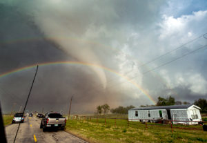
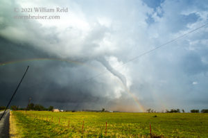
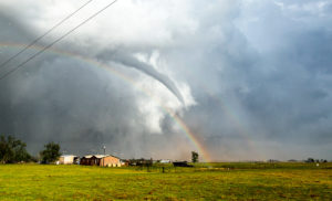
Yikes, a giant white funnel cloud was sticking down, right into the tornadic dust swirl! Was this really happening?! We were safe, as the tornado was moving to the east or ESE, away from us. On the north side of 433 the tornado approached a farmhouse and other farm structures. It spared the farmhouse, destroyed a farm building or two, and knocked over a tree and some utility poles along 433. This was just four or five utility poles down the road! Matt stayed inside the van for these intense few seconds and shot video with his phone — check out the link to his video above.
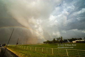
I was intent on getting some quality stills. I generally don’t hold the shutter button down and reel off a half dozen stills in a second, and I can’t recall if I did that or not, but I WAS taking pictures fairly quickly! I took eleven images while the tornado was north of the highway, and all of them are provided above. About the first half of these were horribly over-exposed, by at least 2 f-stops. Somehow, Photoshop was able to fix, manage and salvage the overexposed RAW images. The remaining images were exposed properly. If I recall correctly, the over-exposed images were around f6.3 at 1/160 sec ISO 160, and the correctly exposed images were at f6.3, 1/1000 sec and ISO 160. Thank goodness the focus was okay on these. After shooting these, I tried some video with the Canon 6D. As usual when I try to do tornado video with the camera, it winds up annoyingly shaky. Maybe I will share it here eventually. It is only about 10 seconds worth…I wanted more stills!
But before those, here are cropped images from the batch above to illustrate some flying debris in the vicinity of the farmhouse.
I am usually nowhere near this close to a tornado with the tour group, but this one kind of fell into our laps and we found ourselves in a perfect spot!
Shorty after the attempt in video mode, I ran across the road and snapped a bunch more photographs. The tornado was now on the south side of FM 433. A line of trees was in the way, so we drove just beyond the damaged farmhouse and around some downed power lines to get another good look. Bob’s dashcam timelapse video shows our navigation around the downed utility poles and wires.
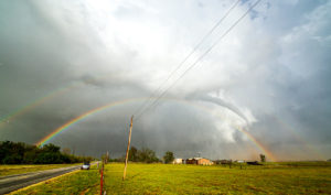
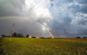
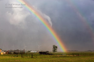
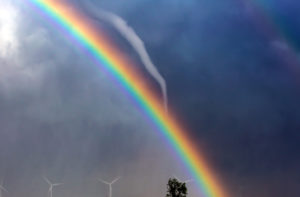
A double rainbow was now showing itself alongside the tornado. This doesn’t happen very often! Take more pictures, Bill!
The images above were all with the wide-angle lens. Below are a couple more with the long lens.
The “Lockett” tornado continued beyond the wind farm and roped out eventually. Apparently the only damage by it was to the buildings near the nearby farmhouse. No one was hurt.
We collected ourselves a bit. The previous 7-8 minutes were something else! The NWS has this second Lockett tornado (our Tornado #5) from 6:34 to 6:42 p.m. CDT. The rating is EF1.
The supercell continued to the east, towards Harrold and Elektra. It was starting to become a little less organized, though, and its stretch of tornado-making had ended. I no longer felt a need to get ahead of this storm. Some weak convection south and southeast of our tornadic supercell was likely responsible for its significant weakening phase post-Lockett.
I don’t recall where we went following the Lockett tornado, or where the photos below were shot. Does it matter?! This was somewhere SW of Wichita Falls and east of Lockett.
Here is a quick summary of the day’s tornado events:
Tornado #1, about 5:43 to 5:50 p.m. CDT, about 4-5 miles NW to N of Margaret, TX (in Hardeman County, just east of Highway 6 and just north of Pease River)
Tornado Triad #2, #3 and #4 (two simultaneous dusty spin-ups quickly followed by another good-sized tornado, aka Lockett Tornado #1), about 6:08 to 6:22 p.m. CDT, from about 4-5 miles NNW of Rayland to about 4-5 miles ENE of Rayland, ending just a mile or so west of Lockett (starting in Hardeman County and then quickly crossing into Wilbarger County, along the Pease River and then south and east of the Pease River above farmland). Rated EF2.
Tornado #5, about 6:34 to 6:42 p.m. CDT, from about 2 miles east of Lockett to 6 miles ESE of Lockett, Wilbarger County. Aka Lockett Tornado #2, rated EF1.
Additional chase video of this event:

ecmemphis says
This is Storm Chasing at its best…I am so envious because I have never seen one except here is MS:) Nevertheless, I am happy for the Tour. May every Tour group see one. Also, I am thankful not to be picnicking at the Rattlesnake roundup. My toes just curl up thinking about it.