Start: Woodward, OK/Lunch: Kinsley KS, Romano’s Pizza/End: Park City, KS/538 miles
SPC Mesoscale Discussion 561 SPC Mesoscale Discussion 563
SPC Mesoscale Discussion 564 SPC Mesoscale Discussion 565
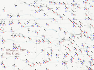
21Z/4 p.m. CDT surface map
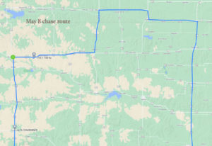
Chase route into and out of southern Nebraska
Time-lapse “green bucket” van roof-cam video by Chris Gullikson
The final chase day of Tour 2 was blessed with a 5 percent tornado risk and a 30 percent hatched hail area by SPC! These swaths were generally along and north of I-70 in north-central Kansas to the Nebraska border, in the vicinity of a triple point (out west near Wakeeny and Hays) and eastward along a warm front. Dew points were in the upper 50s to near 60F…not fabulous for tornadoes, but quite a bit better than what we had been working with for a while. Lunch was near the center of Kansas in Kinsley, and I directed Chris and Bill northward towards I-70 at Hays. Development here in the Hays area looked like a sure bet in the next few hours. But, I was intrigued by another play to our northeast, near the KS/NE border. This latter area had much better backed winds (compared to southerly at Hays), and slightly better (lower) temp/dew point spreads. And, it was near the warm front. I suspect that some CAMs (convective-allowing models) helped me to decide on this day, but I can’t recall! I blew off the triple-point play and continued north to Phillipsburg. By this time a storm was developing to our NE, maybe a county distant, in the vicinity of Red Cloud, Nebraska. I was a little worried that it might zoom off to the east a little too quickly and that we would have problems catching up.
We gunned it east to Lebanon and then north on 281 to Red Cloud. The timing worked out perfectly, as we came right up to the storm base of this new supercell!
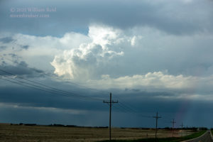
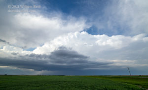
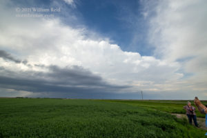
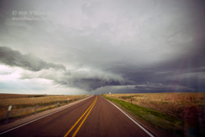
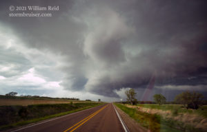
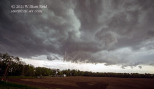
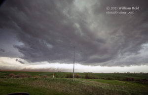
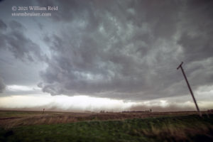
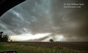
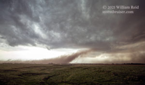
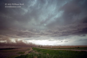
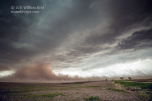
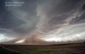
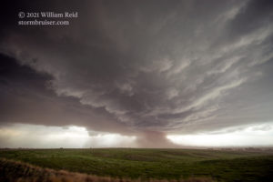
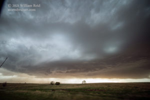
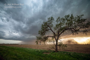
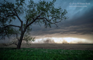
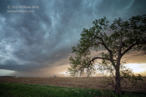
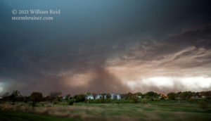
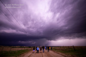
There was a problem, though — Red Cloud and our next east option (U.S. 136) were just a SMIDGEN too far north for comfort. As we neared Red Cloud within a mile or so, the action area of the base was just to our east (first 3 images below). I had to fret about the possibility of hail, maybe large hail, were we to track this cell eastward on 136. The radar showed that big and nasty red core hugging the route. We turned right in the middle of Red Cloud.
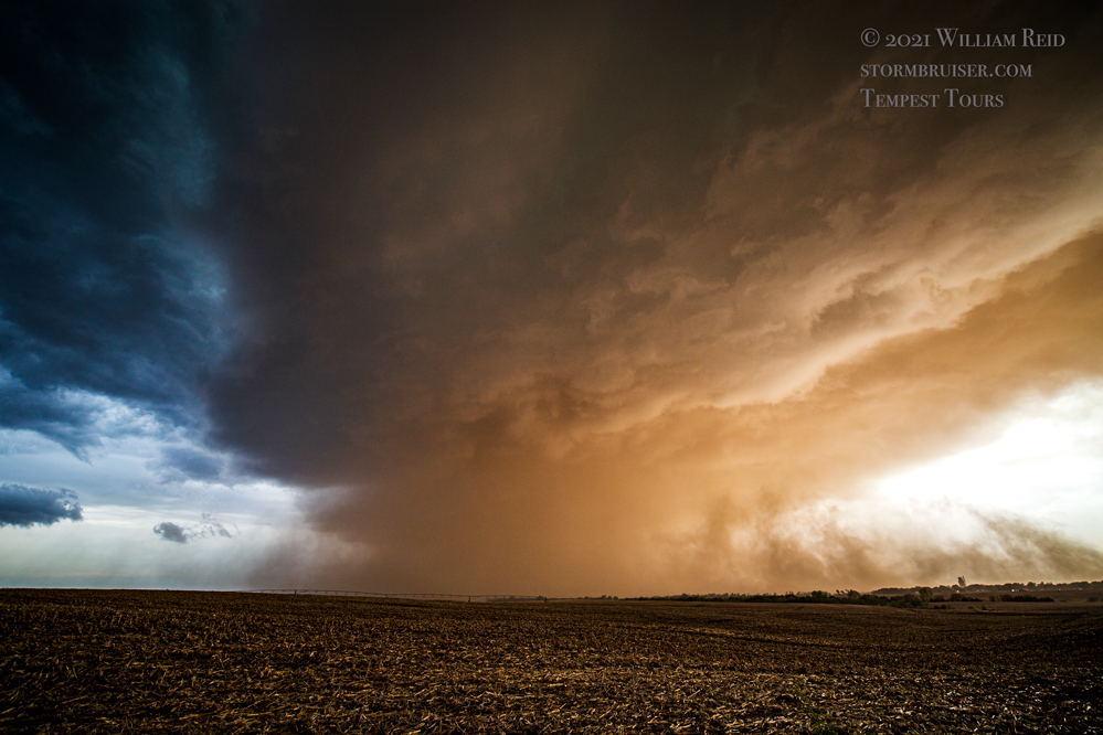
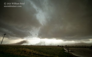
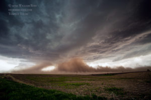
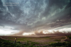
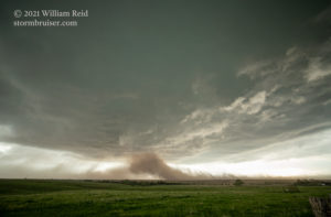
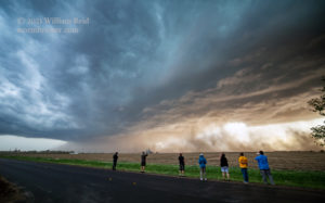
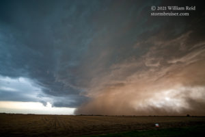
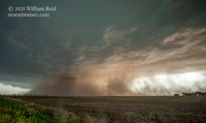
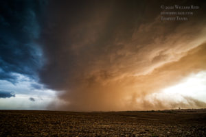
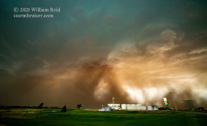
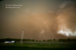
Well, our east option was not problematic with the hail. I do not recall much if any rain along it, either! Once we were a mile or two east of Red Cloud, we were afforded a ring-side and unobstructed seat to the shallow wall cloud and dusty inflow plumes into the storm base. The images above are views to the south for the most part between Red Cloud and Highway 14 (north of Superior). Though the surface inflow (from the north and southeast) looked great, and though dust was being sucked up into a fairly low storm base, it did not appear that low-level rotation was particularly strong. That was a bit surprising, given the storm’s proximity to the warm front (it was riding the front to the east, seemingly), and given the look on radar and the big-time “hook” appendage on the south end. The storm structure was a bit peculiar (visually) from our vantage point, and I think that the storm structure was a bit unlike a classic supercell morphology-wise. The base was a bit elongated, the rain and hail core appeared to be well separated from the south end of the updraft base, with this elongated “neck” connecting the two (connecting the base and the core) arching across U.S. 136.
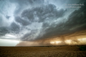
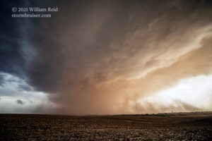
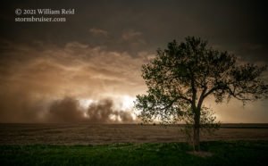
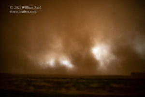
The images below were taken primarily between Superior and Byron, Nebraska. The supercell continued to suck in the dust, and the scenes were quite spectacular! It looked a lot more like a storm near Lubbock in early May, with all of the dirt and dust blowing off of the bare fields. U.S. 136 worked perfectly with the jog to the south near Superior. The storm base continued eastward, just to our south and southwest now.
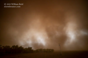
As we neared Chester, I had to decide whether to stay with this storm or not. From Red Cloud to this point near Chester, our surface winds had been primarily from the northeast, and somewhat cool. They did not seem to be conducive for tornado-making. The previous hour’s chase had shown that the storm was not too keen on even trying to make a tornado. (It’s best chance may have been in the vicinity of Red Cloud, when it sported a big and impressive wall cloud.) I think that the storm was a little too far north with respect to the warm front, and I think that the low-level air was just a bit too stable to aid in tornado-development. At Chester, with a wall of dirt and dust to our southwest, we dove south on U.S. 81.
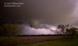
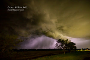
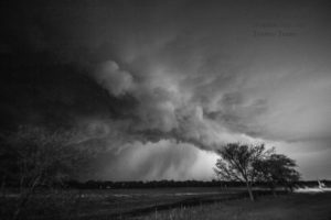
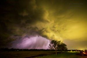
The images above show some structures in Chester and then the rising dust just to our west (south of Chester). Eventually, we were motoring through the dust and some fairly strong winds, but nothing too hazardous. The severe storm was not photogenic at all from the south side. I let it go, and we headed south towards Salina. Towards dusk and towards Salina, we had a decent lightning show going to our south and southwest. After a pit stop, we went a little southwest of Salina and came up on the east side of a tornado-warned storm. We had plenty of good looks in the lightning flashes, but did not observe a tornado (images below). The storm forced us to get out of the way, so we continued south to Park City for the night.
And, if you have yet to do so — click on that link above to the time-lapse YouTube video of this day’s chase by Chris. It is spectacular and rather unique, given the dusty inflow plumes and our vantage point looking south and southwest for the most part.

Leave a Reply
You must be logged in to post a comment.