
Begin: Oakley, KS/lunch: Farmhouse at Sharon Springs/End: Guymon, OK/480 miles
SPC Mesoscale Discussion 609 SPC Mesoscale Discussion 610
Time lapse video of the chase day by Chris Gullikson
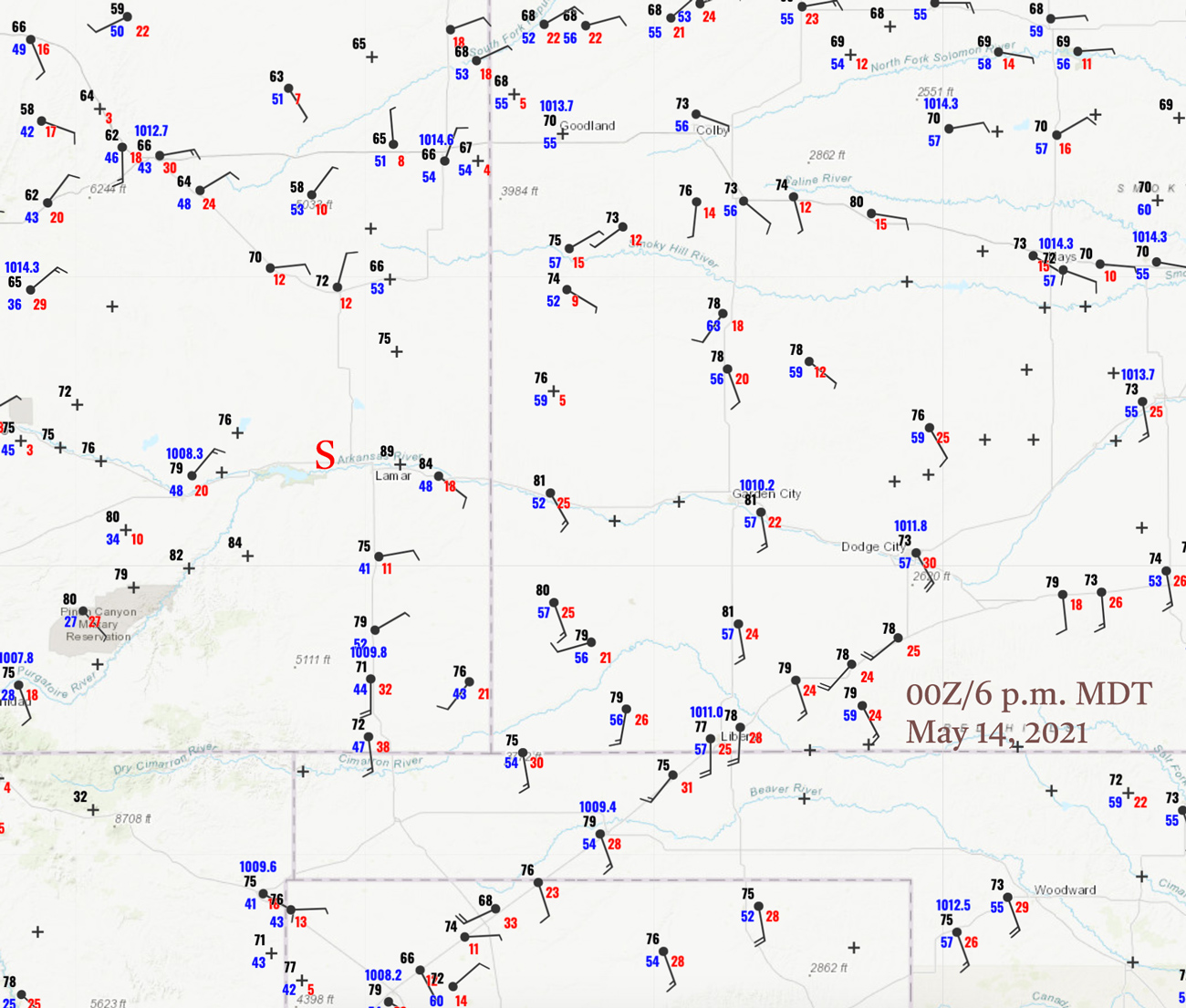
00Z/6 p.m. MDT surface map
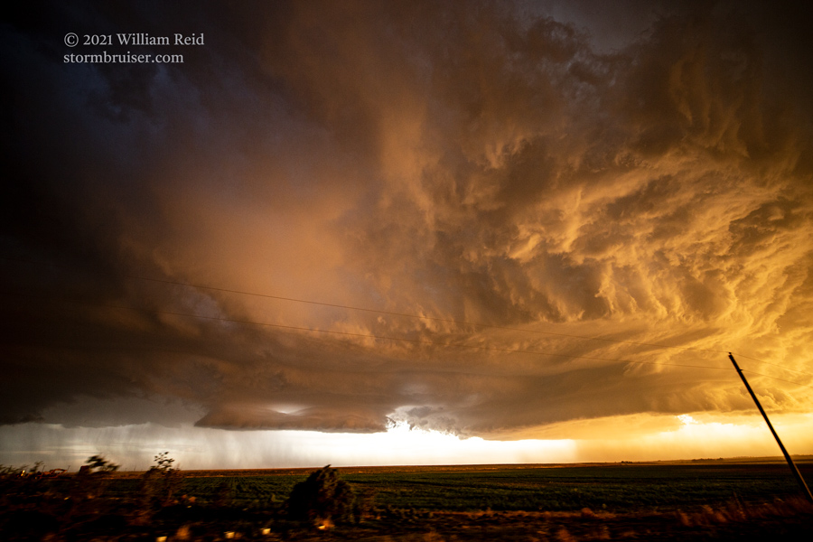
The red “S” marks the approximate location of the Hasty, CO, supercell
Our T3 group woke up in excellent position for today’s chase. We were in Oakley, KS, which was near the center of a hatched SPC oval designating a risk of very large hail. This coincided with a 2% tornado risk. Once again, tornado probabilities were low as low-level moisture was less-than-adequate. Upslope flow into Eastern Colorado was decent, with a surface low somewhere near Trinidad. By late afternoon, dew points were a little better up along I-70 in Eastern Colorado compared to those in southeastern Colorado. But, temperature, instability and wind direction looked a little better to me in southeastern Colorado. That was a ways outside of SPC’s favored area. Where would we wind up today?
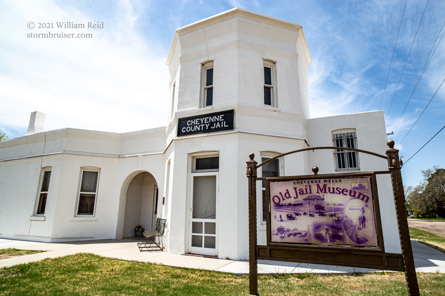
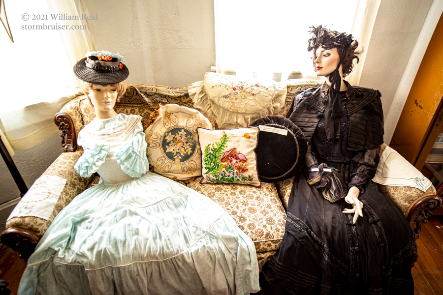
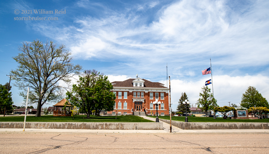
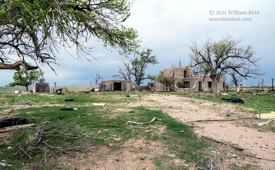
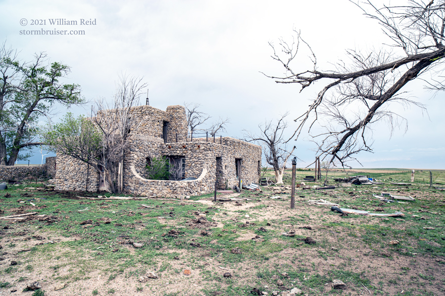
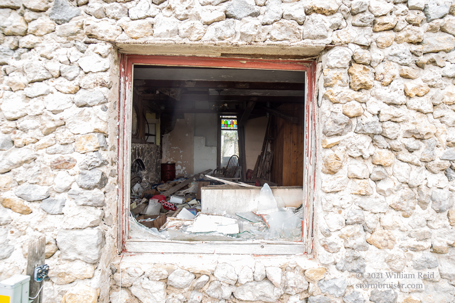
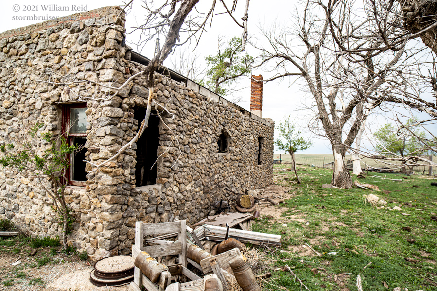
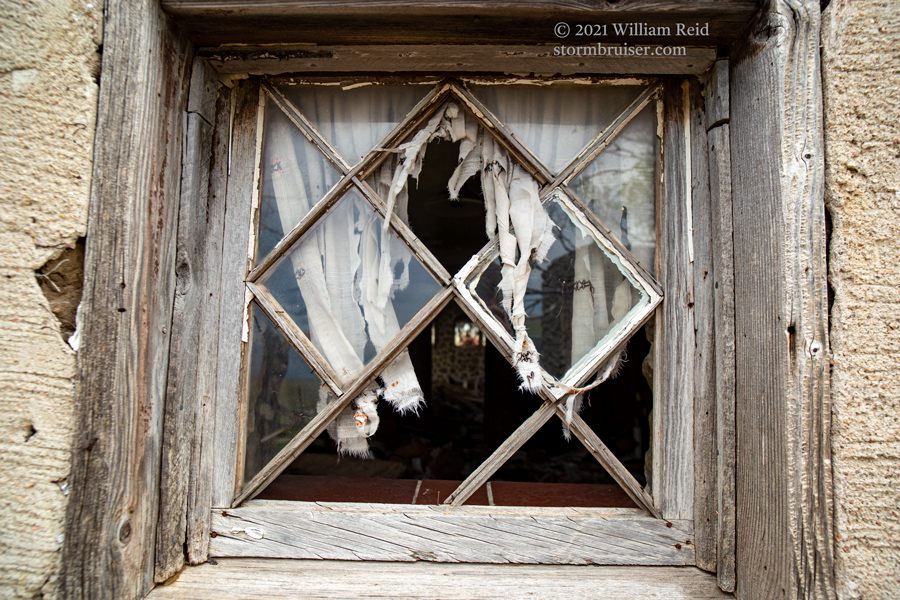
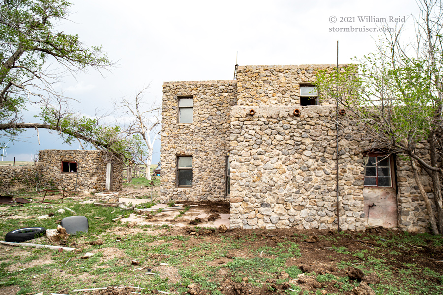
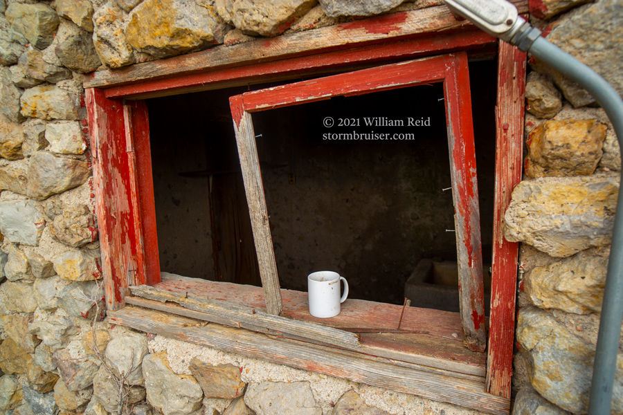
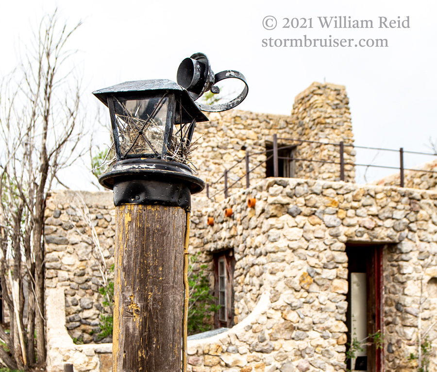
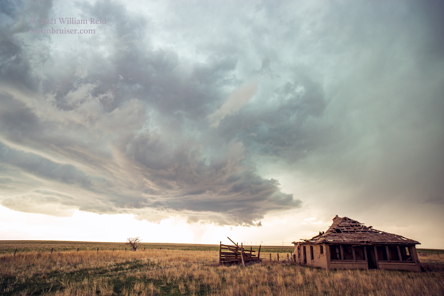
We spent some time at a jailhouse museum in Cheyenne Wells, Colorado. This area looked to be a good starting point. From here we drifted westward to Kit Carson. We ventured onto a side dirt road and found an abandoned house built out of stones — see pics below.

A storm soon went up to our northwest, and we headed up to I-70 at Seibert to check it out. The cell was rather high-based, but it showed more rotation as it headed to the southeast. Though it struggled to strengthen, it continued to rotate hard. Near Kit Carson, we had a nice LP updraft base! But, a weakening trend ensued. The prospects for SPC’s hatched area (primarily north and northeast of our current location) were not looking very good to me.
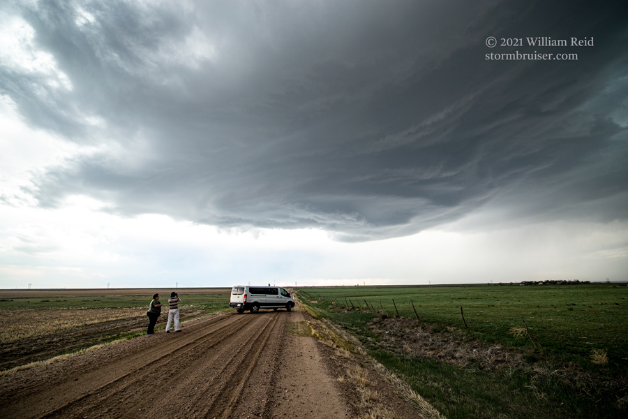
A check of radar and severe weather parameters showed some hope towards our south-southwest, where the air was warmer and where a surface circulation was evident. Still, moisture was rather lame, with dew points not even 50F. We are in Eastern Colorado, though…
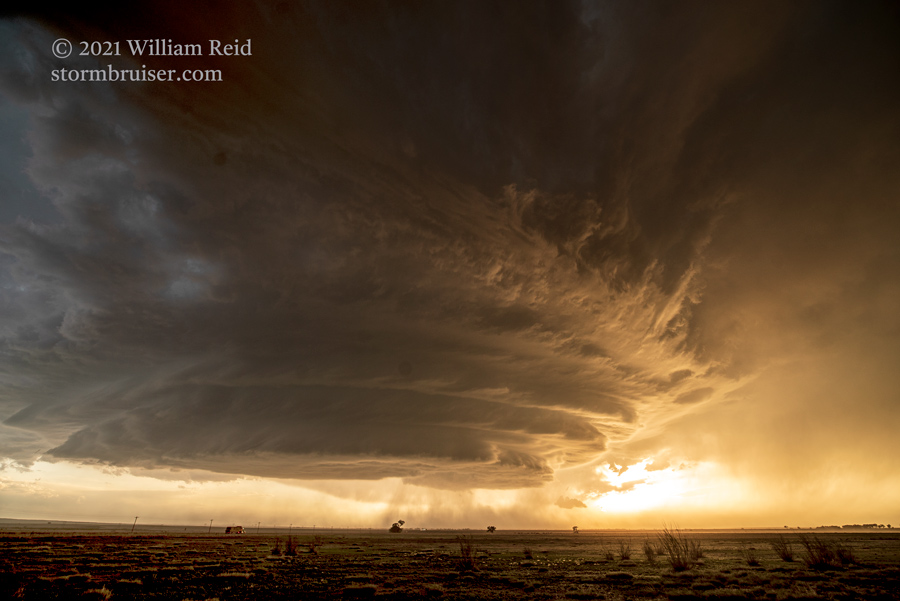
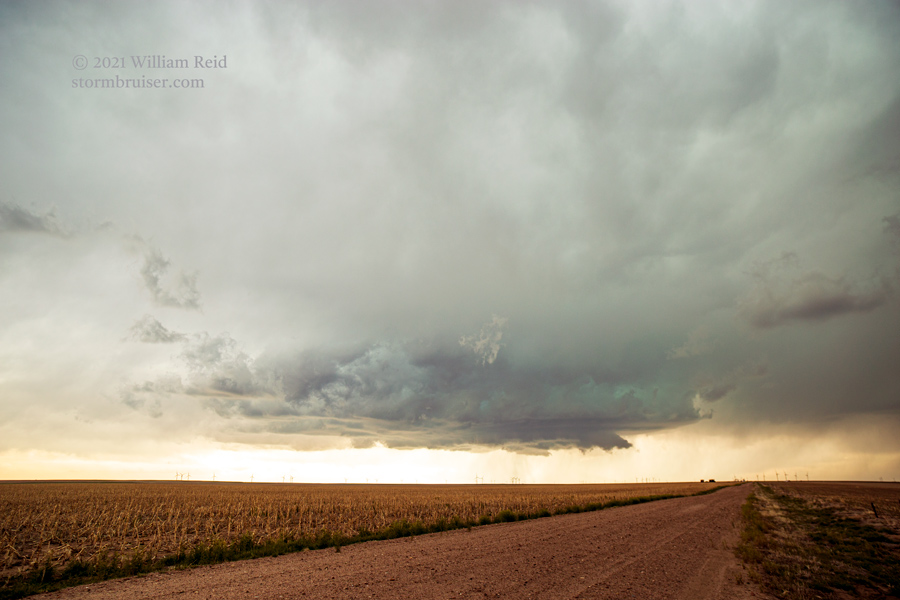
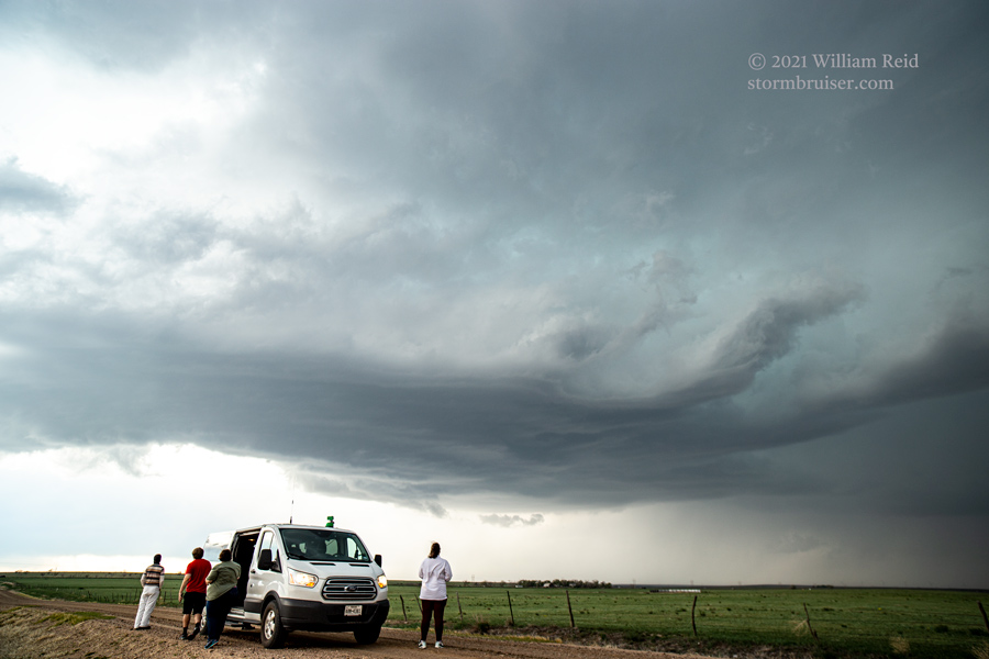
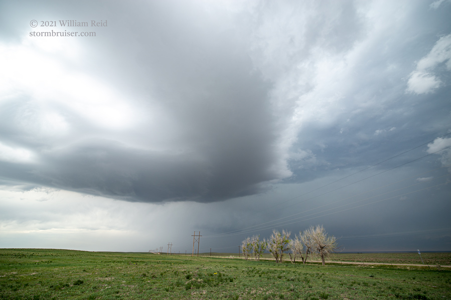
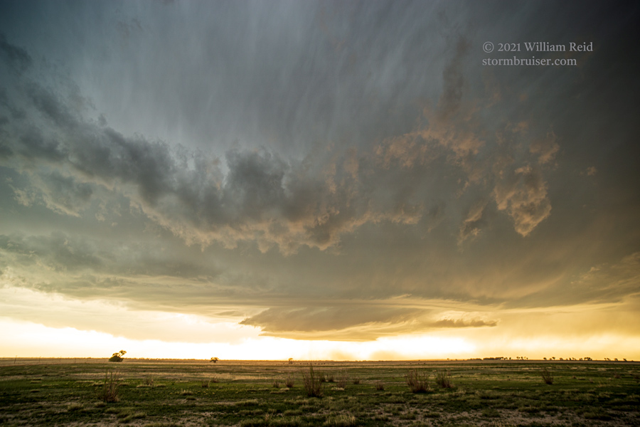
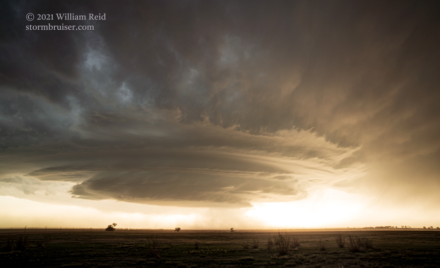
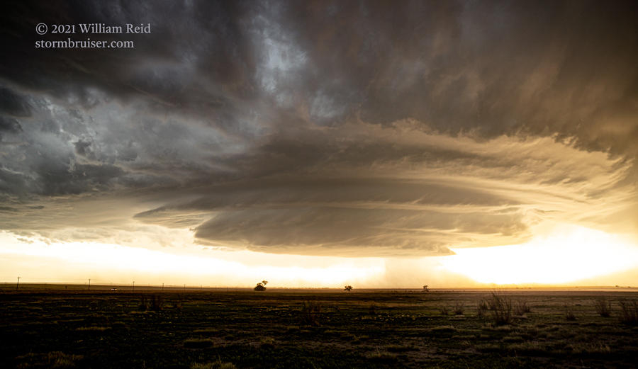
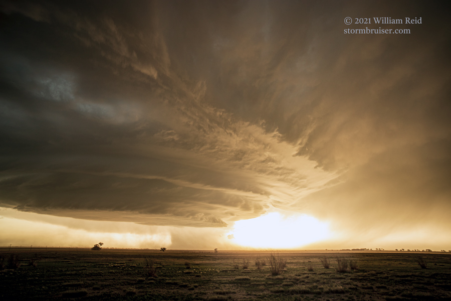
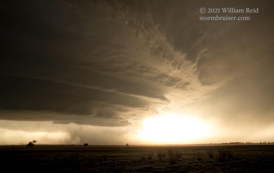
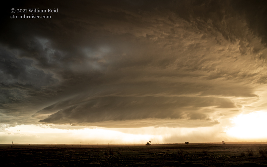
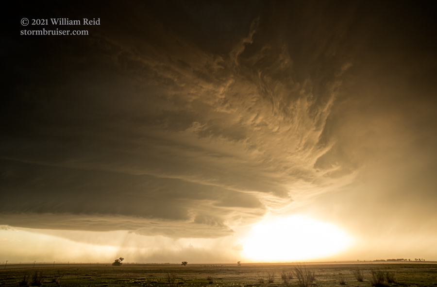
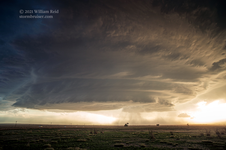
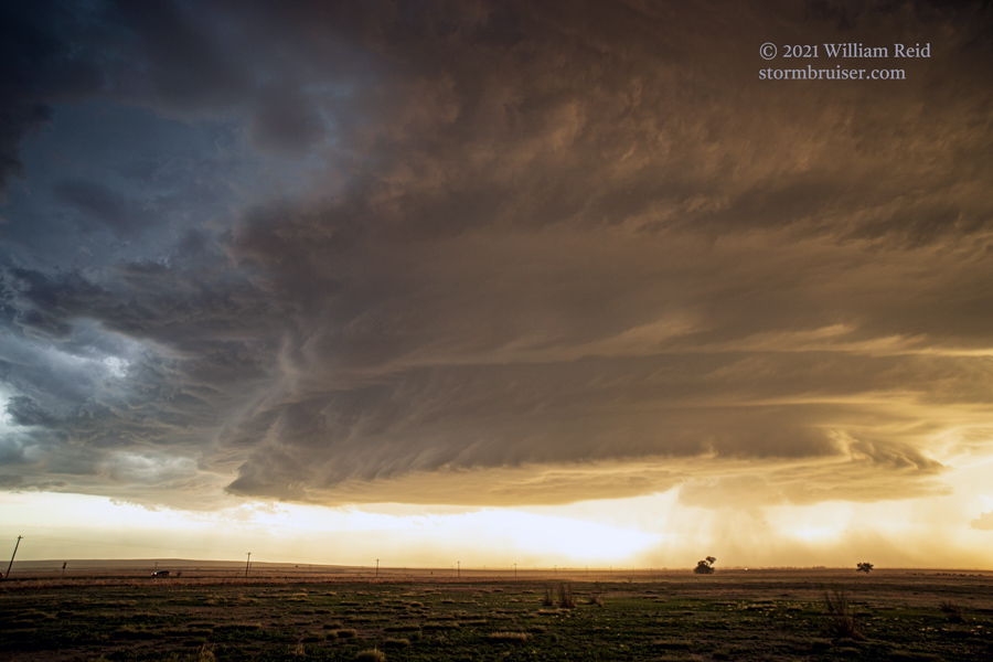
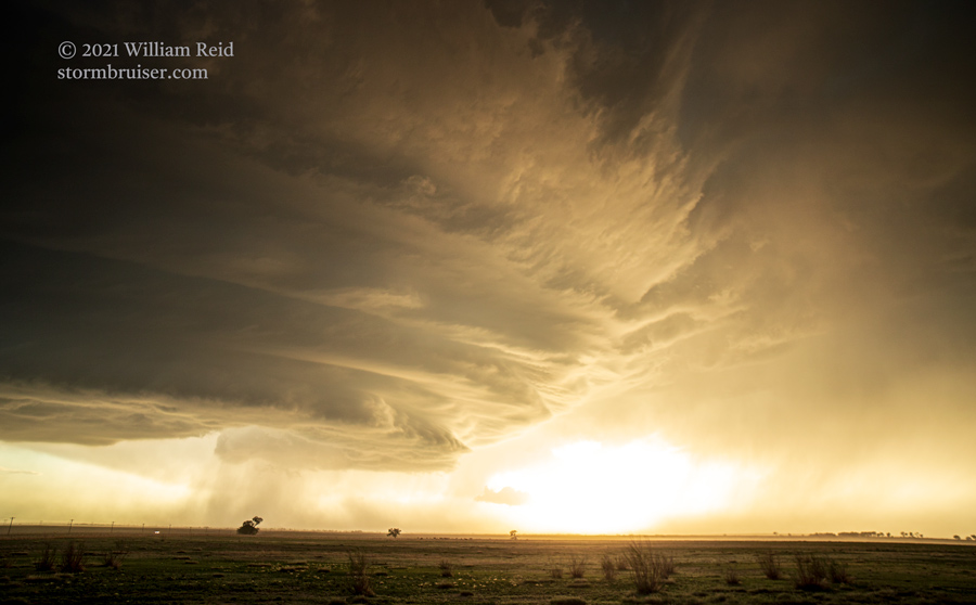
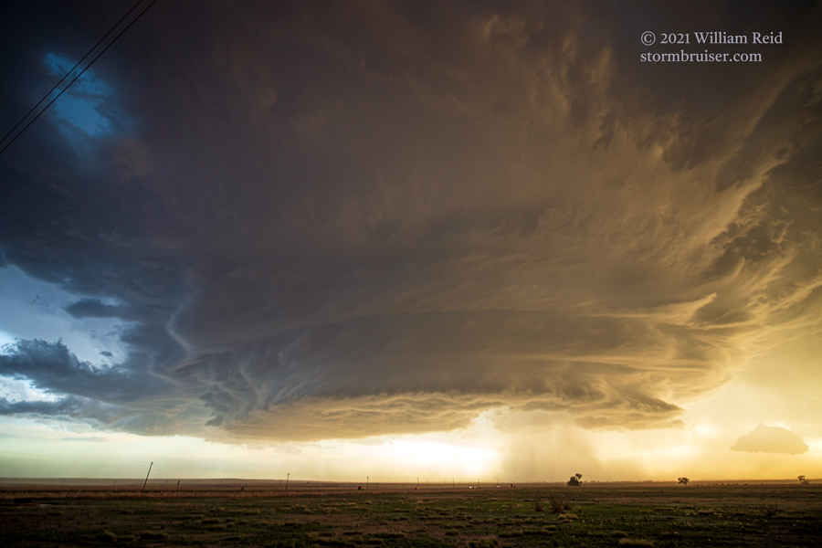
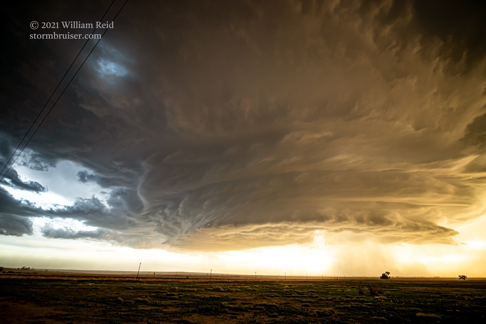
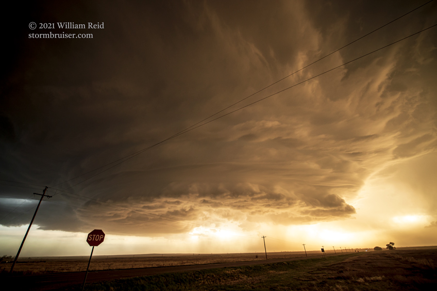
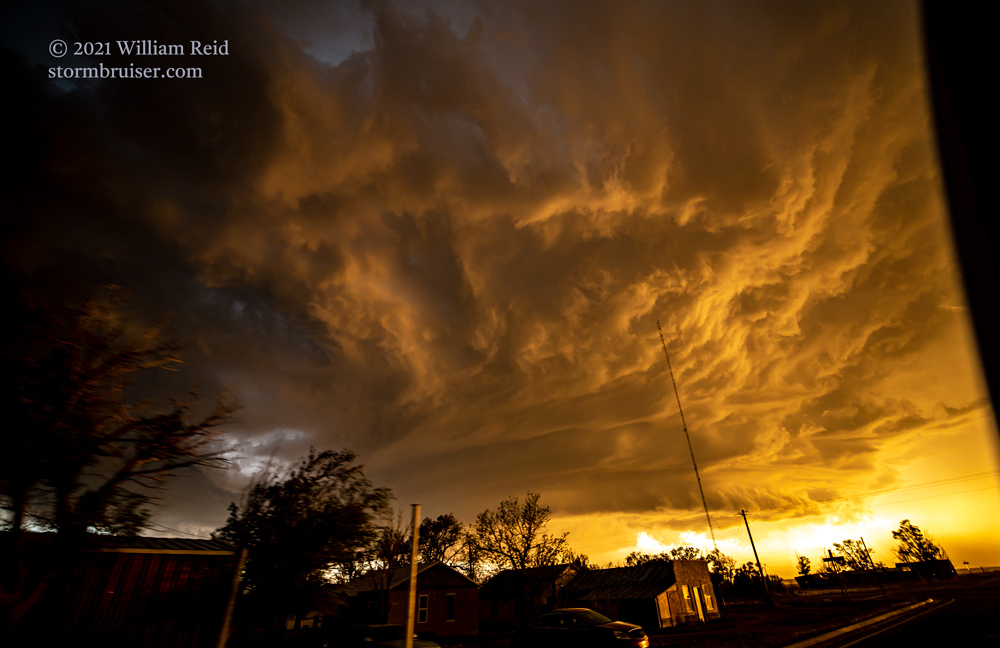
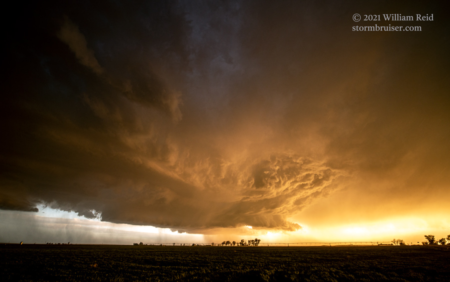
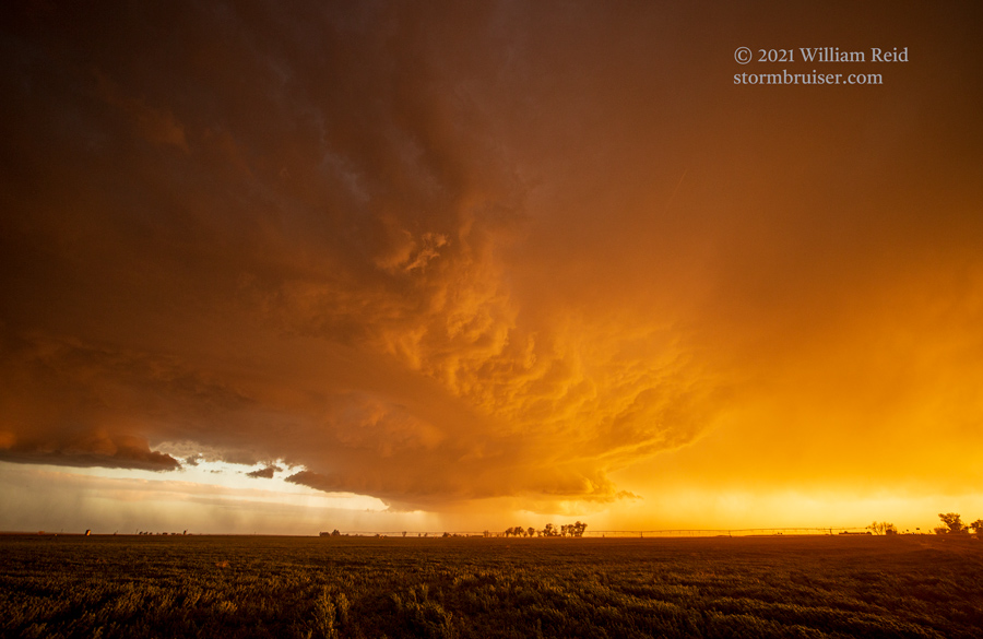
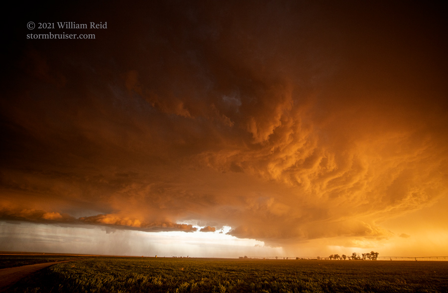
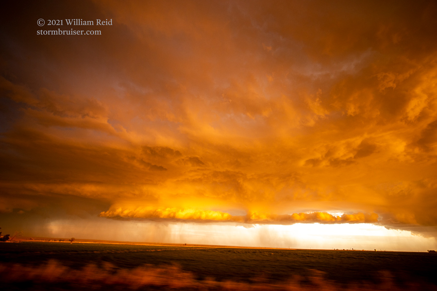
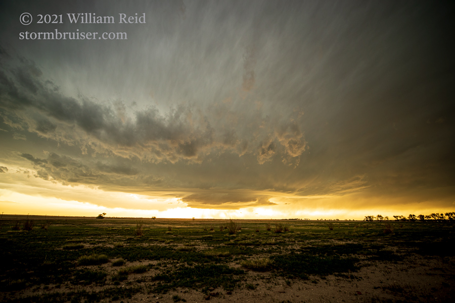
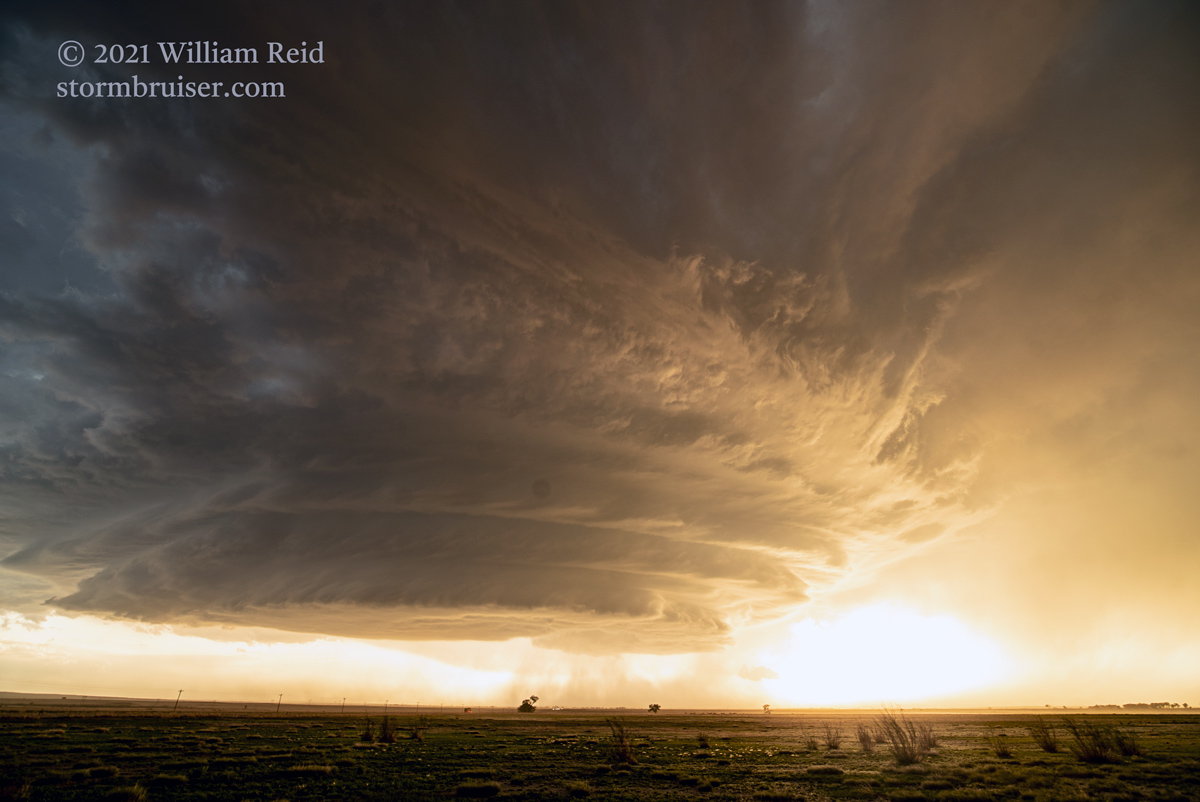
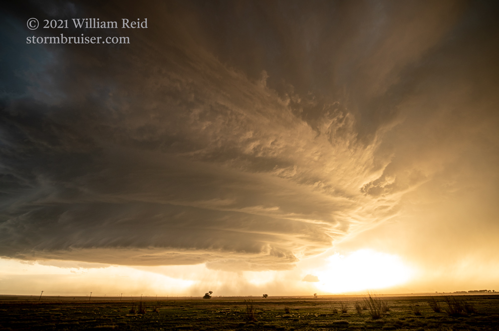
There was enough time to head south to U.S. 50 near Lamar and to see if something might happen! From the junction west of Lamar, we headed west on 50 towards a nondescript, flat and dull-looking storm base that was north of Las Animas. We stopped short a bit near Hasty. Almost immediately, a switch flipped and the developing storm to our WNW went into beast-making mode! The base drifted southward in front of the setting sun and became a sculpted masterpiece. During this timeframe, northeast winds came up very strongly, and dust plumes were getting sucked up into the storm base — YES!
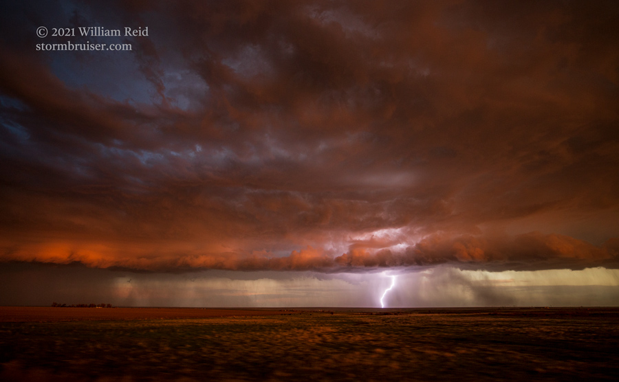
We had to reposition as the base crossed to the south side of U.S. 50. We went east on 50 towards Lamar, stopping once to look back one more time at the supercell. Frequent CG lightning flashed beneath its anvil on the south side of 50. This was an awesome show!

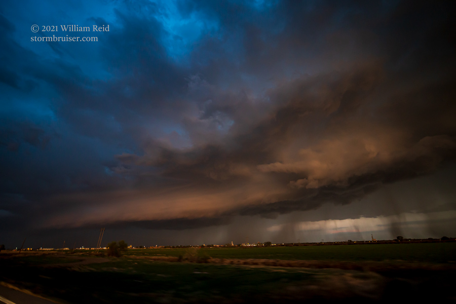
The supercell continued to the southeast, and my plan was to get south of it along 385, south of Lamar. But, there was road construction on the south side of Lamar, and they quit doing the pilot car thing as the severe storm approached. We were stuck.
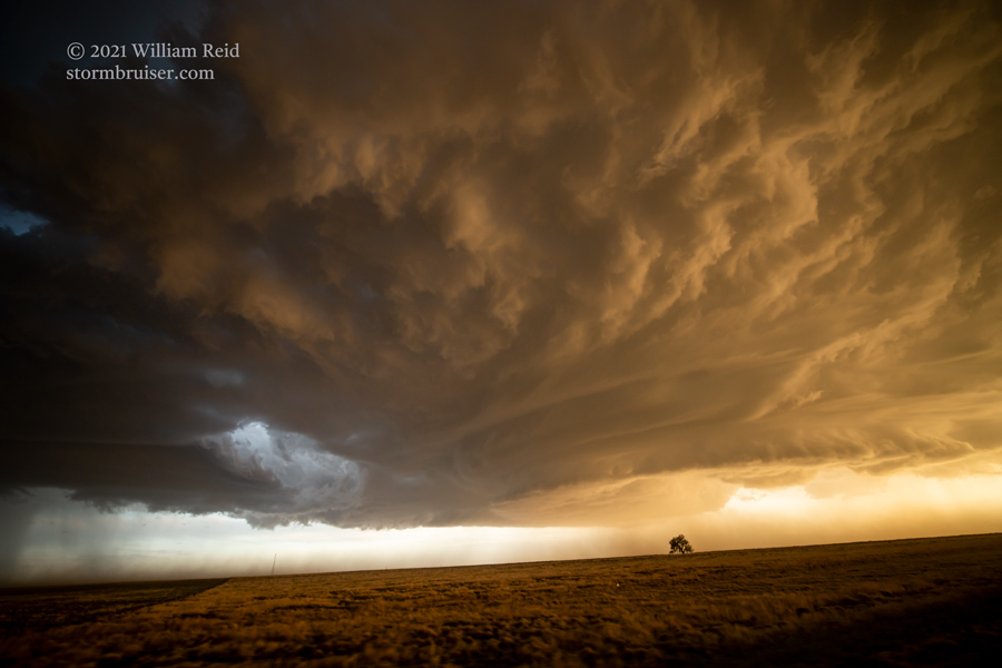
After about 15 minutes, we went back into Lamar for a pit stop. The storm was not looking as good on radar, anyway. We headed to Guymon for the night. Below are a few more pics from the Sony camera.
As always, I highly recommend that you check out the Chris Gullikson time-lapse video link provided above, as it tells the whole story!
Leave a Reply
You must be logged in to post a comment.