
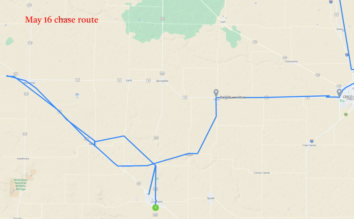
Start: Guymon, OK/Braums in Canyon, TX/End: Littlefield, TX/344 miles
SPC Mesoscale Discussion 636 SPC Mesoscale Discussion 638
SPC Mesoscale Discussion 642 SPC Mesoscale Discussion 643
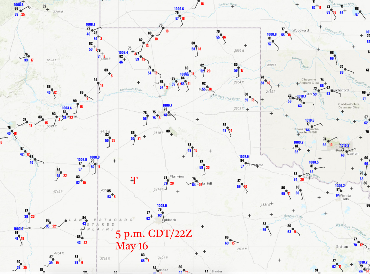
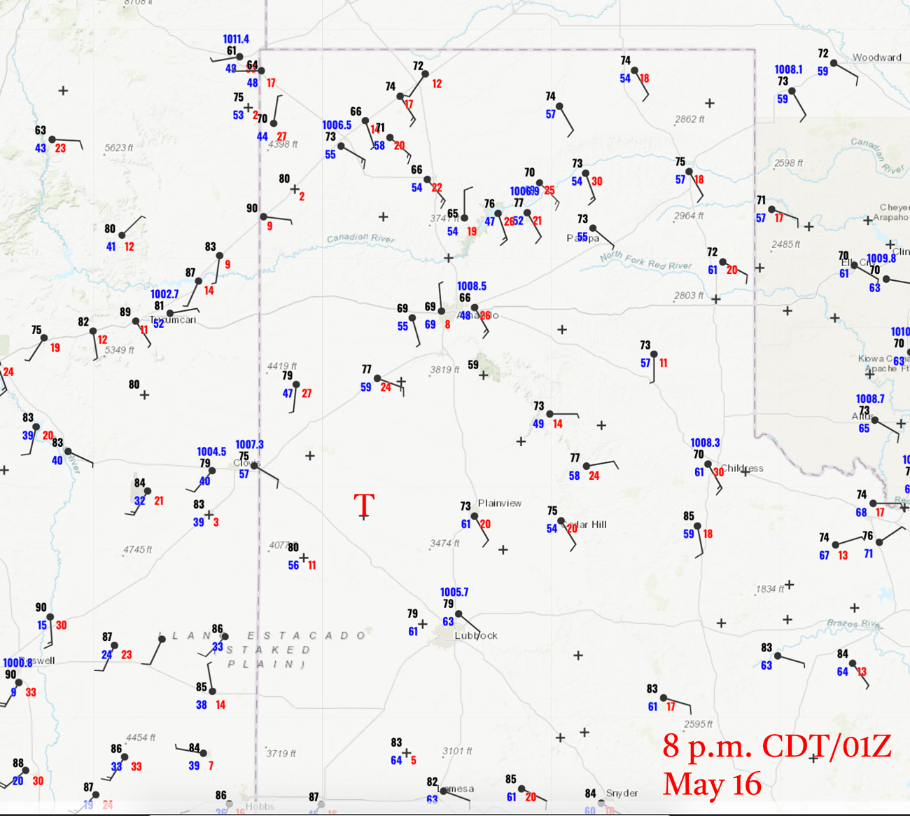
22Z/5 p.m. CDT surface map and 01Z/8 p.m. surface map above/chase route below
Sudan/Earth Tornado video by Chris Gullikson
Wide-angle/Time Lapse of chase event by Chris G.
Time Lapse of Supercell updraft at sunset by TT guide Richard Rostant
Today’s slight risk area on the High Plains extended from about Wray to Tahoka, with a large tornado risk area of only 2%. We began in Guymon, and the best (general) play seemed somewhat obvious to me: we needed to get down south in the Texas Panhandle and south of I-40 a little. I don’t recall a big difference in upper-level support north-to-south, but I liked the slightly better forecast instability and dew points in the vicinity of Plainview and Lubbock. At 3 p.m. CDT/20Z, Lubbock had a dew point of 63F, while it was only 57F at Amarillo and lower still at Dumas. Dews jumped back up to near 60F in southwest Kansas, but I don’t recall why western Kansas did not seem to be the better play. Lowest surface pressure was near Tucumcari. Winds were not backed much at all anywhere at 3 or 5 p.m. CDT (but by 8 p.m. wind was southeasterly at Plainview and Lubbock and even ESE at Hereford). There was a weak dry line boundary near the NM/TX border, but no other boundaries were obvious to me in the Panhandles. Thus, it looked like a decent day for a supercell on the nice, flat Caprock of the Texas Panhandle, but a tornado might require a little Panhandle Magic. I was kind of feeling my way around semi-blindly as to where I needed to be exactly. It is possible that the models suggested that nice backing of the wind south of I-40 in the western TX Panhandle towards sunset and why I targeted that area.
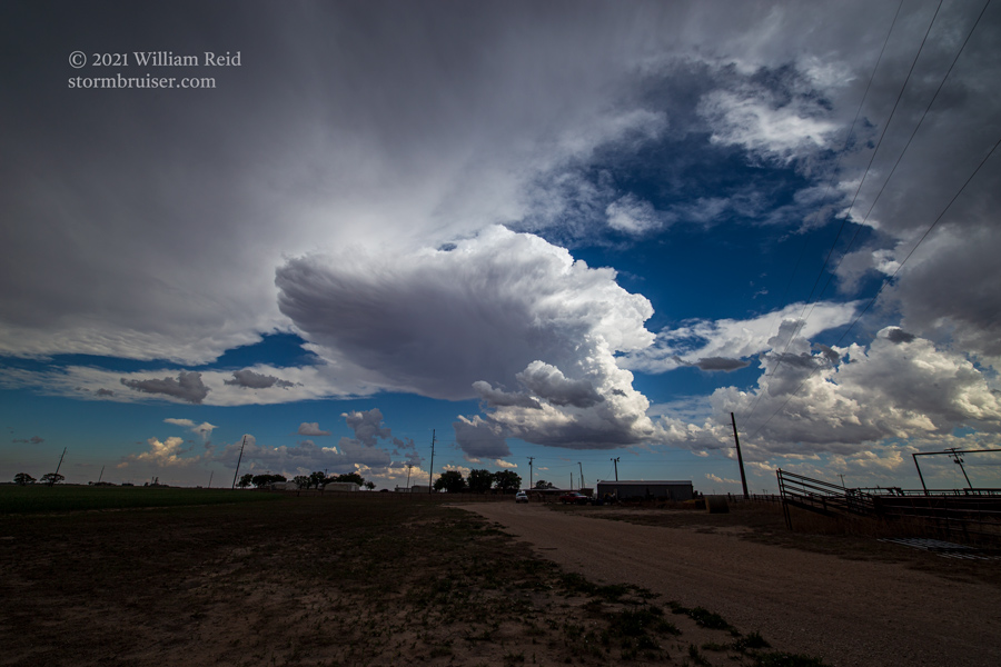
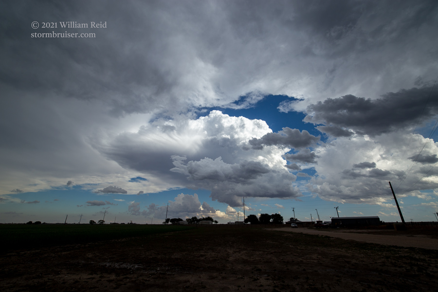
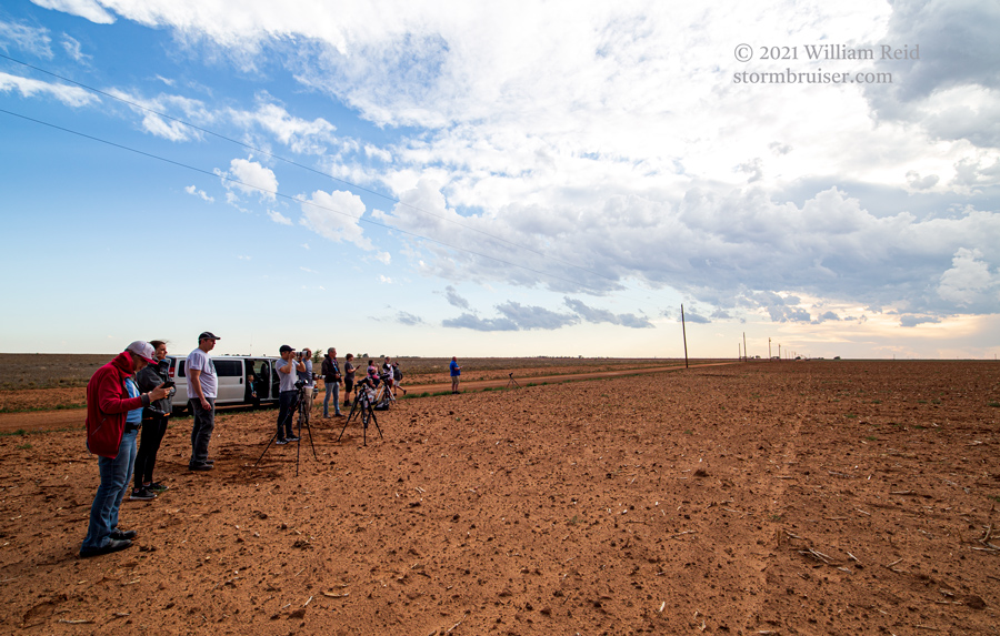
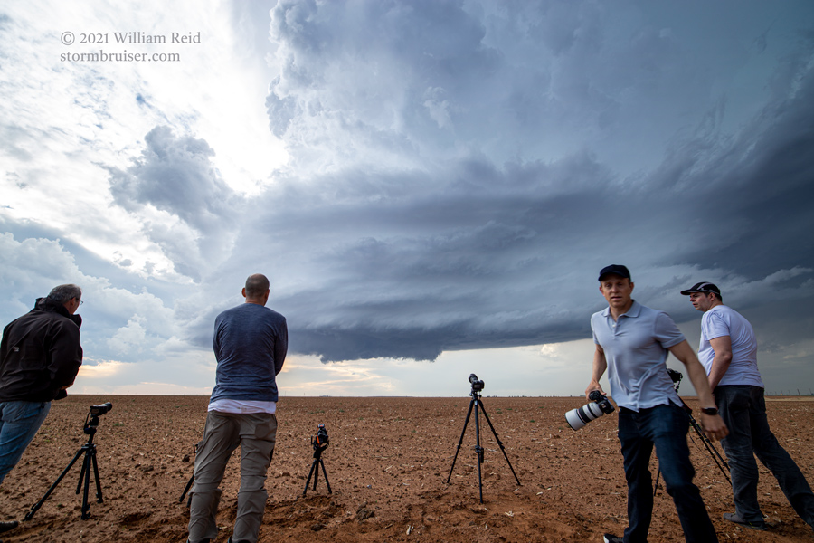
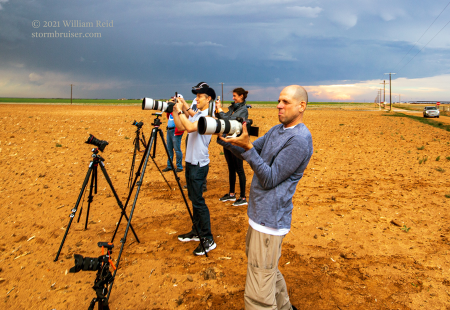
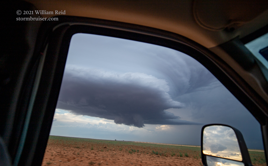
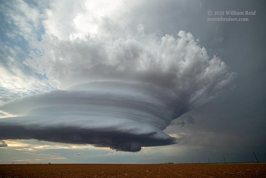
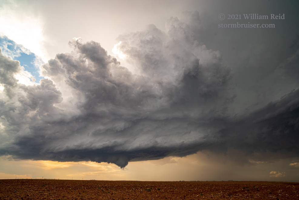
We had lunch in Canyon, and then headed further south to Plainview. We jumped on U.S. 70 west to Olton and then south a little to Feldton. By this time there was some bubbling to our west on the dry line near New Mexico, and a little later I was drawn northwestward on U.S. 84 from Sudan to just west of Muleshoe. Here, a cumulonimbus was struggling. Its base was high and I was not impressed. We sat under its anvil, and then saw another updraft start to go up not too far to our south in the sunshine (first two pics below). This updraft was very robust from the get-go, and it turned out to be the tornado-maker today. I did a little zoomed-in time-lapse video of this updraft, and then determined that it would be a good idea to get close. About 15-20 minutes later we were back at Sudan and setting up just northeast of town. This storm base was looking good.
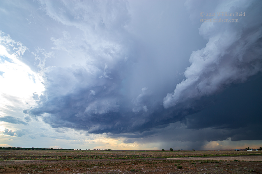
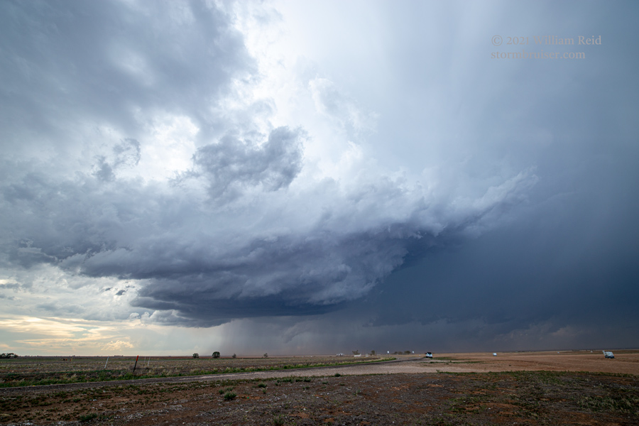
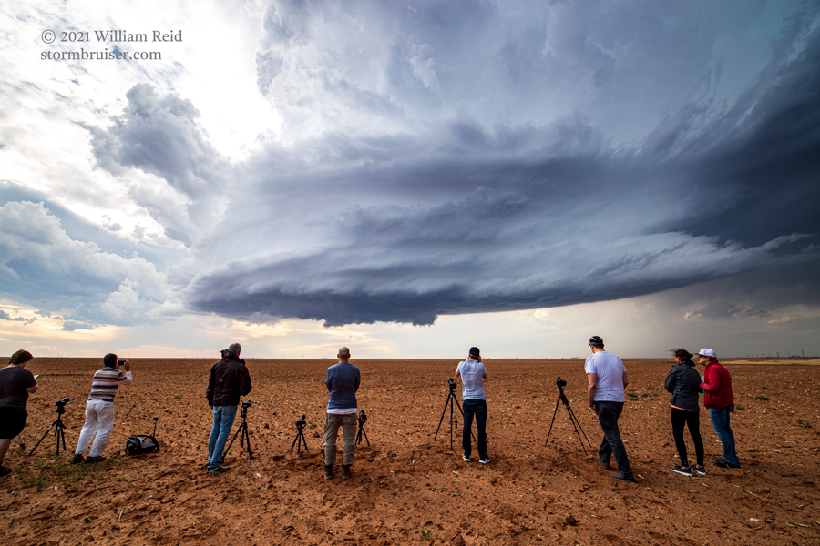
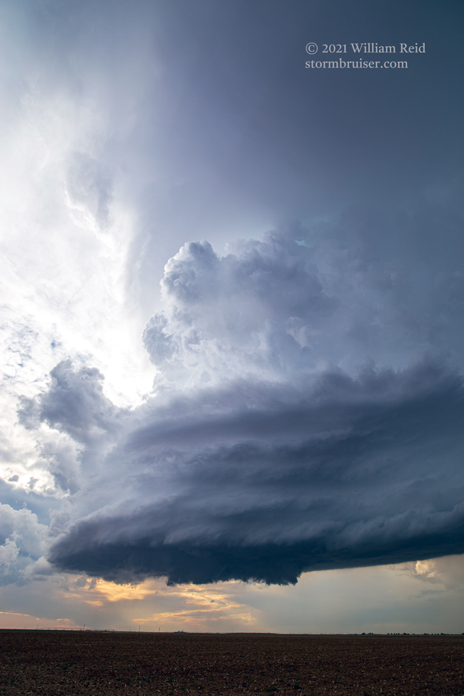
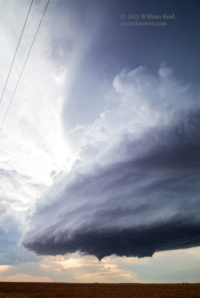
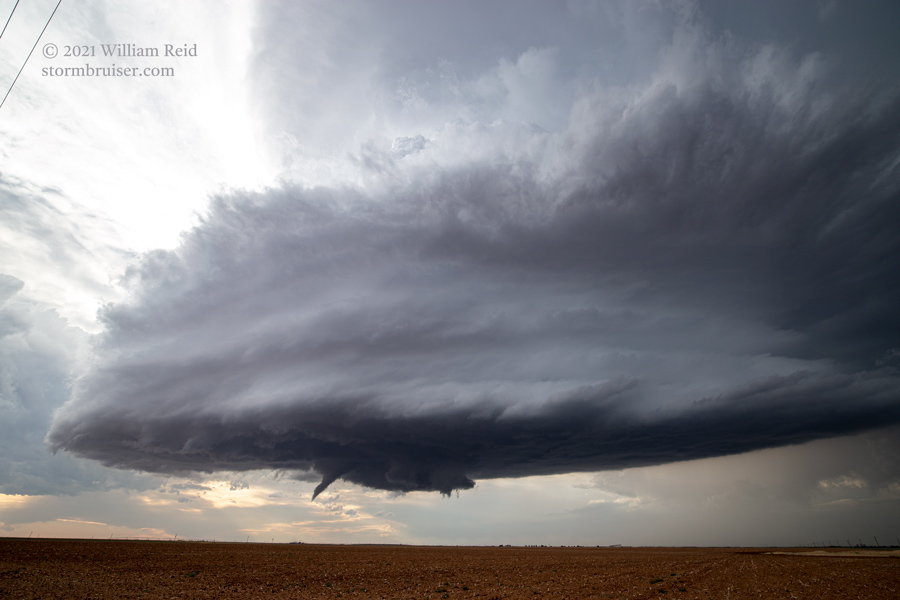
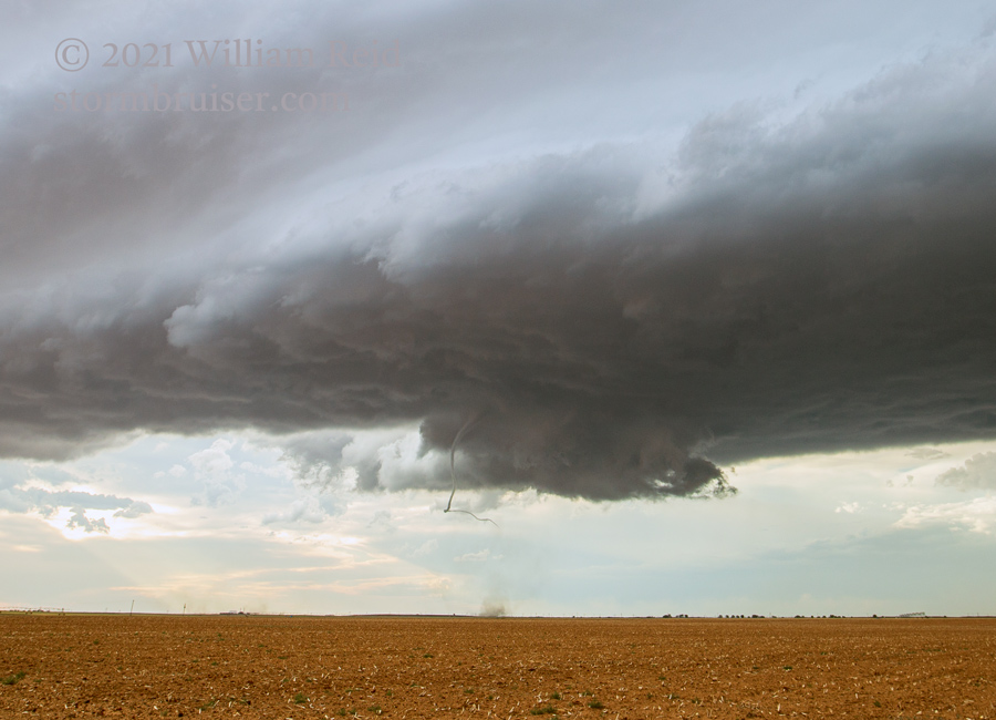
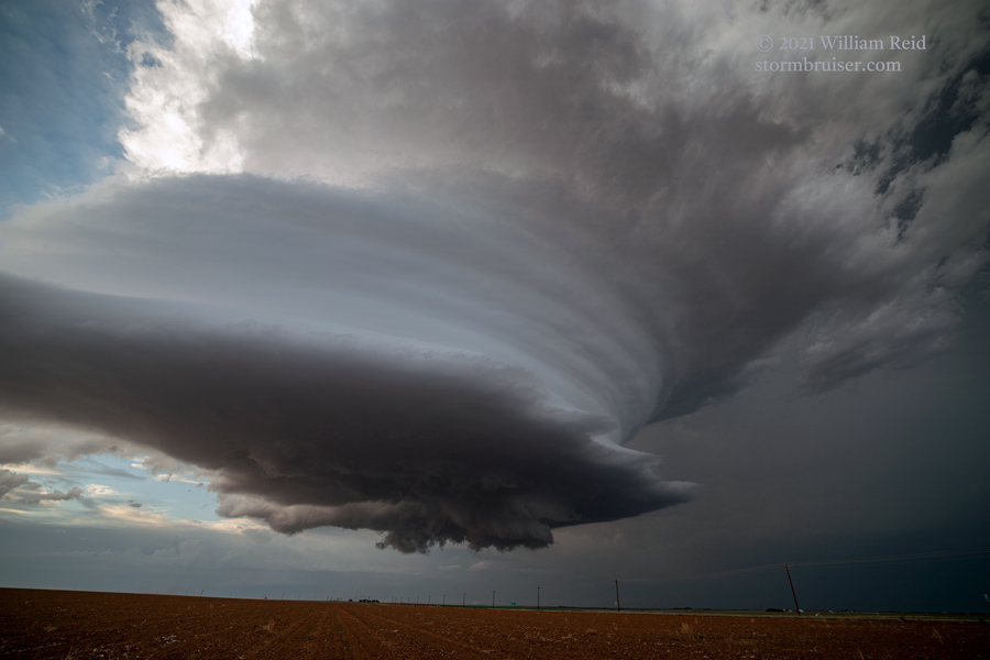
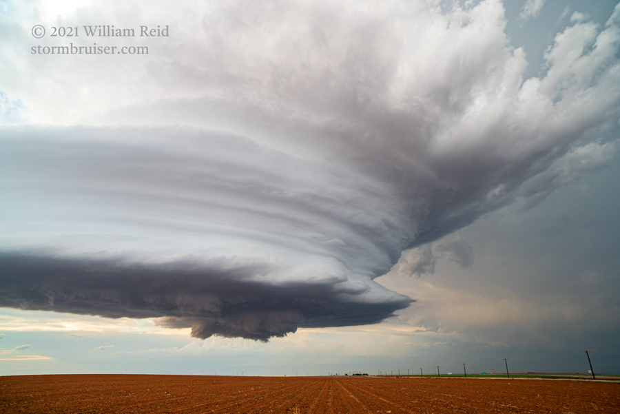
We were here perhaps 20 minutes, and then it was time to jog a little farther east and north (via FM1843 and FM135). We stopped just a mile or so short of the updraft base to maintain the view of the increasingly maturing (and strongly rotating) updraft. Slowly but surely, a shallow lowering developed as a clear slot cut into the back of the updraft base.

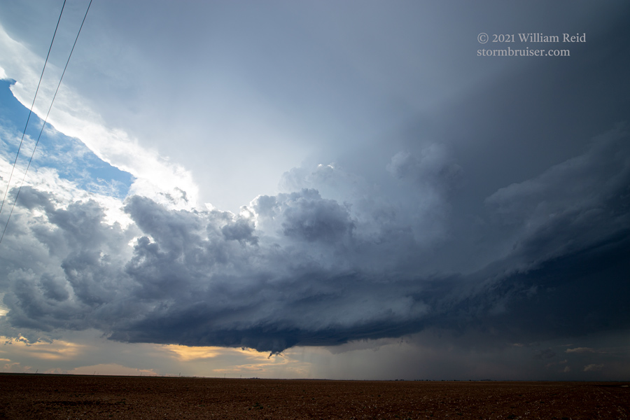
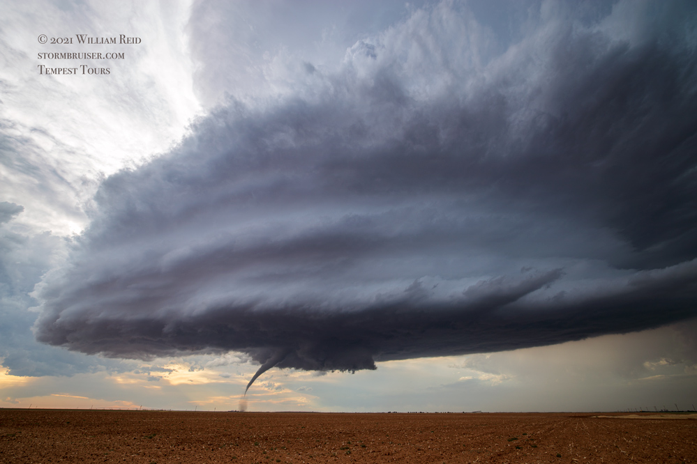
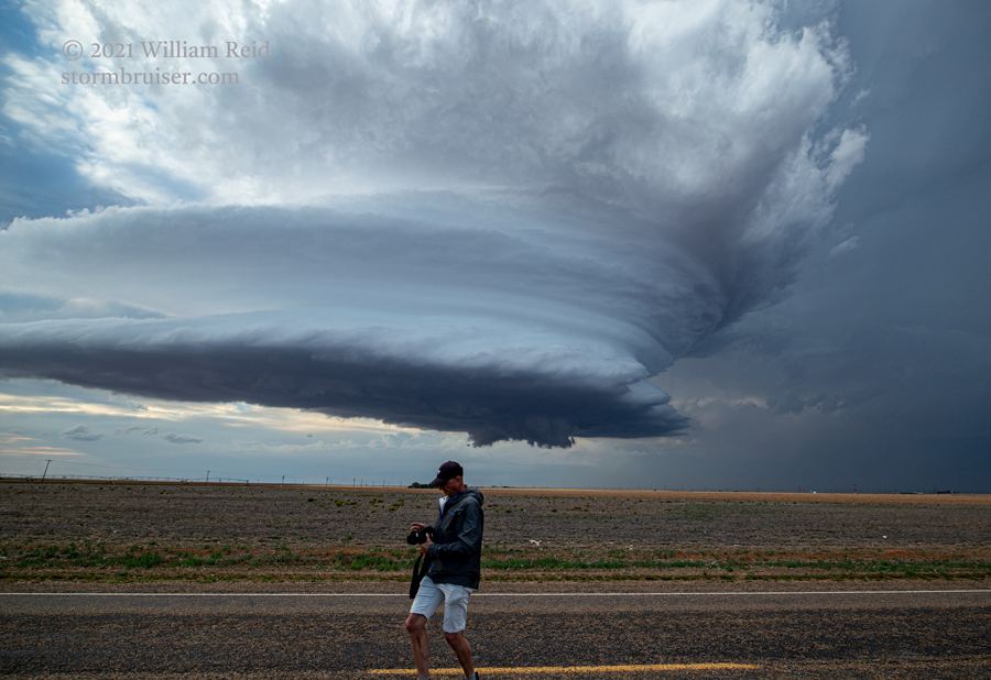
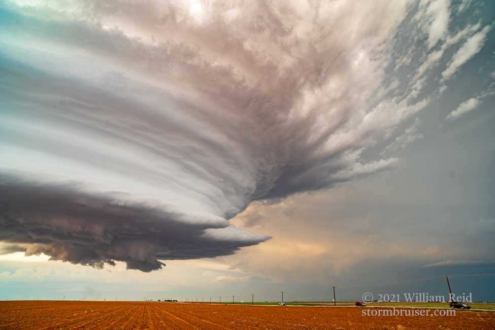
We were lined up along our dirt road, adjacent to a very barren field, about 5 miles ENE of Sudan and 11 miles SSW of Earth. To our NNW, the supercell moved slowly eastward. It didn’t wait around to do its thing. A skinny and stubby funnel came into view, and a minute or two later it was tornado time! This one lasted perhaps 6 minutes, and I managed to take a bunch of wide-angle shots and a few zoom shots, along with my tripodded video.
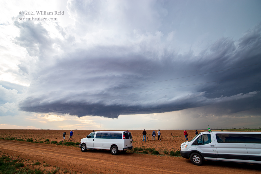
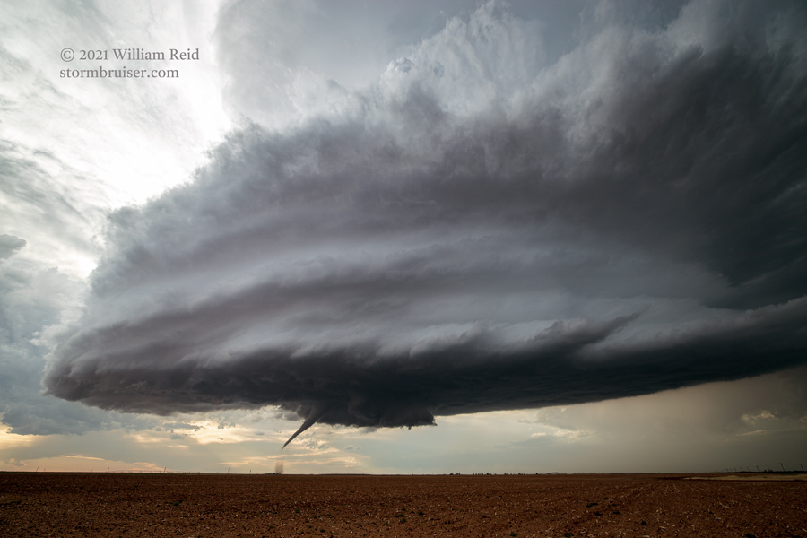
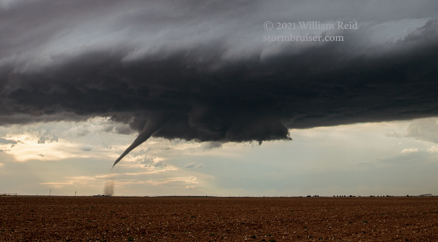
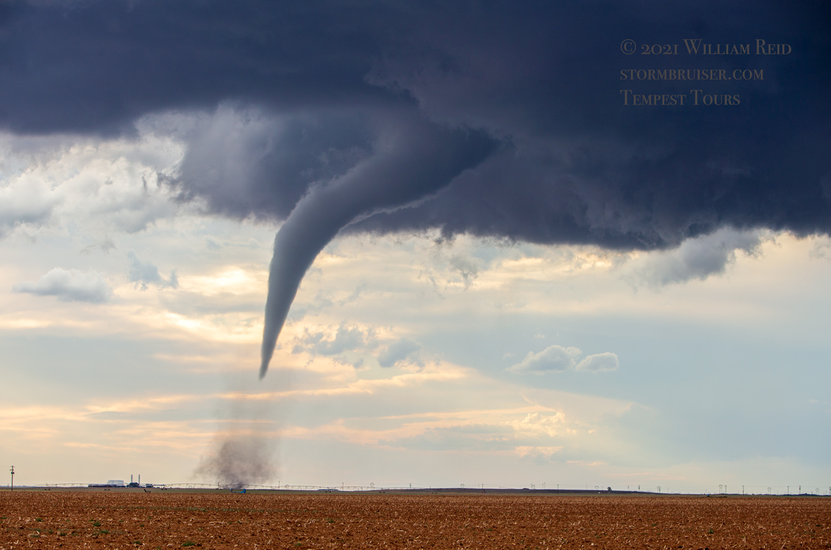
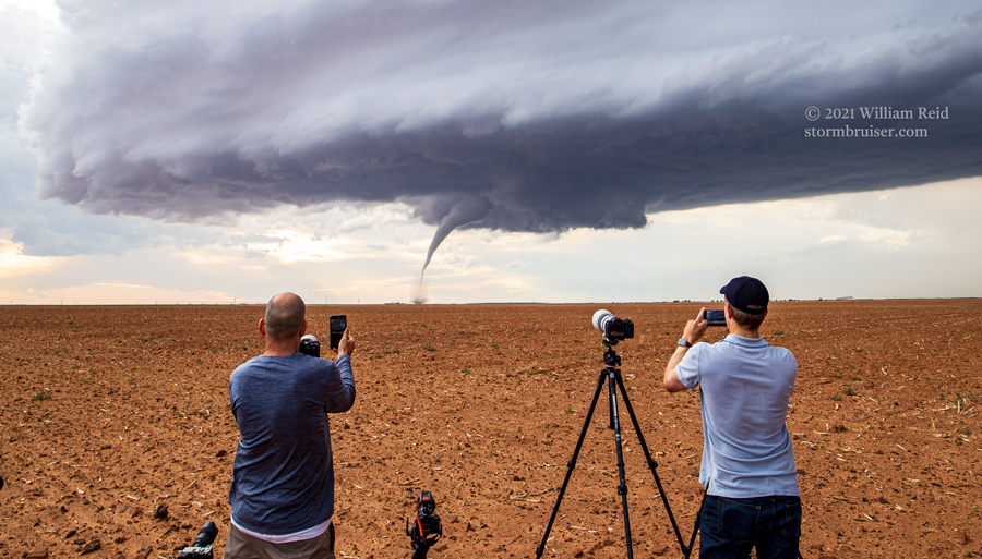
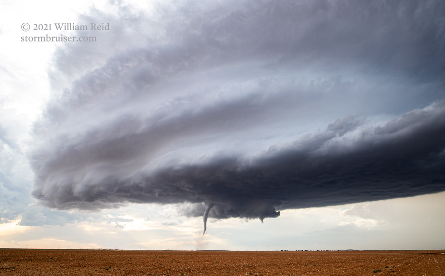
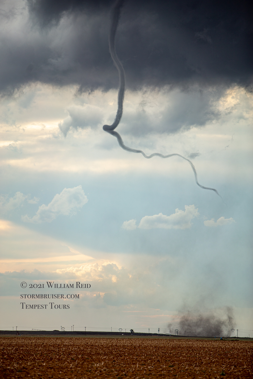
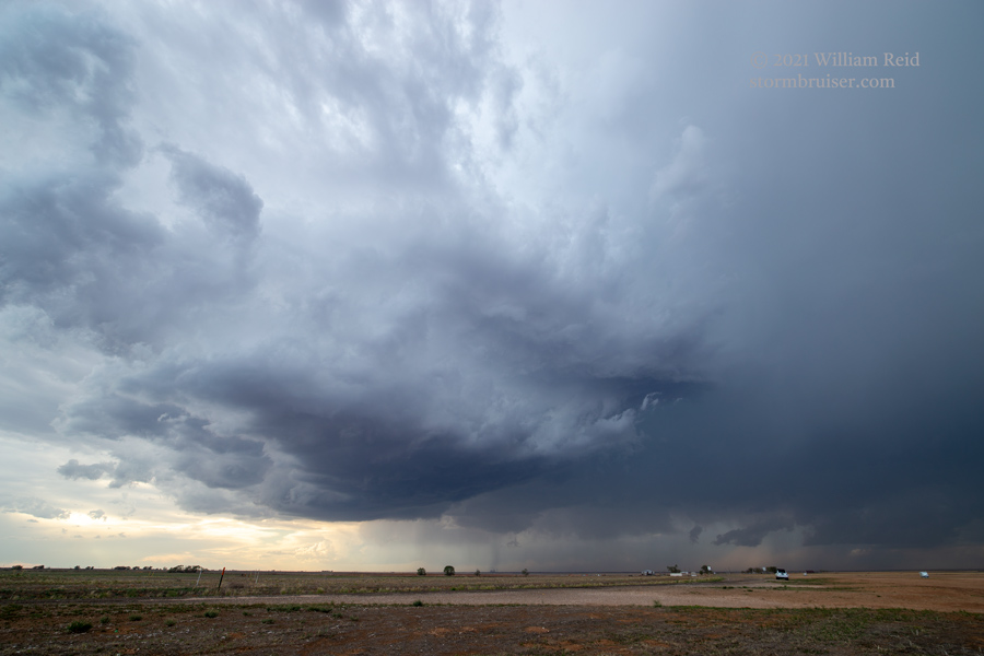
It was certainly nice to provide the guests with a worry-free tornado experience from start to end! Storm reports has the time of the tornado at 7:40 p.m. CDT, and it was in Lamb County, about equidistant between Earth and Sudan. The supercell was spinning like mad now, and another tornado seemed rather likely. Another attempt was made towards our northeast, but it failed. I wonder why. We repositioned towards the ESE and stopped for a look at structure along FM 192.
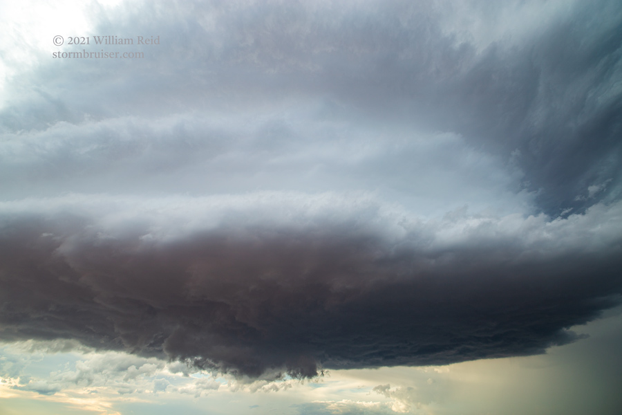
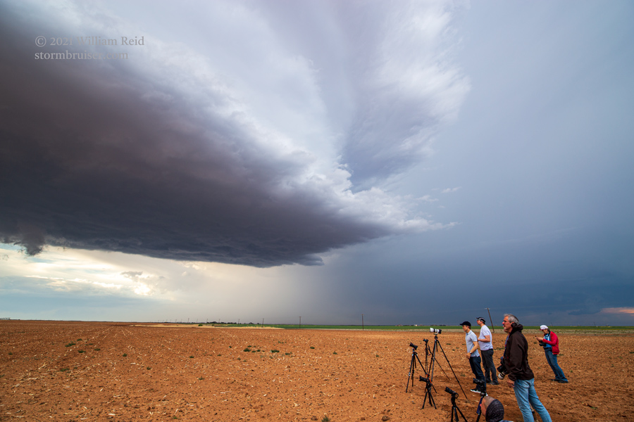
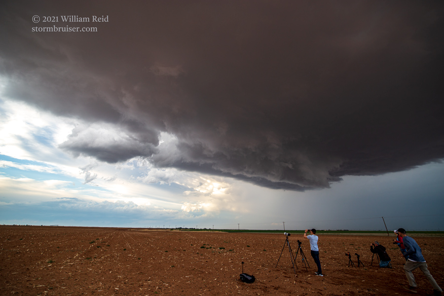
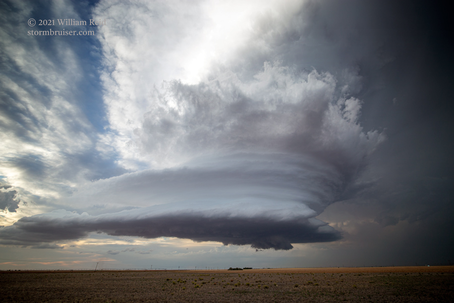
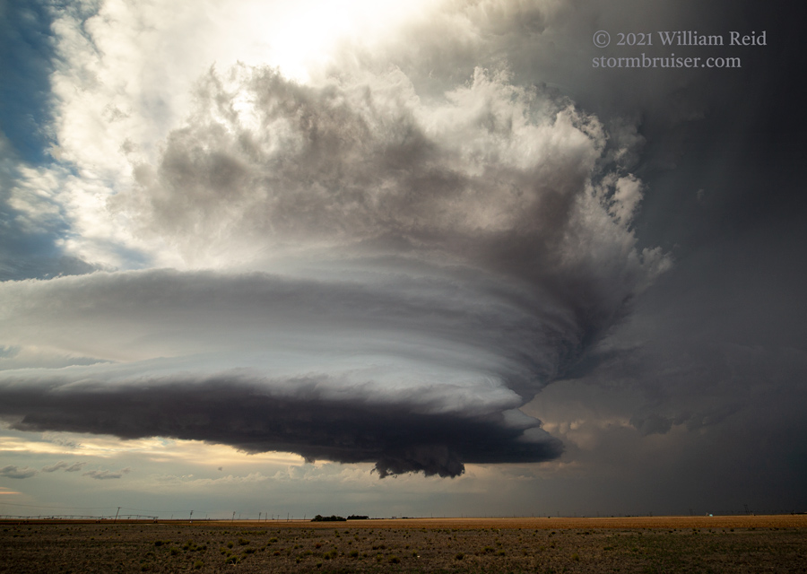
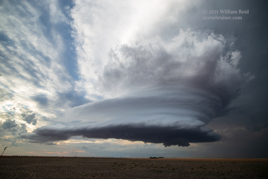
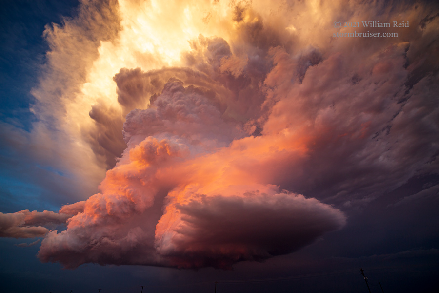
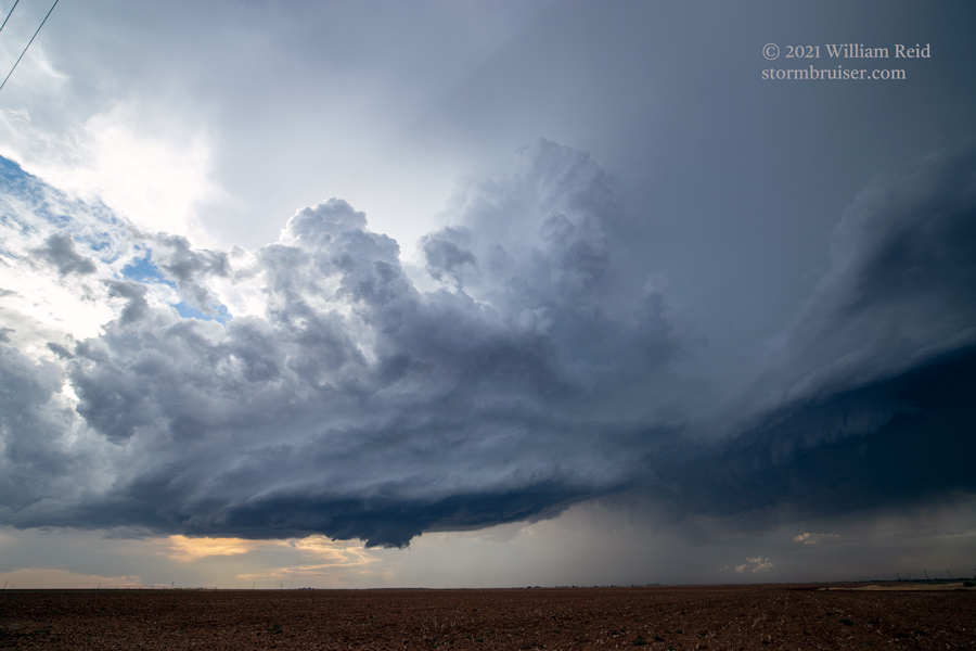
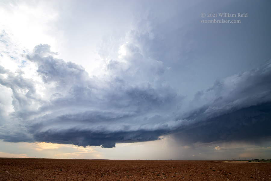
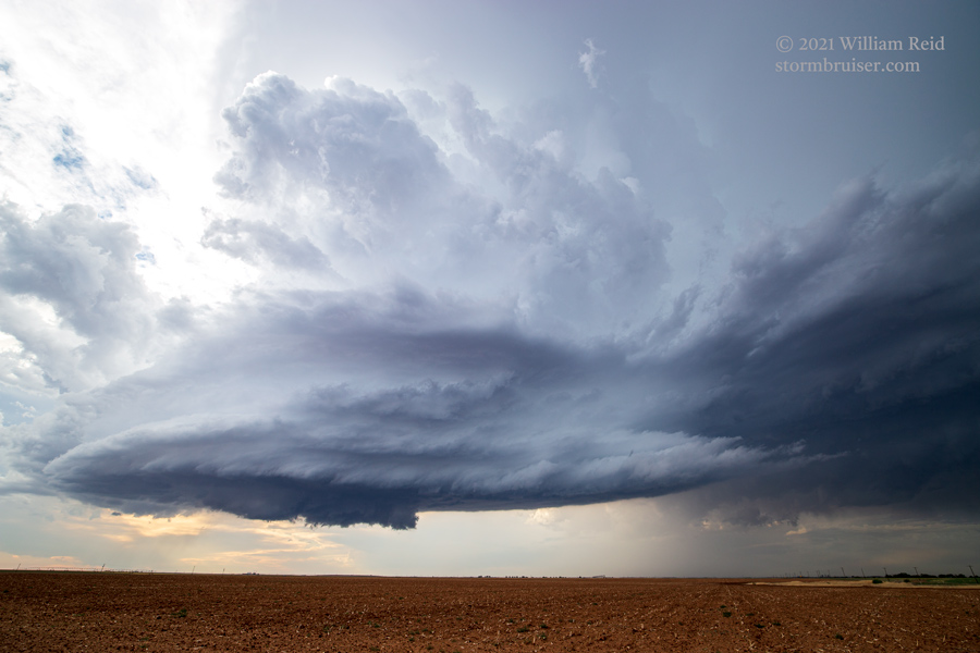
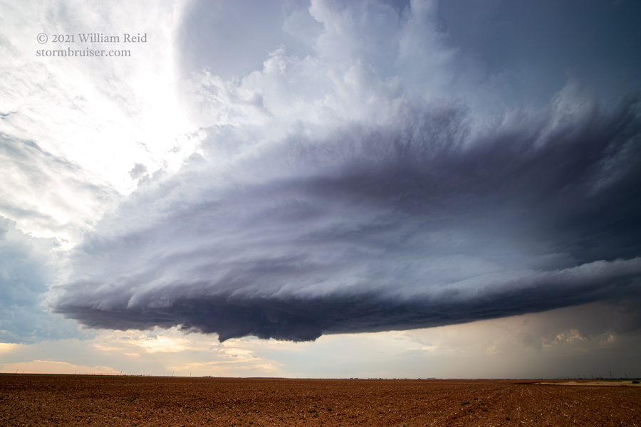
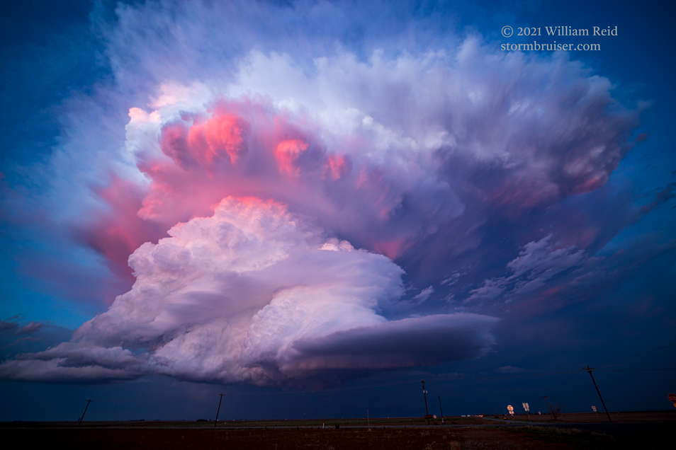
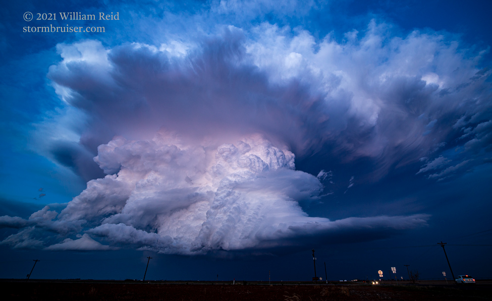
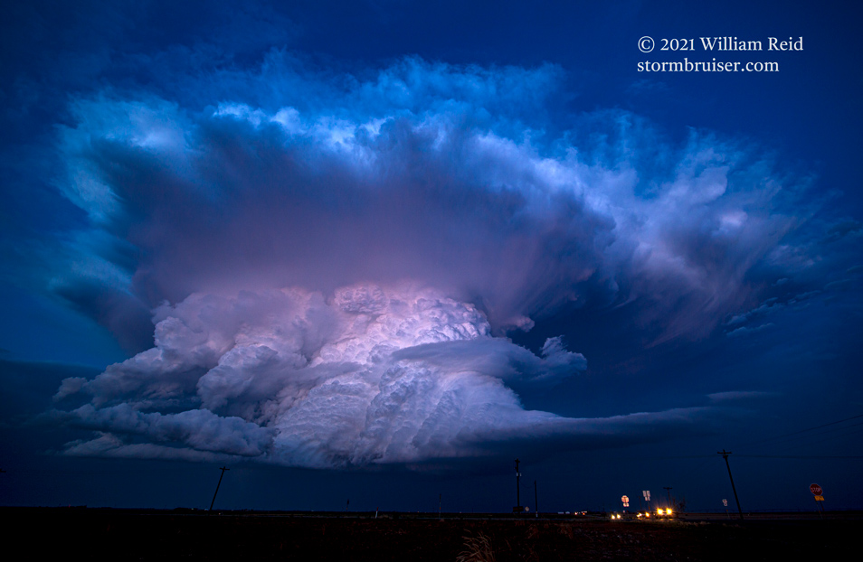
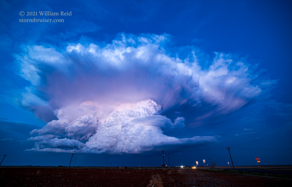
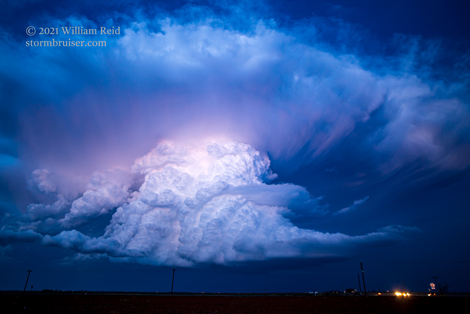
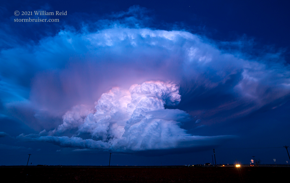
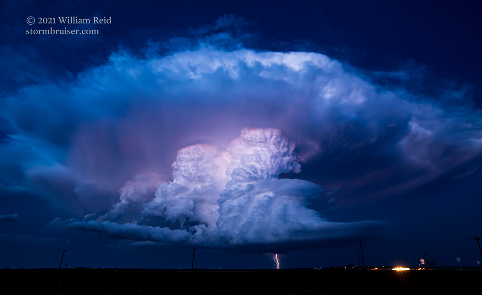
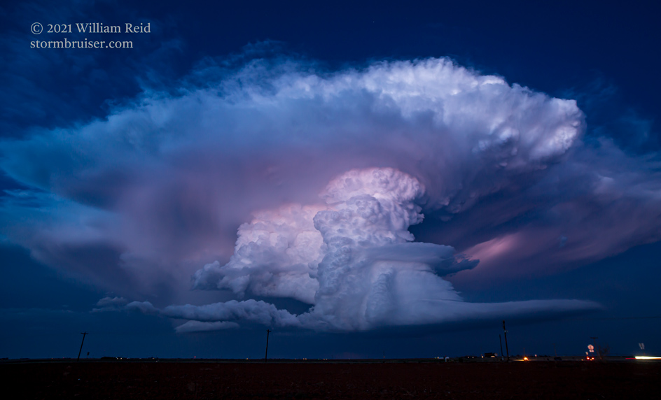
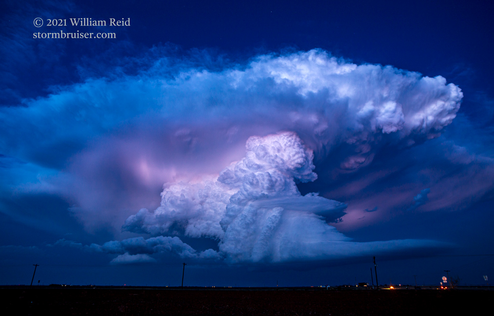
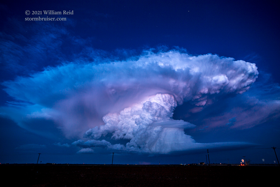
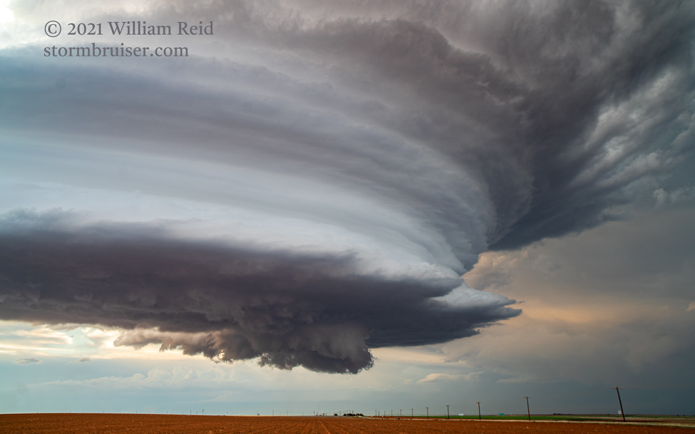
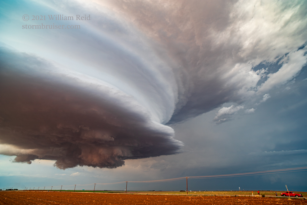
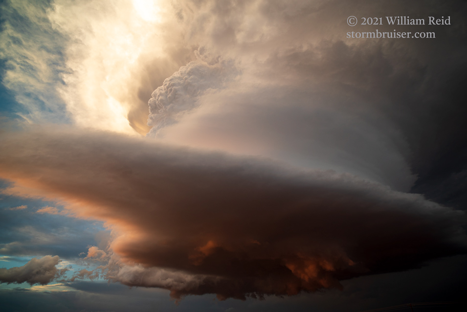
As sunset neared we pulled up to U.S. 385 and set up again. The sculpted beauty was just to our north, and the light on it improved with every minute. Both the laminar look of the front end of the updraft and the convective (lumpy) look on the backside of the updraft were in view. A lot of pictures were required.
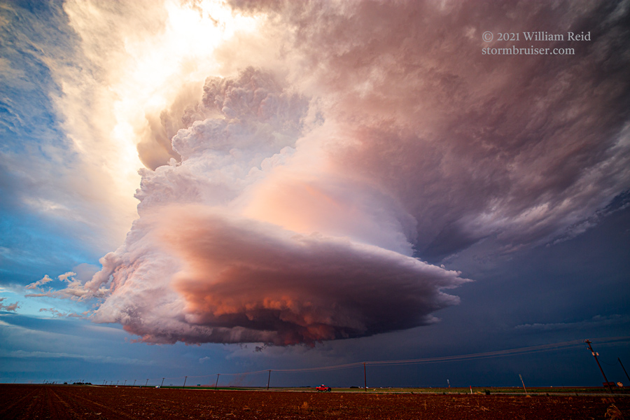
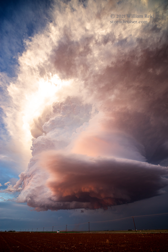
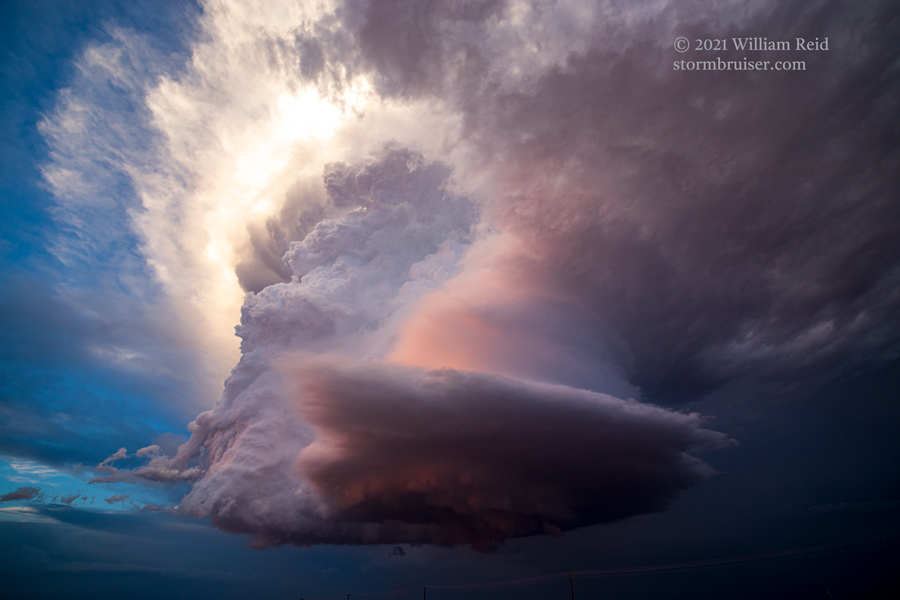
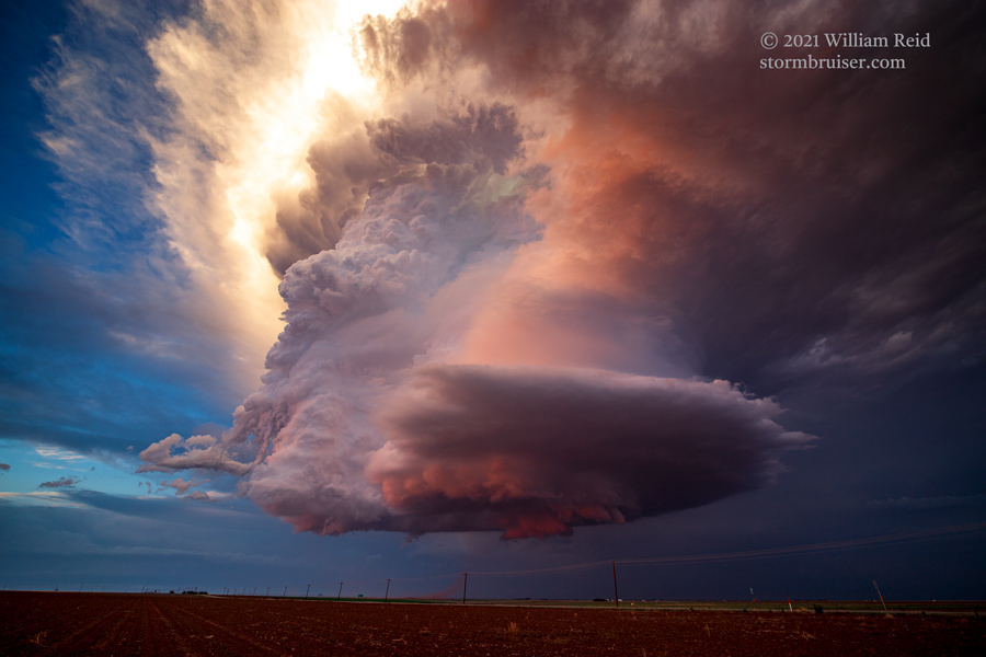

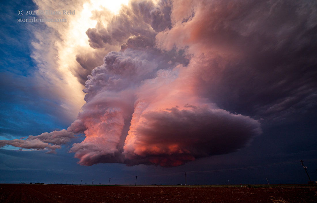
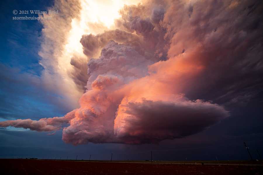
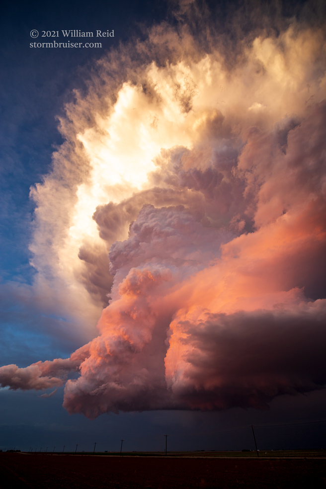
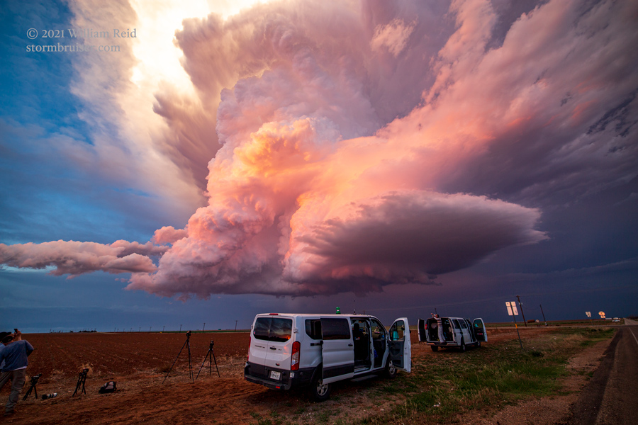
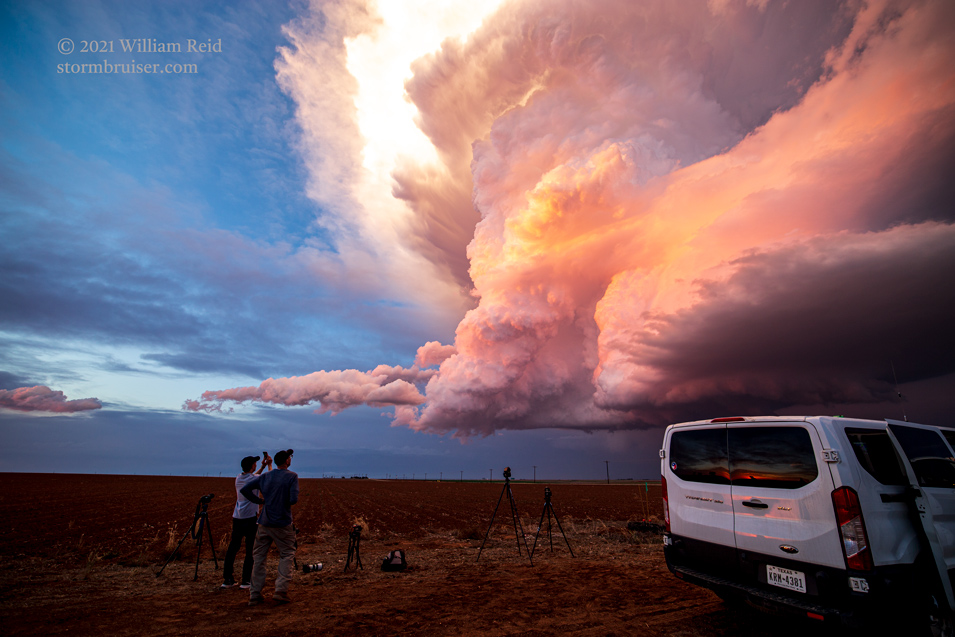
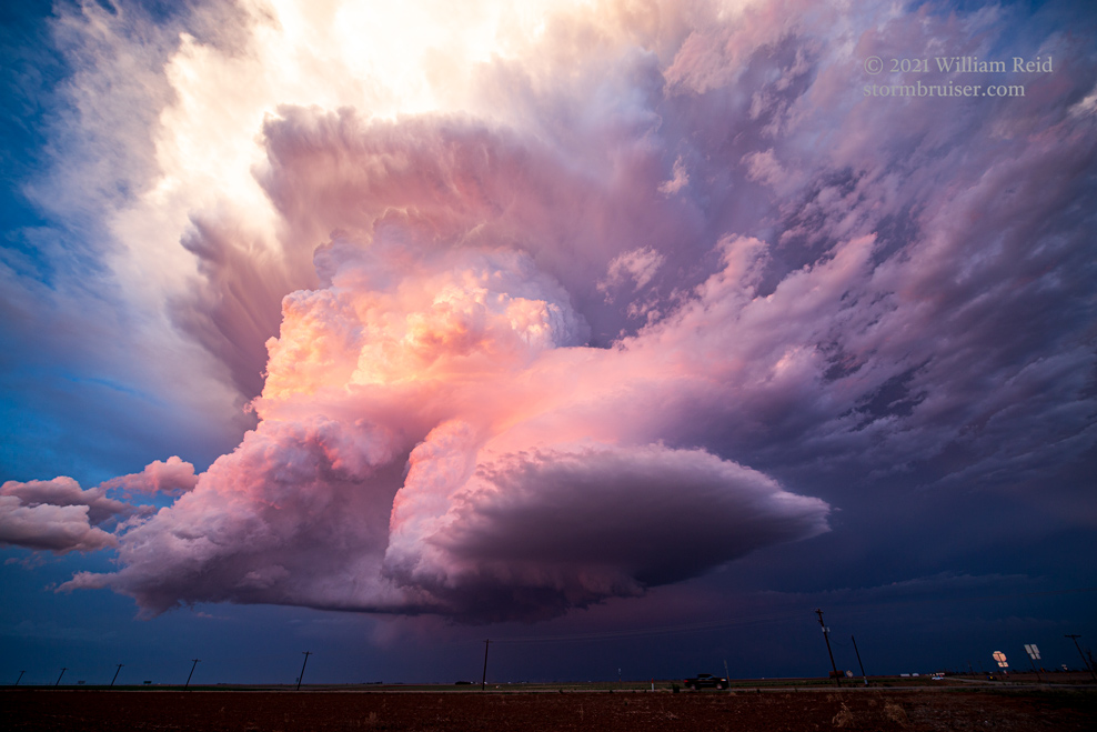
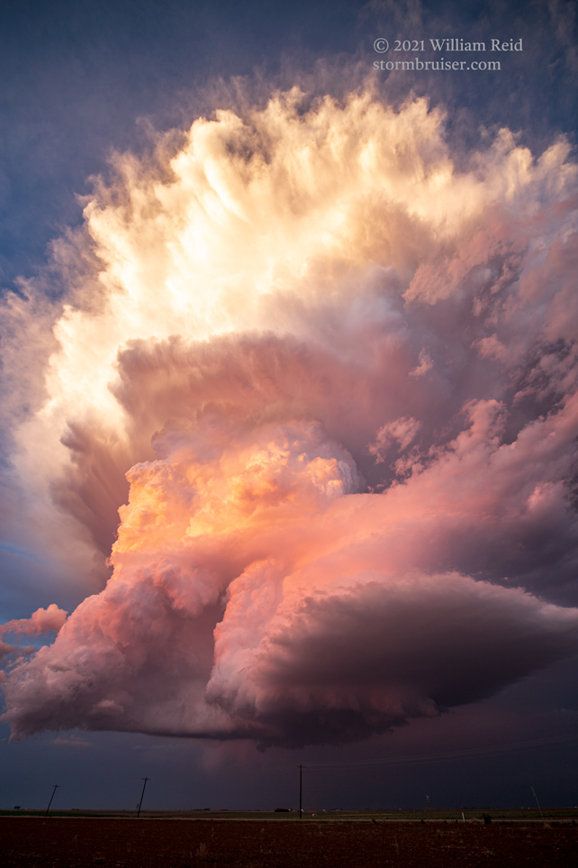
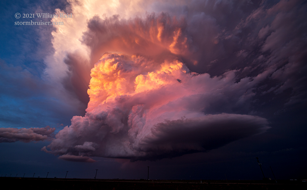
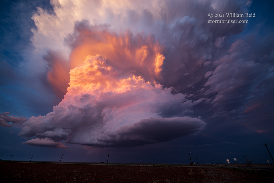
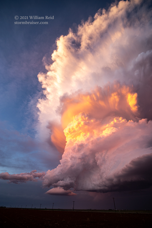
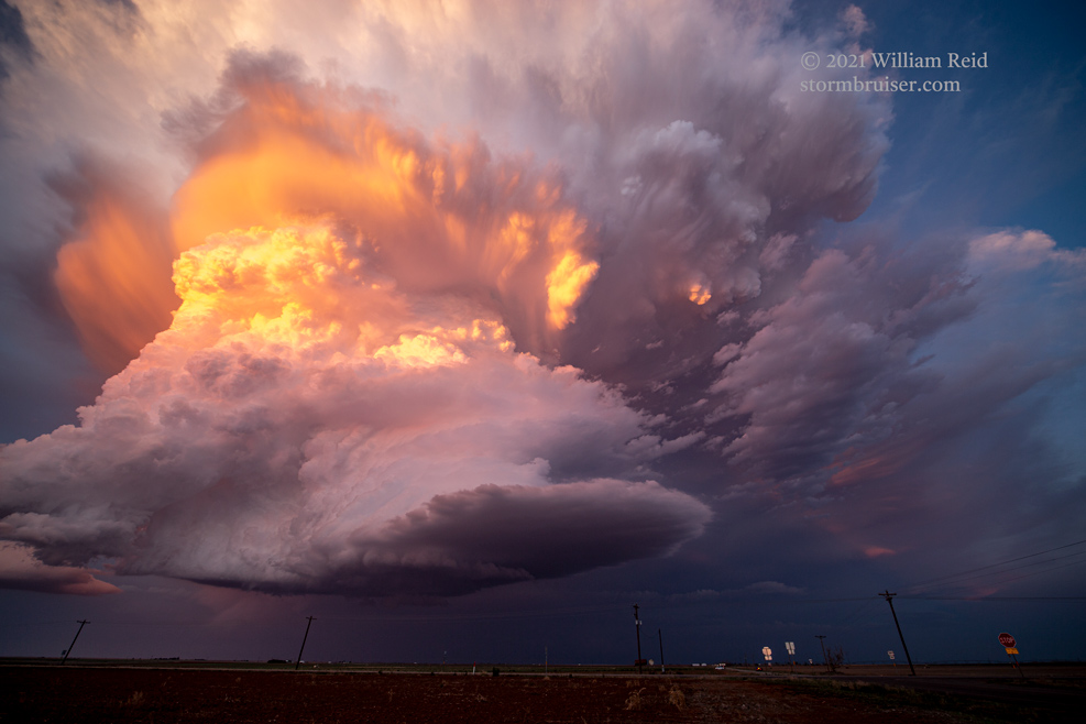
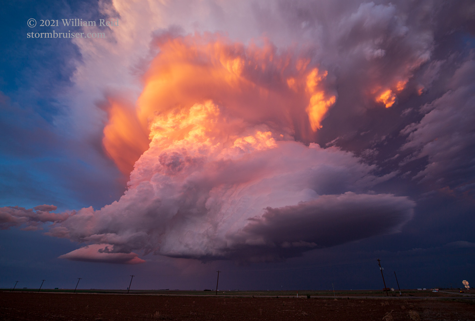
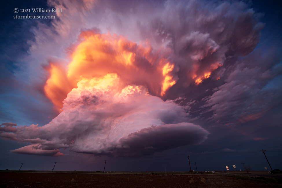
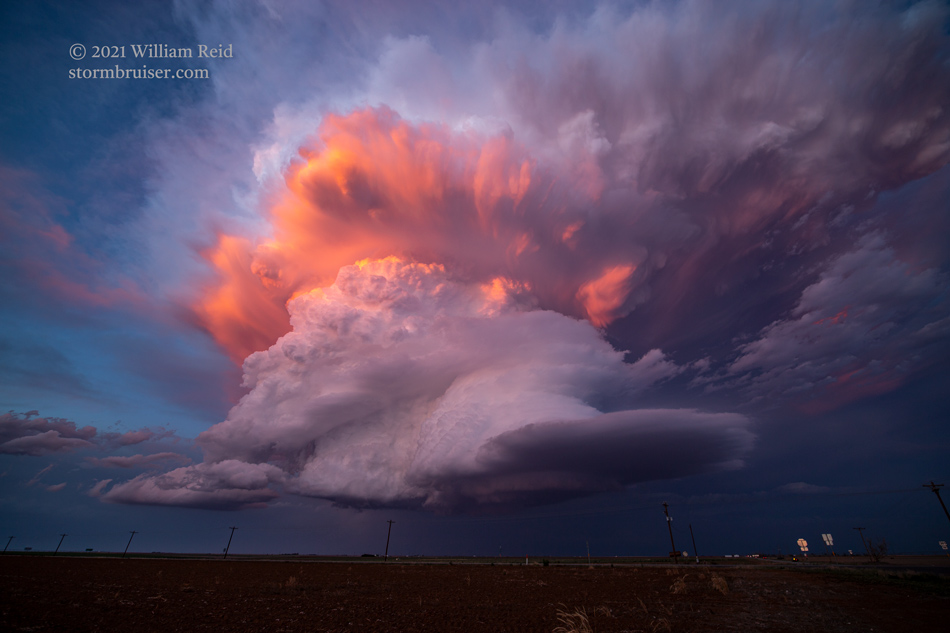
There was little reason for us to move as the supercell continued to our east at dusk. It produced just the one tornado this day, but the tornado was almost a footnote compared to the light, colors and structure around sunset.
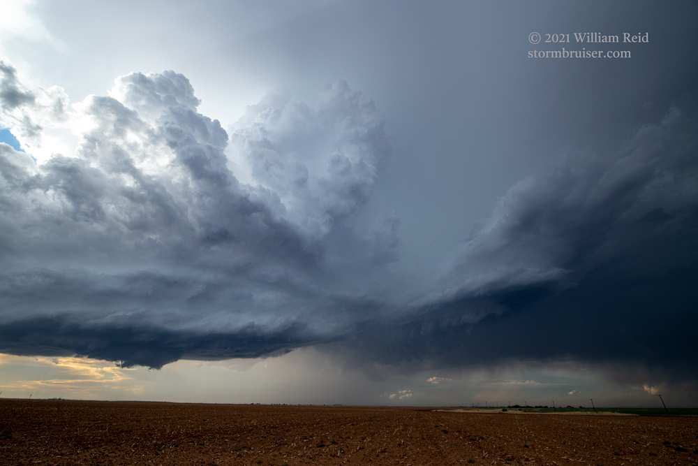
Below are a few additional images from this chase day, off of the Sony camera.
Leave a Reply
You must be logged in to post a comment.