
Start: Carlsbad, NM/Lunch: La Sierra BBQ in Roswell/End: Hereford, TX/393 miles
SPC Mesoscale Discussion 837 SPC Mesoscale Discussion 841
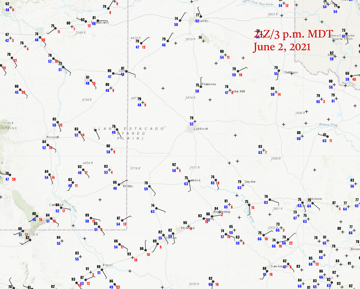
21Z/3 p.m. MDT surface map
The atmosphere continued to be only marginally supportive of severe weather on the Great Plains today. Shear was decent, with sufficient mid-level flow from the northwest, and weak upslope flow into eastern New Mexico. Moisture was better along an outflow boundary in the Carlsbad-to-Midland area, but not good enough for SPC to plunk down even a 2% tornado risk. The forecast for the latter part of this tour was favoring the northern Plains, so I was looking more at thunderstorm prospects in east-central NM versus Carlsbad and Midland and points southeastward. SPC upgraded this latter area to slight at 1630Z.
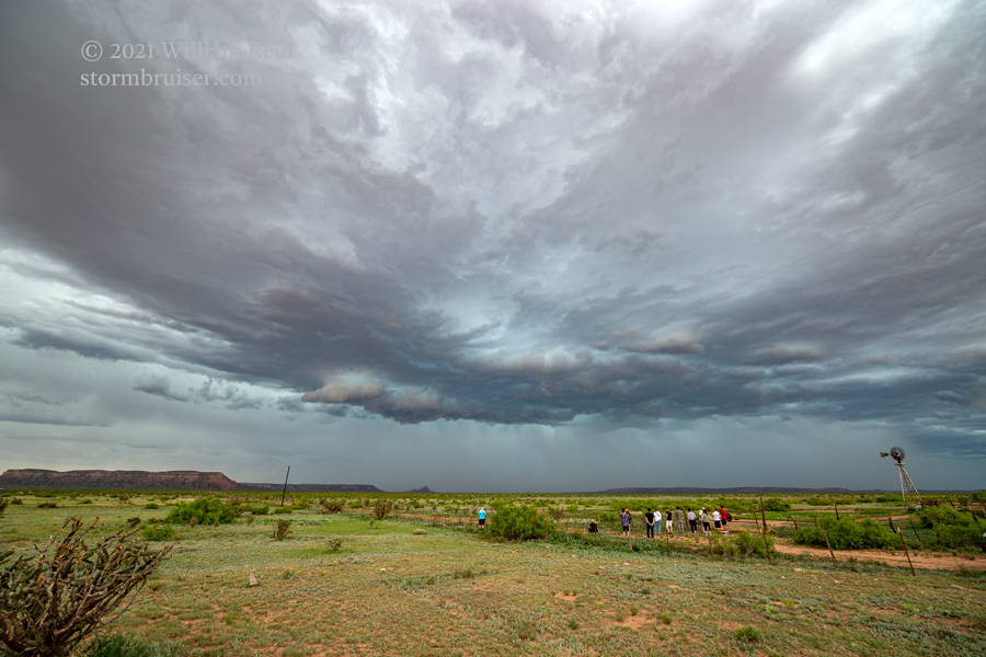
I was drawn toward expected development closer to I-40 by mid-afternoon. After lunch in Roswell, we wound up in front of some weak convection in the vicinity of House or McAlister, I think, near the Quay/Curry county line. This ho-hum stuff developed more to the south and southeast, and started to push some dust up in front of it. The storm base was on the high side, but the storm looked a little bit organized. That was near Field.
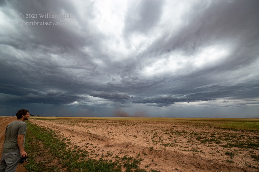
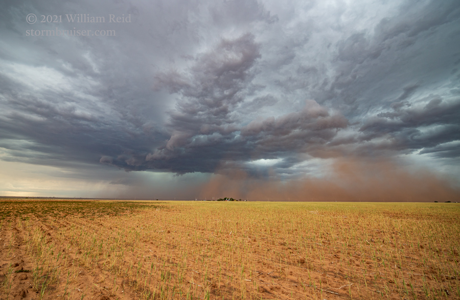
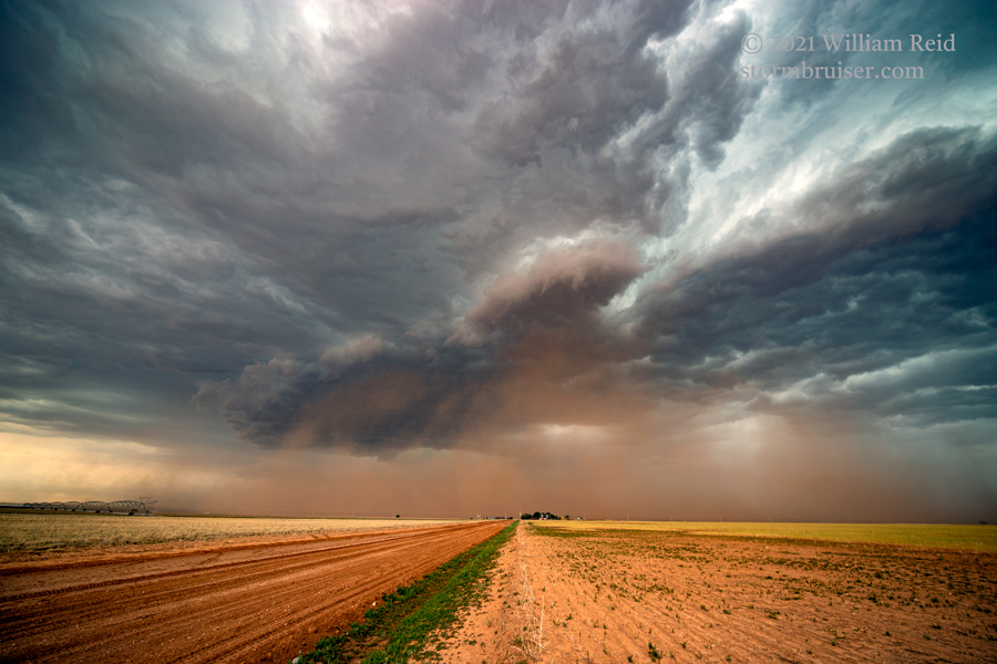
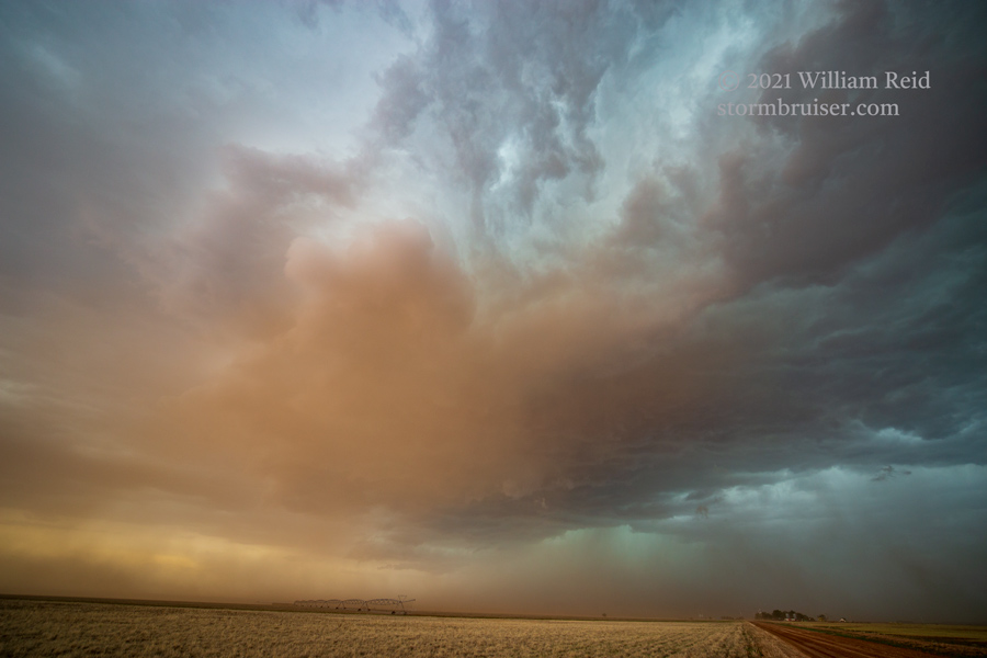
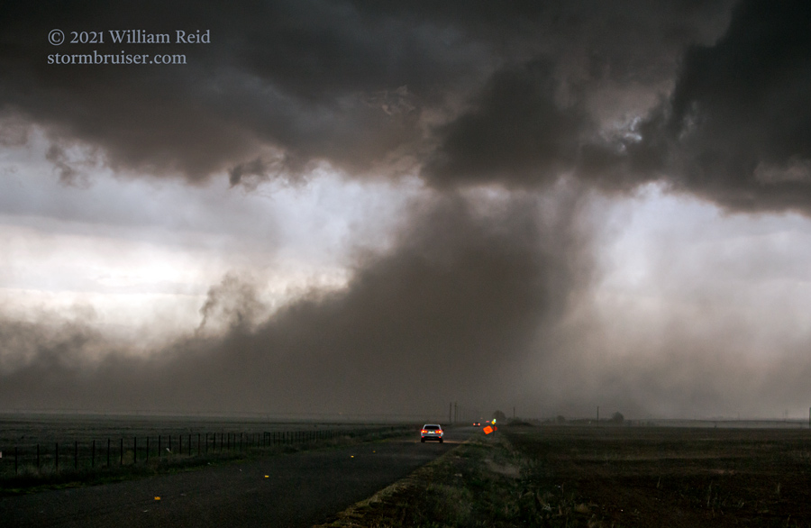
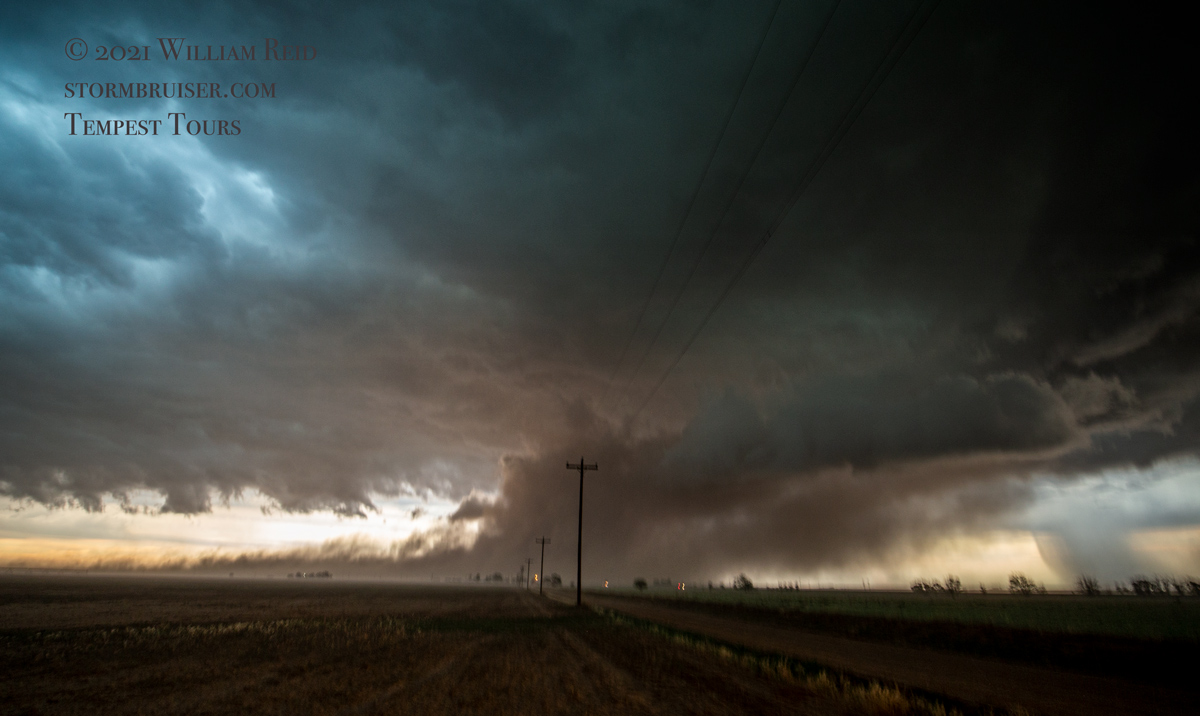
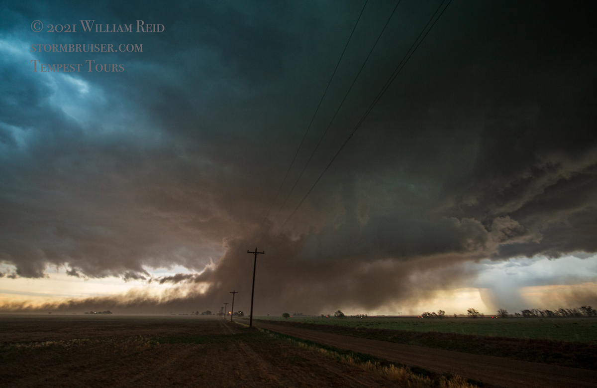
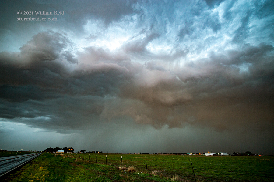
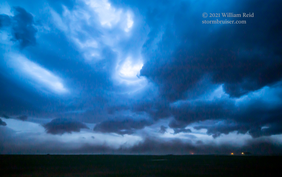
The dusty and outflow-ish storm pushed us east and south and into Clovis from the north side. As we came into the north edge of Clovis, an interesting rising dust plume developed to our east, and we went after that along E 21st St. There was a little rotation in the base, where the dust plume was headed! This was quite the “wicked-looking” scene! We stopped a time or two in light rain and maybe some small hail to shoot it. These pics are looking east.
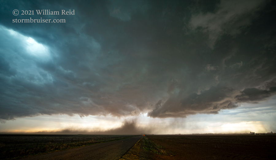
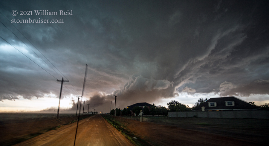
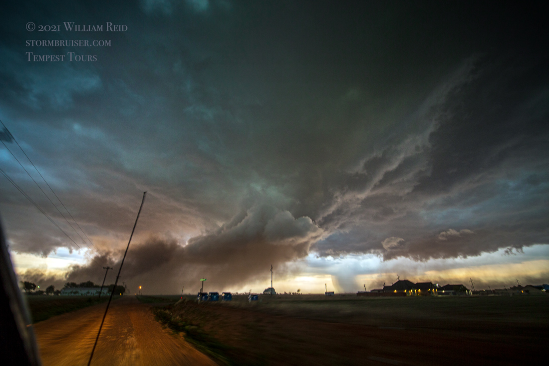
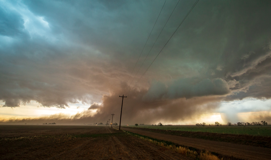
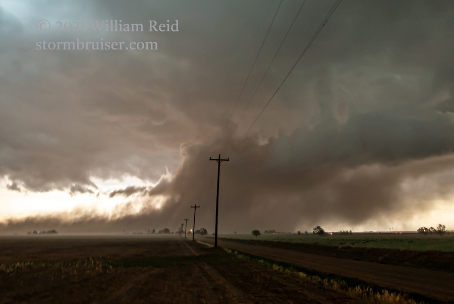
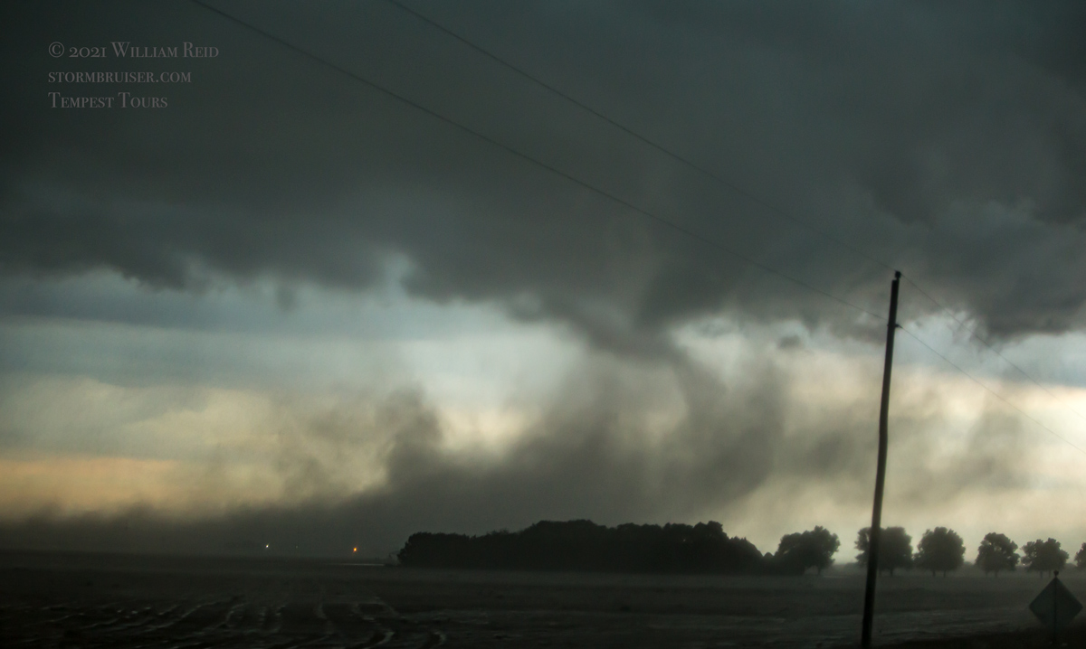
A few more pics of this updraft and dusty inflow plume are below (first three). We continued to Texico and southeast a little bit, but the show was pretty much over and dusk was falling upon the land.
Leave a Reply
You must be logged in to post a comment.