
Start: Alliance, NE/lunch: Longhorn Saloon in Harrison, NE/End: Torrington/368 miles
Time lapse video of the chase by Chris Gullikson
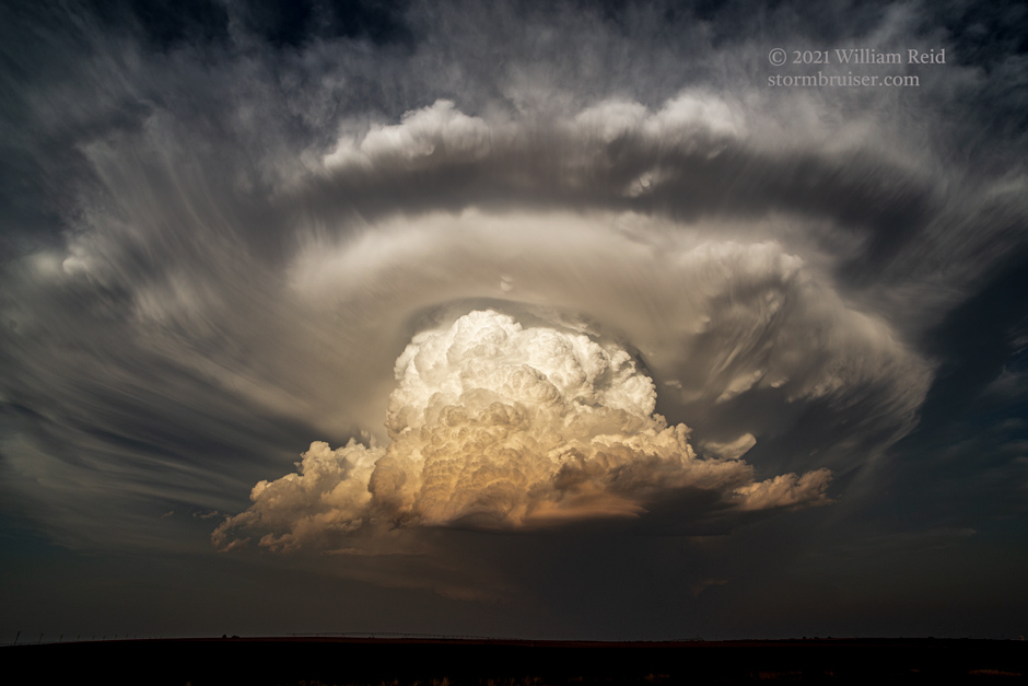
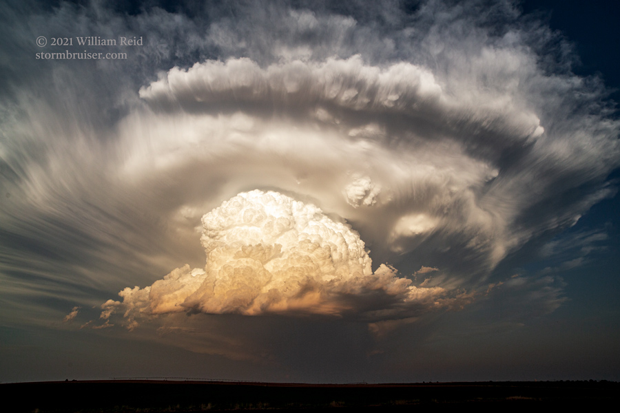
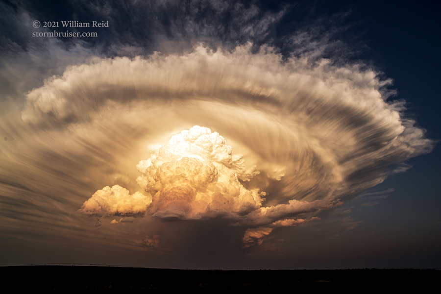
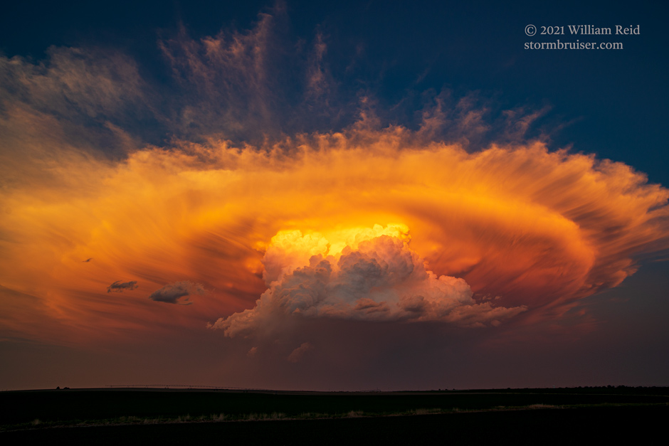
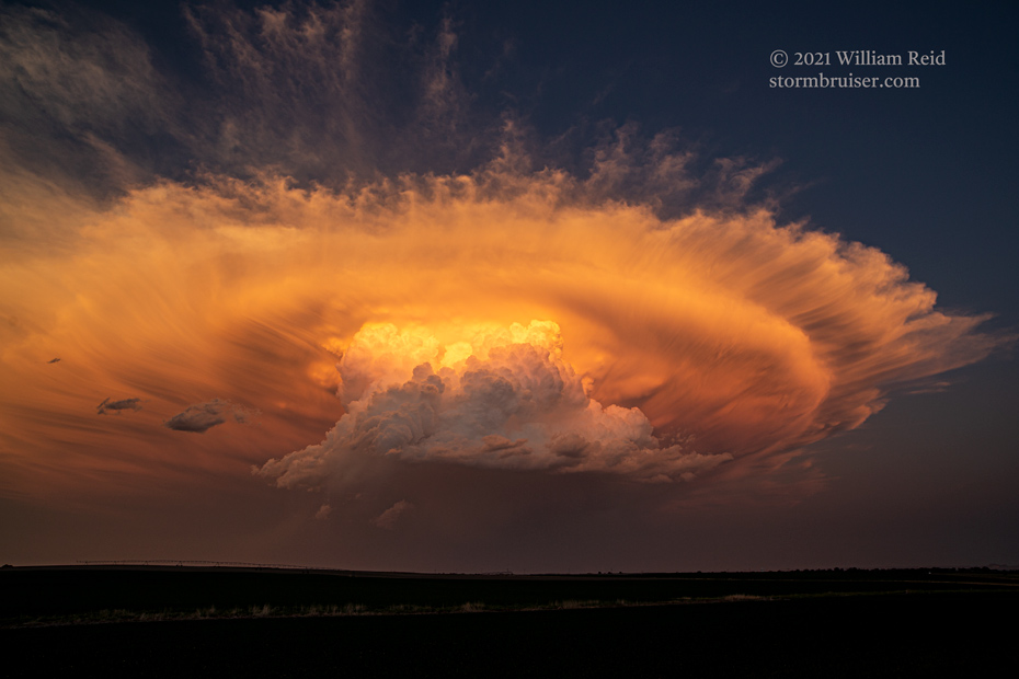
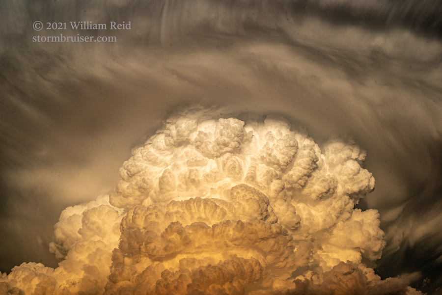
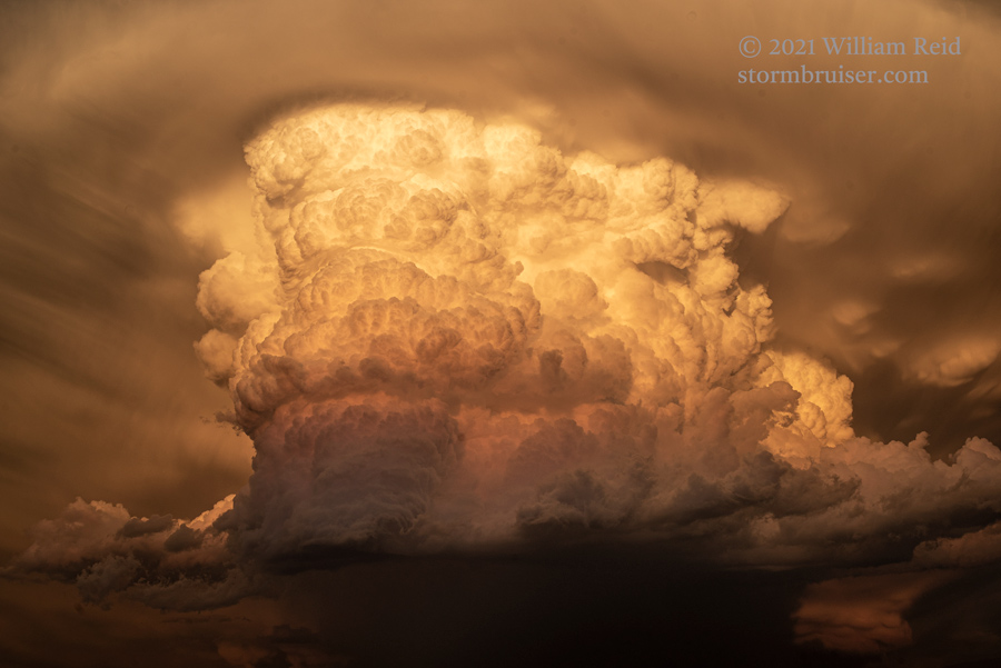
Another chase day — another rather mediocre High Plains setup with so-so moisture. Upper level flow was very reasonable, though, and surface flow was upslope. SPC bestowed our region with a marginal risk. We drifted from Harrison to Lusk after lunch and then moseyed west and north to Lance Creek. An agitated area was in the works west of Lance Creek, but it was in no hurry to get strong at all. We found a shade tree on a hill, but it was still hot. We waited and waited for something worthwhile here, where moisture convergence and storm initiation appeared to be most probable. But, this area was just not happening. A big and puffy cumulus cloud made an appearance to our southeast…WAY to our southeast. Was that where we should be? I elected to head that way just in case — east from Lance Creek to 85, south to Lusk, and then east into Nebraska. Along the way, the storm increased in size and intensity. It was not too far from Alliance, where we had been for the morning briefing. UGH. By the time we hit Lusk, we knew that this big and isolated cell was our ticket. The images below were taken along the way, from about Harrison to points about 10 miles north of Mitchell. It took about two hours to get close. The storm was drifting slowly to the south, and perhaps even a little to the SSW. The deviant motion meant that we had a rotating updraft.
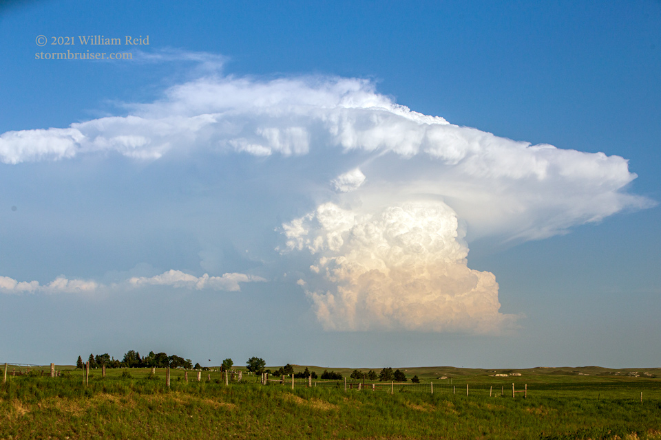
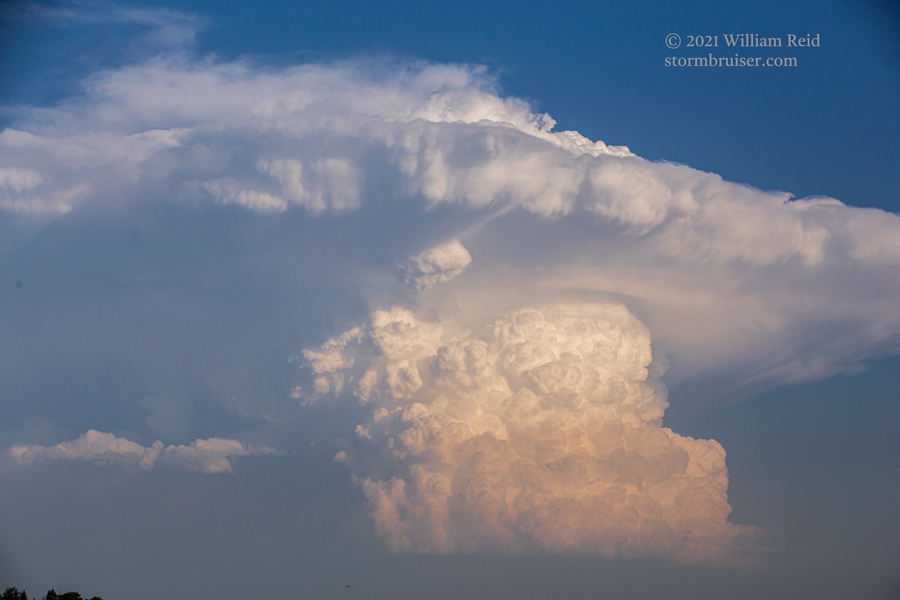
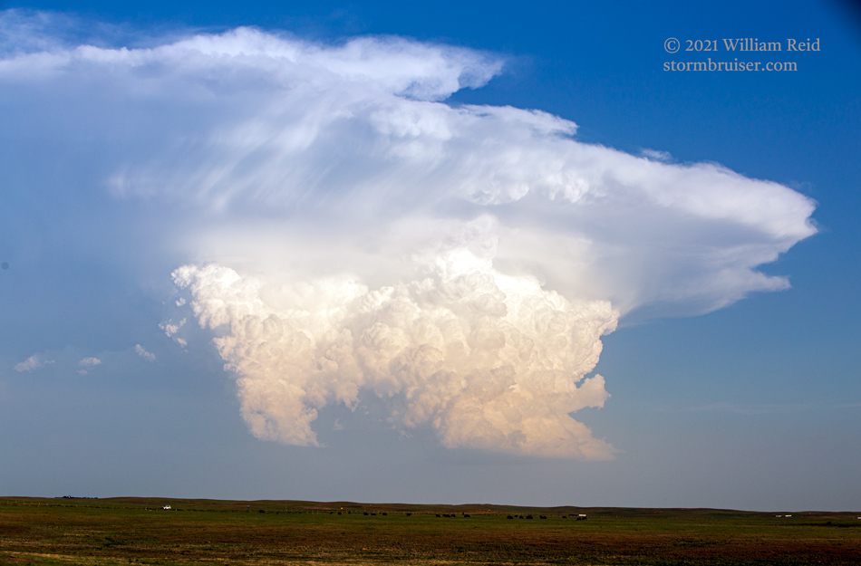
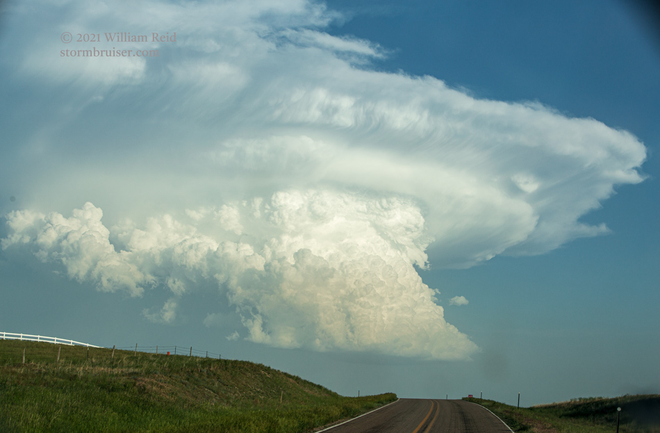
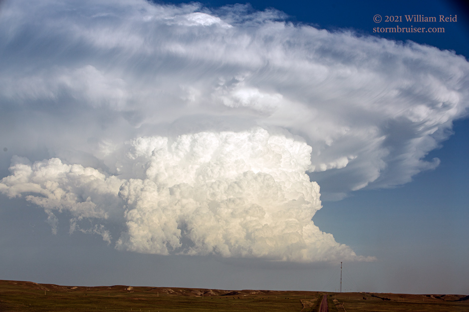
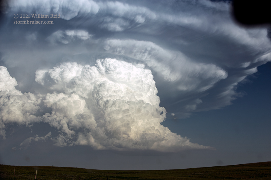
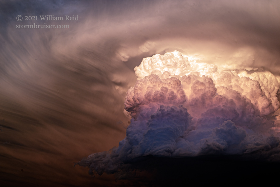
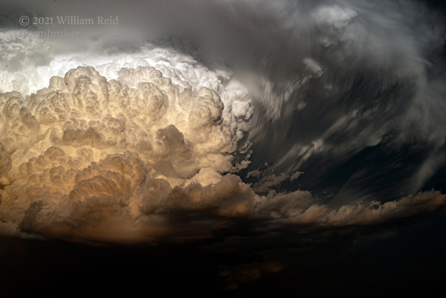
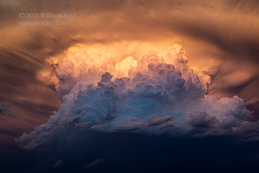
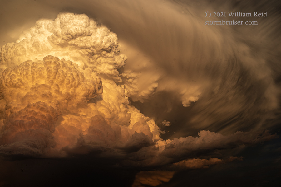
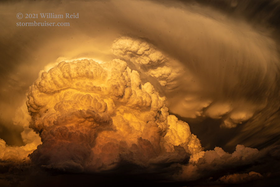
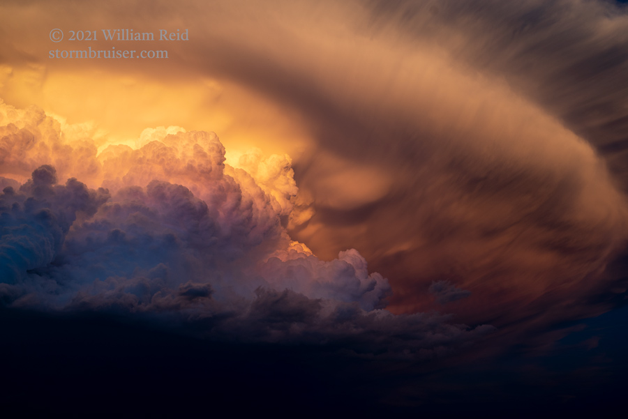
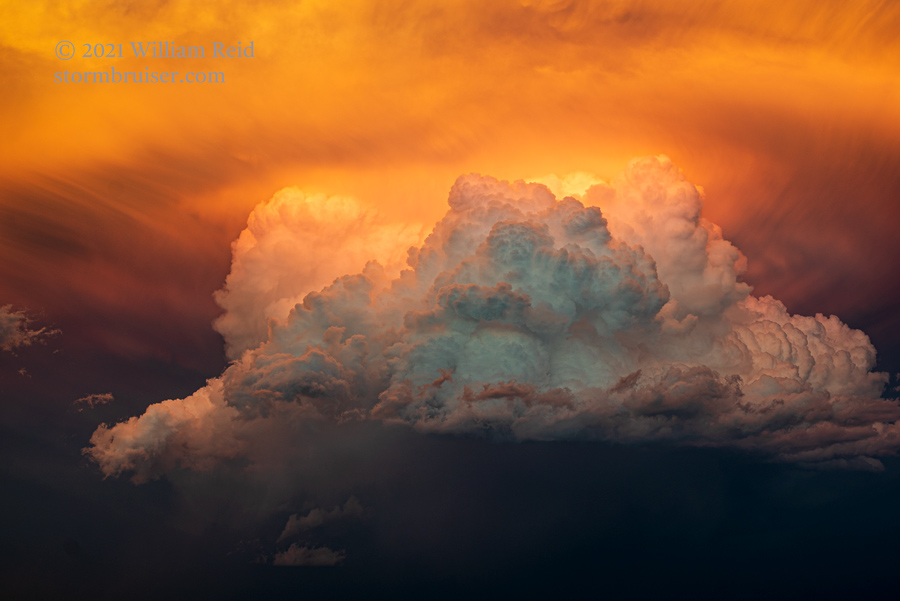
Fortunately, the storm moved slowly enough to allow us to get just west of the updraft right around sunset time. The light on the back end was magnificent! I had the tour stop a mile or two WSW of Mintle, Nebraska, or about 5 miles NNW of Scottsbluff.
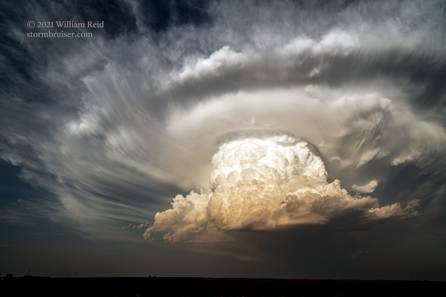
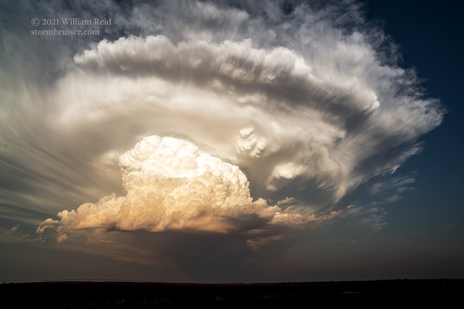
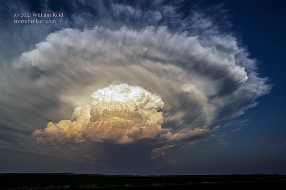
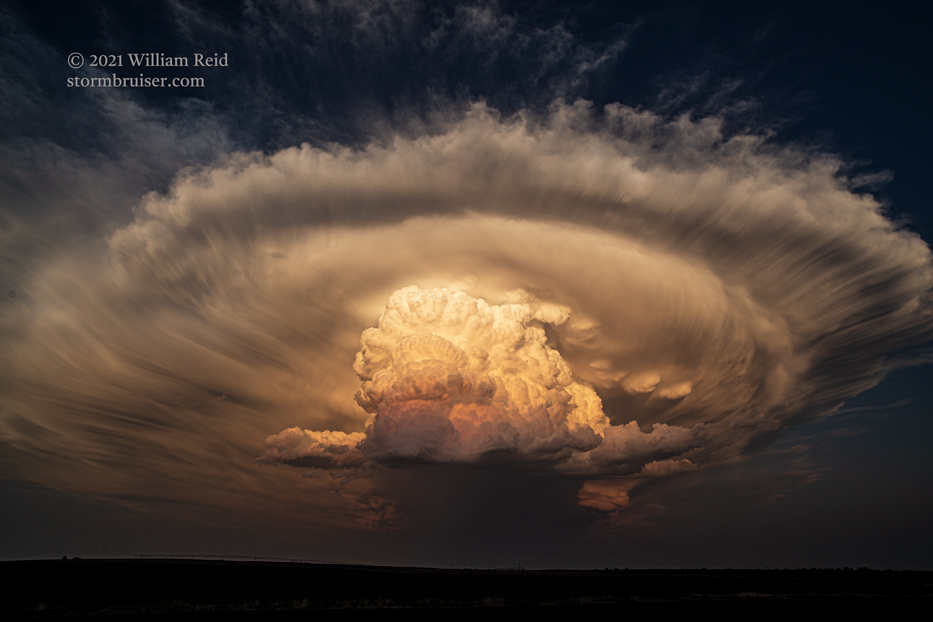
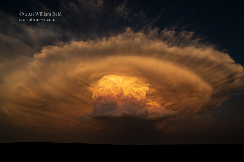
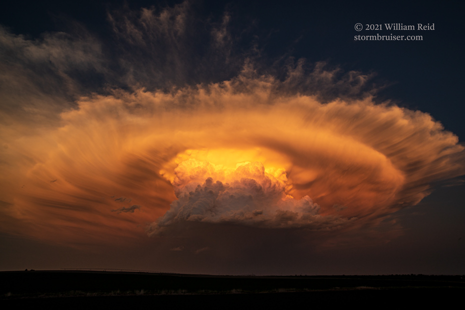
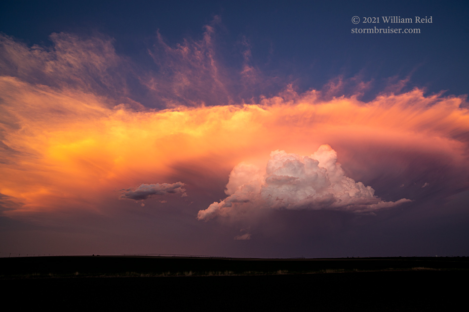
The images above were with the 15mm wide angle, and the ones below were with the 70-200mm zoom lens. The storm went into sputter mode with the loss of daytime heating. We said our “goodbyes” and drove to Torrington for the night.
Leave a Reply
You must be logged in to post a comment.