Start: Kiowa, KS
Lunch: Hardtner/Yur Place
End: Oklahoma City (500 miles)
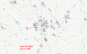
NWS Wichita page on the Andover event. This page includes tabs for weather maps, radar loops, videos, and of course info on each tornado in the Wichita CWA.
Video of the tornado by Chris Gullikson, who had just arrived in Kansas hours earlier to meet up with Tempest Tours. Chris took on a couple of Tempest guests in his vehicle for the chase.
Time lapse/wide-angle/roof-cam video of the tornado by Chris Gullikson. Our tour vans are visible about the time Chris stops near Butler and 140th.
Video of the Andover tornado by Tempest guide Bob Conzemius. Bob and company met up with my group just north of Wichita mid-afternoon.
Bob’s excellent chase account for April 29
Video by Tempest guide Matt Phelps, who was chasing solo today.
Superb drone video of the Andover tornado by Reed Timmer
—————–
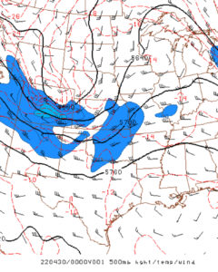
Today looked like a classic severe-weather and tornado day for the Central Plains. At 500mb, a negatively-tilted trough was edging into western Kansas. At the surface, a triple-point low was near the Smoky Hills of north-central Kansas, between Russell and Concordia. At 4 p.m. CDT, a dry line was from about Ellsworth to Hutchinson (KS) to Watonga (OK) to Vernon (TX). Dew points were in the low-mid 60s just east of the dry line in KS, and into the upper 60s east of the dry line and south of I-40 in OK. The 500 flow (at about 7 p.m. CDT) was SSW-SW at 40 knots above the triple-point low along and north of I-70, and WSW at 40 knots from about Wichita to Oklahoma City. A warm front was along the KS/NE border, with moist easterly winds on the Nebraska side. The flow at 300mb was very divergent above central Kansas. This upper-level divergence is often associated with Great Plains tornado outbreaks as it promotes upward motions. Sunshine was abundant early and mid-afternoon over KS and OK. SBCAPE values were from 3000 to 4000 near the surface low and the dry line. It was obvious that shear and instability were not problematic today.
A strong cap was in place over the OK portion of the dry line. Convection was almost certain along the dry line in KS (at least near the triple point), but was iffy in OK. SPC was fairly bullish on tornado chances, with a 15% hatched area near, N, NE, and E of Salina, KS. The 10% tornado area extended down the dry line to about Perry, OK. Their hatched (strong) tornado graphic extended from Grand Island to Perry.
So…where does the storm chaser play today? The Oklahoma play is quite risky as the cap is strong. The CAM (models) were inconsistent with regard to any storm development in Oklahoma. But if one DID form in Oklahoma, tornado chances with it would be very good. In Kansas, storm development was a sure bet, especially closer to the surface low. A good number of chasers was around Salina by early afternoon. Another option was south-central Nebraska, in those easterlies. I often favor the area just northeast of the surface low (near the triple point), provided the winds are sufficiently backed, the sun is shining, and no awful cold air is lurking closely to the north.
Fate stepped in prominently for me and the tour group this day. This was the day when we would be (presumably) taking the Tour 1 group back to Oklahoma City, as their final scheduled chase day was April 28. On the 29th, the guides and I would otherwise be preparing the vans in OKC for Tour 2, which began on April 30. But, the prospects were just too good on the 29th, so we had to make the 29th a chase day. We were running a couple of vans, with a couple of empty seats. Most of the guests wanted to chase on the 29th and to get back to the base hotel in OKC by late on the 29th. A couple of guests needed to be back to OKC by midday on the 29th. We busted in the northeastern Texas Panhandle on the 28th, and I sent my drivers Bob and Richard to OKC in van 2 that evening with the guests who needed to get back. I drove the rest of the group to Kiowa, KS, for the night. So, this was the long-winded way of saying that our chase on the 29th had to wind up somewhat close to OKC, since we had to drive back to OKC that night after the chase. Tour 2 would be gathering in the lobby by 10 a.m. on the 30th.
I didn’t want to wind way up north along or north of I-70 at dusk, so I was looking for good reasons to play the south end of SPC’s 10% hatched tornado area, generally south of Newton. Our group enjoyed a meal midday at nearby Hardtner, and then headed east and north a little bit to Harper. We were just east of the dry line, it was early-mid afternoon. I had definitely decided that I was not going to play the triple point up near I-70. I would wait it out here in south-central Kansas for now, and cross my fingers that the cap would eventually break.
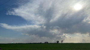
iPhone images below show conditions a bit southwest of Wichita around 3 p.m.

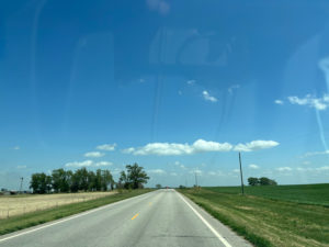

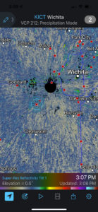
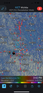
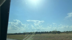
The dry line to our west is bubbling a little bit, so we had our eyes on those weak and skinny updrafts. The Wichita radar at 3:07 p.m. CDT shows little happening nearby yet, and our position is between Viola and Wichita. Chris Gullikson had recently met up with my group at Viola, and a couple of guests jumped into his car. About 35 minutes later we are on the north side of Wichita, as some nearby updrafts were getting rather perky and were heading north-northeastward at a pretty good clip. The radar shows a lot of chasers lined up along I-135 from Wichita to Newton, all watching those cloud towers shown in the last image above. I was not impressed with the way these developing cells looked, and I did not want to chase them northeastward. Check out the third image below. It shows the effective bulk shear map around 4 p.m. These first dry line storms of the day were headed into very marginal conditions with regard to shear, which meant that it might be difficult to get a rip-snorting supercell…at least for a while. Shear values were much better on the dry line near the OK/KS border.


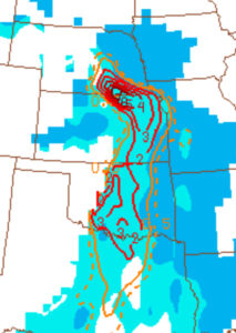
Bob Conzemius, with his Tempest van 2 and with some new tour guests and staff, was blasting north through Wichita. I let Bob know that I was not going to stick closely to these early cells. Would I have continued to the north with these if there were no need to be back in OKC this day?! I don’t know. Take a look at that STP (Sig Tor Parameter) map for 6 p.m. CDT above. There are very good numbers (2 to 3) south of Wichita, with 3 to 4 and even higher north of Wichita. “Get to the triple-point on the KS/NE line,” says the STP graphic! Anyway, Bob exited I-135 and met up with Chris and my group on the north side of Wichita.
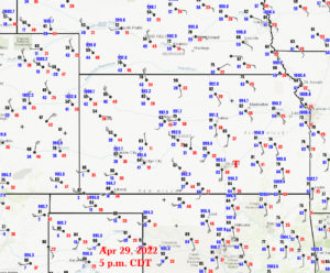
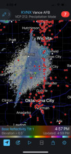
What to do now? I don’t recall that the surface moisture convergence maps this afternoon, nor the CAMs, were particularly helpful at pinpointing a particular spot to home in on, at least from Wichita southward. I elected to drift southward some towards the KS/OK border. I don’t recall exactly why…it was probably because satellite was showing a cumulus field that way. Maybe I just thought it was a good idea to get farther from the junky-looking stuff that was near I-135 north of Wichita. The 4:57 p.m. CDT radar above is a wide look at the dry line from Hutchison to Lawton, with a shower or two northeast of Enid. About this time SPC was issuing a tornado watch for Oklahoma. The wording included “intense tornadoes.” We don’t want to miss an intense tornado in Oklahoma now, do we?! SPC seemed to be somewhat certain that there would indeed be storms in Oklahoma today. (A couple of tornado watches had already been issued for Kansas.) We continued into Oklahoma on I-35 some 20 miles or so to Tonkawa, and then drifted westward to Lamont. Storm towers were trying to develop to our west and southwest (see 4th and 5th images above). One or two of these tried hard to get going, but that was all they could do. The cap was winning this battle.
The mood was a bit dour. It was already past 6 p.m., and we were watching clouds fizzle. Should we blast south to OKC, where a CAM was suggesting a strong storm soon? At least we would be back near the base hotel whether anything happened or not! We could put ourselves out of our misery right now and just roll south.
Well, the dry line wasn’t completely finished around here yet. From the Lamont area, we could see a clump of unimpressive cumulus clouds to our northwest. These did not appear to be trying to break the cap at all. It was clump city and not turkey tower city. But, the cumulus clump was persistent. I liked where it was with respect to the available instability and shear. We had a couple of hours of daylight remaining, barely. It looked like it would be prudent to get ourselves close to this clump.
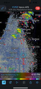
We went back to I-35 and headed north into Kansas. The first image below shows the Vance, OK, radar at 6:50 p.m. CDT. Our location is near the KS/OK line, about 50 miles south of Wichita. Radar showed a couple of new storms. We could now see that the cumulus clouds had grown into storm cells, still to our northwest. There were a couple of them, and they were moving to the NNE at perhaps 25-30 mph. We were playing a little catch-up, and it is a good thing that we had not drifted any farther south into Oklahoma.
On our way north, back into Kansas along I-35, we finally came even with these cells near Haysville (on the south side of Wichita). Images below show that these updrafts already sported quite impressive low-level organization.

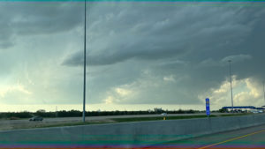

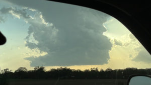
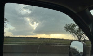
We exited at Haysville, and to our WSW was the nicely-sculpted updraft base of a developing supercell. It was about 7:30 p.m. CDT. Bright sunlight filled the clear slot that had strongly cut into the storm base — see the first four images below. There was a sense of relief now, and a sense of great anticipation. In one hour our fortunes and our expectations had changed considerably, for the better. What might transpire in the next hour?
I had to think ahead. We needed to be in a good location in case this storm decided to put on a show. Right now, the base was coming at us at nearly 30 mph, we were vulnerable to hail, and we were dealing with the outskirts of Wichita and the problems associated with urban chasing. The best course of action looked to be to jump onto I-35 again, to take it northeastward, and to get to more open areas in front of the supercell. We exited about 12 miles later at U.S. 400, about 3-4 miles west of Andover. I goofed at the Turnpike exit and we lost a few minutes, but eventually found U.S. 400 and turned eastward. The supercell updraft to our SW was looking great!


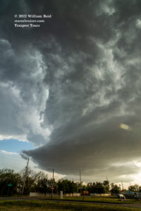

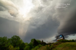
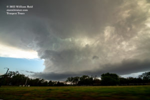
A little skinny funnel cloud was spotted (first pic below), and it stayed well above the ground. The updraft base was beefy, rounded, beefy and beefy…with that continued clear slot/RFD. There was little or no lightning nearby, however. There was no hail on us, also, though we must have been quite vulnerable, just northeast of this updraft. Did I remember to say that the updraft was a beefy healthy beast of an updraft?!

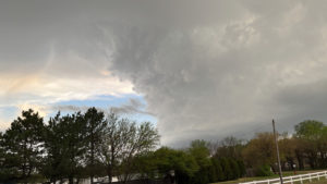

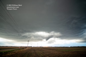
We headed east into Andover a couple of miles on U.S. 400 and then I elected to turn right/south onto South Andover Road. I managed a bunch of wide-angle images as we headed south. See the last image above and the first two below. Our views to the W and WSW were hindered for the most part by trees — UGH. Finally, about three miles south of 400 the views to the west improved. The road name had changed from Andover to SW Butler Road and the full glory of the supercell was apparent, not too far to our west. We were due east of the base, the RFD, and the action area as we motored south past SW 140th St. (four miles south of U.S. 400). My plan was to stop soon, within a mile or so. I glanced to the west as we passed 140th, and it looked like a little funnel might be tucked up next to that clear slot. Bob saw the same thing and radioed me. We didn’t want to go any farther south! We turned around, went back north to SW 140th St., and stopped just west of SW Butler Rd.
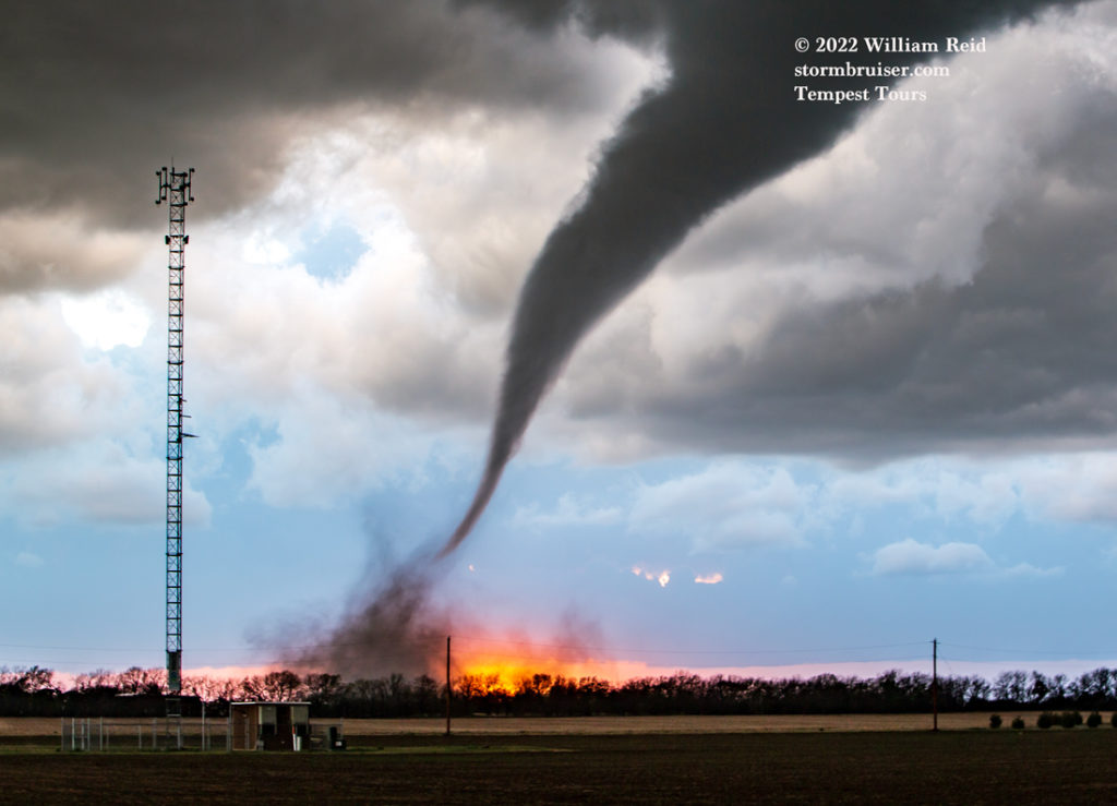
Perfect timing! An obvious funnel cloud was now reaching towards the ground to our west. This was the beginning of the Andover tornado. A dirt and debris whirl kicked up right in front of where the sun was setting…nice! In the next 5 minutes or so, I shot a lot of still photos. I traded off between the Canon 6D with the 15mm lens and the other Canon 6D with the 70-200mm telephoto zoom. Below are samples from the wide angle lens, as the skinny tornado moved to our NW and N.


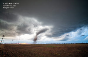
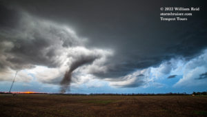

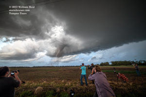
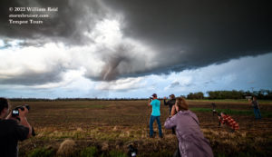
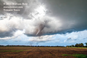


Below are images from the same timeframe, taken with the long lens. These were mostly at the 70mm setting. The tornado went from backlit and black to front lit and whitish/gray. What a show!
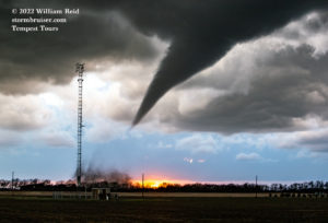
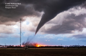
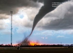
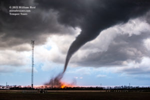
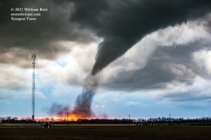
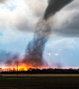
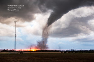
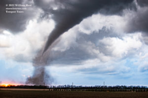
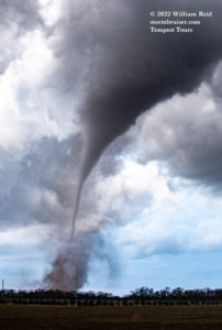

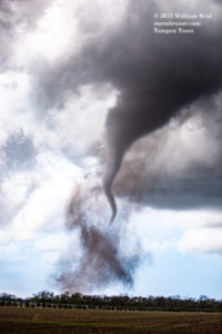
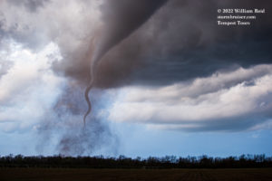

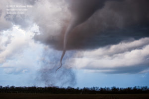
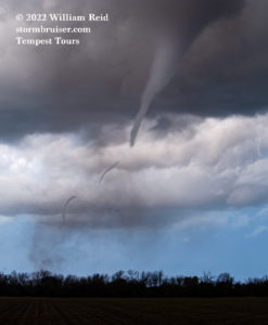
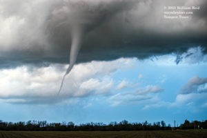
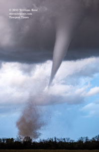
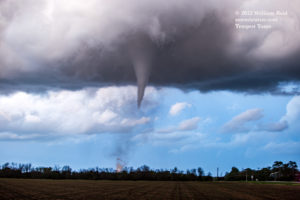
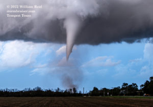
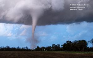
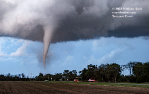
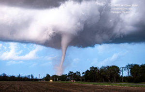


The tornado was now to our NNE and it was moving away from us. It was also looking quite a bit stronger, and more and more debris was getting kicked up. It didn’t really occur to me at the time that it was cutting a swath through the town of Andover. In fact, it had not even occurred to me that here I was, just south of Andover, Kansas, watching a tornado, very close to where a very famous and monster tornado had occurred about 31 years prior. On April 26, 1991, the Andover tornado was videoed by several people, and these spectacular videos prompted me to purchase a camcorder and to head to the Plains to chase for the first time just a month later!
It was time to catch up to the tornado. Unfortunately, it was moving diagonally across the N-S and E-W road network at a fairly healthy pace, maybe 30 mph. And, it was probably already three miles distant to our NNE. We had just seen a bunch of emergency vehicles and police heading northbound on Butler while the tornado was to our north. I figured that making it through the tornado path across Butler would be difficult or impossible due to debris and poles and wires; or that police had the road blocked already. I knew that there was a major E-W road a mile to our south, so we backtracked to SW 150th St. and headed east.
That decision to backtrack might have been the poorer choice, as I could have headed north and turned right onto Pawnee. The tornado had tracked across Andover/Butler another mile north, near Harry St. But, I was not familiar enough with these local roads and did not even consider it.
After a mile or two eastbound on SW 150th St. we were afforded decent views of the Andover tornado to our north. These are pics with the long lens.
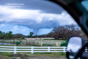
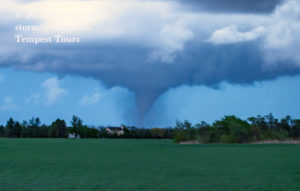

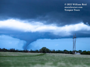
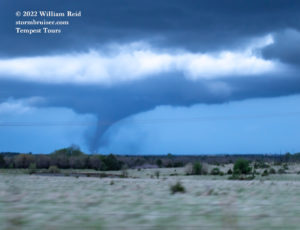

On that last image above we are headed north on SW Santa Fe Lake Road. The tornado is well north of Andover now, and it soon dissipates. The large RFD cut is very obvious to the south of the tornado.
All of us were elated! We managed to be in great position to watch the tornado form and to pass by to our north. We stopped near Augusta along U.S. 400 for some structure shots with the lightning at dusk. Bob’s camera, pointed north, caught a new, second tornado. A third tornado formed with the same storm later, near Rosalia, but we were already on our way back south to Oklahoma City. We had to hustle a bit in order to keep from getting mauled by a squall that was approaching I-35 south of Wichita, and we barely made it. Unfortunately, a chase team perished on the wet Interstate behind us in the squall when they lost control and were struck by a big rig.

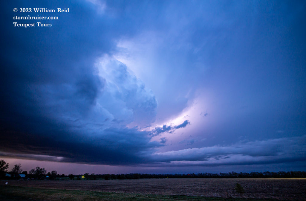
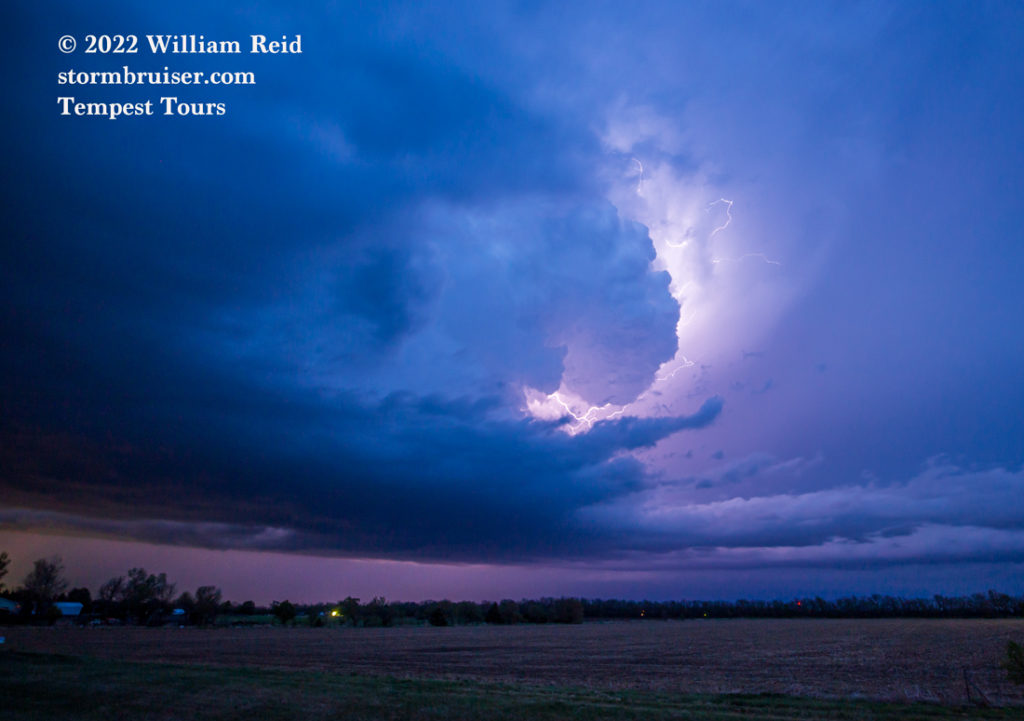
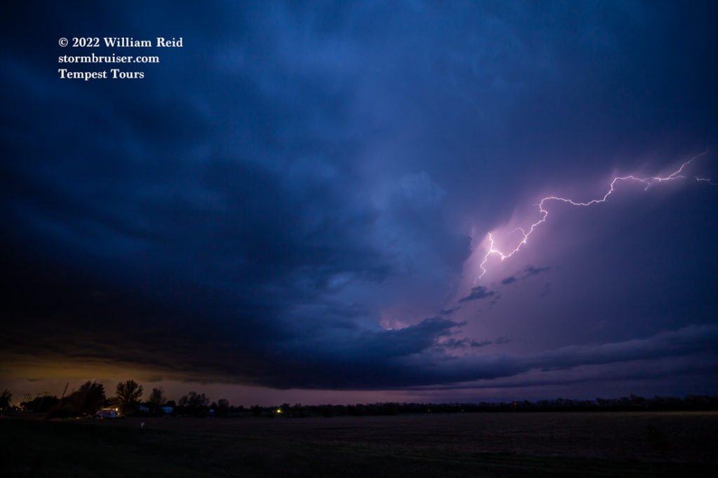
Somehow we caught the best storm of the day! Oklahoma wound up with nothing, and the tornadoes north of Wichita and along the KS/NE line were weaker and not nearly as photogenic, apparently. The storms that we had let go earlier in the day on the NW side of Wichita were evidently a bit on the HP and wet side, and it was a bit of a mess with plenty of competing cells up that way.
Matt Phelps’ video along the turnpike, I-35, is exceptional. He had the storm coming right at him as he neared Andover from the northeast. Matt liked the Newton and Wichita areas — here is some of his thinking on the chase day:
“I sat in Newton for forever that morning and afternoon trying to ignore the initial convection attempts. I liked the Wichita area and that diffuse boundary. Eventually the north stuff got its act together and went tornado warned. I figured I’d have time to take a look at it and still be able to jump back south if needed. As soon as I was within about 15 miles of the north tornado-warned storm I could see that it was likely struggling with moisture issues and also an outflow boundary slamming into it from the west from the other junk behind it. I could see the Wichita area CU growing agitated and gunned it back south just in time.“

Leave a Reply
You must be logged in to post a comment.