

Start: Chamberlain, SD
Lunch: grab-and-go convenience store in Nebraska
End: Kiowa, KS (627 miles)
We awoke at Chamberlain, along I-90 in South Dakota. The previous two days were high on hopes but rather short on quality product and results, as a lot of energy and dynamics equaled a lot of fast-moving and messy storms. Give me a low-end day with a lot of sunshine and one slow-moving supercell, please. This plea was granted on May 13th, but we had to hurry south through 3 states to make it happen.
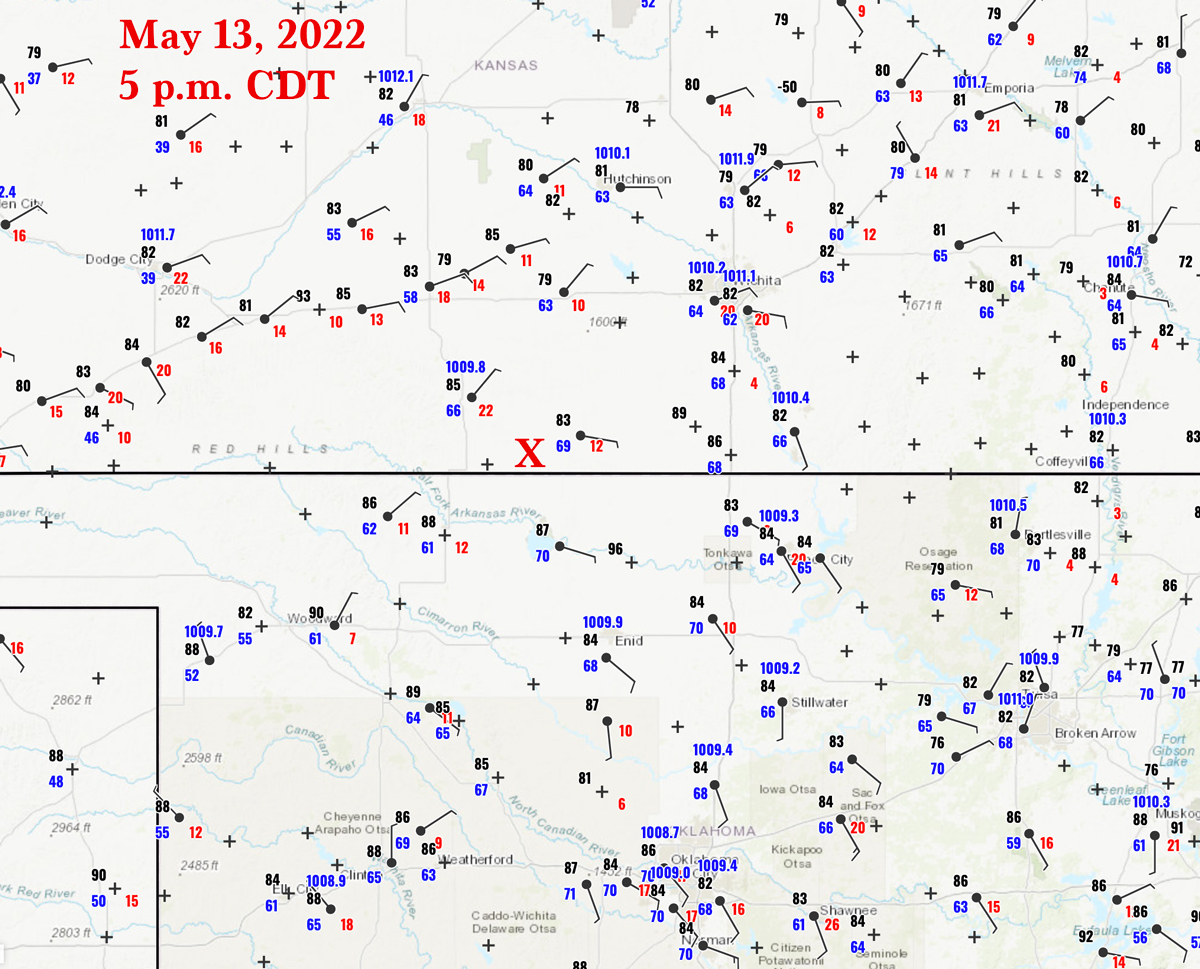
Wind was westerly in Nebraska (in the wake of the strong system the day prior) and weak easterly in Kansas, with a weak surface low around SW OK. Quality moisture on SE winds was headed into south-central KS, east of a weak or diffuse dry line. There was enough convergence expected to provide a chance of strong late-afternoon convection and a supercell, given near 50-knot effective bulk shear and SBCAPE near 3000 J/kg. See the nice obs along the northern tier of counties in Oklahoma in the OK mesonet image below.
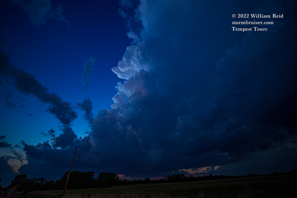
Models seemed to waffle a little bit on whether or not there would be a decent storm within reach for us. We made our way south through Nebraska, with a quick convenience store lunch at Taylor, I think. We scooted east a little on I-70 (from 183/Hays to 281/Russell) in Kansas and took aim southward on 281 towards Medicine Lodge, where a cumulus field was percolating by 5 p.m. CDT or so.
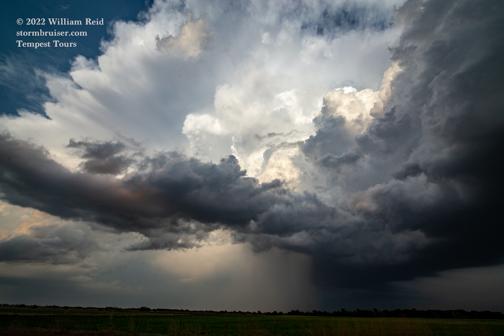
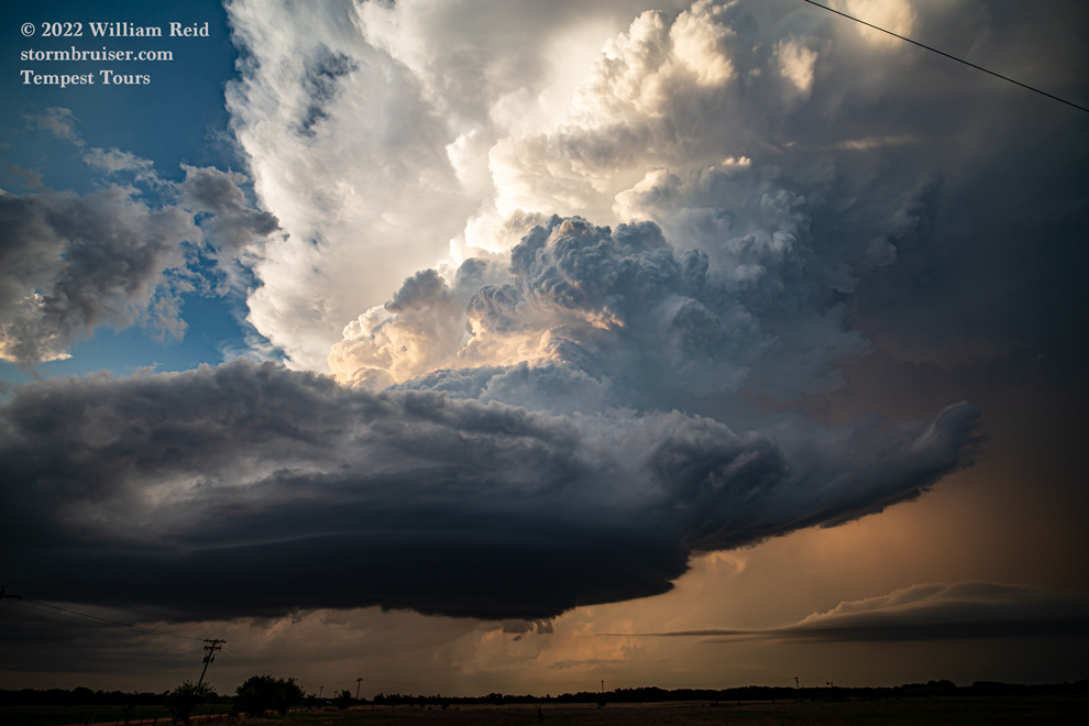
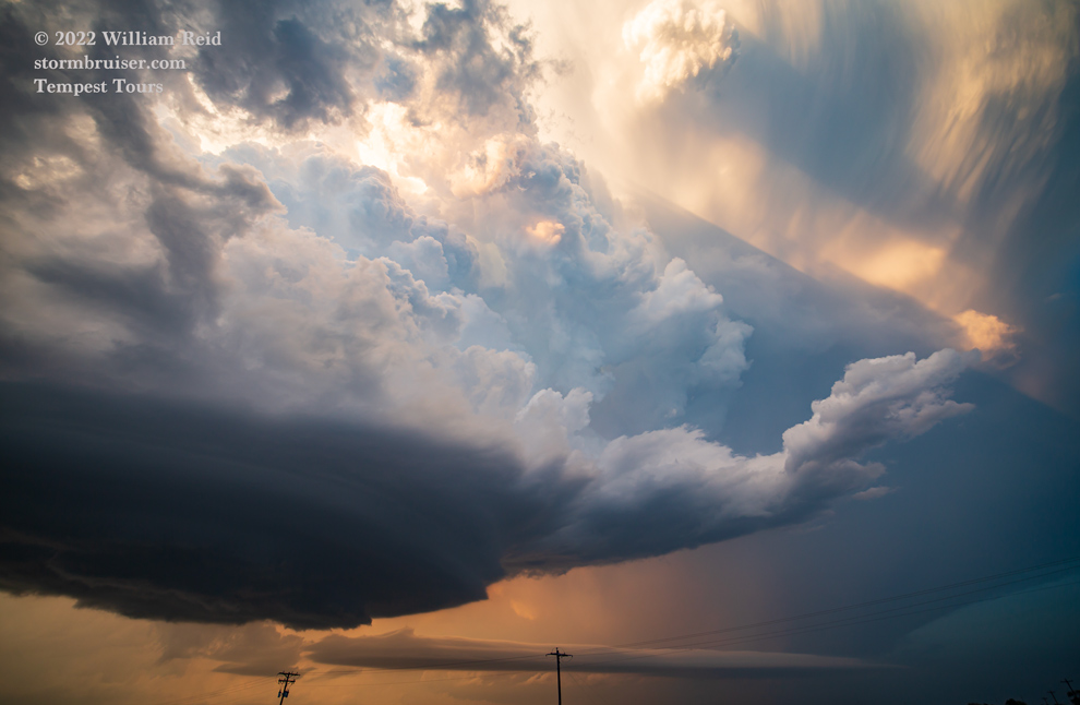
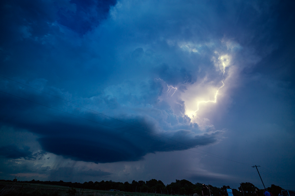
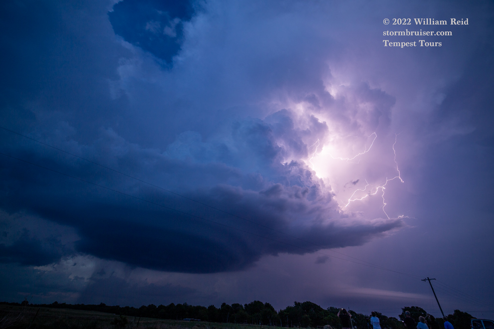
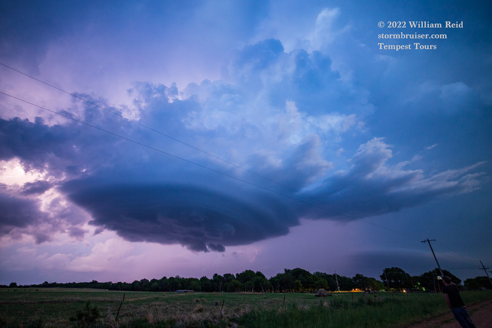
We lucked out on timing and positioning, as an updraft finally got really strong as we approached on its northwest side near Hazelton (SSE of Medicine Lodge in Barber County). These four images are from the iPhone, looking S and SSE.


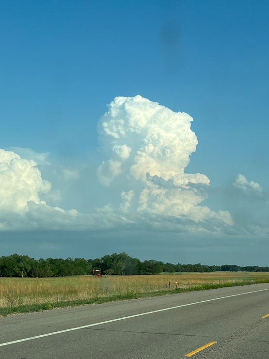
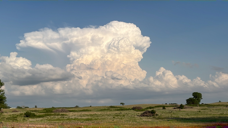
This was shaping up to be a great experience, with an isolated and explosive updraft going up close to 7 p.m. CDT. Whenever a strong storm develops this late in the afternoon or early evening (i.e., well past peak heating), it is likely that upper-level support is becoming more favorable and perhaps a low-level jet is starting to help out. I took an unpaved road east off of 281 to Hazelton, with the nicely-organized storm base and updraft filling up the windshield.

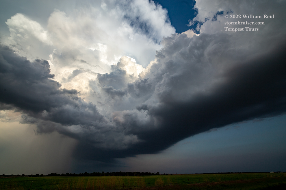
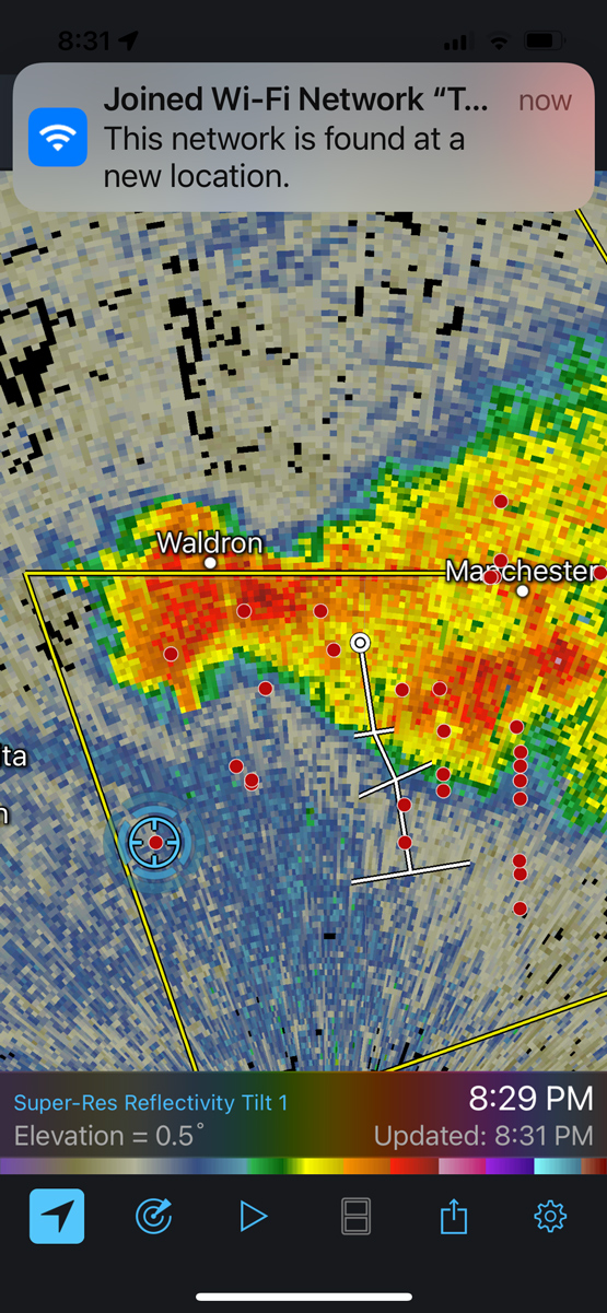
At or near Hazelton we made our way a little farther east and south, winding up just south of an obviously rotating storm base. The shots below were taken very close to the KS/OK border, about halfway between Kiowa and Manchester. The supercell moved slowly to the south and pushed us into northern Oklahoma.
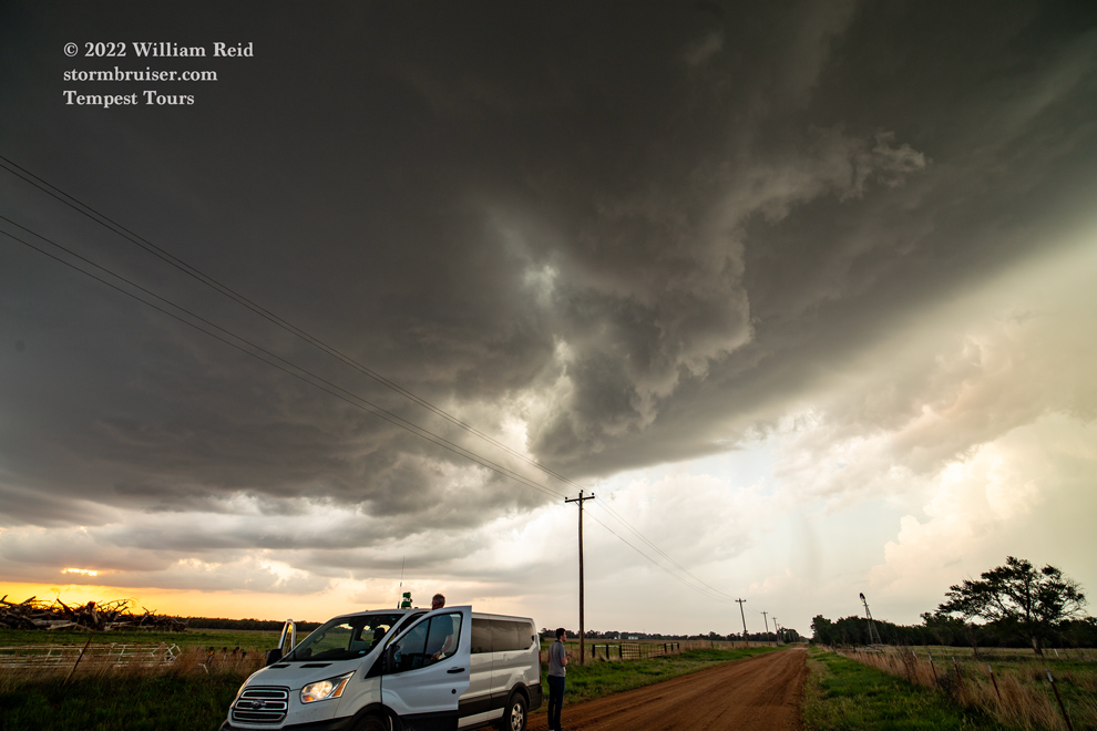
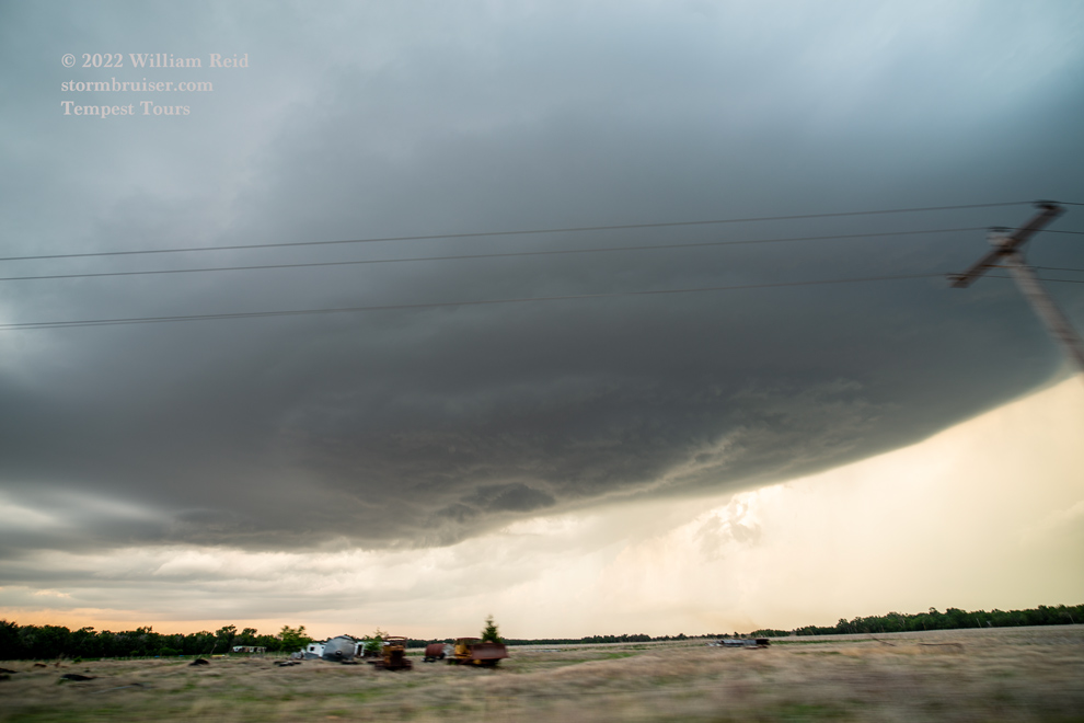

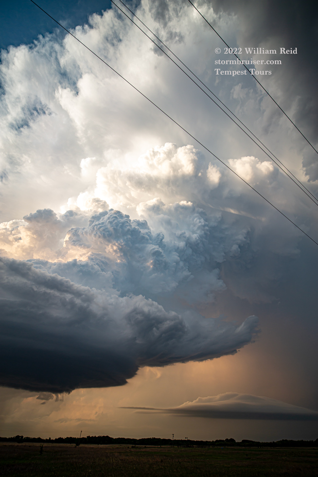


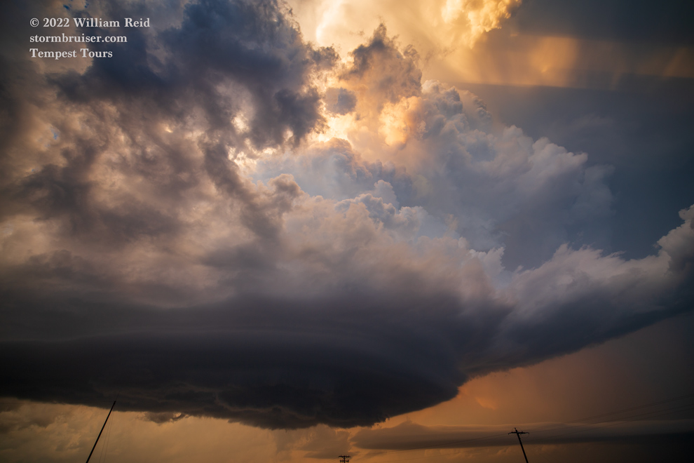
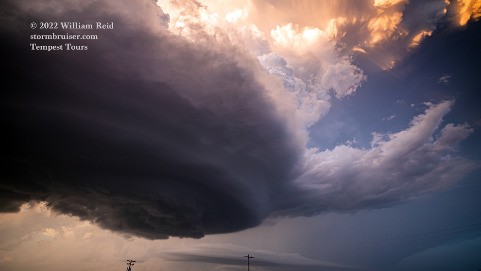
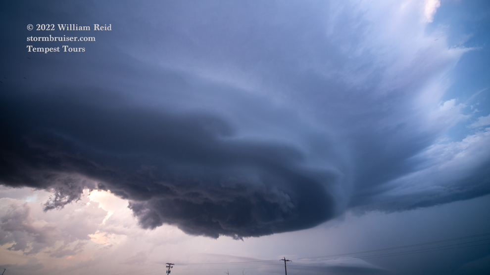
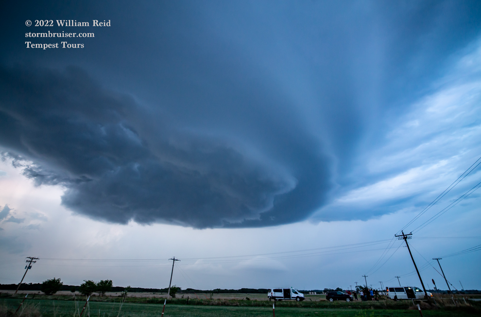
The base was rotating hard, and the RFD cut into the base was hard and persistent. A little lowering came and went, but there was no real attempt at a tornado. It seems that a little more precipitation in the area of the storm base would have helped to bring the base down some and to provide a good tornado chance, but that did not transpire with this LP supercell.
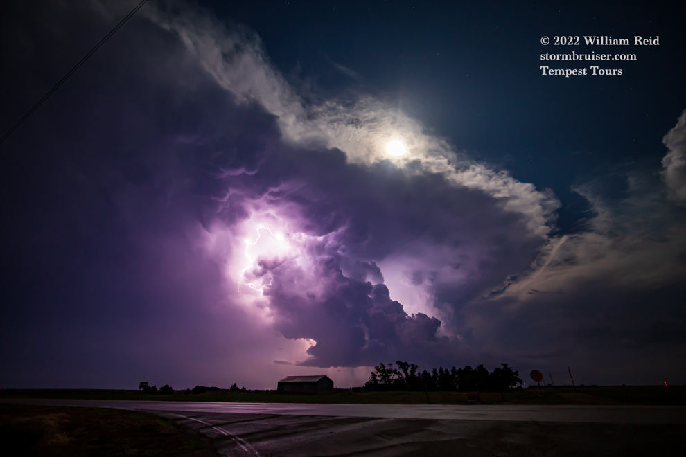
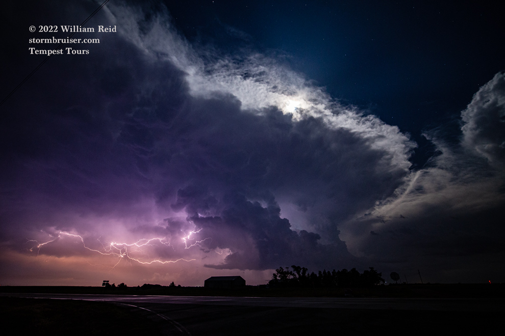
We found a decent location to watch our cell drift to our east, and I think a second trailing supercell eventually took over just to our northwest as it got dark.
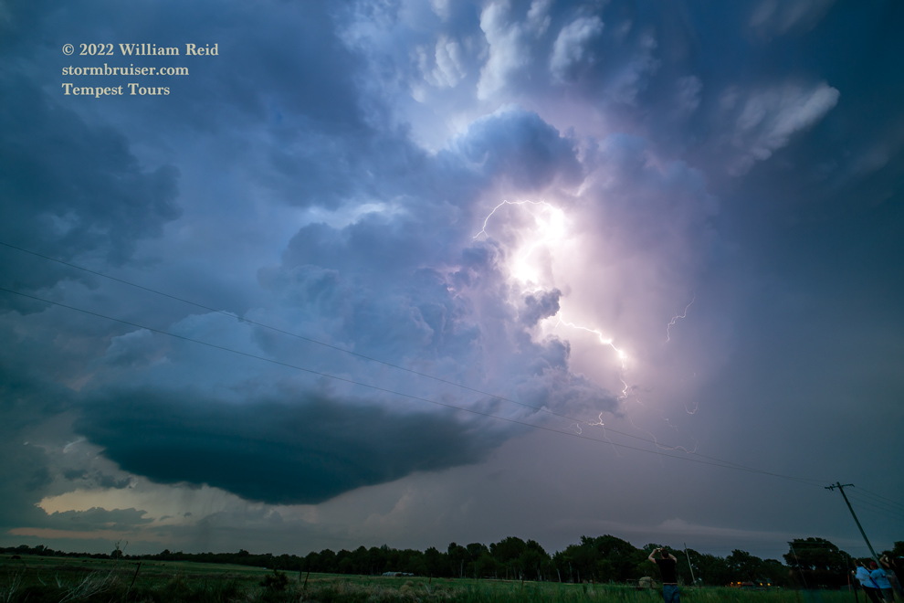


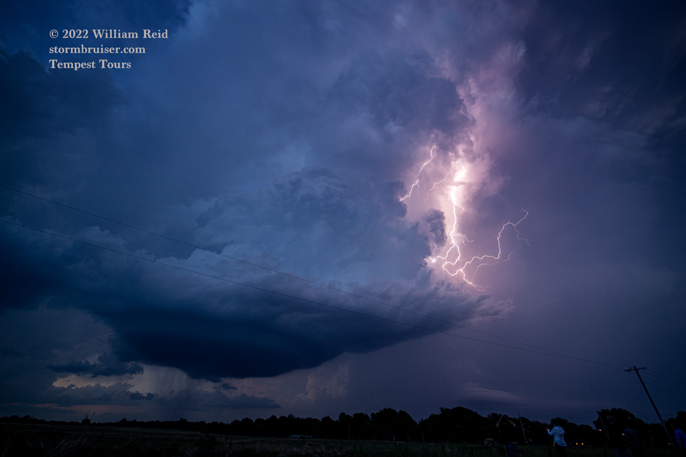

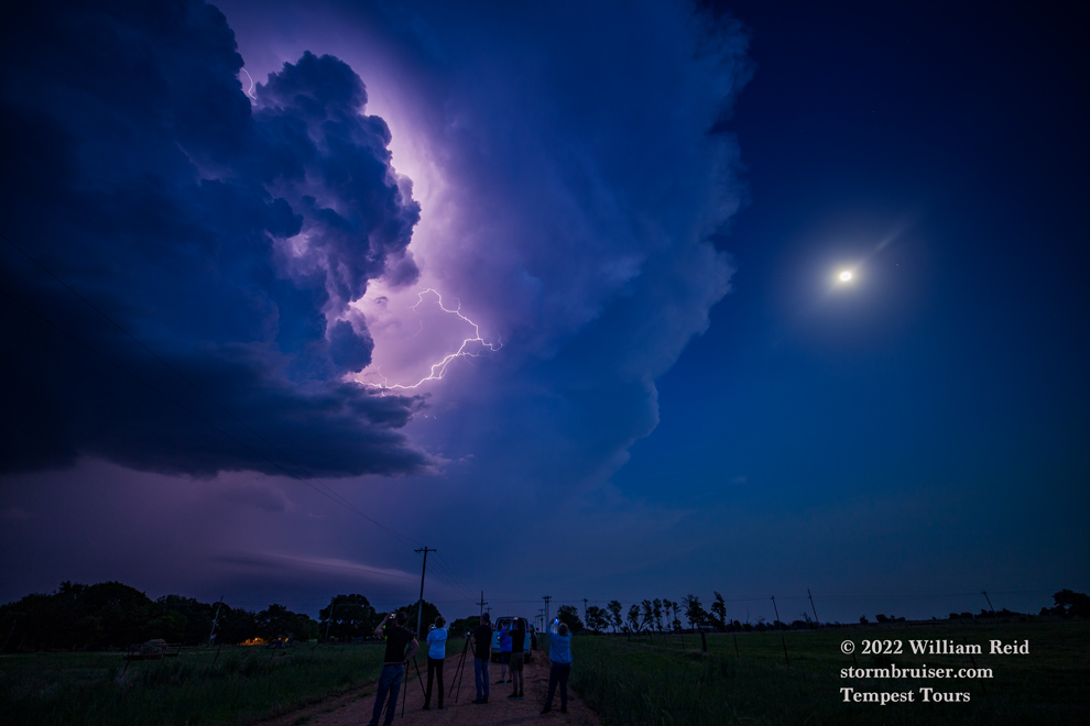
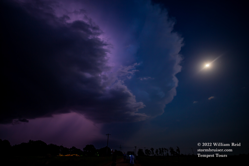
Later, we stopped a couple of times after drifting west in OK to shoot lightning with the supercell. It was nice having our motel nearby in Kiowa after a long drive and a really satisfying chase.


Leave a Reply
You must be logged in to post a comment.